Category:Betws Garmon

Cymraeg: Pentref gwledig gwasgaredig yn ardal Arfon, sir Gwynedd, yw Betws Garmon. Saif ar yr A4085 ar ymyl Eryri, traean o'r ffordd rhwng Caernarfon a Beddgelert; Cyfeirnod OS: SH 54546 56819. Ar hyd y ffordd i gyfeiriad y gogledd, Waunfawr yw'r pentref agosaf ac i'r de mae'r ffordd yn ei gysylltu â Salem a Rhyd-ddu, pentref genedigol T.H. Parry-Williams.
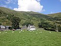
English: Betws Garmon is a community and small hamlet outside Waenfawr and near Beddgelert in Gwynedd, Wales. It has a population of 216.
village and community in Gwynedd, Wales   | |||||
| Upload media | |||||
| Instance of | |||||
|---|---|---|---|---|---|
| Location | Gwynedd, Wales | ||||
| Population |
| ||||
| Area |
| ||||
 | |||||
Subcategories
This category has the following 6 subcategories, out of 6 total.
C
- Cwm Du, Betws Garmon (3 F)
L
P
- Plas-y-Nant railway station (3 F)
S
W
- Waunfawr railway station (19 F)
Media in category "Betws Garmon"
The following 200 files are in this category, out of 1,122 total.
(previous page) (next page)-

-

-
 'Tan yr Wyddfa' at Rhyd-Ddu - geograph.org.uk - 1964818.jpg 1,500 × 1,125; 1.89 MB
-

-
 A big grassy bank - geograph.org.uk - 2397030.jpg 640 × 480; 99 KB
-
 A busy day below Crib Goch - geograph.org.uk - 6412135.jpg 5,640 × 3,760; 2.37 MB
-
 A busy hill - geograph.org.uk - 2423204.jpg 640 × 426; 62 KB
-

-
 A fork in the track - geograph.org.uk - 4590753.jpg 800 × 531; 108 KB
-
 A mountain view from Rhyd Ddu - geograph.org.uk - 3535489.jpg 800 × 470; 89 KB
-
 A raven passes by... - geograph.org.uk - 5993352.jpg 4,032 × 2,407; 3.55 MB
-
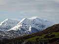 A snowy Snowdon range - geograph.org.uk - 4798414.jpg 1,024 × 768; 127 KB
-
 A touch of India in the foothills of Snowdonia - geograph.org.uk - 2596828.jpg 2,816 × 2,112; 1.49 MB
-
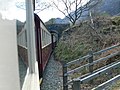
 A train on the Snowdon Railway - geograph.org.uk - 4596564.jpg 800 × 531; 100 KB
-

-

-
 A4085 at Rhyd Ddu Station - geograph.org.uk - 3007589.jpg 3,253 × 2,249; 3.24 MB
-
 A4085 at Rhyd Ddu Station - geograph.org.uk - 3007620.jpg 2,513 × 1,733; 1.63 MB
-

-
 A4085 Pitt's Head - geograph.org.uk - 5876387.jpg 4,000 × 3,000; 4.81 MB
-
 Abandoned quarry remains - geograph.org.uk - 5541731.jpg 6,000 × 4,000; 7.34 MB
-
 About To Go Under - geograph.org.uk - 4303462.jpg 1,024 × 683; 148 KB
-
 Above Craig Cwmbychan - geograph.org.uk - 3769047.jpg 1,964 × 1,343; 1.15 MB
-
 Above Ty'n-y-ceunant - geograph.org.uk - 6517303.jpg 1,024 × 683; 206 KB
-
 Afon Cwm Du - geograph.org.uk - 4604427.jpg 1,200 × 1,600; 940 KB
-
 Afon Gogh at the Foot of Castell Cidwm - geograph.org.uk - 1830028.jpg 640 × 480; 116 KB
-
 Afon Gwyrfai - geograph.org.uk - 1889403.jpg 640 × 480; 153 KB
-
 Afon Gwyrfai - geograph.org.uk - 2036232.jpg 3,296 × 2,472; 1.95 MB
-
 Afon Gwyrfai - geograph.org.uk - 2367029.jpg 1,657 × 1,127; 1.27 MB
-
 Afon Gwyrfai - geograph.org.uk - 2524318.jpg 4,000 × 3,000; 5.03 MB
-
 Afon Gwyrfai - geograph.org.uk - 2524332.jpg 4,000 × 3,000; 4.63 MB
-
 Afon Gwyrfai - geograph.org.uk - 3838311.jpg 4,000 × 3,000; 3.73 MB
-
 Afon Gwyrfai - geograph.org.uk - 3839409.jpg 4,000 × 3,000; 2.67 MB
-
 Afon Gwyrfai - geograph.org.uk - 5541645.jpg 6,000 × 4,000; 7.25 MB
-
 Afon Gwyrfai and Snowdon - geograph.org.uk - 2114548.jpg 640 × 425; 150 KB
-
 Afon Gwyrfai at Rhyd-Ddu - geograph.org.uk - 6396577.jpg 2,160 × 2,880; 1.51 MB
-
 Afon Gwyrfai looking upstream - geograph.org.uk - 2110783.jpg 640 × 480; 95 KB
-
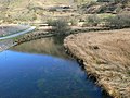 Afon Gwyrfai near Betws Garmon - geograph.org.uk - 1248973.jpg 640 × 480; 92 KB
-
 Afon Gwyrfai valley - geograph.org.uk - 4116303.jpg 1,024 × 768; 167 KB
-
 Afon Gwyrfai, Betws Garmon, on a rainy day - geograph.org.uk - 4536681.jpg 1,024 × 768; 110 KB
-
 Afon Treweunydd - geograph.org.uk - 4037778.jpg 2,666 × 3,999; 7.65 MB
-
 Aircraft Wreckage On Mynydd Mawr - geograph.org.uk - 5391136.jpg 1,600 × 1,200; 757 KB
-
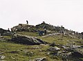
 Almost At the Top - geograph.org.uk - 2214133.jpg 1,024 × 683; 215 KB
-
 An old shelter on Moel Eilio - geograph.org.uk - 5693469.jpg 4,032 × 3,024; 2.74 MB
-
-
 Approaching a path junction on Snowdon - geograph.org.uk - 4167833.jpg 4,000 × 3,000; 3.36 MB
-
 Approaching Llyn Cwellyn - geograph.org.uk - 1249816.jpg 640 × 480; 56 KB
-
 Approaching Llyn Cwellyn - geograph.org.uk - 4103230.jpg 3,984 × 2,218; 5.04 MB
-
 Approaching Nant y Betws - geograph.org.uk - 4078912.jpg 4,184 × 2,789; 1.3 MB
-
 Approaching Rhyd Ddu - geograph.org.uk - 1849663.jpg 1,280 × 856; 242 KB
-
 Approaching Snowdon Ranger - geograph.org.uk - 4038992.jpg 4,000 × 3,000; 7.21 MB
-
 Approaching Snowdon Summit - geograph.org.uk - 3909627.jpg 574 × 383; 52 KB
-
 Approaching Snowdon Summit - geograph.org.uk - 4036284.jpg 4,000 × 2,666; 7.23 MB
-

-
 Approaching the summit of Yr Wyddfa-Snowdon - geograph.org.uk - 2003321.jpg 1,024 × 748; 180 KB
-
 Arriving at Rhyd Ddu - geograph.org.uk - 4035447.jpg 4,000 × 2,249; 7.62 MB
-
 Arriving at Rhyd Ddu - geograph.org.uk - 4037982.jpg 4,000 × 2,666; 6.38 MB
-
 Arriving at Rhyd Ddu - geograph.org.uk - 4037990.jpg 4,000 × 3,000; 6.44 MB
-
 Arriving at Rhyd Ddu - geograph.org.uk - 4037999.jpg 4,000 × 3,000; 7.78 MB
-
 Ascending Snowdon, 1966 - geograph.org.uk - 5157897.jpg 683 × 1,024; 203 KB
-
 Ascent of Y Garn - geograph.org.uk - 2984362.jpg 3,968 × 2,976; 2.58 MB
-

-
 At Snowdon Summit - geograph.org.uk - 4036338.jpg 4,000 × 2,666; 7.7 MB
-
 At Snowdon summit in November - geograph.org.uk - 3747973.jpg 640 × 480; 48 KB
-
 B4418 just south of Llyn Dywarchen - geograph.org.uk - 3203649.jpg 640 × 412; 41 KB
-
 Beddgelert - 2013 - geograph.org.uk - 4077245.jpg 1,920 × 1,080; 308 KB
-
 Beddgelert - 2013 - geograph.org.uk - 4077250.jpg 1,920 × 1,080; 410 KB
-
 Beddgelert - 2013 - geograph.org.uk - 4090797.jpg 3,648 × 2,736; 1.27 MB
-
 Beddgelert - 2013 - geograph.org.uk - 4090808.jpg 3,648 × 2,736; 1.25 MB
-
 Beddgelert - 2013 - geograph.org.uk - 4090820.jpg 3,648 × 2,736; 3.35 MB
-
 Beddgelert - 2013 - geograph.org.uk - 4090826.jpg 3,648 × 2,736; 3.77 MB
-
 Beddgelert 3 - geograph.org.uk - 5069623.jpg 1,024 × 683; 241 KB
-
 Beddgelert 4 - geograph.org.uk - 5070468.jpg 1,024 × 683; 189 KB
-
 Beddgelert 5 - geograph.org.uk - 5070493.jpg 1,024 × 683; 193 KB
-
 Beddgelert 7 - geograph.org.uk - 5073617.jpg 1,024 × 768; 324 KB
-
 Beddgelert 8 - geograph.org.uk - 5070518.jpg 1,024 × 683; 239 KB
-
 Beddgelert 9 - geograph.org.uk - 5070531.jpg 1,024 × 683; 258 KB
-
 Beddgelert Forest, Snowdonia - geograph.org.uk - 3216980.jpg 640 × 369; 67 KB
-
 Below Summit Station - geograph.org.uk - 3720164.jpg 800 × 530; 446 KB
-
 Benchmark on St Garmon's church, Betws Garmon - geograph.org.uk - 5791375.jpg 1,200 × 1,600; 652 KB
-
 Bettws bridge.jpeg 900 × 708; 407 KB
-
 Bettws Garmon - 2013 - geograph.org.uk - 4094439.jpg 3,648 × 2,736; 3.95 MB
-
 Bettws Garmon - 2013 - geograph.org.uk - 4094442.jpg 3,648 × 2,736; 1.43 MB
-
 Bettws Garmon - 2013 - geograph.org.uk - 4094443.jpg 3,648 × 2,736; 1 MB
-
 Bettws Garmon - 2013 - geograph.org.uk - 4094468.jpg 3,648 × 2,736; 1.5 MB
-
 Bettws Garmon - 2013 - geograph.org.uk - 4094477.jpg 3,648 × 2,736; 1.3 MB
-
 Betws Bend - geograph.org.uk - 2524329.jpg 4,000 × 3,000; 5.9 MB
-
 Betws Garmon - geograph.org.uk - 2036212.jpg 3,296 × 2,472; 1.93 MB
-

-
 Betws Garmon geograph-3260681-by-Ben-Brooksbank.jpg 2,291 × 1,453; 4.02 MB
-
 Betws Garmon Iron Mine - geograph.org.uk - 251739.jpg 640 × 449; 66 KB
-
 Betws Garmon Iron Mine - geograph.org.uk - 254123.jpg 640 × 468; 48 KB
-
 Betws Garmon Iron Mine - geograph.org.uk - 60691.jpg 640 × 480; 80 KB
-
 Betws Garmon, church in the mountains - geograph.org.uk - 473799.jpg 640 × 424; 67 KB
-
 Betws Garmon, millpond at Llwyn Onn - geograph.org.uk - 88370.jpg 640 × 432; 165 KB
-
 Betws Garmon, postbox № LL54 47 - geograph.org.uk - 5313045.jpg 480 × 640; 74 KB
-
 Betws Garmon, the Afon Gwyrfai - geograph.org.uk - 5725689.jpg 1,600 × 1,077; 615 KB
-
 Betws Inn at Betws Garmon - geograph.org.uk - 2110757.jpg 640 × 480; 94 KB
-
 Beyer Garratt number 138 at Rhyd-Ddu - geograph.org.uk - 5662492.jpg 640 × 480; 80 KB
-
 Beyer Garratt number 138 at Waunfawr - geograph.org.uk - 5662524.jpg 640 × 480; 79 KB
-
 Bluebells Near Waunfawr - geograph.org.uk - 3985321.jpg 1,600 × 1,200; 885 KB
-
 Bluebells, bracken and blossom - geograph.org.uk - 1889801.jpg 2,736 × 3,648; 4.11 MB
-
 Boathouse at Llyn y Dywarchen - geograph.org.uk - 5564722.jpg 3,000 × 4,000; 2.18 MB
-
 Boundary Wall On Llechog - geograph.org.uk - 4549519.jpg 1,200 × 1,600; 511 KB
-
 Breached Dam - geograph.org.uk - 1993870.jpg 1,499 × 842; 1.74 MB
-
 Bridge on the Lôn Gwyrfai Path - geograph.org.uk - 4034620.jpg 4,000 × 2,666; 7.54 MB
-
 Bridge over stream at Llyn Cwellyn - panoramio.jpg 1,200 × 800; 402 KB
-
 Bridleway Entering Forest Plantation - geograph.org.uk - 1963310.jpg 1,499 × 842; 1.76 MB
-
 Bridleway entering forestry plantation - geograph.org.uk - 3547545.jpg 640 × 480; 158 KB
-
 Bron-y-fedw - geograph.org.uk - 4116001.jpg 1,024 × 757; 131 KB
-
 Bron-y-fedw Isaf - geograph.org.uk - 4303459.jpg 1,024 × 683; 147 KB
-
 Bron-y-fedw isaf - geograph.org.uk - 4654301.jpg 800 × 531; 108 KB
-
 Bron-y-Fedw Isaf - geograph.org.uk - 6109396.jpg 1,600 × 1,200; 903 KB
-
 Bron-y-fedw isaf farm near Snowdon Ranger - geograph.org.uk - 2597485.jpg 2,816 × 2,112; 1.37 MB
-
 Bryn Cwellyn - geograph.org.uk - 4115982.jpg 1,024 × 768; 108 KB
-
 Bryn Gloch Campsite - (Plus Steam Train) - geograph.org.uk - 2367023.jpg 1,651 × 1,050; 899 KB
-
 Buildings at Waunfawr Railway Station - geograph.org.uk - 3838344.jpg 4,000 × 3,000; 3.14 MB
-
 Busy day at the top of Snowdon - geograph.org.uk - 4757653.jpg 4,608 × 3,456; 4.03 MB
-
 Busy day on the mountain railway near the summit of Snowdon - geograph.org.uk - 4757657.jpg 4,608 × 3,456; 3.42 MB
-
 Bwlch Cilau and Y Lliwedd - geograph.org.uk - 4592680.jpg 800 × 531; 77 KB
-
 Bwlch Cwm Brwynog from the Snowdon Ranger Path - geograph.org.uk - 2815507.jpg 2,562 × 1,813; 1.56 MB
-
 Bwlch Cwm Llan - geograph.org.uk - 6434902.jpg 800 × 536; 103 KB
-
 Bwlch Cwm Llan Quarry - geograph.org.uk - 3089750.jpg 2,288 × 1,712; 888 KB
-
 Bwlch Cwm Llan Quarry - geograph.org.uk - 6434898.jpg 800 × 497; 98 KB
-
 Bwlch Main - geograph.org.uk - 2016148.jpg 640 × 425; 151 KB
-
 Bwlch Main - geograph.org.uk - 4751269.jpg 640 × 391; 37 KB
-
 Bwlch-y-Ddwy-elor - 1960 - geograph.org.uk - 3036402.jpg 3,383 × 2,515; 5.41 MB
-
 Bwlch-y-Ddwy-elor - geograph.org.uk - 1889380.jpg 640 × 480; 114 KB
-

-
 Caeaugwinion Farm - geograph.org.uk - 4662464.jpg 1,600 × 1,200; 507 KB
-
 Caeaugwynion - geograph.org.uk - 4078949.jpg 5,184 × 3,456; 3.67 MB
-
 Caernarfon Bay from Mount Snowdon - geograph.org.uk - 968707.jpg 640 × 480; 58 KB
-
 Caernarfon bound train at Waunfawr - geograph.org.uk - 5563239.jpg 4,000 × 3,000; 2.71 MB
-

-
 Caeugwynion - geograph.org.uk - 4116306.jpg 1,024 × 768; 168 KB
-
 Cairn beside the Rhyd Ddu path - geograph.org.uk - 4591727.jpg 800 × 531; 118 KB
-
 Cairns on the descent from Garnedd Ugain - geograph.org.uk - 4167830.jpg 3,807 × 2,855; 2.38 MB
-
 Campsite on the shores of Llyn Cwellyn - geograph.org.uk - 2796652.jpg 2,592 × 1,484; 1,010 KB
-
 Checking the Line - geograph.org.uk - 3837376.jpg 4,000 × 3,000; 4.44 MB
-
 Church at Betws Garmon - geograph.org.uk - 2110749.jpg 480 × 640; 68 KB
-
 Church from railway bridge - geograph.org.uk - 2110756.jpg 640 × 480; 86 KB
-
 Cliffs of Y Garn - geograph.org.uk - 2984372.jpg 3,968 × 2,976; 3.22 MB
-
 Climbing Y Garn - geograph.org.uk - 6434904.jpg 5,640 × 3,760; 1.84 MB
-
 Clogwyn y Garreg - geograph.org.uk - 1046626.jpg 480 × 640; 80 KB
-
 Clogwyn-y-gwin farm - geograph.org.uk - 5865250.jpg 1,024 × 768; 453 KB
-
 Clogwynygarreg - geograph.org.uk - 1511072.jpg 640 × 480; 100 KB
-
 Clogwynygarreg Looking Across Llyn Y Dywarchen - geograph.org.uk - 3281481.jpg 2,560 × 1,920; 2.69 MB
-
 Cloud above Moel Eilio - geograph.org.uk - 4757541.jpg 3,456 × 4,608; 2.26 MB
-
 Clouds on Snowdon - geograph.org.uk - 3480204.jpg 640 × 480; 66 KB
-
 Clouds passing over Yr Aran - geograph.org.uk - 4281974.jpg 4,608 × 3,456; 3.47 MB
-

-

-

-
 Coniferous trees at edge of Cwm Du - geograph.org.uk - 5908467.jpg 2,000 × 1,228; 2.06 MB
-
 Construction of Snowdon summit restaurant - geograph.org.uk - 2738228.jpg 1,500 × 903; 1.41 MB
-
 Construction site at Waunfawr Station - geograph.org.uk - 2035288.jpg 3,296 × 2,472; 1.97 MB
-
 Corrie on the Snowdon massif (Cwm Clogwyn) - geograph.org.uk - 2564658.jpg 4,752 × 3,168; 6.01 MB
-
 Crags on Llechog - geograph.org.uk - 4591733.jpg 800 × 531; 114 KB
-
 Craig Cwm Du - geograph.org.uk - 2522213.jpg 2,736 × 3,648; 4.12 MB
-
 Craig Cwm Du - geograph.org.uk - 4116426.jpg 1,024 × 818; 166 KB
-
 Crib Goch - geograph.org.uk - 3720120.jpg 800 × 530; 519 KB
-
 Crib Goch from Snowdon summit ridge - geograph.org.uk - 4919793.jpg 2,048 × 1,536; 547 KB
-
 Crib y Ddysgl ^ Crib Goch - geograph.org.uk - 2016144.jpg 640 × 425; 105 KB
-
 Crossing the pass at Bwlch-y-ddwy-elor - geograph.org.uk - 5433512.jpg 1,600 × 1,200; 703 KB
-
 Crossing the tracks - geograph.org.uk - 5991062.jpg 4,032 × 3,024; 1.93 MB
-
 Cwellyn - geograph.org.uk - 4656134.jpg 800 × 531; 110 KB
-
 Cwellyn - geograph.org.uk - 4823164.jpg 800 × 528; 97 KB
-
 Cwellyn Arms - geograph.org.uk - 4657565.jpg 1,024 × 680; 239 KB
-
 Cwellyn Arms at Rhyd-Ddu - geograph.org.uk - 2562821.jpg 4,752 × 3,168; 5.79 MB
-
 Cwellyn Water Treatment plant (2) - geograph.org.uk - 3839209.jpg 640 × 339; 78 KB
-
 Cwellyn Water Treatment plant - geograph.org.uk - 3839200.jpg 640 × 360; 79 KB
-
 Cwellyn Water Treatment Works - geograph.org.uk - 3838603.jpg 4,000 × 3,000; 2.56 MB
-
 Cwm Clogwyn - geograph.org.uk - 4599405.jpg 800 × 531; 109 KB
-
 Cwm Clogwyn from Bwlch Main - geograph.org.uk - 2114570.jpg 640 × 425; 135 KB
-
 Cwm Clogwyn from Snowdon - geograph.org.uk - 2040396.jpg 1,024 × 700; 131 KB
-
 Cwm Marchnad - geograph.org.uk - 4917811.jpg 640 × 480; 69 KB
-
 Dam at Llyn Y Dywarchen - geograph.org.uk - 3547618.jpg 640 × 480; 155 KB
-
 Dam at Llyn y Dywarchen with Snowdon behind - geograph.org.uk - 6505547.jpg 1,799 × 1,199; 313 KB
-

-
 Decaying Barn at Rhyd-Ddu - geograph.org.uk - 1993526.jpg 1,499 × 842; 1.69 MB
-
 Departing for Caernarfon - geograph.org.uk - 4039266.jpg 4,000 × 2,666; 7.31 MB
-
 Descending above Llyn Du'r Arddu - geograph.org.uk - 4599402.jpg 800 × 531; 116 KB
-
 Descending from Bwlch Main on Snowdon's south ridge - geograph.org.uk - 6194892.jpg 3,737 × 4,983; 6.79 MB
-
 Descending Mynydd Mawr - geograph.org.uk - 3769024.jpg 2,288 × 1,712; 837 KB
-
 Descending Snowdon's south ridge - geograph.org.uk - 6194896.jpg 5,184 × 3,888; 7.2 MB
-
 Descent by the railway - geograph.org.uk - 3196512.jpg 640 × 430; 22 KB
-
 Descent towards Bwlch Cwm Llan - geograph.org.uk - 6194917.jpg 3,888 × 5,184; 5.38 MB
-
 Diesel loco No.12 at summit station - geograph.org.uk - 5629087.jpg 640 × 480; 79 KB
-
 Diesel paddy shunting up to Summit Station - panoramio.jpg 3,264 × 2,448; 622 KB
-
 Diesel Train at Snowdon Summit Station (1) - geograph.org.uk - 5927208.jpg 2,592 × 1,944; 1.4 MB
-
 Diesel Train at Snowdon Summit Station (2) - geograph.org.uk - 5927226.jpg 2,592 × 1,944; 1.41 MB
-
 Distant glimpse of Yr Aran from Cwm Llan - geograph.org.uk - 4281967.jpg 4,608 × 3,456; 5.17 MB
-
 Distant view of the Nantlle Ridge - geograph.org.uk - 2431934.jpg 3,968 × 2,976; 2.69 MB
-
 Disused quarry near Bwlch Cwm Llan - geograph.org.uk - 6194915.jpg 5,184 × 3,888; 7.21 MB
-
 Disused Quarry Workings - geograph.org.uk - 3089787.jpg 1,522 × 1,144; 480 KB
-
 Double Fairlies near Rhyd Ddu - geograph.org.uk - 2596822.jpg 2,816 × 2,112; 1.94 MB
-
 Double headed train approaching Rhyd Ddu - geograph.org.uk - 2036239.jpg 3,296 × 2,472; 1.95 MB
-
 Drive to Bron-y-fedw isaf - geograph.org.uk - 4654292.jpg 800 × 531; 136 KB
-
 Drive to Bron-y-fedw uchaf - geograph.org.uk - 4654347.jpg 800 × 531; 102 KB
-
 Drive to Glogwyn y Gwin - geograph.org.uk - 4656128.jpg 800 × 531; 111 KB


_-_geograph.org.uk_-_2367023.jpg)


_-_geograph.org.uk_-_2564658.jpg)


_-_geograph.org.uk_-_3839209.jpg)


_-_geograph.org.uk_-_5927208.jpg)
_-_geograph.org.uk_-_5927226.jpg)


