Category:Betws yn Rhos
village and community in Conwy County Borough, Wales, UK   | |||||
| Upload media | |||||
| Instance of | |||||
|---|---|---|---|---|---|
| Location | Conwy County Borough, Wales | ||||
| Population |
| ||||
| Area |
| ||||
 | |||||
Cymraeg: Pentref, plwyf, a chymuned yn ardal Rhos, bwrdeistref sirol Conwy, yw Betws yn Rhos (Betws-yn-Rhos).
English: Betws yn Rhos is located about five miles inland between the coastal towns of Abergele and Colwyn Bay. Until 1974 it formed part of Denbighshire; subsequent local government reorganisations saw it administered as part of Clwyd (1974–96) before its current administration as part of Conwy county borough.
Subcategories
This category has the following 7 subcategories, out of 7 total.
Media in category "Betws yn Rhos"
The following 200 files are in this category, out of 316 total.
(previous page) (next page)-
 A tributary of the Afon Dulas - geograph.org.uk - 4317203.jpg 1,600 × 1,200; 628 KB
-
 A view of Betws-yn-Rhos from Cae'r Person NLW3361268.jpg 598 × 453; 63 KB
-
 A view of Betws-yn-Rhos from Cae'r Person NLW3362960.jpg 597 × 426; 52 KB
-
 A view of Betws-yn-Rhos from Cae'r Person NLW3362961.jpg 598 × 428; 55 KB
-
 A view of Betws-yn-Rhos from the Llanfair road NLW3361272.jpg 589 × 452; 62 KB
-
 A view of Betws-yn-Rhos from W.C. field NLW3362962.jpg 595 × 426; 51 KB
-

-
 A458 Northbound towards Abergele - geograph.org.uk - 4444502.jpg 640 × 480; 308 KB
-
 Aber-ymryson field - geograph.org.uk - 5210132.jpg 640 × 480; 88 KB
-
 Afon Dulas - geograph.org.uk - 4858447.jpg 480 × 640; 123 KB
-
 Afon Dulas clearance - geograph.org.uk - 5158709.jpg 640 × 480; 107 KB
-
 Afon Dulas gateway - geograph.org.uk - 4859290.jpg 640 × 480; 80 KB
-
 Another view of St John's Church ^ graveyard - geograph.org.uk - 4317214.jpg 1,600 × 1,200; 503 KB
-
 Araf (slow) - geograph.org.uk - 4605790.jpg 1,024 × 640; 95 KB
-
 Autumn fields, Ffynhonnau - geograph.org.uk - 5209217.jpg 640 × 480; 95 KB
-
 B5113 near Cefn Dhu - geograph.org.uk - 4668928.jpg 1,000 × 750; 562 KB
-
 B5381 near Peniarth Bach - geograph.org.uk - 4444469.jpg 640 × 480; 284 KB
-
 Barn Pole - geograph.org.uk - 2128217.jpg 3,200 × 2,704; 5.45 MB
-
 Barn ^ sheep - geograph.org.uk - 4307277.jpg 1,600 × 1,200; 519 KB
-
 Beehive Hotel, Betws-yn-Rhos NLW3362966.jpg 594 × 426; 62 KB
-
 Bethgeth beef - geograph.org.uk - 3498698.jpg 640 × 480; 106 KB
-
 Betws Approach - geograph.org.uk - 2128749.jpg 4,000 × 3,000; 5.91 MB
-
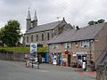 Village stores Betws yn Rhos - geograph.org.uk - 29866.jpg 512 × 384; 38 KB
-
 Betws yn Rhos village centre - geograph.org.uk - 29864.jpg 512 × 384; 36 KB
-
 Betws-yn Rhos, Dolwen Road - geograph.org.uk - 4442757.jpg 640 × 480; 291 KB
-
 Betws-yn-Rhos from the South - geograph.org.uk - 4444397.jpg 640 × 480; 309 KB
-
 Betws-yn-Rhos War Memorial - geograph.org.uk - 4442987.jpg 481 × 640; 360 KB
-
 Betws-yn-Rhos, Ffordd Llanelwy - geograph.org.uk - 4443075.jpg 640 × 480; 275 KB
-
 Betws-yn-Rhos, The Wheatsheaf Inn - geograph.org.uk - 4443058.jpg 640 × 480; 257 KB
-
 Betws-yn-Rhos, The Wheatsheaf Inn - geograph.org.uk - 4444290.jpg 640 × 480; 260 KB
-
 Black 'n Gray - geograph.org.uk - 2128314.jpg 3,200 × 2,200; 7 MB
-
 Bluebell bank - geograph.org.uk - 3497436.jpg 640 × 480; 104 KB
-

-
 Bod Elian, Llanelian, Colwyn Bay. - geograph.org.uk - 1896355.jpg 1,280 × 1,024; 401 KB
-
 Bonyn derwen - An oak stump - geograph.org.uk - 5977807.jpg 640 × 435; 127 KB
-
 Bottom of the hill - geograph.org.uk - 4836720.jpg 640 × 480; 124 KB
-
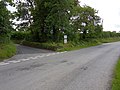
 Bridge and crossroads - geograph.org.uk - 4316242.jpg 1,600 × 1,200; 626 KB
-
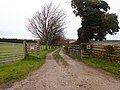
 Bridleway near Sarn - geograph.org.uk - 4836804.jpg 640 × 480; 104 KB
-
 Bridleway to Bethgeth - geograph.org.uk - 3498664.jpg 640 × 480; 102 KB
-
 Bryn Dansi - geograph.org.uk - 3178378.jpg 640 × 480; 66 KB
-
 Bryn ffanigl-ganol - geograph.org.uk - 125446.jpg 640 × 480; 112 KB
-
 Bryn-Elian Farm - geograph.org.uk - 3176633.jpg 640 × 480; 81 KB
-
 Bryn-ffanigl-ganol - geograph.org.uk - 6005898.jpg 640 × 479; 62 KB
-
 Bryn-ffanigl-ganol path - geograph.org.uk - 2550491.jpg 4,000 × 3,000; 4.86 MB
-
 Bryncar - geograph.org.uk - 127727.jpg 640 × 480; 80 KB
-
 Brynffanigl Isaf - geograph.org.uk - 5158719.jpg 640 × 480; 82 KB
-
 Brynffanigl Isaf track 1 - geograph.org.uk - 5158733.jpg 640 × 480; 101 KB
-
 Brynffanigl Isaf track 2 - geograph.org.uk - 5158742.jpg 640 × 480; 93 KB
-
 Brynfford Crossroads - geograph.org.uk - 127723.jpg 640 × 480; 57 KB
-
 Bryngwenallt path - geograph.org.uk - 2550560.jpg 3,000 × 4,000; 5.8 MB
-
 Bryngwenallt way - geograph.org.uk - 2550577.jpg 3,000 × 4,000; 4.98 MB
-
 Bryniau crwn - Rounded hills - geograph.org.uk - 3176641.jpg 640 × 465; 84 KB
-
 Bus shelter near the junction - geograph.org.uk - 4306399.jpg 1,600 × 1,200; 349 KB
-
 Busy stream - geograph.org.uk - 3310822.jpg 640 × 480; 115 KB
-
 Byway near Pen-y-bryn - geograph.org.uk - 5209181.jpg 480 × 640; 133 KB
-
 Capel Rehoboth - geograph.org.uk - 6335673.jpg 800 × 600; 177 KB
-
 Caravan field - geograph.org.uk - 4708783.jpg 640 × 480; 78 KB
-
 Cattle pasture - geograph.org.uk - 5209204.jpg 640 × 480; 99 KB
-
 Cefn Castell Junction - geograph.org.uk - 2550320.jpg 4,000 × 3,000; 5.69 MB
-
 Cefn Du - geograph.org.uk - 4668904.jpg 1,000 × 750; 545 KB
-
 Chapel view - geograph.org.uk - 3310827.jpg 640 × 480; 78 KB
-

-
 Church of St Elian, Llanelian-yn-Rhos - geograph.org.uk - 6457877.jpg 1,280 × 839; 321 KB
-
 Climb to Gloddaeth - geograph.org.uk - 5806577.jpg 640 × 427; 100 KB
-
 Coed Bryn Mawr - geograph.org.uk - 3411167.jpg 640 × 480; 68 KB
-
 Coed Coch - geograph.org.uk - 2681931.jpg 640 × 480; 146 KB
-
 Coed Coch - geograph.org.uk - 5977820.jpg 640 × 435; 109 KB
-
 Coed Coch 2 - geograph.org.uk - 2681937.jpg 640 × 480; 133 KB
-
 Coed Coch 3 - geograph.org.uk - 2700960.jpg 640 × 479; 113 KB
-

-
 Coed yr Odyn - geograph.org.uk - 3911577.jpg 640 × 480; 67 KB
-
 Copse near Betws-yn-Rhos - geograph.org.uk - 126789.jpg 640 × 421; 88 KB
-
 Cottage conversions - geograph.org.uk - 5210145.jpg 640 × 480; 70 KB
-
 Cottages at Betws-yn-Rhos - geograph.org.uk - 4443090.jpg 640 × 481; 272 KB
-
 Country Lane - geograph.org.uk - 2550550.jpg 4,000 × 3,000; 4.44 MB
-
 Country lane between Abergele and Betws-yn-Rhos - geograph.org.uk - 6409903.jpg 3,528 × 2,470; 2.41 MB
-
 Country lane near Pen-y-Bryn - geograph.org.uk - 4307283.jpg 1,600 × 1,200; 513 KB
-
 Country road near Bryn-ffanigl Uchaf - geograph.org.uk - 4307300.jpg 1,600 × 1,200; 395 KB
-
 Cows at pasture - geograph.org.uk - 4708607.jpg 640 × 480; 59 KB
-
 Croesengan Isa - geograph.org.uk - 5269653.jpg 640 × 480; 74 KB
-
 Crossroads looking towards Plas Helyg - geograph.org.uk - 4316240.jpg 1,600 × 1,200; 298 KB
-
 Crossroads near Coed Coch - geograph.org.uk - 4317191.jpg 1,600 × 1,200; 439 KB
-
 Crossroads near Pen-y-cefn - geograph.org.uk - 4316237.jpg 1,600 × 1,200; 250 KB
-
 Cut grass field Betws - yn - Rhos - geograph.org.uk - 1827205.jpg 3,296 × 2,472; 1.88 MB
-

-
 Dafarn-y-Pwll - geograph.org.uk - 5158753.jpg 640 × 480; 71 KB
-
 Dairy calves - geograph.org.uk - 5158643.jpg 640 × 480; 91 KB
-

-
 Derelict building near Glasfryn - geograph.org.uk - 1492058.jpg 640 × 480; 96 KB
-
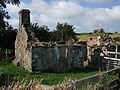
 Derelict farm building - geograph.org.uk - 165442.jpg 640 × 480; 105 KB
-
 Descending to the Nant yr Efail - geograph.org.uk - 5806582.jpg 640 × 427; 141 KB
-
 Dulas headwaters - geograph.org.uk - 5208918.jpg 640 × 480; 109 KB
-
 Dulas valley - geograph.org.uk - 5158701.jpg 640 × 480; 90 KB
-
 Dwy adwy - Two gateways - geograph.org.uk - 3176557.jpg 480 × 640; 81 KB
-
 Dyffryn Dulas - Dulas Valley - geograph.org.uk - 3176645.jpg 640 × 480; 86 KB
-
 Dyffryn Dulas - Dulas Valley - geograph.org.uk - 5978126.jpg 640 × 480; 87 KB
-
 Edge of Ffernant Dingle - geograph.org.uk - 4799318.jpg 640 × 480; 106 KB
-
 Entrance to Pen-y-bryn caravan site - geograph.org.uk - 4307289.jpg 1,600 × 1,200; 404 KB
-
 Fallen tree - geograph.org.uk - 4858455.jpg 480 × 640; 115 KB
-
 Farm at Peniarthy Bach - geograph.org.uk - 4605803.jpg 1,024 × 627; 113 KB
-
 Farm buildings and muddy track - geograph.org.uk - 6409881.jpg 4,000 × 3,000; 2.86 MB
-
 Farm buildings, Ffernant - geograph.org.uk - 4799329.jpg 640 × 480; 102 KB
-
 Farm road to Ffynnonau Farm - geograph.org.uk - 6409898.jpg 4,000 × 3,000; 3.01 MB
-
 Farmland at Nant-yr-efail - geograph.org.uk - 5681716.jpg 640 × 441; 50 KB
-
 Farmland in the hills south of Abergele - geograph.org.uk - 6409944.jpg 4,000 × 3,000; 2.86 MB
-
 Farmland South of the B5381 - geograph.org.uk - 4444450.jpg 640 × 480; 310 KB
-
 Farmland to the West of Dolwen - geograph.org.uk - 4443108.jpg 640 × 480; 289 KB
-
 Ffernant Dingle - geograph.org.uk - 4799324.jpg 640 × 480; 105 KB
-
 Ffordd droellog - A winding road - geograph.org.uk - 2700932.jpg 480 × 640; 99 KB
-
 Ffordd y B5381 - The B5381 road - geograph.org.uk - 3176556.jpg 480 × 640; 96 KB
-
 Field above Bryn - y - Maen Farm - geograph.org.uk - 1492207.jpg 640 × 480; 80 KB
-
 Field below Hafodty - geograph.org.uk - 5269640.jpg 640 × 480; 71 KB
-
 Field near Coed Coch - geograph.org.uk - 4317185.jpg 1,600 × 1,200; 357 KB
-
 Field near Gwyndy-isaf - geograph.org.uk - 4316252.jpg 1,600 × 1,200; 565 KB
-
 Field near Tan Rallt - geograph.org.uk - 4318088.jpg 1,600 × 1,200; 375 KB
-
 Field near the Afon Dulas - geograph.org.uk - 4317195.jpg 1,600 × 1,200; 410 KB
-
 Field near the lake at Coed Coch - geograph.org.uk - 4316258.jpg 1,600 × 1,200; 348 KB
-
 Field near Ty Isa Trofarth - geograph.org.uk - 4317209.jpg 1,600 × 1,200; 351 KB
-
 Field next to River Dulas - geograph.org.uk - 4311240.jpg 1,600 × 1,200; 431 KB
-
 Field View - geograph.org.uk - 2128143.jpg 3,200 × 2,632; 6.34 MB
-
 Field with a view - geograph.org.uk - 1147869.jpg 640 × 480; 98 KB
-
 Field-side footpath - geograph.org.uk - 4858246.jpg 640 × 480; 75 KB
-
 Fields below Bryn Dansi - geograph.org.uk - 4836790.jpg 640 × 480; 74 KB
-
 Fields below Bryn Rodyn - geograph.org.uk - 3911529.jpg 640 × 479; 84 KB
-
 Fields near Bethgeth - geograph.org.uk - 4373978.jpg 1,600 × 1,200; 519 KB
-
 Fields near Bethgeth - geograph.org.uk - 4373982.jpg 1,600 × 1,200; 603 KB
-
 Fields near Betws-yn-Rhos - geograph.org.uk - 4373965.jpg 1,600 × 1,200; 619 KB
-
 Fields near Bryn-ffanigl-ganol - geograph.org.uk - 4307316.jpg 1,600 × 1,200; 454 KB
-
 Fields near Glyn Bâch - geograph.org.uk - 4374019.jpg 1,600 × 1,200; 607 KB
-
 Fields to Garnedd-isa - geograph.org.uk - 3498565.jpg 640 × 480; 107 KB
-
 Fields ^ electricity sub-station - geograph.org.uk - 4373907.jpg 1,600 × 1,200; 410 KB
-
 Flooded road - geograph.org.uk - 3311016.jpg 640 × 480; 98 KB
-
 Footpath bridge - geograph.org.uk - 4858194.jpg 640 × 480; 114 KB
-
 Footpath exit - geograph.org.uk - 2550564.jpg 3,000 × 4,000; 5.95 MB
-
 Footpath field - geograph.org.uk - 5269643.jpg 640 × 480; 69 KB
-
 Footpath near Gwyndy-isaf - geograph.org.uk - 4316248.jpg 1,600 × 1,200; 644 KB
-
 Footpath to Peniarth Bach - geograph.org.uk - 5210141.jpg 480 × 640; 96 KB
-
 Footpath with rock-art - geograph.org.uk - 947888.jpg 640 × 480; 102 KB
-
 Forest Gate - geograph.org.uk - 2128058.jpg 3,352 × 2,349; 6.57 MB
-
 Former dwelling place - geograph.org.uk - 6335624.jpg 800 × 600; 198 KB
-
 Gate and Summer sky Tyddyn-y-graig - geograph.org.uk - 4605729.jpg 1,024 × 768; 121 KB
-
 Gate with stump - geograph.org.uk - 2378368.jpg 640 × 480; 95 KB
-
 Giving Direction - geograph.org.uk - 2128278.jpg 4,000 × 3,000; 5.13 MB
-
 Glan Aber - geograph.org.uk - 3498632.jpg 640 × 480; 104 KB
-
 Glan Aber Road - geograph.org.uk - 2550313.jpg 4,000 × 3,000; 5.98 MB
-
 Gorse and snowdrift - geograph.org.uk - 1147865.jpg 640 × 480; 99 KB
-
 Grassy lane to Glyn Bâch - geograph.org.uk - 4374016.jpg 1,600 × 1,200; 604 KB
-

-
 Gwatheg yn pori - Grazing cattle - geograph.org.uk - 3178146.jpg 640 × 458; 57 KB
-
 Gwyndy, Betws-yn-Rhos NLW3362965.jpg 596 × 425; 70 KB
-
 Hedge and Gate next to the B5381 - geograph.org.uk - 4444436.jpg 640 × 480; 307 KB
-
 Hedge, lane, trees - geograph.org.uk - 4799373.jpg 640 × 480; 79 KB
-
 Hedgerow Snowdrops - geograph.org.uk - 4836758.jpg 640 × 480; 92 KB
-

-
 Hen gapel - An old chapel - geograph.org.uk - 2681952.jpg 640 × 480; 130 KB
-
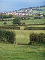
 Hill to the South of Betws-yn-Rhos - geograph.org.uk - 4444407.jpg 640 × 480; 290 KB
-
 Holly hedge - geograph.org.uk - 5209196.jpg 640 × 480; 101 KB
-
 Home Farm, Coed Coch - geograph.org.uk - 2681930.jpg 640 × 480; 107 KB
-

-
 In Betws-yn-Rhos village - geograph.org.uk - 4341847.jpg 640 × 360; 49 KB
-
 Incised stream - geograph.org.uk - 3310934.jpg 640 × 480; 83 KB
-
 Inquisitive sheep - geograph.org.uk - 4858468.jpg 640 × 480; 89 KB
-
 Junction near Glasfryn - geograph.org.uk - 4668799.jpg 1,000 × 750; 666 KB
-

-
 Lane at Hafodty - geograph.org.uk - 5269628.jpg 640 × 480; 84 KB
-
 Lane below Coed Uchaf - geograph.org.uk - 4317198.jpg 1,600 × 1,200; 478 KB
-
 Lane near Caeau bedw - geograph.org.uk - 4318091.jpg 1,600 × 1,200; 513 KB
-
 Lane near Pant Idda - geograph.org.uk - 4318074.jpg 1,600 × 1,200; 578 KB
-
 Looking towards Cefn Castell - geograph.org.uk - 4373908.jpg 1,600 × 1,200; 368 KB
-
 Lunch time at Nant-yr-efail - geograph.org.uk - 5727989.jpg 640 × 480; 76 KB
-
 Main road through Betws yn Rhos - geograph.org.uk - 29869.jpg 512 × 384; 40 KB
-
 Maize crop residua - geograph.org.uk - 4799339.jpg 640 × 480; 96 KB
-
 Meandering stream - geograph.org.uk - 5269645.jpg 640 × 480; 110 KB
-
 Meanders with trees - geograph.org.uk - 3310813.jpg 640 × 480; 124 KB
-
 Melting snowdrifts - geograph.org.uk - 5700523.jpg 640 × 480; 65 KB
-
 Miniature forest - geograph.org.uk - 947895.jpg 640 × 480; 93 KB
-
 Minor road crossing - geograph.org.uk - 5209202.jpg 640 × 480; 102 KB
-
 Misleading road signs above Glan Conwy - geograph.org.uk - 3039170.jpg 3,296 × 2,472; 3.84 MB
-
 Missing gate - geograph.org.uk - 2378248.jpg 640 × 480; 96 KB
-
 Moelfre Uchaf drainage - geograph.org.uk - 4374002.jpg 1,600 × 1,200; 471 KB
-
 Moelfre Uchaf view to the east - geograph.org.uk - 3498464.jpg 640 × 480; 107 KB
-
 Molehills and mallards - geograph.org.uk - 4316256.jpg 1,600 × 1,200; 412 KB
-
 Muddy gateway near Ty Isa Trofarth - geograph.org.uk - 4317207.jpg 1,600 × 1,200; 552 KB
-
 Mynydd Llanelian Trig - geograph.org.uk - 3291730.jpg 640 × 480; 95 KB
-
 Nant Ganol - geograph.org.uk - 2550529.jpg 4,000 × 3,000; 4.87 MB
-
 Nant Ganol Farm - geograph.org.uk - 2550533.jpg 4,000 × 3,000; 5.89 MB
-
 Nant Ganol path - geograph.org.uk - 2550525.jpg 3,000 × 4,000; 4.95 MB
-
 Nant y Glyn - geograph.org.uk - 1920089.jpg 521 × 640; 91 KB
-

-
 Oak wreck - geograph.org.uk - 5158662.jpg 640 × 480; 101 KB
-

-
-
 Old school, Bryn-y-maen - geograph.org.uk - 5649721.jpg 640 × 480; 105 KB
-
 Old tractor at exit to field - geograph.org.uk - 5806580.jpg 640 × 427; 147 KB
-
 Organic farmland - geograph.org.uk - 4373959.jpg 1,600 × 1,200; 496 KB
-
 Over The Gate - geograph.org.uk - 2128738.jpg 4,000 × 3,000; 5.88 MB
-
 Ox Bow - geograph.org.uk - 2128080.jpg 3,284 × 2,281; 6.38 MB
-
 Parc y Mor construction - geograph.org.uk - 4799286.jpg 640 × 480; 59 KB
-
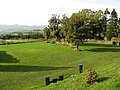
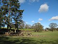 Parkland trees - geograph.org.uk - 4858211.jpg 640 × 480; 70 KB
-
 Pasture above Bryn-ffanigl Uchaf - geograph.org.uk - 5209189.jpg 640 × 480; 93 KB


_-_geograph.org.uk_-_4605790.jpg)


