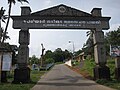
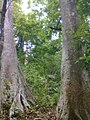
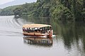
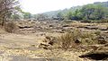
Category:Bhoothathankettu
| Object location | | View all coordinates using: OpenStreetMap |
|---|
dam across Periyar river, Ernakulam, Kerala, India  | |||||
| Upload media | |||||
| Instance of | |||||
|---|---|---|---|---|---|
| Location | Kerala, India | ||||
| Nominal power capacity |
| ||||
 | |||||
Subcategories
This category has the following 4 subcategories, out of 4 total.
Media in category "Bhoothathankettu"
The following 56 files are in this category, out of 56 total.
-
 Bhoothathankettu - ഭൂതത്താൻകെട്ട്-1.JPG 3,648 × 2,736; 3.61 MB
-
 Bhoothathankettu - ഭൂതത്താൻകെട്ട്-10.JPG 2,048 × 1,536; 1.31 MB
-
 Bhoothathankettu - ഭൂതത്താൻകെട്ട്-11.jpg 3,840 × 2,160; 2.21 MB
-
 Bhoothathankettu - ഭൂതത്താൻകെട്ട്-2.JPG 3,648 × 2,736; 2.48 MB
-
 Bhoothathankettu - ഭൂതത്താൻകെട്ട്-6.JPG 3,648 × 2,736; 2.33 MB
-
 Bhoothathankettu - ഭൂതത്താൻകെട്ട്-9.JPG 3,648 × 2,736; 4.21 MB
-
 Bhoothathankettu forest Range - panoramio.jpg 1,200 × 1,600; 739 KB
-
 Boating Bhoothathankettu Dam.jpg 6,000 × 4,000; 4.18 MB
-
 Boothathankettu Forest Area.jpg 4,160 × 2,368; 5.81 MB
-
 Boothathankettu Forest.jpg 4,160 × 2,368; 3.45 MB
-
 Boothathankettu forests.jpg 4,160 × 2,368; 4.02 MB
-
 Boothathankettu.jpg 4,160 × 2,368; 4 MB
-
 Durga Temple,Bhoothathankettu,kerala - panoramio.jpg 1,600 × 1,200; 628 KB
-
 Knema attenuata-Bhoothathaankettu 01.JPG 4,000 × 3,000; 2.06 MB
-
 Knema attenuata-Bhoothathaankettu 02.JPG 4,000 × 3,000; 2.56 MB
-
 Knema attenuata-Bhoothathaankettu 03.JPG 4,000 × 3,000; 2.32 MB
-
 Views from and near BhoothathanKettu Dam (1).jpg 4,608 × 3,456; 4.42 MB
-
 Views from and near BhoothathanKettu Dam (10).jpg 4,608 × 3,456; 3.52 MB
-
 Views from and near BhoothathanKettu Dam (11).jpg 4,608 × 3,456; 6.04 MB
-
 Views from and near BhoothathanKettu Dam (12).jpg 4,608 × 3,456; 6.19 MB
-
 Views from and near BhoothathanKettu Dam (13).jpg 3,456 × 4,608; 6.09 MB
-
 Views from and near BhoothathanKettu Dam (14).jpg 4,608 × 3,456; 3.62 MB
-
 Views from and near BhoothathanKettu Dam (15).jpg 3,456 × 4,608; 4.57 MB
-
 Views from and near BhoothathanKettu Dam (16).jpg 4,608 × 3,456; 3.45 MB
-
 Views from and near BhoothathanKettu Dam (17).jpg 4,608 × 3,456; 3.74 MB
-
 Views from and near BhoothathanKettu Dam (18).jpg 3,456 × 4,608; 4.42 MB
-
 Views from and near BhoothathanKettu Dam (19).jpg 4,608 × 3,456; 2.88 MB
-
 Views from and near BhoothathanKettu Dam (2).jpg 4,608 × 3,456; 2.56 MB
-
 Views from and near BhoothathanKettu Dam (20).jpg 4,608 × 3,456; 2.87 MB
-
 Views from and near BhoothathanKettu Dam (21).jpg 4,608 × 3,456; 4.93 MB
-
 Views from and near BhoothathanKettu Dam (22).jpg 4,608 × 3,456; 4.39 MB
-
 Views from and near BhoothathanKettu Dam (23).jpg 4,608 × 3,456; 2.76 MB
-
 Views from and near BhoothathanKettu Dam (24).jpg 4,608 × 3,456; 3.66 MB
-
 Views from and near BhoothathanKettu Dam (25).jpg 4,608 × 3,456; 3.4 MB
-
 Views from and near BhoothathanKettu Dam (26).jpg 4,608 × 3,456; 2.64 MB
-
 Views from and near BhoothathanKettu Dam (27).jpg 4,608 × 3,456; 2.65 MB
-
 Views from and near BhoothathanKettu Dam (28).jpg 4,608 × 3,456; 4.15 MB
-
 Views from and near BhoothathanKettu Dam (29).jpg 4,608 × 3,456; 3.86 MB
-
 Views from and near BhoothathanKettu Dam (3).jpg 4,608 × 3,456; 2.66 MB
-
 Views from and near BhoothathanKettu Dam (30).jpg 4,608 × 3,456; 2.19 MB
-
 Views from and near BhoothathanKettu Dam (31).jpg 4,608 × 3,456; 3.68 MB
-
 Views from and near BhoothathanKettu Dam (32).jpg 4,608 × 3,456; 3.48 MB
-
 Views from and near BhoothathanKettu Dam (33).jpg 4,608 × 3,456; 2.8 MB
-
 Views from and near BhoothathanKettu Dam (34).jpg 4,608 × 3,456; 2.43 MB
-
 Views from and near BhoothathanKettu Dam (35).jpg 4,608 × 3,456; 4.11 MB
-
 Views from and near BhoothathanKettu Dam (36).jpg 4,608 × 3,456; 4.11 MB
-
 Views from and near BhoothathanKettu Dam (37).jpg 4,608 × 3,456; 3.02 MB
-
 Views from and near BhoothathanKettu Dam (38).jpg 4,608 × 3,456; 4.47 MB
-
 Views from and near BhoothathanKettu Dam (39).jpg 4,608 × 3,456; 5.19 MB
-
 Views from and near BhoothathanKettu Dam (4).jpg 4,608 × 3,456; 2.33 MB
-
 Views from and near BhoothathanKettu Dam (40).jpg 4,608 × 3,456; 2.76 MB
-
 Views from and near BhoothathanKettu Dam (5).jpg 4,608 × 3,456; 3.61 MB
-
 Views from and near BhoothathanKettu Dam (6).jpg 3,456 × 4,608; 3.55 MB
-
 Views from and near BhoothathanKettu Dam (7).jpg 4,608 × 3,456; 5.21 MB
-
 Views from and near BhoothathanKettu Dam (8).jpg 4,608 × 3,456; 4.95 MB
-
 Views from and near BhoothathanKettu Dam (9).jpg 4,608 × 3,456; 3.59 MB


.jpg)
.jpg)
.jpg)
.jpg)
.jpg)
.jpg)
.jpg)
.jpg)
.jpg)
.jpg)
.jpg)
.jpg)
.jpg)
.jpg)
.jpg)
.jpg)
.jpg)
.jpg)
.jpg)
.jpg)
.jpg)
.jpg)
.jpg)
.jpg)
.jpg)
.jpg)
.jpg)
.jpg)
.jpg)
.jpg)
.jpg)
.jpg)
.jpg)
.jpg)
.jpg)
.jpg)
.jpg)
.jpg)
.jpg)
.jpg)