Category:Bicycles in the East Riding of Yorkshire
Media in category "Bicycles in the East Riding of Yorkshire"
The following 62 files are in this category, out of 62 total.
-
 476 Hessle Road, Hull - geograph.org.uk - 675902.jpg 449 × 640; 98 KB
-
 A Jaguar on Keldgate, Beverley (geograph 4476345).jpg 2,448 × 1,624; 1.63 MB
-
 A Jaguar on Keldgate, Beverley (geograph 4476349).jpg 2,448 × 1,624; 1.87 MB
-
 A Winter's Morning at Woodmansey - geograph.org.uk - 1156287.jpg 480 × 640; 137 KB
-
 A63 Underpass, Melton - geograph.org.uk - 901034.jpg 640 × 443; 62 KB
-
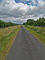
 Bridleway - geograph.org.uk - 25645.jpg 640 × 480; 88 KB
-
 Bridleway Intersection - geograph.org.uk - 565298.jpg 640 × 475; 161 KB
-
 Burnbutt Lane (geograph 6901902).jpg 1,024 × 683; 418 KB
-
 Canal towpath at Sandhill Lock - geograph.org.uk - 1415095.jpg 640 × 480; 137 KB
-
 Cobdale Cottage, Cobdale - geograph.org.uk - 761322.jpg 640 × 357; 146 KB
-
 Cottingham Post Office - geograph.org.uk - 750254.jpg 640 × 460; 109 KB
-

-
 Driffield Post Office - geograph.org.uk - 453769.jpg 640 × 428; 100 KB
-
 Driffield Station Platform - geograph.org.uk - 1180617.jpg 532 × 640; 102 KB
-
 East Riding Treasure House, Beverley - panoramio.jpg 1,200 × 797; 373 KB
-

-
 Entering Asselby (geograph 5600714).jpg 5,376 × 3,024; 2.58 MB
-
 Fangfoss-station-by-DS-Pugh.jpg 640 × 479; 54 KB
-
 Field Entrance, beside the A166 - geograph.org.uk - 1374808.jpg 640 × 480; 62 KB
-
 Floral display on Sutton Road, Wawne (geograph 5483062).jpg 1,600 × 1,065; 796 KB
-
 Fork in the road. - geograph.org.uk - 16333.jpg 640 × 480; 90 KB
-

-
 Gas pipe line marker post (and bike). - geograph.org.uk - 537317.jpg 640 × 483; 148 KB
-
 Gate onto overgrown Trans Pennine Trail. - geograph.org.uk - 537348.jpg 640 × 433; 137 KB
-
 Harpham Crossing - geograph.org.uk - 462827.jpg 471 × 640; 114 KB
-
 Hodgsons, Beverley - geograph.org.uk - 1527886.jpg 640 × 480; 69 KB
-
 Hornsea museum.jpg 3,264 × 2,448; 3.39 MB
-

-
 K6 telephone box on Wold Road, Hull (geograph 6081051).jpg 5,184 × 3,888; 5.35 MB
-
 Kilnwick church.jpg 3,264 × 2,448; 3.97 MB
-
 LJs Bar on Lincoln Way, Beverley (geograph 6358200).jpg 800 × 600; 98 KB
-
 Main Street, Wawne (geograph 6067564).jpg 863 × 1,024; 1.05 MB
-
 Main Street, Wetwang (geograph 4457484).jpg 640 × 427; 191 KB
-

-
 Melton Junction - geograph.org.uk - 901039.jpg 498 × 640; 96 KB
-
 Middlehowe Road near Walkington (geograph 7227904).jpg 3,888 × 5,184; 4.92 MB
-
 Millington, nice day for a ride IMG 1258.JPG - panoramio.jpg 1,600 × 982; 571 KB
-
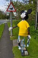 Minnie-cycle, Wetwang, E Yorks (geograph 4457492).jpg 427 × 640; 206 KB
-
 Morrisons in Beverley (geograph 5018367).jpg 1,500 × 976; 144 KB
-
 Newton Garth, Paull - geograph.org.uk - 289764.jpg 640 × 426; 78 KB
-
 On the Warter to Huggate road - geograph.org.uk - 25636.jpg 640 × 480; 130 KB
-
 Parking sign, Wetwang, E Yorks (geograph 4457517).jpg 640 × 447; 211 KB
-
 Riplingham Common - geograph.org.uk - 829509.jpg 519 × 640; 109 KB
-
 Road safety lesson in Wilberfoss (geograph 3137644).jpg 800 × 600; 338 KB
-
 Secure Parking for a bicycle^ - geograph.org.uk - 537952.jpg 640 × 289; 48 KB
-
 Shops on Wold Road, Hull (geograph 6081048).jpg 640 × 407; 55 KB
-
 Swithlands, Northmoor, Cottingham - geograph.org.uk - 666957.jpg 640 × 480; 87 KB
-
 The Christmas Rush - geograph.org.uk - 294502.jpg 640 × 469; 101 KB
-
 The Hop Pole, Willerby (geograph 6130671).jpg 800 × 672; 122 KB
-
 The Huggate to North Dalton Road - geograph.org.uk - 25626.jpg 640 × 480; 134 KB
-
 The Trans Pennine Trail, Hornsea - geograph.org.uk - 516056.jpg 640 × 480; 103 KB
-
 The Warter to Huggate road. - geograph.org.uk - 10758.jpg 640 × 480; 113 KB
-
 The Warter to North Dalton road. - geograph.org.uk - 25619.jpg 640 × 480; 89 KB
-
 Toll Gavel, Beverley - geograph.org.uk - 878102.jpg 640 × 480; 89 KB
-
 Tour de Yorkshire 2015 - Day 1 (17154442119).jpg 800 × 1,200; 333 KB
-
 Tour de Yorkshire bike on Megson Way (geograph 4476390).jpg 2,448 × 1,624; 2 MB
-
 Tour de Yorkshire bunting on Cartwright Lane (geograph 4464972).jpg 2,448 × 1,624; 1.76 MB
-
 Trans Pennine Trail near Castle Hill (geograph 6369360).jpg 800 × 533; 121 KB
-
 UOH Jan23 DAIM Building Construction.jpg 4,176 × 2,784; 3.84 MB
-
 Vic Sutton Memorial Road Race 2011 (5900738126).jpg 710 × 1,000; 245 KB
-
 Withernsea Indoor Market on Queen Street (geograph 3611345).jpg 1,024 × 768; 138 KB
-
 Withernsea Pier towers - geograph.org.uk - 1747203.jpg 640 × 480; 58 KB

.jpg)
.jpg)


.jpg)


_(25970739593).jpg)
.jpg)


.jpg)

_(26481289012).jpg)
._-_geograph.org.uk_-_537317.jpg)


_(25970739443).jpg)
.jpg)

.jpg)
.jpg)
.jpg)
_(26207641031).jpg)

.jpg)

.jpg)
.jpg)


.jpg)

.jpg)

.jpg)


.jpg)


.jpg)
.jpg)
.jpg)

.jpg)
.jpg)

.jpg)