Category:Bijlokeabdij
| Object location | | View all coordinates using: OpenStreetMap |
|---|
|
This is a category about onroerend erfgoed number 20338
|
| NO WIKIDATA ID FOUND! Search for Bijlokeabdij on Wikidata | |
| Upload media |
Media in category "Bijlokeabdij"
The following 41 files are in this category, out of 41 total.
-
 043-02-Biloque-05.jpg 608 × 1,008; 306 KB
-
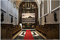
 20338 Refectorium in de Bijlokeabdij met het grafmonument van Hugo II.jpg 3,084 × 4,096; 9.17 MB
-
 Bijloke Abbey refectory in Ghent city museum STAM.jpg 1,920 × 1,280; 576 KB
-
 Bijloke abdij. 1.JPG 4,676 × 3,117; 10.82 MB
-
 Bijloke abdij. 12.JPG 3,168 × 4,752; 11.96 MB
-
 Bijloke abdij. 6.jpg 4,742 × 3,177; 11.65 MB
-
 Bijloke gent.JPG 1,296 × 972; 224 KB
-
 Bijlokeabdij (1) Gent.jpg 10,947 × 6,280; 14.63 MB
-
 Bijlokeabdij (2) Gent.jpg 9,000 × 7,836; 14.12 MB
-
 Bijlokeabdij Campus Gent 1.jpg 12,000 × 5,441; 15.8 MB
-
 Bijlokeabdij Campus Gent 2.jpg 9,538 × 5,184; 10.61 MB
-
 Bijlokeabdij Campus Gent 3.jpg 6,234 × 7,131; 9.72 MB
-
 Bijlokeabdij Gent 1.jpg 14,821 × 6,394; 15.62 MB
-
 Bijlokeabdij Gent 2.jpg 14,313 × 6,961; 16.06 MB
-
 Bijlokeabdij Gent 3.jpg 16,320 × 7,401; 28.64 MB
-
 Bijlokekaai boog.JPG 3,264 × 2,448; 3.04 MB
-
 Byloke, Ghent (BM 1870,0813.188).jpg 1,600 × 1,159; 344 KB
-
 Campus Bijloke.jpg 3,264 × 4,928; 1.12 MB
-
 Fierens-Gevaert, La renaissance septentrionale - 1905 (page 21 crop).jpg 1,319 × 2,143; 497 KB
-
 Gebäude mit undefinierbarer Adresse an Ecke Jozef Kluyskensstraat-Bijlokekaai (Bijlokeabdij).jpg 8,160 × 3,182; 13.31 MB
-
 Gent - 20220626 120534.jpg 4,128 × 3,096; 5.13 MB
-
 Gent Bijloke 001.JPG 3,264 × 2,448; 2.51 MB
-
 Gent Bijloke 002.JPG 3,264 × 2,448; 2.92 MB
-
 Gent Bijloke 003.JPG 3,264 × 2,448; 4.15 MB
-
 Gent Bijloke 004.JPG 3,264 × 2,448; 2.9 MB
-
 Gent Bijloke 005.JPG 3,264 × 2,448; 2.67 MB
-
 Gent Bijloke 006.JPG 3,264 × 2,448; 3.52 MB
-
 Gent Bijloke 007.JPG 2,448 × 3,264; 5.18 MB
-
 Gent Bijloke 008.JPG 3,264 × 2,448; 4.01 MB
-

-

-
-
 Gent Bijlokekaai 3, Jozef Kluyskensstraat 2 - 23076 - onroerenderfgoed.jpg 1,000 × 1,282; 195 KB
-
 Gent Bijlokekaai 3, Jozef Kluyskensstraat 2 - 23173 - onroerenderfgoed.jpg 1,000 × 1,280; 267 KB
-
 Godshuizenlaan Oude Bijloke Containers.JPG 3,264 × 2,448; 3.98 MB
-
 Godshuizenlaan Oude Bijloke Nieuwbouw.JPG 3,264 × 2,448; 4.35 MB
-
 OA BIJLOKE CH F20 Z 1.jpg 1,140 × 1,140; 411 KB
-
 OA BIJLOKE CH F20.jpg 3,371 × 4,369; 8.81 MB
-
 Refterzaal, STAM Gent.jpg 3,648 × 5,472; 7.06 MB
-
 STAM Gent, Refterzaal.jpg 5,472 × 3,648; 4.77 MB
-
 Stam willem.jpg 3,405 × 2,280; 982 KB


_Gent.jpg)
_Gent.jpg)


.jpg)

.jpg)


.jpg)