Category:Billesley, Warwickshire
village and civil parish in Warwickshire, United Kingdom  | |||||
| Upload media | |||||
| Instance of | |||||
|---|---|---|---|---|---|
| Location | Stratford-on-Avon, Warwickshire, West Midlands, England | ||||
 | |||||
English: Billesley is a village and civil parish in the Stratford district of Warwickshire, England, just off the A46 road, between Stratford and Alcester. According to the 2001 census, the parish had a population of 46.
Subcategories
This category has the following 2 subcategories, out of 2 total.
A
M
- Billesley Manor Hotel (10 F)
Media in category "Billesley, Warwickshire"
The following 42 files are in this category, out of 42 total.
-
-
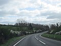
 A46 Temple Grafton Junction - geograph.org.uk - 3655880.jpg 640 × 490; 62 KB
-
 Barns near Iron Gate Farm - geograph.org.uk - 3047708.jpg 640 × 480; 87 KB
-
 Billesley Brake - geograph.org.uk - 635115.jpg 640 × 480; 80 KB
-
 Bridle path at Iron Gate Farm - geograph.org.uk - 3235020.jpg 640 × 480; 109 KB
-
 Cast iron shelter - geograph.org.uk - 667747.jpg 640 × 482; 161 KB
-
 Cereal field opposite Upper Billesley - geograph.org.uk - 5066611.jpg 1,024 × 768; 273 KB
-
 Driveway to Redhill Farm - geograph.org.uk - 122580.jpg 640 × 480; 113 KB
-
 Fields nr Billesley - geograph.org.uk - 1633116.jpg 640 × 427; 53 KB
-
 Footpath to Iron Gate Farm - geograph.org.uk - 124362.jpg 640 × 480; 115 KB
-
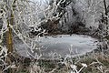 Frozen pond by Billesley Brake - geograph.org.uk - 2189246.jpg 2,000 × 1,333; 256 KB
-
 Grass fields near Iron Gate Farm - geograph.org.uk - 3234994.jpg 640 × 480; 82 KB
-
 Harrowing Stone - geograph.org.uk - 5066377.jpg 768 × 1,024; 297 KB
-
 In Shakespeare country - geograph.org.uk - 5066784.jpg 800 × 600; 162 KB
-
 Iron Gate Farm - geograph.org.uk - 2189213.jpg 2,000 × 1,438; 253 KB
-
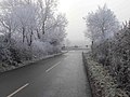 Lane from Billesley towards A46 Alcester Road - geograph.org.uk - 2189259.jpg 2,000 × 1,495; 204 KB
-
 Looking through the trees - geograph.org.uk - 2373632.jpg 1,200 × 1,600; 542 KB
-
 Moat at Billesley - geograph.org.uk - 5068265.jpg 1,024 × 680; 293 KB
-
 Moat at Billesley - geograph.org.uk - 6230663.jpg 1,024 × 768; 282 KB
-

-
 Old Level Crossing gates - geograph.org.uk - 635120.jpg 640 × 480; 94 KB
-
 Old Moat at Billesley Manor - geograph.org.uk - 1081598.jpg 640 × 480; 71 KB
-
 On Iron Gate farm - geograph.org.uk - 1081597.jpg 640 × 480; 103 KB
-
 Power Lines at Billesley - geograph.org.uk - 3047690.jpg 640 × 480; 53 KB
-
 Site of a medieval village - geograph.org.uk - 6230665.jpg 1,024 × 768; 226 KB
-
 Site of the lost village of Billesley Trussel - geograph.org.uk - 5068272.jpg 1,024 × 680; 360 KB
-
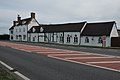 The Stag Inn - geograph.org.uk - 2339472.jpg 1,024 × 680; 133 KB
-
 Tree stump by Billesley Brake - geograph.org.uk - 2189249.jpg 2,000 × 1,333; 319 KB
-
 View towards Upper Billesley - geograph.org.uk - 3235001.jpg 640 × 480; 146 KB
-
 Walnut tree at Billesley Manor Farm - geograph.org.uk - 6270802.jpg 1,024 × 768; 298 KB
-
 Watery view at Billesley - geograph.org.uk - 635134.jpg 639 × 476; 96 KB
-

-
 Anne Hathaway meets Mary Arden - geograph.org.uk - 60572.jpg 640 × 480; 128 KB
-
 Billesley Brake - geograph.org.uk - 7029.jpg 640 × 480; 90 KB
-
 Billesley Manor Farm - geograph.org.uk - 60577.jpg 640 × 480; 82 KB
-
 Dilapidated Barn, Billesley Manor Farm - geograph.org.uk - 60591.jpg 640 × 480; 82 KB
-
 Footpath to Billesley - geograph.org.uk - 122579.jpg 640 × 480; 82 KB
-
 Iron Gate Farm - geograph.org.uk - 60569.jpg 640 × 480; 94 KB
-
 Stile on the footpath to Billesley - geograph.org.uk - 122675.jpg 640 × 480; 147 KB
-
 The Night Cap - geograph.org.uk - 124954.jpg 640 × 480; 81 KB
-
 View towards Red Hill - geograph.org.uk - 122678.jpg 640 × 480; 69 KB
-
 View towards Wilmcote - geograph.org.uk - 124894.jpg 640 × 480; 51 KB
_-_geograph.org.uk_-_5342070.jpg)


_-_geograph.org.uk_-_5379799.jpg)


