Category:Binchester
English: Binchester is a small village in County Durham, England. It has a population of 271. It is situated between Bishop Auckland, which is to the south, and a short distance to the west of Spennymoor. It has a community centre, swing park and football field and is surrounded by countryside.
village in County Durham, England, UK | |||||
| Upload media | |||||
| Instance of | |||||
|---|---|---|---|---|---|
| Location | County Durham, North East England, England | ||||
 | |||||
Media in category "Binchester"
The following 38 files are in this category, out of 38 total.
-
 A688 above Coundon Burn - geograph.org.uk - 404380.jpg 640 × 480; 84 KB
-
 A688 at Parkhead Farm - geograph.org.uk - 404589.jpg 640 × 480; 98 KB
-
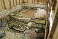 Binchester Roman baths, March 2017 cold plunge baths2 (33458817190).jpg 5,184 × 3,456; 6.84 MB
-
 Binchester Roman baths, March 2017 second hot room3 (33802194486).jpg 3,738 × 2,492; 1.93 MB
-
 Binchester Roman baths, March 2017 warm room (33713972351).jpg 5,184 × 3,456; 7.38 MB
-
 Binchester Roman vicus, March 2017 (15) (33842852465).jpg 5,184 × 3,456; 8.82 MB
-
 Church Street - geograph.org.uk - 5891992.jpg 640 × 480; 57 KB
-
 Church Street, Binchester - geograph.org.uk - 5891988.jpg 640 × 466; 60 KB
-
 Clergy House in Long Lane Binchester - geograph.org.uk - 2586600.jpg 3,648 × 2,736; 2.21 MB
-

-
 Crossing point on the Auckland Way - geograph.org.uk - 341251.jpg 640 × 480; 91 KB
-
 Disused Railway Bridge by Bellburn Wood - geograph.org.uk - 75725.jpg 427 × 640; 156 KB
-
 End of terrace in Binchester - geograph.org.uk - 3322754.jpg 1,500 × 1,125; 1.56 MB
-
 Fields north of Binchester - geograph.org.uk - 3322787.jpg 1,500 × 915; 1.06 MB
-
 Folly, Auckland Park - geograph.org.uk - 299084.jpg 640 × 384; 55 KB
-
 Ford, Bellburn Wood - geograph.org.uk - 299097.jpg 640 × 384; 138 KB
-
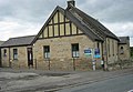 Former Wesleyan Church Binchester, now a private residence - geograph.org.uk - 2586605.jpg 3,568 × 2,462; 1.87 MB
-
 Grazing near Binchester - geograph.org.uk - 5891982.jpg 640 × 480; 64 KB
-
 North side of field west of Binchester - geograph.org.uk - 3322693.jpg 1,500 × 1,125; 1.55 MB
-

-

-

-
 Stubble field, Binchester - geograph.org.uk - 5891990.jpg 640 × 480; 78 KB
-
 Vinovium Cottage near Binchester - geograph.org.uk - 2056780.jpg 640 × 480; 110 KB
-
 Auckland Park - geograph.org.uk - 299089.jpg 640 × 384; 96 KB
-
 B6287 , Leeholme - geograph.org.uk - 322508.jpg 640 × 351; 60 KB
-
 Bell Burn - geograph.org.uk - 299038.jpg 640 × 480; 170 KB
-
 Bellburn Wood, near Binchester - geograph.org.uk - 75718.jpg 640 × 427; 177 KB
-
 Binchester - geograph.org.uk - 341244.jpg 640 × 480; 83 KB
-
 Byers Green Junction - geograph.org.uk - 341259.jpg 640 × 480; 98 KB
-
 Castlegarth, South View, Spennymoor - geograph.org.uk - 404389.jpg 640 × 480; 63 KB
-
 High Park - geograph.org.uk - 299031.jpg 480 × 640; 100 KB
-
 Pathside pond at Binchester - geograph.org.uk - 341248.jpg 640 × 480; 105 KB
-

-
 Top end of Bell Burn Woods - geograph.org.uk - 341226.jpg 640 × 480; 112 KB
-
 Viewpoint at Binchester Moor - geograph.org.uk - 404382.jpg 640 × 480; 74 KB
-
 Wayside pond on the Auckland Way - geograph.org.uk - 341268.jpg 640 × 480; 120 KB
-


.jpg)
.jpg)
.jpg)
_(33842852465).jpg)


