Category:Bird's eye view maps of Vermont
Media in category "Bird's eye view maps of Vermont"
The following 28 files are in this category, out of 28 total.
-
 1885 birds-eye map of Ludlow, Vermont.jpg 8,296 × 5,016; 9.57 MB
-
 1886 birds-eye map of Bellows Falls, Vermont.jpg 9,368 × 5,872; 11.46 MB
-
 Barre, Washington County, Vt. (2675873896).jpg 2,000 × 1,438; 2.16 MB
-
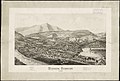
 Barton, Vt. (2675057919).jpg 2,000 × 1,437; 2.08 MB
-
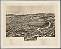
 Bellows Falls, Vt. LOC 75696618.jpg 8,520 × 5,208; 9.1 MB
-
 Bennington, VT (L. R. Burleigh print, 1887).jpg 10,080 × 6,096; 10.39 MB
-
 Bennington, Vt. (2675876866).jpg 2,000 × 1,248; 1.95 MB
-
 Bennington, Vt. 1887. LOC 75696619.jpg 10,080 × 6,096; 13.67 MB
-
 Bethel, Vt. 1886. LOC 75696620.jpg 7,592 × 5,168; 7.18 MB
-
 Castleton, Vt. (2675064089).jpg 2,000 × 1,347; 1.73 MB
-
 Castleton, Vt. 1889. LOC 74693163.tif 7,808 × 5,136; 114.73 MB
-
 Enosburg Falls, Vt. (2675882158).jpg 2,000 × 1,599; 2.25 MB
-
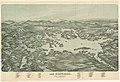
 Fair Haven, Vt LCCN2003666341.jpg 10,223 × 5,572; 9.92 MB
-
 Fair Haven, Vt. (2675884692).jpg 2,000 × 1,252; 1.92 MB
-
 Lyndonville, Caledonia County, Vermont (2675986788).jpg 2,000 × 1,431; 2.13 MB
-
 Map of Connecticut River from Barnet Vermont to Hartford Con. (2674436885).jpg 2,000 × 1,362; 2.41 MB
-
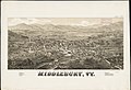 Middlebury, Vt. (2675989344).jpg 2,000 × 1,373; 2.05 MB
-
 Morrisville, Vt. (2675181139).jpg 2,000 × 1,452; 1.91 MB
-
 Poultney, Vt. (2675990106).jpg 2,000 × 1,453; 2.33 MB
-
 Rutland, Vt. (2675171617).jpg 2,000 × 1,212; 1.92 MB
-
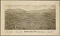
 Rutland, Vt. LOC 75696630.jpg 10,416 × 5,984; 12.6 MB
-
 Rutland, Vt. LOC 75696630.tif 10,416 × 5,984; 178.33 MB
-
 Springfield, Vt. (2675991404).jpg 2,000 × 1,371; 1.96 MB
-
 St. Johnsbury, county seat of Caledonia County, Vt. (2675987880).jpg 2,000 × 1,398; 2.2 MB
-
 West Randolph, Vt. (2675175435).jpg 2,000 × 1,377; 1.94 MB
-
 West Randolph, Vt. 1886. LOC 75696634.tif 7,920 × 5,568; 126.17 MB
-
 Windsor, Vermont (2675176211).jpg 2,000 × 1,352; 1.82 MB
-
 Windsor, Vermont 1886. LOC 75696636.jpg 7,824 × 5,240; 8.02 MB


.jpg)
.jpg)

.jpg)
.jpg)


.jpg)
.jpg)

.jpg)
.jpg)
.jpg)
.jpg)
.jpg)
.jpg)
.jpg)

.jpg)
.jpg)
.jpg)
.jpg)
