Category:Black and white rectangular road signs
Subcategories
This category has the following 10 subcategories, out of 10 total.
Media in category "Black and white rectangular road signs"
The following 200 files are in this category, out of 267 total.
(previous page) (next page)-

-
 2012-01-01 Orta No Way Out.jpg 2,700 × 1,800; 1.24 MB
-

-
 A1AnRoadSign-LeftOntoWorthAvenue (32302387990).jpg 2,400 × 1,600; 2.58 MB
-
 AkörenSilivri (1).jpg 4,904 × 3,228; 4.68 MB
-
 AkörenSilivri (2).jpg 4,824 × 3,098; 4.24 MB
-
 Alabama I10eb Exit 22 ahead hazardous materials.jpg 5,184 × 3,456; 4.67 MB
-
 B62 Stop.JPG 4,912 × 3,264; 3.19 MB
-
 Babadag tabela.jpg 763 × 515; 67 KB
-
 Bagdadi Ozurgeti District.jpg 1,792 × 1,344; 317 KB
-
 Bi-fussgaenger-bitte-andere-strassenseite-benutzen.jpg 1,280 × 709; 184 KB
-
 Biala-Podlaska-19RSMWME-sign.jpg 1,405 × 1,405; 458 KB
-
 Bibb County line, GA11 at Echeconnee Creek.JPG 5,184 × 3,456; 7.83 MB
-
 Blue sky staircase.JPG 1,600 × 1,200; 1.03 MB
-
 Boat-1130127, Dingle, Co. Kerry, Ireland.jpg 4,896 × 3,672; 8.47 MB
-
 Boundary Street Road sign 2015.jpg 2,123 × 1,630; 830 KB
-
 Caserne Trésignies de Charleroi - Panneau routier de la guerre de Yougoslavie (ii).jpg 4,160 × 3,120; 6.83 MB
-
 Charlotte Auerbach Road, Edinburgh.JPG 3,088 × 2,056; 1.53 MB
-
 Coffee County border, GA64EB.JPG 5,152 × 3,864; 7.95 MB
-
 Colin MacLaurin Road, Edinburgh.JPG 3,088 × 2,056; 1.85 MB
-
 Cross City town limit, Florida SR351sb.JPG 4,320 × 3,240; 4.5 MB
-
 Cross City town limit, Florida US19nb.JPG 4,320 × 3,240; 4.53 MB
-
 Cédez le passage (5020211201).jpg 4,060 × 3,060; 1.69 MB
-
 Davidson Co I-85N Rest Area-02.jpg 4,912 × 7,360; 8.89 MB
-
 Dodge County, US441SB.jpg 5,184 × 3,456; 5.63 MB
-
 Downtown Connector sb Exit 244 1 mile.jpg 5,184 × 3,456; 4.38 MB
-
 Emergency Stopping Only sign, I-95 NB exit 12B offramp, Miami.jpg 3,264 × 1,836; 1.34 MB
-
 Empire City Limit sign.jpg 2,848 × 2,136; 1.87 MB
-
 Estrada Turística do Jaraguá.jpg 3,264 × 2,448; 3.18 MB
-
 Fingerposts-1020452, Fenit, Co. Kerry, Ireland.jpg 4,896 × 3,672; 1.62 MB
-
 Florida I10eb Exit 356 .25 mile.jpg 5,184 × 3,456; 4.53 MB
-
 Florida I75nb CR349 Overpass.JPG 5,184 × 3,456; 4.56 MB
-
 Florida I75nb Exit 435 2021.jpg 5,184 × 3,456; 4.75 MB
-
 Florida I75nb Exit 435.JPG 4,608 × 3,456; 4.65 MB
-
 Florida I75nb Exit Nash Rd Overpass.JPG 5,184 × 3,456; 4.42 MB
-
 Florida I75nb Springville Rd Overpass.JPG 5,184 × 3,456; 4.16 MB
-
 Florida I75sb CR132 Overpass.JPG 4,608 × 3,456; 3.51 MB
-
 Florida I75sb CR152 Overpass 2019.jpg 5,184 × 3,456; 4.27 MB
-
 Florida I75sb FLA 247 Overpass.jpg 5,184 × 3,456; 5.1 MB
-
 Florida I75sb King Hill Rd Overpass close.jpg 5,184 × 3,456; 4.23 MB
-
 Florida I75sb King Hill Rd Overpass.JPG 4,608 × 3,456; 3.48 MB
-
 Florida I75sb Springville Rd Overpass.jpg 5,184 × 3,456; 4.46 MB
-
 Georgia I285nb Bouldercrest Rd Overpass.jpg 5,184 × 3,456; 5.25 MB
-
 Georgia I285nb Clarkston city limit.jpg 5,184 × 3,456; 4.75 MB
-
 Georgia I285nb Exit 42.jpg 5,184 × 3,456; 4.73 MB
-
 Georgia I285nb Exit 43 1 mile.jpg 5,184 × 3,456; 4.62 MB
-
 Georgia I285nb Exit 44 1 mile.jpg 5,184 × 3,456; 4.62 MB
-
 Georgia I285nb Redwing Cir Overpass.jpg 5,184 × 3,456; 4.83 MB
-
 Georgia I475sb Columbus Rd Overpass.jpg 5,184 × 3,456; 4.72 MB
-
 Georgia I475sb Estes Rd Overpass close.jpg 5,184 × 3,456; 4.52 MB
-
 Georgia I475sb GA74 Overpass close.jpg 5,184 × 3,456; 4.11 MB
-
 Georgia I475sb Peake Rd Overpass.jpg 5,184 × 3,456; 4.89 MB
-
 Georgia I75nb Colwell Road Overpass.jpg 5,184 × 3,456; 4.35 MB
-
 Georgia I75nb exit 187 1 mile.jpg 5,184 × 3,456; 4.35 MB
-
 Georgia I75nb Exit 22 N Valdosta Rd Overpass.JPG 5,184 × 3,456; 4.92 MB
-
 Georgia I75nb Exit 37.JPG 4,320 × 3,240; 4.44 MB
-
 Georgia I75nb Exit 49.JPG 4,320 × 3,240; 4.46 MB
-
 Georgia I75nb Exit 80.JPG 4,320 × 3,240; 4.4 MB
-
 Georgia I75nb Exit 99.JPG 4,608 × 3,456; 4.32 MB
-
 Georgia I75nb N Perry Parkway Overpass, 2016.jpg 5,184 × 3,456; 4.41 MB
-
 Georgia I75nb Old Clyattville Rd Overpass 2024.jpg 5,184 × 3,456; 4.34 MB
-
 Georgia I75nb Rest Stop 5 Exit.JPG 4,320 × 3,240; 4.45 MB
-
 Georgia I75nb SR376 Lakes Blvd Overpass.JPG 5,184 × 3,456; 4.77 MB
-
 Georgia I75sb 24th Ave E Overpass, Cordele.JPG 4,320 × 3,240; 4.51 MB
-
 Georgia I75sb Aviation Blvd Overpass.jpg 5,184 × 3,456; 4.34 MB
-
 Georgia I75sb Bethlehem Rd overpass.jpg 5,184 × 3,456; 4.31 MB
-
 Georgia I75sb Bowen Rd Overpass close.jpg 5,184 × 3,456; 4.36 MB
-
 Georgia I75sb Colwell Rd overpass.jpg 5,184 × 3,456; 4.57 MB
-
 Georgia I75sb Exit 138 1 mile 2020.jpg 5,184 × 3,456; 3.96 MB
-
 Georgia I75sb Exit 22 Overpass - N. Valdosta Rd.JPG 4,320 × 3,240; 4.41 MB
-
 Georgia I75sb Exit 237 Forest Parkway Overpass.jpg 5,184 × 3,456; 4.13 MB
-
 Georgia I75sb Exit 238A.jpg 5,184 × 3,456; 4.25 MB
-
 Georgia I75sb Exit 238B .5 mile.jpg 5,184 × 3,456; 4.24 MB
-
 Georgia I75sb Exit 239 1.75 miles.jpg 5,184 × 3,456; 4.24 MB
-
 Georgia I75sb Exit 29 Overpass - GA122.JPG 5,184 × 3,456; 4.56 MB
-
 Georgia I75sb Exit 32.JPG 5,184 × 3,456; 4.67 MB
-
 Georgia I75sb Exit 37.JPG 5,184 × 3,456; 4.65 MB
-
 Georgia I75sb Exit 39.JPG 4,320 × 3,240; 4.35 MB
-
 Georgia I75sb Exit 41.JPG 4,320 × 3,240; 4.45 MB
-
 Georgia I75sb exit 41.jpg 5,184 × 3,456; 4.29 MB
-
 Georgia I75sb Exit 45.JPG 4,320 × 3,240; 4.39 MB
-
 Georgia I75sb exit 45.jpg 5,184 × 3,456; 4.32 MB
-
 Georgia I75sb exit 55.jpg 5,184 × 3,456; 4.69 MB
-
 Georgia I75sb Exit 78.jpg 5,184 × 3,456; 4.44 MB
-
 Georgia I75sb Exit 80.jpg 5,184 × 3,456; 4.46 MB
-
 Georgia I75sb Exit 82.jpg 5,184 × 3,456; 4.15 MB
-
 Georgia I75sb Exit49.JPG 4,320 × 3,240; 4.47 MB
-
 Georgia I75sb Farmers Market Rd Overpass.jpg 5,184 × 3,456; 3.94 MB
-
 Georgia I75sb Firetower Rd Overpass close.jpg 5,184 × 3,456; 4.34 MB
-
 Georgia I75sb GA230 Overpass, Unadilla.JPG 5,184 × 3,456; 4.21 MB
-
 Georgia I75sb GA26 Overpass, Perry close.jpg 5,184 × 3,456; 4.69 MB
-
 Georgia I75sb Hampton-McDonough Rd overpass.jpg 5,184 × 3,456; 4.52 MB
-
 Georgia I75sb High Falls Rd Overpass.jpg 5,184 × 3,456; 5.11 MB
-
 Georgia I75sb Indian Creek Rd overpass.jpg 5,184 × 3,456; 4.49 MB
-
 Georgia I75sb Jenkinsburg Rd Overpass.jpg 5,184 × 3,456; 4.24 MB
-
 Georgia I75sb Johnstonville Rd overpass.jpg 5,184 × 3,456; 4.93 MB
-
 Georgia I75sb Musslewhite Rd Overpass 2020.jpg 5,184 × 3,456; 4.37 MB
-
 Georgia I75sb Old Hatley Rd Overpass.JPG 5,184 × 3,456; 4.2 MB
-
 Georgia I75sb Rest Stop 6 Exit.JPG 4,320 × 3,240; 4.41 MB
-
 Georgia I75sb Rockhouse Rd E Overpass.jpg 5,184 × 3,456; 4.68 MB
-
 Georgia I75sb Shiloh Rd Overpass close.jpg 5,184 × 3,456; 4.12 MB
-
 Georgia I85sb Exit 107 exit only.jpg 5,184 × 3,456; 4.43 MB
-
 Georgia I85sb Exit 109 exit only.jpg 5,184 × 3,456; 4.37 MB
-
 Georgia I85sb Exit 89 .75 mile.jpg 5,184 × 3,456; 4.9 MB
-
 Georgia I85sb Exit 91 .75 mile.jpg 5,184 × 3,456; 4.56 MB
-
 Georgia I85sb Exit 94 exit only.jpg 5,184 × 3,456; 4.89 MB
-
 Georgia I85sb Exit 96 .5 mile.jpg 5,184 × 3,456; 5.13 MB
-
 Georgia I85sb Shallowford Rd overpass.jpg 5,184 × 3,456; 5.23 MB
-
 Georgia I95nb Exit 106 2019.jpg 5,184 × 3,456; 4.18 MB
-
 Georgia I95nb Exit 106.jpg 5,184 × 3,456; 5.01 MB
-
 Georgia I95nb Exit 109 .5 mile.jpg 5,184 × 3,456; 4.34 MB
-
 Georgia I95nb Exit 109 1 mile.jpg 5,184 × 3,456; 4.18 MB
-
 Georgia I95nb Exit 38.jpg 5,184 × 3,456; 4.2 MB
-
 Georgia I95nb Exit 42.jpg 5,184 × 3,456; 4.52 MB
-
 Georgia I95nb Exit 99A-B 2 miles.jpg 5,184 × 3,456; 4.95 MB
-
 Georgia I95nb Islands Hwy Overpass.jpg 5,184 × 3,456; 5.38 MB
-
 Georgia I95sb Colonals Island Road Overpass.jpg 5,184 × 3,456; 4.94 MB
-
 Georgia I95sb Exit 49.jpg 5,184 × 3,456; 4.47 MB
-
 Georgia I95sb Exit 67 2017.jpg 5,184 × 3,456; 4.09 MB
-
 Georgia I95sb Retreat Road Overpass.jpg 5,184 × 3,456; 4.73 MB
-
 Glenwood City limit GA19NB.jpg 5,184 × 3,456; 8.79 MB
-
 Grady County line, Georgia State border, GA111NB.jpg 5,184 × 3,456; 7.77 MB
-
 GSM Dwingeloo.jpg 3,456 × 2,304; 4.3 MB
-
 Hamilton County Inspection Station Bypass when flashing sign.jpg 5,184 × 3,456; 4.23 MB
-
 Hinweisschild Marineschule Mürwik, Bild 001.JPG 4,000 × 3,000; 1.89 MB
-
 Hinweisschild Marineschule Mürwik, Bild 002.JPG 4,000 × 3,000; 3.3 MB
-
 Ice road across the Mackenzie, at Tsiigehtchic, Northwest Territories.jpg 3,456 × 2,304; 3.64 MB
-
 Image-Historic U.S. Hwy 40 sign only.jpg 1,312 × 1,792; 577 KB
-
 Int285eRoad-Exit26-Glenridge-GA400US19n (30929834520).jpg 2,400 × 1,600; 1.88 MB
-
 Int285eRoad-Exit30-Chamblee-DunwoodyRoad (30929835670).jpg 2,400 × 1,600; 1.95 MB
-
 Int285s-Exit52-Int675sOneMile (32908204945).jpg 2,400 × 1,600; 1.73 MB
-
 Int75nInt85nRoad-Exit239-US19US41 (34317445562).jpg 2,400 × 1,600; 1.23 MB
-
 Int75sRoad-Exit271-ChastainRoadToInt575n (30929829890).jpg 2,400 × 1,600; 1.76 MB
-
 Int75sRoad-Exit288-GA113w (30929827720).jpg 2,400 × 1,600; 1.91 MB
-
 Int85nRoad-Exit71-GA139-HalfMile (33745347040).jpg 2,400 × 1,600; 1.89 MB
-
 Int85nRoad-MM71-CampCreek-LandingMD88overhead (33999699521).jpg 2,400 × 1,600; 1.65 MB
-
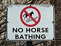
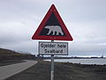 Isbjornskilt-2.jpg 2,816 × 2,112; 2.1 MB
-
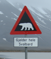 Isbjornskilt.png 677 × 792; 630 KB
-
 Janov (Nový Bor), vjezd.jpg 5,184 × 3,456; 10.92 MB
-
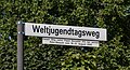 Köln, Straßenschild -Weltjugendtagsweg- -- 2014 -- 1916.jpg 5,338 × 2,878; 7.21 MB
-
 Langley Covered Bridge MI.jpg 1,024 × 683; 405 KB
-
 Left Turn Yield On Flashing Arrow 1.png 646 × 688; 107 KB
-
 Limanköy, Demirköy.JPG 3,634 × 2,350; 5.28 MB
-
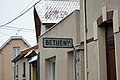 Limite cnale Betheny.JPG 4,272 × 2,848; 5.39 MB
-
 Looking East at US27 129 intersection, Branford.jpg 4,320 × 3,240; 4.47 MB
-
 Metcalfe boundary, Metcalfe Rd SB.jpg 5,184 × 3,456; 10.95 MB
-
 Milltown, Co. Kildare.JPG 1,556 × 1,113; 418 KB
-
 Mořkov, začátek obce.JPG 3,072 × 2,304; 1.42 MB
-
 MTA Flatlands Av Jerome St 02.jpg 2,000 × 1,500; 808 KB
-
 NB I-95 St George Scale; Weigh in Motion Left Sign.jpg 3,648 × 2,736; 2.06 MB
-
 NB I-95 St George Scale; Weigh in Motion Right Sign.jpg 3,648 × 2,736; 2.09 MB
-
 Neubaugebiet Efferen West 35.jpg 3,762 × 2,519; 4.43 MB
-
 No Outlet Sign 1.jpg 3,264 × 2,448; 2.06 MB
-
 Ohio State Route 85 (4102180485).jpg 1,024 × 768; 166 KB
-
 R752 4239c.jpg 2,029 × 904; 301 KB
-

-
 Rectangular one-way sign, North 2nd Street at East St. John Street, San Jose, California.jpg 4,032 × 3,024; 11.53 MB
-
 RivaBeykoz (1).jpg 1,973 × 3,079; 1.11 MB
-
 Roundabout near Skipton - geograph.org.uk - 401313.jpg 640 × 480; 102 KB
-
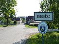 Sedlečko u Soběslavě - začátek obce.jpg 3,648 × 2,736; 1.81 MB
-
 Señal de tráfico (1264809601) Florencia, Alajuela, Costa Rica.jpg 1,363 × 1,716; 723 KB
-
 Sign-1000520, Tralee, Co. Kerry, Ireland.jpg 4,896 × 3,672; 1.81 MB
-
 Sign-1000602, Newcastle West, Co. Limerick, Ireland.jpg 4,896 × 3,672; 2.41 MB
-
 Sign-1010394, Kerry Head, Co. Kerry, Ireland.jpg 4,896 × 3,672; 1.85 MB
-
 Sign-1010520, Abbeyfeale, Co. Limerick, Ireland.jpg 4,896 × 3,672; 3.86 MB
-
 Sign-1010523, Abbeyfeale, Co. Limerick, Ireland.jpg 4,896 × 3,672; 2.91 MB
-
 Sign-1010525, Abbeyfeale, Co. Limerick, Ireland.jpg 4,896 × 3,672; 2.2 MB
-
 Sign-1020154, Dingle Peninsula, Co. Kerry, Ireland.jpg 4,896 × 3,672; 3.27 MB
-
 Sign-1020539, Abbeyfeale, Co. Limerick, Ireland.jpg 4,896 × 3,672; 2.72 MB
-
 Sign-1020541, Abbeyfeale, Co. Limerick, Ireland.jpg 4,896 × 3,672; 1.86 MB
-
 Sign-1020792, Dingle, Co. Kerry, Ireland.jpg 4,896 × 3,672; 9.26 MB
-
 Sign-1020855, Dingle Peninsula, Co. Kerry, Ireland.jpg 4,757 × 3,568; 2.16 MB
-
 Sign-1020860, Tralee, Co. Kerry, Ireland.jpg 3,672 × 4,896; 1.85 MB
-
 Sign-1020879, Abbeyfeale, Co. Limerick, Ireland.jpg 4,896 × 3,672; 3.17 MB
-
 Sign-1020895, M7, Co. Tipperary, Ireland.jpg 3,672 × 4,896; 2.69 MB
-
 Sign-1030095, Lucan, Co. Dublin, Ireland.jpg 4,896 × 3,672; 2 MB
-
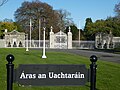
 Sign-1030105, Phoenix Park, Dublin, Ireland.jpg 4,896 × 3,672; 2.76 MB
-
 Sign-1030112, Phoenix Park, Dublin, Ireland.jpg 4,896 × 3,672; 3.57 MB
-
 Sign-1030144, Phoenix Park, Dublin, Ireland.jpg 4,896 × 3,672; 8.43 MB
-
 Sign-1030177, Phoenix Park, Dublin, Ireland.jpg 4,896 × 3,672; 8.88 MB
-
 Sign-1030349, Leixlip, Co. Kildare, Ireland.jpg 4,896 × 3,672; 2.77 MB
-
 Sign-1030717, Tralee, Co. Kerry, Ireland.jpg 4,896 × 3,672; 3.34 MB
-
 Sign-1040038, Lucan, Co. Dublin, Ireland.jpg 4,896 × 3,672; 2.57 MB
-
 Sign-1040039, Lucan, Co. Dublin, Ireland.jpg 4,896 × 3,672; 6.93 MB
-
 Sign-1040066, Lucan, Co. Dublin, Ireland.jpg 4,896 × 3,672; 1.65 MB
-
 Sign-1040104, Dublin, Ireland.jpg 4,896 × 3,672; 3.05 MB
-
 Sign-1040454, Lucan, Co. Dublin, Ireland.jpg 4,896 × 3,672; 2.25 MB
-
 Sign-1040500, Celbridge, Co. Kildare, Ireland.jpg 4,896 × 3,672; 9.19 MB
-
 Sign-1040912, Dingle Peninsula, Co. Kerry, Ireland.jpg 4,896 × 3,672; 3.4 MB
-
 Sign-1040982, Dingle Peninsula, Co. Kerry, Ireland.jpg 4,896 × 3,672; 2.4 MB
-
 Sign-1050213, Dingle, Co. Kerry, Ireland.jpg 4,896 × 3,672; 2.54 MB
-
 Sign-1050219, Dingle Peninsula, Co. Kerry, Ireland.jpg 4,896 × 3,672; 3.24 MB
-
 Sign-1050223, Dingle Peninsula, Co. Kerry, Ireland.jpg 3,672 × 4,896; 1.97 MB
-
 Sign-1050273, Dingle Peninsula, Co. Kerry, Ireland.jpg 4,896 × 3,672; 4.05 MB
-
 Sign-1050349, Dingle Peninsula, Co. Kerry, Ireland.jpg 4,896 × 3,672; 3.03 MB
-
 Sign-1060660, Tralee, Co. Kerry, Ireland.jpg 4,896 × 3,672; 2.34 MB
-
 Sign-1060671, Tralee, Co. Kerry, Ireland.jpg 4,896 × 3,672; 2.8 MB
-
 Sign-1060717, Celbridge, Co. Kildare, Ireland.jpg 4,896 × 3,672; 3.25 MB
-
 Sign-1060749, Dublin, Ireland.jpg 4,896 × 3,672; 1.88 MB
-
 Sign-1060782, Tralee, Co. Kerry, Ireland.jpg 4,896 × 3,672; 1.79 MB


_near_Exit_247_(Interstate_20)_in_Atlanta,_Georgia.jpg)
.jpg)
.jpg)
.jpg)


.jpg)


.jpg)


.jpg)
.jpg)
.jpg)
.jpg)
.jpg)
.jpg)
.jpg)
.jpg)


,_vjezd.jpg)


.jpg)


.jpg)


_Florencia,_Alajuela,_Costa_Rica.jpg)


