Category:Blagdon
English: Blagdon is a Village in Somerset
village and civil parish in Somerset, England  Vue de Blagdon et de son lac | |||||
| Upload media | |||||
| Instance of | |||||
|---|---|---|---|---|---|
| Location | North Somerset, Somerset, South West England, England | ||||
 | |||||
Subcategories
This category has the following 3 subcategories, out of 3 total.
A
B
- Blagdon railway station (2 F)
Media in category "Blagdon"
The following 175 files are in this category, out of 175 total.
-
 "It never snows much in the Mendips" - geograph.org.uk - 1555134.jpg 640 × 480; 59 KB
-
 'Get on my land^' - geograph.org.uk - 5490372.jpg 2,304 × 1,704; 1.65 MB
-
 A bamboo curtain - in Blagdon - geograph.org.uk - 5501265.jpg 2,304 × 1,704; 1.82 MB
-
 A Blagdon benchmark - geograph.org.uk - 5489317.jpg 1,704 × 2,304; 2.33 MB
-
 A greener door - geograph.org.uk - 5500935.jpg 1,704 × 2,304; 1.99 MB
-
 A place for smart people - geograph.org.uk - 4799122.jpg 1,704 × 2,304; 1.72 MB
-
 A restricted byway - geograph.org.uk - 501779.jpg 640 × 427; 96 KB
-
 A short game - geograph.org.uk - 4798995.jpg 2,304 × 1,704; 1.4 MB
-
 A snowy hillside - geograph.org.uk - 1579390.jpg 640 × 480; 57 KB
-
 A stile on Garston Lane - geograph.org.uk - 5499842.jpg 2,304 × 1,704; 1.68 MB
-
 A village path - geograph.org.uk - 4799133.jpg 2,304 × 1,704; 1.8 MB
-
 Above the worshippers - geograph.org.uk - 5500877.jpg 1,704 × 2,304; 1.89 MB
-
 Across Tims Well Batch - geograph.org.uk - 5500353.jpg 1,704 × 2,304; 1.79 MB
-

-
 Aldwick Court Lodge - geograph.org.uk - 2836989.jpg 2,304 × 1,704; 1.77 MB
-
 An old warning from the Old Bill - geograph.org.uk - 5489324.jpg 2,304 × 1,704; 1.78 MB
-
 An unassuming exterior - geograph.org.uk - 5489262.jpg 2,304 × 1,704; 1.55 MB
-
 Bath Road, Blagdon - geograph.org.uk - 2311638.jpg 1,024 × 741; 191 KB
-
 Beehives near the sewage works - geograph.org.uk - 5500245.jpg 2,304 × 1,704; 1.66 MB
-
 Bell Square - geograph.org.uk - 5501250.jpg 2,304 × 1,704; 1.8 MB
-
 Bit of a climb - geograph.org.uk - 5500269.jpg 2,304 × 1,704; 2.26 MB
-
 Blagdon Baptist church - geograph.org.uk - 5500340.jpg 1,704 × 2,304; 1.86 MB
-
 Blagdon cemetery - geograph.org.uk - 5500897.jpg 2,304 × 1,704; 1.65 MB
-
 Blagdon cemetery - geograph.org.uk - 5500911.jpg 2,304 × 1,704; 1.75 MB
-
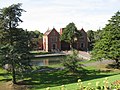
 Blagdon Church and lake - geograph.org.uk - 1273584.jpg 640 × 479; 127 KB
-
 Blagdon Community mosaic - geograph.org.uk - 5500351.jpg 2,304 × 1,704; 1.72 MB
-
 Blagdon Cricket Club - geograph.org.uk - 4799040.jpg 2,304 × 1,704; 1.54 MB
-
 Blagdon electricity plant - geograph.org.uk - 5501264.jpg 2,304 × 1,704; 1.76 MB
-
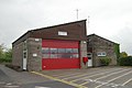 Blagdon Fire Station - geograph.org.uk - 166656.jpg 640 × 427; 173 KB
-
 Blagdon Fire Station - geograph.org.uk - 5489276.jpg 2,304 × 1,704; 1.42 MB
-
 Blagdon Lake - geograph.org.uk - 4955226.jpg 4,896 × 3,672; 6.8 MB
-
 Blagdon Lake. - panoramio.jpg 2,816 × 2,112; 2.76 MB
-
 Blagdon MMB 01 Water Gardens.jpg 2,265 × 1,600; 1.09 MB
-
 Blagdon MMB 02 Water Gardens.jpg 2,400 × 1,600; 1.41 MB
-
 Blagdon old fire station - geograph.org.uk - 629769.jpg 640 × 427; 232 KB
-
 Blagdon play area - geograph.org.uk - 5500345.jpg 2,304 × 1,704; 1.78 MB
-
 Blagdon Primary School - geograph.org.uk - 5500954.jpg 2,304 × 1,704; 1.56 MB
-
 Blagdon Pumping Station - geograph.org.uk - 6386523.jpg 3,648 × 2,736; 2.7 MB
-
 Blagdon Pumping Station. - panoramio.jpg 2,816 × 2,112; 3.12 MB
-
 Blagdon School - geograph.org.uk - 4799130.jpg 1,704 × 2,304; 1.58 MB
-
 Blagdon village hall and the Rent House - geograph.org.uk - 5489280.jpg 2,304 × 1,704; 1.39 MB
-
 Blagdon.JPG 2,961 × 1,173; 657 KB
-
 Brick mixture - geograph.org.uk - 5490337.jpg 2,304 × 1,704; 1.54 MB
-
 Bungalow, on Bath Road - geograph.org.uk - 2311669.jpg 1,024 × 768; 141 KB
-
 Bus shelter on Bath Road, Blagdon - geograph.org.uk - 2311652.jpg 1,024 × 768; 203 KB
-
 Bus stop on the A368 - geograph.org.uk - 5500980.jpg 2,104 × 1,557; 1.46 MB
-
 Cashed up and last deliveries - geograph.org.uk - 5489353.jpg 2,304 × 1,704; 1.54 MB
-
 Cemetery roller - geograph.org.uk - 5500886.jpg 1,704 × 2,304; 2 MB
-
 Cold pickings - geograph.org.uk - 4799026.jpg 2,304 × 1,704; 1.73 MB
-
 Coombe Lodge from Menlea - geograph.org.uk - 5500318.jpg 2,304 × 1,704; 1.27 MB
-
 Corner of field near Lower Ellick Farm - geograph.org.uk - 6078584.jpg 1,024 × 683; 170 KB
-
 Country lane with snow - geograph.org.uk - 1579380.jpg 640 × 480; 56 KB
-
 Cutmark on St Andrew's church - geograph.org.uk - 5500998.jpg 2,304 × 1,704; 1.71 MB
-
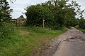
 Direction Sign - Signpost at Aldwick - geograph.org.uk - 6099057.jpg 405 × 600; 252 KB
-

-

-
 Don't take from this tank^ - geograph.org.uk - 5500240.jpg 2,304 × 1,704; 1.74 MB
-
 Drainage ditch - geograph.org.uk - 5034456.jpg 3,648 × 2,048; 3.23 MB
-
 Early morning snow - geograph.org.uk - 1579374.jpg 640 × 480; 74 KB
-

-
 East End PC - geograph.org.uk - 5500920.jpg 2,304 × 1,704; 1.58 MB
-

-
 Fanny's in Blagdon - geograph.org.uk - 5490367.jpg 2,304 × 1,704; 1.64 MB
-
 Field edge boundary at Blagdon Coombe - geograph.org.uk - 2103745.jpg 3,072 × 2,304; 3.6 MB
-
 Field, Lower Ellick Farm - geograph.org.uk - 2559990.jpg 640 × 434; 92 KB
-
 Footpath to Blagdon Combe - geograph.org.uk - 5490381.jpg 1,704 × 2,304; 2.11 MB
-
 Footpath up from Blagdon - panoramio.jpg 2,304 × 3,072; 4.43 MB
-

-
 Former Methodist Church at Blagdon.jpg 4,032 × 3,024; 3.99 MB
-
 Former Methodist church, Blagdon - geograph.org.uk - 5379588.jpg 3,264 × 2,448; 2.01 MB
-
 From the graveyard to West End - geograph.org.uk - 4799064.jpg 2,304 × 1,704; 1.53 MB
-
 Grazing land at Holt Farm - geograph.org.uk - 5034463.jpg 3,648 × 2,048; 2.44 MB
-
 Hannah More House - geograph.org.uk - 4799108.jpg 2,304 × 1,704; 1.72 MB
-
 Holt Farm - geograph.org.uk - 162083.jpg 640 × 426; 127 KB
-
 If only they could read - geograph.org.uk - 5501271.jpg 2,304 × 1,704; 1.77 MB
-
 Keeping Post Office Lane smelling sweet - geograph.org.uk - 5500323.jpg 1,704 × 2,304; 1.47 MB
-
 Leaning one way - geograph.org.uk - 2837290.jpg 2,304 × 1,704; 1.66 MB
-
 Leaze Farm - geograph.org.uk - 2103227.jpg 3,072 × 2,304; 2.65 MB
-
 Listed lychgate - geograph.org.uk - 4799080.jpg 2,304 × 1,704; 1.55 MB
-
 Looking down on those looking up - geograph.org.uk - 4799061.jpg 1,704 × 2,304; 1.37 MB
-

-
 Middle Ellick Farm - geograph.org.uk - 74483.jpg 640 × 426; 167 KB
-
 Nearer to God - geograph.org.uk - 4799075.jpg 1,704 × 2,304; 1.67 MB
-
 No rolling in the clover - geograph.org.uk - 5500843.jpg 2,304 × 1,704; 1.75 MB
-
 Not the path to righteousness - geograph.org.uk - 4799085.jpg 1,704 × 2,304; 2.04 MB
-
 Not too steep for sheep - geograph.org.uk - 5500822.jpg 2,304 × 1,704; 1.73 MB
-

-
 Old garage - geograph.org.uk - 4798945.jpg 2,304 × 1,704; 1.4 MB
-
 Old orchard in the snow - geograph.org.uk - 1579385.jpg 640 × 480; 94 KB
-
 Organic orchard at Lag Farm - geograph.org.uk - 2103450.jpg 3,072 × 2,304; 4.7 MB
-
 Organic Pasture Land with Two Trees at Lag Farm - geograph.org.uk - 2103537.jpg 3,072 × 2,304; 2.85 MB
-
 Pine trees growing on the Southern shore of Blagdon Lake - geograph.org.uk - 5034460.jpg 3,648 × 2,048; 2.56 MB
-
 Play equipment - geograph.org.uk - 4799002.jpg 2,304 × 1,704; 1.59 MB
-
 Pond at Lag Farm - geograph.org.uk - 2103728.jpg 3,072 × 2,304; 3.9 MB
-
 Post Office Lane, Blagdon. - panoramio.jpg 2,304 × 3,072; 4.05 MB
-
 Power Line - geograph.org.uk - 1022881.jpg 640 × 427; 80 KB
-
 Pump House, Blagdon Lake. - panoramio (1).jpg 2,816 × 2,112; 2.02 MB
-
 Reedy Pond at Lag Farm - geograph.org.uk - 2103735.jpg 3,072 × 2,304; 4.97 MB
-
 Reservoir pillar benchmark - geograph.org.uk - 5489326.jpg 2,304 × 1,704; 1.56 MB
-
 Rhodyate picnic spot - geograph.org.uk - 5212572.jpg 2,304 × 1,704; 1.68 MB
-
 Ripening nicely - geograph.org.uk - 5501261.jpg 2,304 × 1,704; 1.77 MB
-
 Rusty remains - geograph.org.uk - 5500272.jpg 2,304 × 1,704; 1.78 MB
-
 Sewage treatment works by Blagdon lake - geograph.org.uk - 5500236.jpg 2,304 × 1,704; 1.75 MB
-
 Seymour Arms - geograph.org.uk - 4798988.jpg 2,304 × 1,704; 1.29 MB
-
 Seymour Arms - patterned - geograph.org.uk - 4798985.jpg 2,304 × 1,704; 1.51 MB
-
 Seymour Arms car park - geograph.org.uk - 5379592.jpg 3,264 × 2,448; 2.04 MB
-
 Sheep on the path north of Lower Ellick Farm - geograph.org.uk - 6078586.jpg 1,024 × 683; 245 KB
-
 Sheltering in Eldred's Orchard - geograph.org.uk - 5500962.jpg 2,304 × 1,704; 1.64 MB
-
 Small enough to leap^ - geograph.org.uk - 5500247.jpg 2,304 × 1,704; 1.79 MB
-
 Snow falling in the early evening - geograph.org.uk - 1579370.jpg 640 × 480; 56 KB
-
 Some hairdo^ - geograph.org.uk - 4799035.jpg 2,304 × 1,704; 1.74 MB
-
 Southern face of St Andrew's church tower - geograph.org.uk - 5501000.jpg 2,304 × 1,704; 1.56 MB
-
 St Andrew's - a Blagdon icon - geograph.org.uk - 4799011.jpg 2,304 × 1,704; 1.75 MB
-
 St Andrew's in the sunlight - geograph.org.uk - 5500849.jpg 2,304 × 1,704; 1.76 MB
-
 St Andrew's in the winter sun - geograph.org.uk - 4799056.jpg 2,304 × 1,704; 1.5 MB
-
 St Andrew's stonework - geograph.org.uk - 5500991.jpg 2,304 × 1,704; 1.79 MB
-
 Street End,Blagdon - geograph.org.uk - 289175.jpg 426 × 640; 100 KB
-
 Talking books^ - geograph.org.uk - 5489339.jpg 1,704 × 2,304; 1.52 MB
-

-
 The answer to a dead end - geograph.org.uk - 5500958.jpg 1,704 × 2,304; 1.58 MB
-
 The Dolls House in Blagdon - geograph.org.uk - 5490343.jpg 2,304 × 1,704; 1.56 MB
-
 The lakes under a blanket - geograph.org.uk - 5212563.jpg 2,304 × 1,704; 1.3 MB
-
 The line turned green again - geograph.org.uk - 5500265.jpg 1,704 × 2,304; 2.47 MB
-
 The New Inn - geograph.org.uk - 4799046.jpg 2,304 × 1,704; 1.51 MB
-
 The Old Farmhouse - geograph.org.uk - 4799116.jpg 2,304 × 1,704; 1.56 MB
-
 The Old Forge - geograph.org.uk - 5490394.jpg 1,704 × 2,304; 2.12 MB
-
 The old George Inn - geograph.org.uk - 5490403.jpg 2,304 × 1,704; 1.38 MB
-
 The path up to Blagdon church - geograph.org.uk - 293993.jpg 640 × 426; 86 KB
-
 The Queen Adelaide - geograph.org.uk - 5490359.jpg 2,304 × 1,704; 1.48 MB
-
 The Queen Adelaide, Blagdon - geograph.org.uk - 2310815.jpg 1,024 × 768; 136 KB
-
 The Rent House - geograph.org.uk - 5489292.jpg 2,304 × 1,704; 1.34 MB
-

-

-
 The valley below Panbottom - geograph.org.uk - 5500231.jpg 2,304 × 1,704; 1.71 MB
-
 The Village Club meets here - geograph.org.uk - 5489311.jpg 2,304 × 1,704; 1.36 MB
-

-

-

-

-

-

-

-

-

-

-

-

-

-
 Tim's pond^ - geograph.org.uk - 5500813.jpg 2,304 × 1,704; 1.79 MB
-
 Tim's Well - geograph.org.uk - 5500804.jpg 1,704 × 2,304; 2.13 MB
-
 Tim's Well Batch to Dark Lane - geograph.org.uk - 5500830.jpg 2,304 × 1,704; 1.61 MB
-
 Tims Well Batch - geograph.org.uk - 4799073.jpg 1,704 × 2,304; 1.87 MB
-
 Track to Lower Ellick Farm - geograph.org.uk - 1745713.jpg 640 × 480; 87 KB
-
 Trampolining on the cross^ - geograph.org.uk - 4798959.jpg 2,304 × 1,704; 1.43 MB
-
 Trees over the mill pond - geograph.org.uk - 4830494.jpg 1,704 × 2,304; 2.27 MB
-
 Two kinds of service - geograph.org.uk - 4799019.jpg 2,304 × 1,704; 1.43 MB
-
 Uxford Bridge - geograph.org.uk - 5500249.jpg 1,704 × 2,304; 1.67 MB
-
 Victorian postbox in Lays Lane - geograph.org.uk - 5500290.jpg 2,304 × 1,704; 1.63 MB
-
 Vineyard at Aldwick Court Farm - geograph.org.uk - 5193432.jpg 3,648 × 2,048; 1.9 MB
-
 Waste water treatment facility at Lag Farm - geograph.org.uk - 2103457.jpg 3,072 × 2,304; 3.18 MB
-
 Water pillar in Bell Square - geograph.org.uk - 5501252.jpg 1,704 × 2,304; 2.07 MB
-
 West End, Blagdon - geograph.org.uk - 2310825.jpg 990 × 1,024; 274 KB
-
 Where the frost remains - geograph.org.uk - 4799031.jpg 1,704 × 2,304; 2 MB
-
 Wooden well - geograph.org.uk - 5500303.jpg 1,704 × 2,304; 2.02 MB
-
 Woods and meadow at Blagdon Coombe - geograph.org.uk - 2103740.jpg 3,072 × 2,304; 2.82 MB
-
 Worn out path sign - geograph.org.uk - 5500226.jpg 1,704 × 2,304; 1.82 MB
-
 Yeo Valley Headquarters.jpg 3,264 × 2,448; 2.96 MB
-
 YeoValleyLagFarm.jpg 640 × 426; 111 KB
-
 You'll end up right back where you started - geograph.org.uk - 5489328.jpg 2,304 × 1,704; 1.28 MB
-
 B3134 - The Combe - geograph.org.uk - 1504444.jpg 640 × 480; 213 KB
-
 Blagdon Lake - geograph.org.uk - 162078.jpg 640 × 426; 129 KB
-
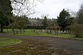 Blagdon Village Cemetery - geograph.org.uk - 138505.jpg 640 × 426; 136 KB
-
 Coombe Lodge College - geograph.org.uk - 456844.jpg 640 × 480; 108 KB
-
 Rhodyate Hill Farm - geograph.org.uk - 289174.jpg 640 × 427; 94 KB
-
 View towards the Mendip Hills - geograph.org.uk - 456833.jpg 640 × 480; 118 KB


.jpg)


_-_geograph.org.uk_-_3143357.jpg)
_-_geograph.org.uk_-_3143366.jpg)
_-_geograph.org.uk_-_3143368.jpg)
_-_geograph.org.uk_-_3143372.jpg)
_-_geograph.org.uk_-_3143375.jpg)
_-_geograph.org.uk_-_3143379.jpg)
_-_geograph.org.uk_-_3143380.jpg)
_-_geograph.org.uk_-_3143388.jpg)
_-_geograph.org.uk_-_3143390.jpg)
_-_geograph.org.uk_-_3143396.jpg)
_-_geograph.org.uk_-_3143401.jpg)
_-_geograph.org.uk_-_3143411.jpg)
_-_geograph.org.uk_-_3144144.jpg)


