Category:Blakenhall, Cheshire
English: Blakenhall is a village and former civil parish in the unitary authority area of Cheshire East and the ceremonial county of Cheshire, England, about seven miles south-east of Nantwich. According to the 2001 census it had a population of 125.
village and former civil parish in Cheshire East, England, UK | |||||
| Upload media | |||||
| Instance of |
| ||||
|---|---|---|---|---|---|
| Location |
| ||||
| Population |
| ||||
 | |||||
Media in category "Blakenhall, Cheshire"
The following 12 files are in this category, out of 12 total.
-
Blakenhall - Gonsley Cottages.jpg 640 × 462; 147 KB
-
Checkley Brook - geograph.org.uk - 793413.jpg 640 × 480; 100 KB
-
Farmland near Lower Den Farm - geograph.org.uk - 3686899.jpg 640 × 316; 18 KB
-
Farmland, Lower Den Farm - geograph.org.uk - 2816699.jpg 640 × 342; 36 KB
-
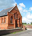
Former chapel at Blakenhall - geograph.org.uk - 249653.jpg 558 × 640; 174 KB
-
Lower Den Farm - geograph.org.uk - 3686873.jpg 640 × 336; 36 KB
-
Pasture at Blakenhall - geograph.org.uk - 249673.jpg 640 × 480; 119 KB
-
Pylon by WCML - geograph.org.uk - 3686872.jpg 640 × 225; 17 KB
-
Trees near Mere Gutter - geograph.org.uk - 3686870.jpg 640 × 430; 47 KB
-
View from the West Coast Main Line - geograph.org.uk - 2816696.jpg 640 × 360; 43 KB
-
Forge Brook and Mill Covert - geograph.org.uk - 249648.jpg 513 × 640; 183 KB
-
Mill Lane, near Blakenhall - geograph.org.uk - 249677.jpg 640 × 470; 182 KB


