Category:Blank maps of Finland
Media in category "Blank maps of Finland"
The following 47 files are in this category, out of 47 total.
-
 000 Finlanda harta.PNG 279 × 599; 141 KB
-
 Administrative divisions of Finland.svg 610 × 1,056; 11.27 MB
-
 Aluevaltuustopaikat.svg 1,666 × 3,169; 741 KB
-
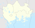 Capital Region Districts of Finland.svg 1,500 × 1,200; 355 KB
-
 Dioceses of Finnish Evangelical Lutheran Church 2022.svg 512 × 863; 1.04 MB
-
 FI-provs.svg 1,835 × 3,209; 41 KB
-
 Finland administrative divisions 2.svg 1,667 × 2,897; 765 KB
-
 Finland administrative divisions.svg 1,750 × 2,950; 918 KB
-
 Finland empty template.png 1,430 × 2,523; 830 KB
-
 Finland equi2.png 1,914 × 3,238; 60 KB
-
 Finland grad.png 3,828 × 6,476; 334 KB
-
 Finland locator map.svg 600 × 773; 227 KB
-
 Finland names.png 1,430 × 2,523; 845 KB
-
 Finland Regions Map.svg 1,850 × 3,220; 112 KB
-
 Finnish municipalities 2007.png 1,905 × 3,296; 151 KB
-
 Finnish municipalities 2008.png 1,905 × 3,296; 192 KB
-
 Finnish municipalities and provinces.png 1,957 × 3,429; 883 KB
-
 Finnish municipalities.png 1,957 × 3,429; 841 KB
-
 Finnish provinces.png 2,000 × 3,500; 378 KB
-
 Map of Finland in Finnish war 1808.svg 956 × 1,460; 1.19 MB
-
 Muncipalities and Provinces of Finland Black.PNG 1,905 × 3,296; 288 KB
-
 Nykyiset Suomen maakunnat (Tyhjä).png 548 × 898; 81 KB
-
 Regions in Finland (Blanko).png 548 × 898; 82 KB
-
 Regions in Finland (old map before 2011) (Blanko).png 548 × 898; 82 KB
-
 Regions of Finland blank map.svg 1,668 × 2,898; 413 KB
-
 Subregions of Finland.svg 1,750 × 2,950; 957 KB
-
 Suomen maakunnat (ennen vuoden 2011 jakoa) (Tyhjä).png 548 × 898; 82 KB
-
 Suomen-läänit-template.png 229 × 398; 3 KB
-
 Suomen-maakunnat-template.png 229 × 398; 3 KB
-
 Suomenkartta 1.PNG 1,132 × 1,400; 38 KB
-
 Suomenmaakunat.sijainti.suomi.2010.png 1,850 × 3,220; 516 KB
-
 Suomi.karttapohja.2013 thicker-lines.svg 1,850 × 3,220; 199 KB
-
 Suomi.karttapohja.2013.svg 1,850 × 3,220; 178 KB
-
 Suomi.karttapohja.2015.svg 1,850 × 3,220; 222 KB
-
 Suomi.karttapohja.2016.svg 1,850 × 3,220; 108 KB
-
 Suomi.karttapohja.2017.svg 1,850 × 3,220; 108 KB
-
 Suomi.kunnat.2008.template.svg 1,850 × 3,220; 245 KB
-
 Suomi.kunnat.2009.template.svg 1,850 × 3,220; 250 KB
-
 Suomi.kunnat.2009.template.thick.svg 1,850 × 3,220; 300 KB
-
 Suomi.kunnat.2010.svg 1,850 × 3,220; 174 KB
-
 Suomi.kunnat.2010.template.svg 1,850 × 3,220; 232 KB
-
 Suomi.kunnat.2011.template.svg 1,850 × 3,220; 219 KB
-
 Suomi.kunnat.2013.svg 1,850 × 3,220; 144 KB
-
 Suomi.maakunnat.2008.template.svg 1,850 × 3,220; 67 KB
-
 Suomi.seutukunnat.2009.template.svg 1,850 × 3,220; 319 KB
-
 Suomi.seutukunnat.2010.template.svg 1,850 × 3,202; 279 KB
-
 Suomi.seutukunnat.2011.template.svg 1,850 × 3,220; 294 KB


.png)

_(Tyhj%C3%A4).png)


.png)
_(Blanko).png)