Category:Blank maps of South Korea
Subcategories
This category has the following 2 subcategories, out of 2 total.
B
J
Media in category "Blank maps of South Korea"
The following 20 files are in this category, out of 20 total.
-
 2010 Administrative divisions map of South Korea.svg 509 × 716; 97 KB
-
 Administrative divisions map of South Korea.svg 512 × 720; 74 KB
-
 Asendi kaart Lõuna-Korea.png 510 × 500; 90 KB
-
 Cities and Metropolitan Cities map of South Korea.svg 512 × 720; 63 KB
-
 Map of South Korea-blank.svg 800 × 1,200; 320 KB
-
 Map of the administrative district of South Korea.svg 720 × 1,040; 127 KB
-
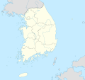
 South Korea adm (1953–1962) location map.svg 1,772 × 1,672; 375 KB
-
 South Korea adm (1962–1963) location map.svg 1,772 × 1,672; 375 KB
-
 South Korea adm (1963–1973) location map.svg 1,772 × 1,672; 376 KB
-
 South Korea adm (1973–1978) location map.svg 1,772 × 1,672; 376 KB
-
 South Korea adm (1978–1981) location map.svg 1,772 × 1,672; 376 KB
-
 South Korea adm (1981–1986) location map.svg 1,772 × 1,672; 378 KB
-
 South Korea adm (1986–1989) location map.svg 1,772 × 1,672; 380 KB
-
 South Korea adm (1989–1995) location map.svg 1,772 × 1,672; 382 KB
-
 South Korea adm (1995–1997) location map.svg 1,772 × 1,672; 383 KB
-
 South Korea adm (1997–2012) location map.svg 1,772 × 1,672; 377 KB
-
 South Korea adm (2012–2023) location map.svg 1,772 × 1,672; 382 KB
-
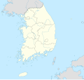
 South Korea adm location map.svg 1,772 × 1,672; 375 KB
-
 South Korea map (White).png 189 × 257; 2 KB
-
 거점국립대학교의 위치.png 500 × 472; 71 KB


_location_map.svg)
_location_map.svg)
_location_map.svg)
_location_map.svg)
_location_map.svg)
_location_map.svg)
_location_map.svg)
_location_map.svg)
_location_map.svg)
_location_map.svg)
_location_map.svg)

.png)
