Category:Blue Bell Hill (village)
English: Blue Bell Hill is a village halfway between Chatham and Maidstone in Kent, England, which lies on top of Blue Bell Hill. The community significantly expanded with the developments of the Walderslade area in the post war years, creating several housing estates around the village.
village in Kent, United Kingdom | |||||
| Upload media | |||||
| Instance of | |||||
|---|---|---|---|---|---|
| Location | Aylesford, Tonbridge and Malling, Kent, South East England, England | ||||
 | |||||
Subcategories
This category has the following 2 subcategories, out of 2 total.
C
- Coffin Stone, Aylesford (15 F)
W
- White Horse Stone, Kent (36 F)
Media in category "Blue Bell Hill (village)"
The following 56 files are in this category, out of 56 total.
-
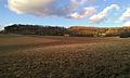
 A229, Blue Bell Hill - geograph.org.uk - 3630620.jpg 640 × 427; 224 KB
-
 Barling Close, Blue Bell Hill - geograph.org.uk - 3935696.jpg 3,488 × 2,616; 2.47 MB
-
 Blue Bell Hill - geograph.org.uk - 3066747.jpg 4,000 × 3,000; 4.29 MB
-
 Blue Bell Hill Village Sign - geograph.org.uk - 1033068.jpg 481 × 640; 58 KB
-
 Blue Bell Hill Village sign and disused pub - geograph.org.uk - 3064395.jpg 4,000 × 3,000; 4.1 MB
-
 Blue Bell Hill Village Signpost - geograph.org.uk - 2564628.jpg 3,000 × 4,000; 3.91 MB
-
 BlueBellHill0001.JPG 2,048 × 1,536; 812 KB
-
 BlueBellHill0002.JPG 2,048 × 1,536; 765 KB
-
 BlueBellHill0003.JPG 2,048 × 1,536; 746 KB
-
 BlueBellHill0005.JPG 2,048 × 1,536; 767 KB
-
 BlueBellHill000P.jpg 3,294 × 1,191; 1.69 MB
-
 BlueBellHill0011.JPG 2,048 × 1,536; 751 KB
-
 BlueBellHill0012.JPG 2,048 × 1,536; 748 KB
-
 BlueBellHillA229 0019.JPG 2,048 × 1,536; 815 KB
-
 BlueBellHillA229 0022.JPG 2,048 × 1,536; 762 KB
-
 Bungalow on Robin Hood Lane, Blue Bell Hill - geograph.org.uk - 2073629.jpg 1,600 × 1,200; 672 KB
-

-
 Channel Tunnel Rail Link at Blue Bell Hill - geograph.org.uk - 3059259.jpg 4,000 × 3,000; 4.07 MB
-
 Cliff Overlooking A229 Bluebell Hill - geograph.org.uk - 880947.jpg 640 × 480; 66 KB
-

-
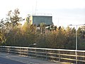
 Common Road Water Tower, Blue Bell Hill - geograph.org.uk - 3935707.jpg 3,488 × 2,616; 2.31 MB
-
 Common Road, Blue Bell Hill - geograph.org.uk - 1351240.jpg 640 × 480; 73 KB
-
 Common Road, Blue Bell Hill - geograph.org.uk - 1351248.jpg 640 × 480; 86 KB
-
 Common Road, Blue Bell Hill - geograph.org.uk - 1351815.jpg 640 × 480; 68 KB
-
 Construction site in Blue Bell Hill village - geograph.org.uk - 3545629.jpg 4,288 × 3,216; 5.11 MB
-
 Cossington Farm - geograph.org.uk - 1171581.jpg 640 × 480; 50 KB
-
 Cossington Fields, near Blue Bell Hill - geograph.org.uk - 2894227.jpg 2,896 × 1,944; 1.57 MB
-
 Cossington TV transmitters - geograph.org.uk - 1171583.jpg 640 × 480; 38 KB
-
 Derelict Cars, near Blue Bell Hill - geograph.org.uk - 2894224.jpg 2,896 × 1,944; 3.08 MB
-
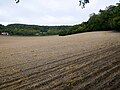 Field north of the White Horse Stone.jpg 4,592 × 3,448; 17.21 MB
-
 Former A229, Blue Bell Hill - geograph.org.uk - 1355606.jpg 640 × 480; 54 KB
-
-
 Generators, Blue Bell Hill Transmitting Towers - geograph.org.uk - 2894218.jpg 2,896 × 1,944; 2.99 MB
-

-
 Maidstone Road, Blue Bell Hill - geograph.org.uk - 1351821.jpg 640 × 480; 44 KB
-
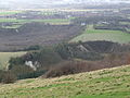
 Medway Valley from Blue Bell Hill - geograph.org.uk - 1351257.jpg 640 × 480; 65 KB
-
 Mill Lane, Blue Bell Hill - geograph.org.uk - 1351818.jpg 640 × 480; 66 KB
-
 Podkin Meadow - geograph.org.uk - 1639166.jpg 640 × 479; 78 KB
-
 Prefabs on Robin Hood Lane Upper - geograph.org.uk - 1355628.jpg 640 × 480; 66 KB
-
 Radio masts at Cossington Farm - geograph.org.uk - 1033098.jpg 481 × 640; 40 KB
-
 Robin Hood pub sign - geograph.org.uk - 1226853.jpg 480 × 640; 163 KB
-
 Rover Road, Lordswood - geograph.org.uk - 1201792.jpg 640 × 480; 98 KB
-
 Slip Road onto M2, Junction 3 - geograph.org.uk - 1252991.jpg 640 × 427; 51 KB
-
 Smythe's Megalith field.jpg 2,592 × 1,552; 1,002 KB
-
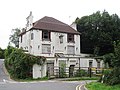
 St Alban's Church, Blue Bell Hill (Geograph Image 2729931 4e203727).jpg 3,488 × 2,616; 2.49 MB
-

-
 Taddington Wood Lane, Walderslade Woods - geograph.org.uk - 1360758.jpg 640 × 480; 120 KB
-

-
 The old Chatham-Maidstone Road - geograph.org.uk - 931479.jpg 640 × 480; 43 KB
-
 The Upper Bell Inn has seen better days - geograph.org.uk - 3064401.jpg 4,000 × 3,000; 4.04 MB
-
 Toddington Crescent, Blue Bell Hill - geograph.org.uk - 1084058.jpg 640 × 480; 45 KB
-
 Transmitting Station, Blue Bell Hill - geograph.org.uk - 2894195.jpg 2,896 × 1,944; 1.71 MB
-
 Upper Bell Inn, Blue Bell Hill - geograph.org.uk - 1351805.jpg 640 × 480; 82 KB
-
 Upper Bell Inn, Blue Bell Hill - geograph.org.uk - 903097.jpg 640 × 480; 68 KB
-
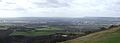
 View of Maidstone - Winter 2009 - geograph.org.uk - 1639070.jpg 640 × 479; 38 KB
-
 Water Tower at Blue Bell Hill - geograph.org.uk - 1033078.jpg 640 × 481; 81 KB


.jpg)


