Category:Blyth, Nottinghamshire
English: Blyth is a village in the Bassetlaw district of the county of Nottinghamshire, in the East Midlands, north west of East Retford, on the River Ryton.
Nederlands: Blyth is een plaats in het bestuurlijke gebied Bassetlaw, in het Engelse graafschap Nottinghamshire. De plaats ligt aan de rivier Ryton.
village and civil parish in Nottinghamshire, UK  | |||||
| Upload media | |||||
| Instance of | |||||
|---|---|---|---|---|---|
| Location | Bassetlaw, Nottinghamshire, East Midlands, England | ||||
| Population |
| ||||
 | |||||
Subcategories
This category has the following 5 subcategories, out of 5 total.
Media in category "Blyth, Nottinghamshire"
The following 200 files are in this category, out of 319 total.
(previous page) (next page)-
 "The White Swan" in Blyth - geograph.org.uk - 4778075.jpg 4,969 × 3,760; 4.6 MB
-
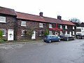
 1 and 2 Angel Cottages, Blyth.jpg 1,280 × 911; 335 KB
-
 1 and 2 Angel Row, Blyth.jpg 1,280 × 921; 275 KB
-
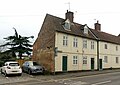
 12-16 High Street, Blyth.jpg 1,280 × 960; 361 KB
-
 2014 A1 road sign Maltby.jpg 2,000 × 1,500; 1.43 MB
-
 20170422 Johnson Bros G804 SMV.jpg 5,184 × 3,456; 3.21 MB
-
 20170422-Johnson-Bros-G804SMV.jpg 5,184 × 3,456; 5.77 MB
-
 22-26 High Street, Blyth.jpg 1,280 × 960; 285 KB
-
 3, 4 and 5 Angel Cottages, Blyth.jpg 1,280 × 960; 370 KB
-
 A1 (M) heading north - geograph.org.uk - 2556820.jpg 1,600 × 1,057; 243 KB
-
 A1 - A634 bridge, Blyth - geograph.org.uk - 2645622.jpg 640 × 428; 81 KB
-
 A1 - approaching Common Lane bridge - geograph.org.uk - 2645648.jpg 640 × 428; 68 KB
-
 A1 - Blyth interchange - geograph.org.uk - 2645653.jpg 640 × 428; 69 KB
-
 A1 - motorway status soon - geograph.org.uk - 2645641.jpg 640 × 428; 68 KB
-
 A1 approaching Blyth Services - geograph.org.uk - 4790308.jpg 640 × 426; 46 KB
-
 A1 approaching the A1(M) - geograph.org.uk - 4790306.jpg 640 × 449; 42 KB
-
 A1 bypasses Blyth - geograph.org.uk - 2645632.jpg 640 × 428; 84 KB
-
 A1 footbridge near Blyth - geograph.org.uk - 4962015.jpg 2,256 × 1,496; 867 KB
-
 A1 north - geograph.org.uk - 1758011.jpg 640 × 426; 64 KB
-
 A1 North traffic jam - geograph.org.uk - 741522.jpg 640 × 366; 42 KB
-
 A1 Northbound Approaching Blyth Services - geograph.org.uk - 4888929.jpg 640 × 480; 332 KB
-
 A1 One and a half miles to Blyth services - geograph.org.uk - 4961154.jpg 1,876 × 1,244; 1.01 MB
-
 A1 road near Worksop - geograph.org.uk - 3789011.jpg 640 × 360; 54 KB
-
 A1 south bridge near Blyth - geograph.org.uk - 607802.jpg 640 × 369; 38 KB
-
 A1 south of Blyth - geograph.org.uk - 4962009.jpg 1,600 × 1,061; 205 KB
-
 A1 south of Blyth Services - geograph.org.uk - 2514692.jpg 640 × 364; 34 KB
-
 A1 Southbound - geograph.org.uk - 1326979.jpg 640 × 480; 43 KB
-
 A1 southbound at Blyth - geograph.org.uk - 2552604.jpg 1,600 × 1,200; 355 KB
-

-
 A1(M) becomes the A1 - geograph.org.uk - 4035025.jpg 1,600 × 1,034; 206 KB
-
 A1(M) north of Blyth Services - geograph.org.uk - 4811555.jpg 640 × 329; 29 KB
-
 A1(M) north of Blyth Services - geograph.org.uk - 4962029.jpg 2,061 × 1,402; 1.5 MB
-
 A1(M) Services Interchange Blyth Wood - geograph.org.uk - 2884536.jpg 3,072 × 2,304; 1.28 MB
-
 A1(M), Doncaster bypass - geograph.org.uk - 4811919.jpg 640 × 391; 35 KB
-
 A1(M), J34 - geograph.org.uk - 4811556.jpg 640 × 479; 32 KB
-
 A1(M), northbound - geograph.org.uk - 4790313.jpg 640 × 377; 46 KB
-
 A1, Blyth Services turning - geograph.org.uk - 4790309.jpg 640 × 426; 33 KB
-
 A1, Maltby turning - geograph.org.uk - 4790304.jpg 640 × 426; 45 KB
-
 A1, Northbound near to Blyth - geograph.org.uk - 4888863.jpg 640 × 480; 343 KB
-
 A634 at Blyth New Bridge - geograph.org.uk - 6071363.jpg 1,024 × 810; 144 KB
-
 A634 at High Street junction, Blyth - geograph.org.uk - 6071360.jpg 1,024 × 764; 124 KB
-
 A634 High Street Junction - geograph.org.uk - 1368346.jpg 640 × 480; 67 KB
-
 A634 Retford Road at Blyth village boundary - geograph.org.uk - 6071357.jpg 1,024 × 759; 103 KB
-
 A634 towards Maltby - geograph.org.uk - 2552634.jpg 1,600 × 1,200; 520 KB
-
 Access Bridge, A1 - geograph.org.uk - 4811561.jpg 640 × 343; 26 KB
-
 Angel Inn - geograph.org.uk - 5819655.jpg 1,280 × 960; 373 KB
-
 Angel Inn.jpg 3,994 × 2,824; 6.18 MB
-
 Angel Row.jpg 6,000 × 8,000; 9.19 MB
-
 Approaching Spital Farm - geograph.org.uk - 4615134.jpg 5,032 × 3,654; 4.38 MB
-
 Approaching the Blyth turn off, A1 - geograph.org.uk - 2514676.jpg 640 × 367; 30 KB
-
 Approaching the road - geograph.org.uk - 3943643.jpg 1,024 × 768; 218 KB
-
 Archway House and Cottage, Blyth.jpg 1,280 × 995; 427 KB
-
 Autumn colours - geograph.org.uk - 2174461.jpg 640 × 443; 68 KB
-
 B6045 leaving Blyth - geograph.org.uk - 3890442.jpg 640 × 480; 52 KB
-
 Barn near Low Farm - geograph.org.uk - 6585233.jpg 1,600 × 1,065; 727 KB
-
 Bawtry Road towards Blyth - geograph.org.uk - 2552610.jpg 1,600 × 1,200; 545 KB
-
 A634 Milestone - geograph.org.uk - 1242025.jpg 640 × 426; 153 KB
-
 Blyth , A1(M) - geograph.org.uk - 6634590.jpg 3,171 × 2,114; 1.68 MB
-
 Blyth , A1(M) - geograph.org.uk - 6634594.jpg 6,000 × 4,000; 7.4 MB
-
 Blyth , Grassy Field - geograph.org.uk - 6634592.jpg 5,895 × 3,930; 5.25 MB
-
 Blyth Junction, A1 - geograph.org.uk - 2514685.jpg 640 × 374; 34 KB
-
 Blyth Lodge - geograph.org.uk - 2444307.jpg 640 × 427; 136 KB
-

-
-

-
 Blyth Park - geograph.org.uk - 3943603.jpg 1,024 × 768; 149 KB
-
 Blyth Priory Church, c.1912.jpg 1,778 × 2,320; 1,000 KB
-
 Blyth Priory Church, screen, c.1912.jpg 2,400 × 1,497; 701 KB
-
 Blyth Road towards Ranskill - geograph.org.uk - 2087329.jpg 900 × 626; 368 KB
-
 Blyth roundabout - geograph.org.uk - 1326970.jpg 640 × 480; 45 KB
-
 Blyth Services - geograph.org.uk - 5442579.jpg 640 × 425; 48 KB
-
 Blyth Services - geograph.org.uk - 5479114.jpg 1,024 × 683; 260 KB
-
 Blyth Services - geograph.org.uk - 6811450.jpg 4,032 × 3,024; 3.34 MB
-
 Blyth Services on the A1 - geograph.org.uk - 4741618.jpg 640 × 480; 56 KB
-
 Blyth Services on the A1 - geograph.org.uk - 4741619.jpg 640 × 480; 63 KB
-
 Blyth Services, A1 - geograph.org.uk - 4394003.jpg 640 × 480; 76 KB
-
 Blyth Travelodge - geograph.org.uk - 3890429.jpg 640 × 480; 67 KB
-
 Blyth Travelodge - geograph.org.uk - 4394006.jpg 640 × 402; 48 KB
-
 Blyth village centre - geograph.org.uk - 167283.jpg 640 × 470; 36 KB
-
 Blyth Village Centre - geograph.org.uk - 4810647.jpg 4,408 × 3,365; 3.66 MB
-
 Blyth Village Centre - geograph.org.uk - 4810680.jpg 4,497 × 3,308; 3.27 MB
-
 Blyth Village nr the White Swan Pub - geograph.org.uk - 1284450.jpg 640 × 406; 77 KB
-
 Blyth Village Sign - geograph.org.uk - 1477453.jpg 480 × 640; 132 KB
-
 Blyth Wood old and new - geograph.org.uk - 1777073.jpg 2,048 × 1,536; 1,020 KB
-
 Blyth, Cereal crop next to the A1M - geograph.org.uk - 6284981.jpg 4,831 × 3,221; 4.49 MB
-

-

-

-

-

-

-

-

-

-

-

-

-

-

-

-

-

-
 Blyth, St. Mary and St. Martin Church, South western aspect - geograph.org.uk - 6329586.jpg 6,529 × 4,352; 6.53 MB
-
 Blyth, St. Mary and St. Martin Church, Stained glass window - geograph.org.uk - 6329992.jpg 3,996 × 5,994; 5.57 MB
-
 Blyth, St. Mary and St. Martin Church, Stained glass window - geograph.org.uk - 6329993.jpg 3,927 × 5,890; 4.12 MB
-
 Blyth, St. Mary and St. Martin Church, Stained glass window - geograph.org.uk - 6329995.jpg 3,466 × 5,199; 3.56 MB
-

-
 Blyth, St. Mary and St. Martin Church, Stained glass window - geograph.org.uk - 6329999.jpg 4,339 × 6,508; 5.21 MB
-

-
 Blyth, St. Mary and St. Martin Church, The c17th font 1 - geograph.org.uk - 6329596.jpg 6,303 × 4,202; 5.38 MB
-
 Blyth, St. Mary and St. Martin Church, The c17th font 2 - geograph.org.uk - 6329597.jpg 7,436 × 4,958; 7.22 MB
-
 Blyth, St. Mary and St. Martin Church, The c17th font 3 - geograph.org.uk - 6329598.jpg 6,893 × 4,596; 6.64 MB
-
 Blyth, St. Mary and St. Martin Church, The c17th font 4 - geograph.org.uk - 6329600.jpg 3,209 × 4,813; 3.31 MB
-

-

-

-

-

-
 Blyth, St. Mary and St. Martin Church, The nave ceiling - geograph.org.uk - 6329591.jpg 6,669 × 4,446; 5.93 MB
-
 Blyth, St. Mary and St. Martin Church, The nave ceiling - geograph.org.uk - 6329594.jpg 4,623 × 3,082; 3.54 MB
-
 Bridge Lodge - geograph.org.uk - 6073848.jpg 640 × 480; 107 KB
-
 Bridleway alongside Roman Bank - geograph.org.uk - 4260467.jpg 1,280 × 861; 542 KB
-
 Bridleway and Farm - geograph.org.uk - 190738.jpg 640 × 480; 111 KB
-
 Bridleway at Brecks Wood - geograph.org.uk - 4810703.jpg 4,546 × 3,341; 4.21 MB
-
 Bridleway heading north - geograph.org.uk - 2557098.jpg 1,600 × 1,200; 664 KB
-
 Bridleway to the west of Blyth - geograph.org.uk - 3019426.jpg 4,000 × 3,000; 4.76 MB
-

-
 Communications mast near Blyth Services - geograph.org.uk - 2557136.jpg 1,600 × 1,200; 271 KB
-
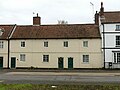
 Cottages, Sheffield Road, Blyth.jpg 1,280 × 942; 383 KB
-
 Drain by Low Farm, Serlby Park - geograph.org.uk - 6814075.jpg 1,800 × 4,000; 3.31 MB
-
 Edge of Serlby Park Golf Club - geograph.org.uk - 6814095.jpg 4,000 × 1,800; 4.83 MB
-
 Effigy of Knight, Ss Mary ^ Martin's church, Blyth - geograph.org.uk - 6343675.jpg 3,712 × 5,568; 5.5 MB
-
 Entering Blyth - geograph.org.uk - 3890439.jpg 640 × 480; 77 KB
-
 Entrance to Blyth Truck stop - geograph.org.uk - 1326966.jpg 640 × 480; 53 KB
-
 Evening light at Blyth green - geograph.org.uk - 1284480.jpg 640 × 427; 123 KB
-
 Exiting Blyth Services - geograph.org.uk - 4811559.jpg 640 × 282; 39 KB
-
 Farm track off Long Brecks Lane - geograph.org.uk - 5975929.jpg 1,024 × 768; 153 KB
-
 Farm track to Long Brecks Lane - geograph.org.uk - 4615137.jpg 5,184 × 3,888; 5.82 MB
-
 Farmland off Long Brecks Lane - geograph.org.uk - 2557119.jpg 1,600 × 1,200; 463 KB
-
 Farmland off the A634 - geograph.org.uk - 2557116.jpg 1,600 × 1,200; 486 KB
-
 Field covered in straw - geograph.org.uk - 5975963.jpg 1,024 × 768; 155 KB
-
 Footpath and Fields - geograph.org.uk - 141081.jpg 640 × 480; 97 KB
-
 Footpath in Blyth Park - geograph.org.uk - 3943246.jpg 1,024 × 768; 200 KB
-
 Former Gateway to Blyth Hall.jpg 1,280 × 960; 649 KB
-
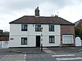
 Former Rose and Crown Inn, Blyth.jpg 1,280 × 960; 298 KB
-
 Fourways Hotel Blyth.jpg 6,000 × 8,000; 8.44 MB
-
 Fourways Inn, Blyth - geograph.org.uk - 2031472.jpg 1,024 × 720; 448 KB
-
 Frankies Diner - geograph.org.uk - 189826.jpg 640 × 480; 94 KB
-
 Gargoyle - South wall of The Priory Church, Blyth - geograph.org.uk - 4777143.jpg 4,717 × 3,529; 3.84 MB
-
 Genever Butchers probably.jpg 8,000 × 6,000; 11.03 MB
-
 Get your plug in ecotricity here^ - geograph.org.uk - 6303806.jpg 1,600 × 1,200; 290 KB
-
 Ginevers, Blyth.jpg 1,280 × 954; 306 KB
-
 Golf Clubhouse - geograph.org.uk - 2557018.jpg 1,600 × 1,200; 382 KB
-
 Golf Cottage, Serlby Park - geograph.org.uk - 4260474.jpg 1,280 × 888; 599 KB
-
 Golf Cottage, Serlby Park - geograph.org.uk - 4260475.jpg 1,280 × 851; 331 KB
-
 GravesMoor Lane off the A634 - geograph.org.uk - 6587729.jpg 1,600 × 1,117; 451 KB
-
 Grazing at 'The Mantles' - geograph.org.uk - 4810643.jpg 4,497 × 3,299; 3.23 MB
-
 Green Lane - geograph.org.uk - 4810770.jpg 4,608 × 3,456; 3.98 MB
-
 Greystones, Blyth.jpg 1,280 × 994; 320 KB
-
 Grimme Combi Star CS 1700 trailed destoner (at Blyth Notts) 09 - IMG 9613.jpg 2,256 × 1,504; 1.49 MB
-
 High Street, Blyth - geograph.org.uk - 2552629.jpg 1,600 × 1,200; 418 KB
-
 High Street, Blyth - geograph.org.uk - 3431570.jpg 640 × 480; 104 KB
-
 High Street, Blyth - geograph.org.uk - 5940627.jpg 5,376 × 3,024; 3.88 MB
-
 High Street, Blyth - geograph.org.uk - 6586305.jpg 1,600 × 1,065; 410 KB
-
 Hotel at Blyth Services - geograph.org.uk - 5567672.jpg 1,500 × 947; 1.47 MB
-
 House on High Street, Blyth - geograph.org.uk - 2552624.jpg 1,600 × 1,200; 485 KB
-
 In Blyth, Nottinghamshire - geograph.org.uk - 4777168.jpg 3,826 × 4,712; 5.01 MB
-
 Indian restaurant on Retford Road, Blyth - geograph.org.uk - 4778059.jpg 3,509 × 4,659; 3.95 MB
-
 Interior, Ss Mary ^ Martin's church, Blyth - geograph.org.uk - 6341675.jpg 5,568 × 3,712; 6.14 MB
-
 Ivy Cottages, Blyth - geograph.org.uk - 5940642.jpg 5,376 × 3,024; 3.47 MB
-
 Ivy Cottages, Blyth.jpg 1,280 × 960; 445 KB
-
 Joining the A1(M) - geograph.org.uk - 4790311.jpg 640 × 426; 38 KB
-
 Little Lane in Blyth - geograph.org.uk - 4810666.jpg 4,471 × 3,263; 3.4 MB
-
 Lodge and Bridleway Entrance near Blyth - geograph.org.uk - 4810690.jpg 4,479 × 3,308; 3.29 MB
-
 Lonesome lorry - geograph.org.uk - 3446715.jpg 1,024 × 715; 264 KB
-
 Long Brecks Lane - geograph.org.uk - 1242002.jpg 640 × 426; 64 KB
-
 Long Brecks Lane - geograph.org.uk - 2557118.jpg 1,600 × 1,200; 496 KB
-
 Long Brecks Lane - geograph.org.uk - 5968897.jpg 1,024 × 768; 162 KB
-
 Long Brecks Lane towards the A1 - geograph.org.uk - 2557122.jpg 1,600 × 1,200; 438 KB
-
 Looking north - geograph.org.uk - 1284502.jpg 640 × 427; 72 KB
-
 Lower Spital Farmhouse, Blyth.jpg 1,280 × 960; 431 KB
-
 M ^ S Simply Food at Blyth Services - geograph.org.uk - 5828878.jpg 4,608 × 3,072; 1.86 MB
-
 Milestone, Blyth.jpg 1,280 × 960; 549 KB
-
 Minor road towards Ranskill - geograph.org.uk - 2557020.jpg 1,600 × 1,200; 448 KB
-
 Minor Road towards the A614 - geograph.org.uk - 6585230.jpg 1,600 × 1,126; 876 KB
-
 Moor Lane and trees - geograph.org.uk - 2087350.jpg 675 × 900; 381 KB
-
 Moor Lane, near Blyth - geograph.org.uk - 6814107.jpg 2,141 × 1,768; 1.2 MB
-
 Motel and restaurant, Blyth services, A1 - geograph.org.uk - 4004472.jpg 1,600 × 1,064; 380 KB
-
 Moto Services Blyth Wood - geograph.org.uk - 2884506.jpg 3,072 × 2,304; 1.29 MB
-
 New Bridge over A1(M) near Blyth - geograph.org.uk - 4888417.jpg 640 × 480; 234 KB
-
 New industrial unit near Blyth - geograph.org.uk - 5969248.jpg 1,024 × 768; 139 KB
-
 Norman pillars, Ss Mary ^ Martin's church, Blyth - geograph.org.uk - 6341679.jpg 3,859 × 2,701; 3.79 MB
-
 Nornay Water Tower - geograph.org.uk - 1368331.jpg 640 × 480; 59 KB
-
 Nornay water tower - geograph.org.uk - 3446732.jpg 1,024 × 678; 282 KB
-
 North of Blyth - geograph.org.uk - 4777182.jpg 5,184 × 3,888; 5.98 MB
-
 Northbound A1 near Blyth Services - geograph.org.uk - 4888828.jpg 640 × 427; 301 KB
-
 Northbound A1, Blyth - geograph.org.uk - 4888852.jpg 640 × 427; 302 KB
-
 Northbound A1, Common Lane Bridge - geograph.org.uk - 4888823.jpg 640 × 427; 306 KB
-

-


_heading_north_-_geograph.org.uk_-_2556820.jpg)


_-_geograph.org.uk_-_4790306.jpg)


_-_the_start_of_the_Doncaster_bypass_section_-_geograph.org.uk_-_2645667.jpg)
_becomes_the_A1_-_geograph.org.uk_-_4035025.jpg)
_north_of_Blyth_Services_-_geograph.org.uk_-_4811555.jpg)
_north_of_Blyth_Services_-_geograph.org.uk_-_4962029.jpg)
_Services_Interchange_Blyth_Wood_-_geograph.org.uk_-_2884536.jpg)
,_Doncaster_bypass_-_geograph.org.uk_-_4811919.jpg)
,_J34_-_geograph.org.uk_-_4811556.jpg)
,_northbound_-_geograph.org.uk_-_4790313.jpg)


_-_geograph.org.uk_-_6634590.jpg)
_-_geograph.org.uk_-_6634594.jpg)


_-_geograph.org.uk_-_6329607.jpg)


_09_-_IMG_9613.jpg)


_-_geograph.org.uk_-_4790311.jpg)


_near_Blyth_-_geograph.org.uk_-_4888417.jpg)


