Category:Boats in Anglesey
Media in category "Boats in Anglesey"
The following 28 files are in this category, out of 28 total.
-

-

-
-

-
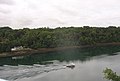
 Afon Menai from Pont y Borth - geograph.org.uk - 369260.jpg 640 × 309; 37 KB
-
 Beaumaris (1133405).jpg 1,000 × 709; 140 KB
-
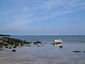 Benllech Sands, Anglesey. - geograph.org.uk - 8045.jpg 640 × 480; 54 KB
-

-
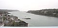
 Conwy Bay - geograph.org.uk - 338834.jpg 640 × 437; 49 KB
-
 East of Gallows Point, Beaumaris - geograph.org.uk - 1407261.jpg 521 × 640; 186 KB
-
-
 Holyhead Fish Dock - geograph.org.uk - 108901.jpg 640 × 480; 71 KB
-
 Holyhead marina 2011 02.jpg 1,540 × 1,155; 719 KB
-
 Holyhead-Harbor.jpg 1,440 × 1,080; 206 KB
-
 Landing the catch - geograph.org.uk - 579791.jpg 640 × 480; 142 KB
-
 Launching area at Bull Bay - geograph.org.uk - 1465083.jpg 640 × 480; 191 KB
-
 Menai Strait - geograph.org.uk - 667615.jpg 480 × 640; 70 KB
-
 Menai Strait - geograph.org.uk - 667617.jpg 640 × 480; 72 KB
-
 New Harbour - geograph.org.uk - 927325.jpg 640 × 481; 130 KB
-
 Porth Diana - geograph.org.uk - 426437.jpg 640 × 480; 261 KB
-
 Red Wharf Bay, Isle of Anglesey - geograph.org.uk - 30348.jpg 640 × 480; 109 KB
-
 The channel marker vessel Big Foot. - geograph.org.uk - 552129.jpg 640 × 480; 117 KB
-
 The harbour, Cemaes - geograph.org.uk - 386315.jpg 480 × 640; 135 KB
-
 The replica of HMS Pickle at Amlwch Port - geograph.org.uk - 1194700.jpg 640 × 480; 109 KB
-

-
 Y Fenai at dusk - geograph.org.uk - 540215.jpg 640 × 310; 30 KB
-
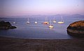
 Yachts on the Menai - geograph.org.uk - 1534582.jpg 640 × 515; 184 KB
-


,_Llanfaelog,_Anglesey._-_geograph.org.uk_-_123070.jpg)

.jpg)


