Category:Bocchetta di San Bernardo
|
Bocchetta di San Bernardo has an entry on OpenStreetMap (show). |
saddle at the border between Dongo and Musso  | |||||
| Upload media | |||||
| Instance of | |||||
|---|---|---|---|---|---|
| Location | Dongo, Province of Como, Lombardy, Italy | ||||
| Elevation above sea level |
| ||||
 | |||||
Subcategories
This category has the following 2 subcategories, out of 2 total.
S
V
Media in category "Bocchetta di San Bernardo"
The following 7 files are in this category, out of 7 total.
-
 Dongo - Chiesetta di San Bernardo - 2023-09-01 12-42-14 001.jpg 5,761 × 3,096; 2.27 MB
-
 Guidepost to Bregagno, by church of San Bernardo (Dongo).jpg 4,488 × 2,517; 4.44 MB
-
 Photosphere at Bocchetta di San Bernardo.jpg 5,322 × 2,661; 6.13 MB
-
 Photosphere between church San Bernardo and Bocchetta of San Bernardo.jpg 5,322 × 2,661; 6.59 MB
-
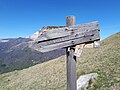 VML3 guidepost at Bocchetta di San Bernardo - 1.jpg 4,608 × 3,456; 6.76 MB
-
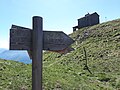 VML3 guidepost at Bocchetta di San Bernardo - 2.jpg 4,608 × 3,456; 7.08 MB
-
 VML3 route marker at Bocchetta di San Bernardo.jpg 4,608 × 3,456; 7.9 MB

.jpg)


