Category:Bolleberg (Maria-Hoop)
| Object location | | View all coordinates using: OpenStreetMap |
|---|
motte hill in Maria-Hoop, Netherlands .JPG) | |||||
| Upload media | |||||
| Instance of | |||||
|---|---|---|---|---|---|
| Location | Maria-Hoop, Echt, Limburg, Netherlands | ||||
| Street address |
| ||||
| Located on street |
| ||||
| Connects with | |||||
| Heritage designation |
| ||||
 | |||||
|
This is a category about rijksmonument number 45201
|
| Address |
|
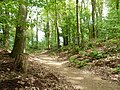
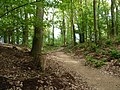
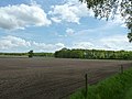
Media in category "Bolleberg (Maria-Hoop)"
The following 20 files are in this category, out of 20 total.
-
 Bolleberg Maria-Hoop.jpg 4,000 × 3,000; 2.43 MB
-
 Maria-Hoop-Motte Bollenberg (1).JPG 4,000 × 3,000; 4.79 MB
-
 Maria-Hoop-Motte Bollenberg (10).JPG 4,000 × 3,000; 4.87 MB
-
 Maria-Hoop-Motte Bollenberg (11).JPG 4,000 × 3,000; 4.99 MB
-
 Maria-Hoop-Motte Bollenberg (12).JPG 4,000 × 3,000; 4.8 MB
-
 Maria-Hoop-Motte Bollenberg (13).JPG 4,000 × 3,000; 4.88 MB
-
 Maria-Hoop-Motte Bollenberg (14).JPG 4,000 × 3,000; 4.74 MB
-
 Maria-Hoop-Motte Bollenberg (15).JPG 4,000 × 3,000; 4.93 MB
-
 Maria-Hoop-Motte Bollenberg (16).JPG 4,000 × 3,000; 4.88 MB
-
 Maria-Hoop-Motte Bollenberg (17).JPG 4,000 × 3,000; 5.12 MB
-
 Maria-Hoop-Motte Bollenberg (18).JPG 4,000 × 3,000; 4.86 MB
-
 Maria-Hoop-Motte Bollenberg (19).JPG 4,000 × 3,000; 4.52 MB
-
 Maria-Hoop-Motte Bollenberg (2).JPG 3,000 × 4,000; 4.08 MB
-
 Maria-Hoop-Motte Bollenberg (3).JPG 4,000 × 3,000; 4.88 MB
-
 Maria-Hoop-Motte Bollenberg (4).JPG 4,000 × 3,000; 4.88 MB
-
 Maria-Hoop-Motte Bollenberg (5).JPG 4,000 × 3,000; 4.95 MB
-
 Maria-Hoop-Motte Bollenberg (6).JPG 4,000 × 3,000; 5.03 MB
-
 Maria-Hoop-Motte Bollenberg (7).JPG 4,000 × 3,000; 4.9 MB
-
 Maria-Hoop-Motte Bollenberg (8).JPG 4,000 × 3,000; 4.95 MB
-
 Maria-Hoop-Motte Bollenberg (9).JPG 4,000 × 3,000; 4.93 MB

.JPG)
.JPG)
.JPG)
.JPG)
.JPG)
.JPG)
.JPG)
.JPG)
.JPG)
.JPG)
.JPG)
.JPG)
.JPG)
.JPG)
.JPG)
.JPG)
.JPG)
.JPG)