Category:Booton, Norfolk
English: Booton is a village and civil parish in the Broadland district of Norfolk, England, just east of Reepham and seven miles west of Aylsham. According to the 2001 census, it had a population of 100.
village and civil parish in Norfolk, UK  | |||||
| Upload media | |||||
| Instance of | |||||
|---|---|---|---|---|---|
| Location | Broadland, Norfolk, East of England, England | ||||
| Population |
| ||||
| Area |
| ||||
 | |||||
Subcategories
This category has the following 4 subcategories, out of 4 total.
Media in category "Booton, Norfolk"
The following 71 files are in this category, out of 71 total.
-

-
 Approaching Reepham on Norwich Road - geograph.org.uk - 755760.jpg 640 × 462; 135 KB
-
 Barn conversion at The Grove - geograph.org.uk - 2982506.jpg 1,024 × 768; 117 KB
-
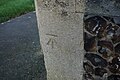 Bench Mark, St Michael the Archangel Church, Booton - geograph.org.uk - 5998913.jpg 1,600 × 1,064; 664 KB
-
 Booton House - geograph.org.uk - 636459.jpg 640 × 480; 87 KB
-
 Booton Village sign - geograph.org.uk - 6574114.jpg 3,456 × 4,608; 4.15 MB
-
 Booton Village sign - geograph.org.uk - 6574736.jpg 3,456 × 4,608; 3.97 MB
-
 Booton Village sign - geograph.org.uk - 6574743.jpg 4,608 × 3,456; 3.95 MB
-
 Booton Village sign - geograph.org.uk - 6576895.jpg 1,377 × 1,836; 973 KB
-
 Booton Village sign - geograph.org.uk - 6576902.jpg 4,608 × 3,456; 4.06 MB
-
 Chancel, St Michael and All Angels' church, Booton - geograph.org.uk - 5020736.jpg 2,848 × 4,164; 7.71 MB
-
 Church Road, Booton - geograph.org.uk - 6573971.jpg 4,608 × 3,456; 4.06 MB
-
 Easton Way junction - geograph.org.uk - 3473370.jpg 3,072 × 2,304; 1.34 MB
-
 Entering Reepham on Norwich Road - geograph.org.uk - 6574850.jpg 4,608 × 3,456; 3.98 MB
-
 Font, St Michael and All Angels' church, Booton - geograph.org.uk - 5022562.jpg 2,693 × 4,319; 5.12 MB
-
 Furze Lane - geograph.org.uk - 5010121.jpg 2,115 × 1,402; 2.7 MB
-
 Furze Lane sign - geograph.org.uk - 6573883.jpg 4,608 × 3,456; 4.14 MB
-
 Furze Lane, Booton - geograph.org.uk - 6573878.jpg 1,842 × 1,318; 3.96 MB
-
 Georgian postbox on Norwich Road, Booton, Reepham - geograph.org.uk - 5967910.jpg 1,208 × 1,600; 631 KB
-
 Green Lane - geograph.org.uk - 636462.jpg 480 × 640; 83 KB
-
 House for sale, Booton - geograph.org.uk - 5557470.jpg 1,600 × 1,200; 264 KB
-
 Looking east past the Booton clay pits - geograph.org.uk - 636458.jpg 480 × 640; 101 KB
-
 Men of Booton War Memorial Plaque - geograph.org.uk - 5970405.jpg 1,197 × 1,600; 525 KB
-
 Mill Hill, Booton - geograph.org.uk - 1160503.jpg 640 × 480; 62 KB
-
 New house at Eve's Hill - geograph.org.uk - 5558491.jpg 1,600 × 1,200; 359 KB
-
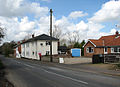
 Norwich Road, Booton - geograph.org.uk - 6573215.jpg 4,608 × 3,456; 4.07 MB
-
 Norwich Road, Booton - geograph.org.uk - 6573967.jpg 4,608 × 3,456; 3.89 MB
-
 Norwich Road, Booton - geograph.org.uk - 6574304.jpg 4,608 × 3,456; 3.98 MB
-
 Norwich Road, Booton - geograph.org.uk - 6574741.jpg 1,920 × 1,440; 4.45 MB
-
 Norwich Road, Booton - geograph.org.uk - 6574839.jpg 4,608 × 3,456; 3.95 MB
-
 Norwich Road, Booton - geograph.org.uk - 6574844.jpg 4,608 × 3,456; 4.01 MB
-
 Norwich Road, Booton, Reepham - geograph.org.uk - 5967906.jpg 1,600 × 1,066; 511 KB
-
 Norwich Road, Reepham - geograph.org.uk - 6576262.jpg 3,456 × 4,608; 3.94 MB
-
 Organ, St Michael and All Angels' church, Booton - geograph.org.uk - 5022546.jpg 3,163 × 4,716; 7.77 MB
-
 Pond in meadow - geograph.org.uk - 1253935.jpg 480 × 640; 155 KB
-
 Reepham Town sign - geograph.org.uk - 6576260.jpg 3,456 × 4,608; 3.93 MB
-
 Reepham Town sign - geograph.org.uk - 6576813.jpg 4,608 × 3,456; 3.87 MB
-
 Road leading to St Michael the Archangel Church, Booton - geograph.org.uk - 5967929.jpg 1,600 × 1,065; 844 KB
-
 Road past Booton Hall - geograph.org.uk - 755691.jpg 480 × 640; 165 KB
-
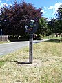
 Signpost on Norwich Road - geograph.org.uk - 6573872.jpg 1,392 × 1,856; 1.35 MB
-
 St Michael the Archangel Church, Booton - geograph.org.uk - 5967931.jpg 1,600 × 1,064; 671 KB
-
 St Michael the Archangel Church, Booton - geograph.org.uk - 5998227.jpg 1,600 × 1,064; 526 KB
-
 St Michael the Archangel Church, Booton - geograph.org.uk - 5998914.jpg 1,064 × 1,600; 404 KB
-
 St Michael the Archangel Church, Booton - geograph.org.uk - 5998918.jpg 1,600 × 1,064; 459 KB
-

-

-

-

-

-
-

-
 The churchyard at Booton - geograph.org.uk - 2982527.jpg 1,024 × 768; 213 KB
-

-
 The Reverend Whitwell Elwin - geograph.org.uk - 755717.jpg 480 × 640; 91 KB
-
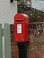
 The Street George V Postbox - geograph.org.uk - 6574764.jpg 3,456 × 4,608; 4.02 MB
-
 The Street George V Postbox - geograph.org.uk - 6574820.jpg 1,377 × 1,836; 755 KB
-

-
 Through the gateway at Booton - geograph.org.uk - 1984655.jpg 640 × 480; 80 KB
-
 Unnamed Lane - geograph.org.uk - 5006604.jpg 2,132 × 1,392; 1.23 MB
-
 Unnamed Lane towards Little Witchingham - geograph.org.uk - 5006598.jpg 2,152 × 1,371; 1.22 MB
-
 Victorian post box next to Booton church - geograph.org.uk - 3877303.jpg 480 × 640; 104 KB
-

-
 View across pasture - geograph.org.uk - 755693.jpg 640 × 480; 163 KB
-
 View downhill - geograph.org.uk - 764759.jpg 640 × 466; 147 KB
-
 View from the top of a pillbox - geograph.org.uk - 3935867.jpg 640 × 480; 79 KB
-
 View towards Salle - geograph.org.uk - 2982536.jpg 1,024 × 768; 140 KB
-
 View west along a hedgerow - geograph.org.uk - 636467.jpg 480 × 640; 75 KB
-
 Woodland on the grounds of Booton estate - geograph.org.uk - 755702.jpg 480 × 640; 195 KB
-
 World War one Memorial in Booton church - geograph.org.uk - 4398469.jpg 1,261 × 1,600; 453 KB
-
 Booton village sign - detail - geograph.org.uk - 755779.jpg 480 × 640; 154 KB
-
 Booton village sign - geograph.org.uk - 755773.jpg 480 × 640; 158 KB


