Category:Botallack
village in west Cornwall, United Kingdom  | |||||
| Upload media | |||||
| Instance of | |||||
|---|---|---|---|---|---|
| Location | St Just, Cornwall, South West England, England | ||||
 | |||||
English: Botallack is an ex- tin mining village in Cornwall, England United Kingdom near Land's End. It is situated between the town of St Just in Penwith and the village of Pendeen. It has a pub and a nearby campsite.
Subcategories
This category has the following 4 subcategories, out of 4 total.
Media in category "Botallack"
The following 76 files are in this category, out of 76 total.
-
 Barn near Botallack - geograph.org.uk - 964374.jpg 640 × 427; 125 KB
-
 Below the tide level at Crowns Mine - geograph.org.uk - 4737085.jpg 4,896 × 3,672; 6.71 MB
-
 Botallack - geograph.org.uk - 1151277.jpg 640 × 480; 106 KB
-
 Botallack Arsenic Kiln - geograph.org.uk - 3140811.jpg 640 × 424; 262 KB
-
 Botallack Arsenic Kiln - geograph.org.uk - 3140850.jpg 640 × 414; 258 KB
-
 Botallack Arsenic Kiln - geograph.org.uk - 3140859.jpg 424 × 640; 253 KB
-
 Botallack Arsenic Kiln - geograph.org.uk - 3140866.jpg 424 × 640; 260 KB
-
 Botallack Arsenic Kiln - geograph.org.uk - 3146937.jpg 640 × 424; 270 KB
-
 Botallack Arsenic Kiln - geograph.org.uk - 3146949.jpg 640 × 424; 251 KB
-
 Botallack Arsenic Kiln - geograph.org.uk - 3146958.jpg 640 × 424; 248 KB
-
 Botallack Arsenic Kiln Chimney - geograph.org.uk - 3140826.jpg 424 × 640; 183 KB
-
 Botallack Arsenic Kiln Chimney - geograph.org.uk - 3140886.jpg 424 × 640; 242 KB
-
 Botallack Common Lake.jpg 4,208 × 3,120; 6.99 MB
-
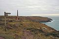
 Botallack Head Trig Point - geograph.org.uk - 4561795.jpg 2,275 × 1,623; 1.68 MB
-
 Botallack Tin Facility - geograph.org.uk - 3140800.jpg 640 × 424; 288 KB
-
 Bottalack Count House - geograph.org.uk - 3134055.jpg 424 × 640; 214 KB
-
 Bottallack Arsenic Works - geograph.org.uk - 3118372.jpg 537 × 800; 89 KB
-
 Bottallack Arsenic Works - geograph.org.uk - 3134025.jpg 640 × 424; 253 KB
-
 Bottallack Arsenic Works - geograph.org.uk - 3134030.jpg 424 × 640; 251 KB
-
 Bottallack Count House - geograph.org.uk - 3118383.jpg 640 × 424; 50 KB
-
 Bottallack Trial Adit - geograph.org.uk - 3118376.jpg 640 × 424; 79 KB
-
 Chimney at Botallack - geograph.org.uk - 1955423.jpg 640 × 426; 52 KB
-
 Cliffs near Botallack (6969).jpg 4,288 × 2,848; 2.97 MB
-
 Crowns Mines, Botallack (8747023787).jpg 2,592 × 1,944; 1.86 MB
-
 Crowns Mines, Botallack (8747025237).jpg 1,944 × 2,592; 1.61 MB
-
 Disused stile on Botallack Common - geograph.org.uk - 230206.jpg 480 × 640; 130 KB
-
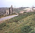
 Enginehouse at Botallack (6984).jpg 4,288 × 2,848; 2.96 MB
-
 Enginehouse at Botallack Crowns (6972).jpg 4,288 × 2,848; 3.02 MB
-
 Enginehouse at Botallack Crowns (6975).jpg 4,288 × 2,848; 3.03 MB
-
 Enginehouse at Botallack Crowns (6979).jpg 4,288 × 2,848; 2.96 MB
-
 Enginehouse at Botallack Crowns (6981).jpg 4,288 × 2,848; 3.06 MB
-
 Holed stone, Kenidjack Common - geograph.org.uk - 526044.jpg 640 × 480; 178 KB
-
 Looking down into North Zawn - geograph.org.uk - 4737102.jpg 4,896 × 3,672; 6.63 MB
-
 Looking south east from Aire Point - geograph.org.uk - 4736954.jpg 4,896 × 3,672; 6.92 MB
-
 Looking south from below Crowns Mine - geograph.org.uk - 4736986.jpg 4,896 × 3,672; 7.1 MB
-
 Mine workings, Botallack - geograph.org.uk - 2206797.jpg 1,024 × 768; 196 KB
-
 Mines near Botallack (6968).jpg 4,288 × 2,848; 2.98 MB
-
 Mines near Botallack (6970).jpg 4,288 × 2,848; 2.97 MB
-

-

-
 Rocks near Botallack Head (6964).jpg 4,288 × 2,848; 2.98 MB
-
 Rocks near Botallack Head (6965).jpg 4,288 × 2,848; 2.96 MB
-
 Roscommon OS Trig point.jpg 2,602 × 2,854; 5.78 MB
-
 South West Coast Path and Botallack Mine (6983).jpg 4,288 × 2,848; 3.05 MB
-
 St Just old fire station - geograph.org.uk - 489889.jpg 640 × 427; 195 KB
-
 Sunset at Botallack Mine - geograph.org.uk - 3117275.jpg 640 × 424; 41 KB
-
 Sunset at Bottallack Arsenic Works - geograph.org.uk - 3118382.jpg 555 × 800; 40 KB
-
 Sunset at Bottallack Count House - geograph.org.uk - 3118386.jpg 530 × 800; 109 KB
-
 Sunset at Bottallack Mine - geograph.org.uk - 3118374.jpg 548 × 800; 26 KB
-
 Sunset at Bottallack Mine - geograph.org.uk - 3118377.jpg 640 × 424; 64 KB
-
 Sunset at Bottallack Mine - geograph.org.uk - 3118380.jpg 424 × 640; 61 KB
-
 Sunset at Bottallack Mine - geograph.org.uk - 3118384.jpg 599 × 800; 64 KB
-
 Sunset at Bottallack Mine - geograph.org.uk - 3118385.jpg 530 × 800; 64 KB
-

-
 The Coast Path near Botallack - geograph.org.uk - 964503.jpg 640 × 427; 103 KB
-
 The Crowns - geograph.org.uk - 4736999.jpg 4,896 × 3,672; 6.51 MB
-
 View of the sunset at Botallack - geograph.org.uk - 6285520.jpg 3,872 × 2,592; 1.39 MB
-
 View of the sunset at Botallack ^3 - geograph.org.uk - 6285525.jpg 3,603 × 2,592; 1.09 MB
-
 View of waves crashing onto the rocks at Botallack - geograph.org.uk - 6285503.jpg 3,872 × 2,592; 1.91 MB
-
 View of waves crashing up against the cliff at Botallack ^2 - geograph.org.uk - 6285498.jpg 3,872 × 2,592; 2.67 MB
-
 View of waves crashing up against the cliff at Botallack ^3 - geograph.org.uk - 6285500.jpg 3,872 × 2,592; 2.99 MB
-

-
 View of waves crashing up against the cliff at Botallack ^6 - geograph.org.uk - 6285513.jpg 3,872 × 2,592; 2.79 MB
-
 Botallack Count House - geograph.org.uk - 777130.jpg 640 × 480; 87 KB
-
 Carnyorth Common - geograph.org.uk - 1038.jpg 640 × 480; 124 KB
-
 Cattle grazing north of Carn Vres - geograph.org.uk - 230202.jpg 640 × 480; 137 KB
-
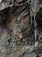 Contorted Rock Strata on the Cliff Face - geograph.org.uk - 489957.jpg 466 × 640; 120 KB
-
 Engine house chimneys at Botallack - geograph.org.uk - 712272.jpg 640 × 606; 140 KB
-

-
 Heifer and hedge on No Go By hill - geograph.org.uk - 88493.jpg 640 × 480; 150 KB
-
 House Renovation in Botallack Village - geograph.org.uk - 489969.jpg 640 × 427; 82 KB
-
 No Go By Hill - geograph.org.uk - 88586.jpg 480 × 640; 116 KB
-
 Road to St Just - geograph.org.uk - 613348.jpg 640 × 403; 101 KB
-
 Ruined building, Kenidjack Castle - geograph.org.uk - 62354.jpg 640 × 427; 62 KB
-
 South West Coast Path at Botallack - geograph.org.uk - 655093.jpg 640 × 427; 61 KB
-
 St Just Town Square - geograph.org.uk - 490059.jpg 640 × 426; 74 KB


.jpg)
.jpg)
.jpg)

.jpg)
.jpg)
.jpg)
.jpg)
.jpg)


.jpg)
.jpg)


.jpg)
.jpg)

.jpg)


