Category:Bothal
village in Northumberland, United Kingdom  | |||||
| Upload media | |||||
| Instance of | |||||
|---|---|---|---|---|---|
| Location | Ashington, Northumberland, North East England, England | ||||
 | |||||
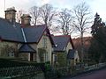
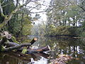
English: Bothal is a village in Northumberland, in England. It is situated between Morpeth and Ashington. There is a castle, a church, a vicarage opposite the church gates, some stepping stones over the River Wansbeck, a few houses and that's about it really. A nice quiet place.
Subcategories
This category has the following 3 subcategories, out of 3 total.
A
B
- Bothal War Memorial (2 F)
Media in category "Bothal"
The following 25 files are in this category, out of 25 total.
-
 Bothal Village - geograph.org.uk - 93126.jpg 640 × 436; 95 KB
-
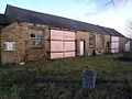
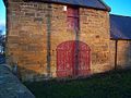 Bothalbarns.jpg 1,152 × 864; 117 KB
-
 Bothaldrift.jpg 1,152 × 864; 105 KB
-
 Bothaldrift2.jpg 1,152 × 864; 124 KB
-
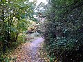
 Bothalfootpath.jpg 864 × 1,152; 119 KB
-
 Bothaltreescross.jpg 864 × 1,152; 224 KB
-
 Bothalvillage.jpg 1,152 × 864; 87 KB
-
 Bothalvillage2.jpg 1,152 × 864; 132 KB
-
 Bothalweir.jpg 1,005 × 825; 100 KB
-
 Bothalwoodpath.jpg 864 × 1,152; 169 KB
-
 Military pill box, Bothal.JPG 2,272 × 1,704; 1.68 MB
-

-
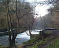
 River Wansbeck at Bothal.jpg 3,072 × 2,304; 1.46 MB
-

-
 Stepping Stones, Bothal - geograph.org.uk - 363942.jpg 640 × 460; 145 KB
-
 Stepping Stones, Bothal.JPG 2,272 × 1,704; 1.5 MB
-
 Stone pill pox, Bothal.JPG 2,272 × 1,704; 1.33 MB
-
 A byway - geograph.org.uk - 1518796.jpg 640 × 479; 81 KB
-
 Bothal Village - geograph.org.uk - 132642.jpg 480 × 640; 81 KB
-
 Coney Garth - geograph.org.uk - 132607.jpg 640 × 480; 83 KB
-
 Hairpin bend on Bothal Bank - geograph.org.uk - 598548.jpg 425 × 640; 125 KB
-
 North Choppington - geograph.org.uk - 145217.jpg 640 × 388; 78 KB
-
 Portland Terrace - geograph.org.uk - 280667.jpg 640 × 480; 81 KB
-
 Riverside Park - geograph.org.uk - 69510.jpg 640 × 480; 164 KB
-
 Road to Bothal Village - geograph.org.uk - 300029.jpg 640 × 480; 104 KB


