Category:Botriphnie
Scottish parish in Moray, Scotland, UK | |||||
| Upload media | |||||
| Instance of | |||||
|---|---|---|---|---|---|
| Named after | |||||
| Location |
| ||||
| Population |
| ||||
| Area |
| ||||
 | |||||
Subcategories
This category has the following 2 subcategories, out of 2 total.
D
M
- Mill of Towie, Moray (1 F)
Media in category "Botriphnie"
The following 110 files are in this category, out of 110 total.
-
 A Plethora of Gates - geograph.org.uk - 677932.jpg 640 × 427; 297 KB
-
 B9115 near Bomakelloch Cottages - geograph.org.uk - 3737396.jpg 1,600 × 1,200; 321 KB
-
 B9115 near Forkins - geograph.org.uk - 3737385.jpg 1,600 × 1,200; 432 KB
-
 B9115 near Newburgh - geograph.org.uk - 3737390.jpg 1,600 × 1,200; 462 KB
-
 Balnascoog - geograph.org.uk - 3026186.jpg 640 × 427; 368 KB
-
 Belnascoug - geograph.org.uk - 3026172.jpg 640 × 427; 399 KB
-
 Beside the River Isla - geograph.org.uk - 3079547.jpg 640 × 360; 133 KB
-
 Blackmuir - geograph.org.uk - 3026233.jpg 640 × 427; 378 KB
-
 Bomakelloch Cottages beside the B9115 road - geograph.org.uk - 5962622.jpg 4,000 × 3,000; 2.68 MB
-
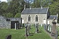
 Botriphnie Parish Kirk - geograph.org.uk - 6251690.jpg 640 × 427; 457 KB
-
 Botriphnie Parish Kirk - geograph.org.uk - 7016.jpg 640 × 419; 229 KB
-
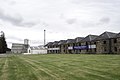
 Botriphnie Primary School - geograph.org.uk - 3026300.jpg 640 × 427; 317 KB
-
 Botriphnie War Memorial - geograph.org.uk - 6251685.jpg 427 × 640; 513 KB
-
 Braehead - geograph.org.uk - 3026292.jpg 640 × 427; 340 KB
-
 Braehead - geograph.org.uk - 3026306.jpg 640 × 340; 285 KB
-
 Broadrashes - geograph.org.uk - 3026330.jpg 455 × 640; 324 KB
-
 Broadrashes and Drywells - geograph.org.uk - 1235715.jpg 640 × 427; 220 KB
-
 Burn of Aultnaknowe - geograph.org.uk - 3026213.jpg 640 × 427; 513 KB
-
 Burn of Towie - geograph.org.uk - 3737356.jpg 1,600 × 1,200; 514 KB
-
 Bus shelter and road junction on the B9115 - geograph.org.uk - 3737391.jpg 1,600 × 1,200; 478 KB
-
 Cattle Grid - geograph.org.uk - 4080915.jpg 640 × 480; 91 KB
-
 Cotterton - geograph.org.uk - 3026315.jpg 640 × 427; 407 KB
-
 Cotterton Steading - geograph.org.uk - 3026323.jpg 640 × 438; 402 KB
-
 Countryside - geograph.org.uk - 4080917.jpg 640 × 480; 92 KB
-
 Craighall - geograph.org.uk - 665446.jpg 640 × 426; 57 KB
-
 Croft near Broomhill - geograph.org.uk - 1235697.jpg 640 × 427; 257 KB
-
 Drummuir - geograph.org.uk - 2747251.jpg 640 × 386; 71 KB
-
 Drummuir Station - geograph.org.uk - 2571757.jpg 640 × 413; 122 KB
-
 Drummuir Wind Farm - geograph.org.uk - 3026142.jpg 640 × 361; 290 KB
-
 Drummuir Wind Farm - geograph.org.uk - 3026149.jpg 640 × 343; 267 KB
-
 Drummuir Wind Farm - geograph.org.uk - 3173088.jpg 427 × 640; 299 KB
-
 Easter Shenwall - geograph.org.uk - 687728.jpg 640 × 283; 148 KB
-
 Engineering company yard at Towiemore - geograph.org.uk - 6147601.jpg 1,024 × 576; 315 KB
-
 Farm road to Mains of Bodinfinnoch - geograph.org.uk - 3737332.jpg 1,600 × 1,200; 563 KB
-
 Farmland at Mossend - geograph.org.uk - 6148702.jpg 1,024 × 576; 193 KB
-
 Felled woodland at Bogallie - geograph.org.uk - 6214948.jpg 2,592 × 1,944; 1.27 MB
-

-
 Footbridge Over The River Isla - geograph.org.uk - 2571751.jpg 640 × 429; 115 KB
-
 Ford above Edintore - geograph.org.uk - 677896.jpg 640 × 442; 288 KB
-
 Forest by Hill of Shenwall - geograph.org.uk - 665451.jpg 640 × 426; 43 KB
-
 Forestry road at Sheanspark - geograph.org.uk - 3737377.jpg 1,600 × 1,200; 449 KB
-
 Gated farm road to Shenwall Farm - geograph.org.uk - 665450.jpg 640 × 426; 66 KB
-
 Glackmuck - geograph.org.uk - 3026287.jpg 640 × 427; 354 KB
-
 Glentauchers distillery - geograph.org.uk - 3457816.jpg 1,440 × 964; 326 KB
-
 Glentauchers Distillery - geograph.org.uk - 4269171.jpg 640 × 446; 46 KB
-
 Glentauchers Distillery - geograph.org.uk - 5433781.jpg 1,600 × 1,200; 374 KB
-

-
 Greens of Woodend - geograph.org.uk - 1235700.jpg 640 × 427; 242 KB
-
 Hill of Towie Wind Farm - geograph.org.uk - 3582626.jpg 4,608 × 3,456; 4.97 MB
-
 Hill of Towie Windfarm - geograph.org.uk - 3737355.jpg 1,600 × 1,200; 468 KB
-
 How to have fun with a lawn-mower - geograph.org.uk - 1235712.jpg 640 × 427; 262 KB
-
 Knockan Wind Farm - geograph.org.uk - 3173103.jpg 640 × 351; 248 KB
-
 LH Stainless Process Engineering - geograph.org.uk - 1235707.jpg 640 × 427; 279 KB
-
 Loch Park - geograph.org.uk - 2571743.jpg 640 × 426; 138 KB
-
 Loch Park - geograph.org.uk - 6144062.jpg 1,024 × 576; 430 KB
-
 Loch Park - geograph.org.uk - 6147587.jpg 1,024 × 576; 387 KB
-
 Looking from Davidston towards Edintore - geograph.org.uk - 677861.jpg 640 × 427; 246 KB
-
 Looking towards Blackmuir - geograph.org.uk - 3026202.jpg 427 × 640; 424 KB
-
 Looking towards Cairds Hill - geograph.org.uk - 672456.jpg 640 × 427; 261 KB
-
 Looking towards Ten Rood Hill - geograph.org.uk - 1192474.jpg 640 × 427; 227 KB
-
 Looking towards the hill above Edintore - geograph.org.uk - 672454.jpg 640 × 427; 259 KB
-
 Lynemore - geograph.org.uk - 1192449.jpg 640 × 427; 234 KB
-
 Mains of Towiebeg - geograph.org.uk - 1235709.jpg 640 × 427; 259 KB
-
 Meadow Sweet - geograph.org.uk - 3079551.jpg 640 × 360; 122 KB
-
 Midthird - geograph.org.uk - 3026176.jpg 640 × 427; 359 KB
-
 Midthird - geograph.org.uk - 3026242.jpg 640 × 399; 281 KB
-
 Midthird - geograph.org.uk - 3026284.jpg 640 × 393; 283 KB
-
 Midthird Farm - geograph.org.uk - 3169919.jpg 640 × 418; 378 KB
-
 Mill of Towie - geograph.org.uk - 6148680.jpg 1,024 × 576; 450 KB
-
 Minor road at Midtown of Bellyhack - geograph.org.uk - 5962620.jpg 4,000 × 3,000; 3.57 MB
-
 Minor road from the Bridge of Davidston to the B9115 road - geograph.org.uk - 5962625.jpg 4,000 × 3,000; 3.13 MB
-
 Minor road near Bodinfinnoch - geograph.org.uk - 3737348.jpg 1,600 × 1,200; 379 KB
-
 Minor road near Mains of Bodinfinnoch - geograph.org.uk - 3737334.jpg 1,600 × 1,200; 453 KB
-
 Minor road near Rosarie - geograph.org.uk - 3737329.jpg 1,600 × 1,200; 431 KB
-
 Minor road near Rosarie - geograph.org.uk - 3737339.jpg 1,600 × 1,200; 407 KB
-
 Minor road near to Myrieward - geograph.org.uk - 5962619.jpg 4,000 × 3,000; 3.65 MB
-
 Minor road near Towiemore - geograph.org.uk - 3737364.jpg 1,600 × 1,200; 295 KB
-
 Minor road near Upper Lynemore - geograph.org.uk - 5962617.jpg 4,000 × 3,000; 2.95 MB
-
 Minor road to Lower Lynemore - geograph.org.uk - 5962618.jpg 4,000 × 3,000; 3.25 MB
-
 More Meadow Sweet - geograph.org.uk - 3079557.jpg 640 × 360; 102 KB
-
 Newburgh - geograph.org.uk - 1235699.jpg 640 × 427; 230 KB
-
 Old Mill Wheel - geograph.org.uk - 1192441.jpg 640 × 427; 231 KB
-
 Ordnance Survey Flush Bracket 11949 - geograph.org.uk - 3183769.jpg 3,264 × 2,448; 2 MB
-

-
 Parish Kirk of Botriphnie, Drummuir - geograph.org.uk - 6214952.jpg 2,592 × 1,944; 2.07 MB
-
 Parish Kirk of Botriphnie, Drummuir - geograph.org.uk - 6214959.jpg 2,592 × 1,944; 2.34 MB
-

-
 Picnic site at Sheanspark - geograph.org.uk - 3737376.jpg 1,600 × 1,200; 488 KB
-
 Platelayers' hut, Keith and Dufftown Railway - geograph.org.uk - 6144069.jpg 1,024 × 576; 464 KB
-
 Road junction near Bomakelloch - geograph.org.uk - 3737397.jpg 1,600 × 1,200; 392 KB
-
 Rough grassland near Woodend - geograph.org.uk - 6147593.jpg 1,024 × 576; 320 KB
-
 Sauchanward - geograph.org.uk - 3026311.jpg 640 × 388; 347 KB
-
 Sauchenward - geograph.org.uk - 3026301.jpg 640 × 427; 371 KB
-
 Sheals - geograph.org.uk - 3190300.jpg 640 × 427; 407 KB
-
 Shelter Belt above Edintore - geograph.org.uk - 677891.jpg 427 × 640; 267 KB
-
 Shenwall - geograph.org.uk - 687735.jpg 640 × 427; 263 KB
-
 Steading at Cotterton - geograph.org.uk - 3026320.jpg 640 × 440; 435 KB
-
 The B9014 heading for Keith - geograph.org.uk - 6214929.jpg 2,592 × 1,944; 1.31 MB
-
 The lane to Glass - geograph.org.uk - 6214942.jpg 2,592 × 1,944; 1.3 MB
-

-
 The Scug - geograph.org.uk - 3026182.jpg 640 × 427; 365 KB
-
 The View from Cairds Hill - geograph.org.uk - 677929.jpg 640 × 427; 262 KB
-
 Track into Burnpark Wood - geograph.org.uk - 3737382.jpg 1,600 × 1,200; 576 KB
-
 Track to Scug Wood - geograph.org.uk - 3026251.jpg 640 × 427; 409 KB
-
 Unclassified road near Craighall - geograph.org.uk - 665449.jpg 640 × 426; 64 KB
-
 Unclassified road near Shenwall - geograph.org.uk - 665445.jpg 640 × 426; 52 KB
-
 Upper Gateside - geograph.org.uk - 3026325.jpg 640 × 427; 367 KB
-
 Upper Lynemore - geograph.org.uk - 1192443.jpg 640 × 427; 240 KB
-
 Upper Lynemore - geograph.org.uk - 1192453.jpg 640 × 427; 260 KB
-
 Wind Farm on Knockan - geograph.org.uk - 3173095.jpg 427 × 640; 251 KB


