Category:Bowfell
Deutsch: Bowfell (Bow Fell auf Karten der Ordnance Survey) ist einer der 214 Wainwright genannten Berge (Fell) im nordenglischen Nationalpark Lake District. Unter den Fellwalkern (Wanderer) im Lake District ist dieser den südlichen Fells zugeordnete Berg einer der beliebtesten Gipfel mit zahlreichen Varianten für den Aufstieg.
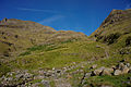
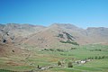
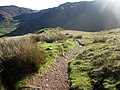
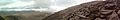
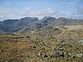
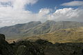
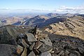
English: Bowfell (named Bow Fell on Ordnance Survey maps) is a pyramid-shaped mountain lying at the heart of the English Lake District, in the Southern Fells area. It is the sixth highest mountain in the lakes and one of the most popular of the Lake District fells. There are several routes to the summit.
mountain in the United Kingdom  | |||||
| Upload media | |||||
| Instance of | |||||
|---|---|---|---|---|---|
| Location | |||||
| Mountain range | |||||
| Topographic prominence |
| ||||
| Elevation above sea level |
| ||||
| Parent peak | |||||
 | |||||
Subcategories
This category has the following 2 subcategories, out of 2 total.
A
- Angle Tarn (Langstrath) (11 F)
T
- Three Tarns (7 F)
Media in category "Bowfell"
The following 124 files are in this category, out of 124 total.
-
 021 Bow Fell Rocks and South East view.JPG 640 × 480; 62 KB
-
 A young cousin of the Great Slab on Bowfell^ - geograph.org.uk - 2529648.jpg 4,592 × 3,056; 6.67 MB
-
 Approaching Bowfell - geograph.org.uk - 365044.jpg 640 × 480; 88 KB
-
 Approaching Bowfell - geograph.org.uk - 4295434.jpg 4,608 × 3,456; 3.85 MB
-
 Ascending Bowfell - geograph.org.uk - 1208233.jpg 640 × 480; 140 KB
-
 Ascending Bowfell - geograph.org.uk - 3844925.jpg 1,024 × 768; 482 KB
-
 Blue Sky over Rossett Pike (14848643269).jpg 2,400 × 1,600; 5.88 MB
-
 Boulders on Quagrigg Moss. - geograph.org.uk - 246586.jpg 640 × 480; 86 KB
-
 Bow Fell - geograph.org.uk - 1040994.jpg 640 × 385; 41 KB
-
 Bow Fell and Crinkle Crags - geograph.org.uk - 5673623.jpg 960 × 720; 170 KB
-
 Bow Fell from Lingcove.JPG 3,008 × 2,000; 1.46 MB
-
 Bow Fell from Three Tarns - geograph.org.uk - 506706.jpg 426 × 640; 105 KB
-
 Bow Fell Great Langdale.jpg 3,872 × 2,592; 3.44 MB
-

-
 Bow Fell, from Shelter Crags (the northernmost Crinkle) - geograph.org.uk - 2887491.jpg 1,600 × 1,073; 316 KB
-
 Bowfell - geograph.org.uk - 1397940.jpg 640 × 426; 101 KB
-
 Bowfell - geograph.org.uk - 307397.jpg 640 × 424; 97 KB
-
 Bowfell and Crinkle Crags - geograph.org.uk - 2598570.jpg 3,968 × 2,976; 2.93 MB
-
 Bowfell and the Langdale Pikes - geograph.org.uk - 3593106.jpg 4,608 × 3,456; 3.81 MB
-
 Bowfell and the Scafells from Three Tarns - geograph.org.uk - 2589871.jpg 3,968 × 2,976; 2.95 MB
-
 Bowfell appearing at the head of the valley - geograph.org.uk - 2589838.jpg 3,968 × 2,976; 2.95 MB
-
 Bowfell Buttress - geograph.org.uk - 1004236.jpg 640 × 427; 243 KB
-
 Bowfell Buttress - geograph.org.uk - 1523823.jpg 640 × 480; 119 KB
-
 Bowfell from Crinkle Crags - geograph.org.uk - 4296746.jpg 4,608 × 3,456; 3.68 MB
-
 Bowfell from Harrison Stickle.jpg 2,048 × 1,536; 1.5 MB
-
 Bowfell from Ore Gap - geograph.org.uk - 2931184.jpg 1,024 × 768; 595 KB
-
 Bowfell from Three Tarns - geograph.org.uk - 2931154.jpg 1,024 × 768; 699 KB
-
 Bowfell Links from Three Tarns - geograph.org.uk - 2589872.jpg 3,968 × 2,976; 2.98 MB
-
 Bowfell reflected in the upper Esk - geograph.org.uk - 1188441.jpg 640 × 427; 72 KB
-
 Bowfell Summit - geograph.org.uk - 108162.jpg 640 × 480; 105 KB
-
 Bowfell Summit - geograph.org.uk - 241337.jpg 640 × 480; 56 KB
-
 Bowfell Summit - geograph.org.uk - 4295699.jpg 4,608 × 3,456; 3.55 MB
-
 Bowfell Summit - geograph.org.uk - 5279957.jpg 1,920 × 1,280; 480 KB
-
 Bowfell summit towards Eskdale.jpg 2,560 × 1,920; 2.24 MB
-
 Bowfell summit view, towards Crinkle Crags - geograph.org.uk - 2591158.jpg 3,968 × 2,976; 2.9 MB
-
 Bowfell's Great Slab (7088464943).jpg 2,610 × 1,468; 1.45 MB
-
 Bowfell, the Langdale Pikes and Sergeant Man - geograph.org.uk - 2571052.jpg 3,968 × 2,976; 2.86 MB
-
 Bowfell.jpg 600 × 338; 47 KB
-
 Brotherilkeld Farm - geograph.org.uk - 210725.jpg 640 × 461; 70 KB
-
 Cairn on Bow Fell - geograph.org.uk - 1257655.jpg 640 × 480; 73 KB
-
 Climber's Traverse at foot of Bow Fell - geograph.org.uk - 1257611.jpg 640 × 480; 116 KB
-
 Climbing The Band on Bowfell - geograph.org.uk - 3942466.jpg 2,592 × 1,944; 1.55 MB
-

-
 Descending The Band - geograph.org.uk - 2771708.jpg 2,560 × 1,920; 775 KB
-
 Descending The Great Slab on Bow Fell - geograph.org.uk - 1257600.jpg 640 × 479; 107 KB
-
 Eskdale - geograph.org.uk - 64204.jpg 457 × 297; 38 KB
-
 Final stretch of path leading to Bowfell summit - geograph.org.uk - 2591152.jpg 3,968 × 2,976; 2.96 MB
-
 Flat Crags Bowfell - geograph.org.uk - 241334.jpg 640 × 218; 37 KB
-

-
 Footpath on The Band - geograph.org.uk - 3787477.jpg 1,024 × 768; 482 KB
-
 From Bowfell Summit - geograph.org.uk - 1208530.jpg 640 × 480; 108 KB
-
 From Pike o Stickle - geograph.org.uk - 241384.jpg 480 × 640; 62 KB
-
 From Rosset Pike - geograph.org.uk - 241648.jpg 640 × 480; 79 KB
-
 From the summit to Bowfell (7363210654).jpg 2,482 × 992; 944 KB
-
 Frozen Tarn Crinkle Crags - geograph.org.uk - 117993.jpg 640 × 424; 61 KB
-
 Great Slab - geograph.org.uk - 1004233.jpg 640 × 427; 231 KB
-
 Great Slab on Bowfell.jpg 5,343 × 910; 780 KB
-
 Hard Crags - geograph.org.uk - 11530.jpg 640 × 480; 94 KB
-
 Hard Knott - geograph.org.uk - 109075.jpg 640 × 480; 98 KB
-
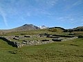 Hardknott Roman Fort, Eskdale - geograph.org.uk - 176106.jpg 640 × 480; 76 KB
-
 Looking along the path to Bowfell summit - geograph.org.uk - 3788490.jpg 1,024 × 768; 383 KB
-

-
 Looking back down The Band - geograph.org.uk - 3787468.jpg 1,024 × 768; 484 KB
-
 Looking back down The Band - geograph.org.uk - 3788455.jpg 1,024 × 768; 459 KB
-

-
 Looking down The Band - geograph.org.uk - 3788430.jpg 1,024 × 768; 389 KB
-
 Looking down The Band towards Great Langdale - geograph.org.uk - 3787476.jpg 1,024 × 768; 366 KB
-
 Looking down to Three Tarns - geograph.org.uk - 3788486.jpg 1,024 × 768; 482 KB
-
 Looking towards Windermere from Bowfell - geograph.org.uk - 3844936.jpg 1,024 × 576; 222 KB
-
 Looking up at Bowfell - geograph.org.uk - 2589859.jpg 3,968 × 2,976; 2.93 MB
-
 Looking up The Band towards Bowfell - geograph.org.uk - 3788440.jpg 1,024 × 768; 340 KB
-
 Marshy ground above Eskdale - geograph.org.uk - 126336.jpg 640 × 480; 110 KB
-
 Mickleden and Bowfell - geograph.org.uk - 2055086.jpg 3,968 × 2,976; 2.84 MB
-
 Nearing Bowfell summit. - geograph.org.uk - 993125.jpg 640 × 429; 81 KB
-

-
 On Bowfell (3277443536).jpg 2,592 × 1,728; 798 KB
-
 On Bowfell - geograph.org.uk - 1004245.jpg 640 × 426; 242 KB
-
 On Bowfell - geograph.org.uk - 1208533.jpg 640 × 480; 145 KB
-
 On Bowfell - geograph.org.uk - 2123124.jpg 2,560 × 1,920; 1.23 MB
-
 On Bowfell - geograph.org.uk - 2123131.jpg 2,560 × 1,920; 1.19 MB
-
 On Bowfell - geograph.org.uk - 2771694.jpg 2,560 × 1,920; 771 KB
-
 On Bowfell - geograph.org.uk - 3064698.jpg 2,560 × 1,920; 2.15 MB
-
 On Bowfell - geograph.org.uk - 4042196.jpg 2,560 × 1,920; 2.01 MB
-
 On Bowfell - geograph.org.uk - 4295450.jpg 4,608 × 3,456; 3.51 MB
-
 On The Band - geograph.org.uk - 1207973.jpg 640 × 480; 72 KB
-
 On the way up Bowfell - geograph.org.uk - 993097.jpg 640 × 429; 82 KB
-

-
 Path ascending Bow Fell - geograph.org.uk - 506899.jpg 640 × 426; 113 KB
-
 Path to Bowfell summit - geograph.org.uk - 2931170.jpg 1,024 × 768; 610 KB
-
 Pike de Bield Summit - geograph.org.uk - 1479673.jpg 640 × 480; 56 KB
-
 Pitched path ascending The Band - geograph.org.uk - 3787474.jpg 1,024 × 768; 566 KB
-
 Rock formations above the Great Slab - geograph.org.uk - 1015629.jpg 640 × 318; 86 KB
-
 Rock outcrops below Bowfell summit - geograph.org.uk - 2591156.jpg 3,968 × 2,976; 2.9 MB
-
 Scafells from Bow Fell.JPG 3,072 × 2,048; 2.22 MB
-
 Snow Bank, Bowfell - geograph.org.uk - 1208255.jpg 480 × 640; 73 KB
-
 Snow on Bowfell - geograph.org.uk - 993119.jpg 640 × 429; 61 KB
-
 South slope of Bowfell - geograph.org.uk - 3062052.jpg 640 × 480; 120 KB
-
 Spring at foot of The Great Slab - geograph.org.uk - 1257605.jpg 640 × 480; 142 KB
-
 Steep and rugged path up Bowfell - geograph.org.uk - 2589873.jpg 3,968 × 2,976; 2.95 MB
-
 Stony footpath climbing The Band - geograph.org.uk - 3788429.jpg 1,024 × 768; 403 KB
-
 Striated sloping rock on Bowfell - geograph.org.uk - 2591150.jpg 3,968 × 2,976; 2.92 MB
-
 Summit cairn on Bowfell - geograph.org.uk - 1736243.jpg 2,272 × 1,712; 760 KB
-
 Summit of Bowfell, Cumbria, England, 1962 - Flickr - PhillipC.jpg 1,800 × 1,200; 1.24 MB
-
 Summit rocks on Bowfell in Winter - geograph.org.uk - 1013074.jpg 640 × 426; 97 KB
-
 The Band path below Three Tarns - geograph.org.uk - 1986067.jpg 640 × 480; 112 KB
-
 The Band, Langdale - geograph.org.uk - 3055776.jpg 1,000 × 664; 297 KB
-
 The Great Slab from Cambridge Crags - geograph.org.uk - 1013072.jpg 640 × 433; 85 KB
-
 The Great Slab of Flat Crags - geograph.org.uk - 1523814.jpg 640 × 480; 121 KB
-
 The Great Slab on Bow Fell - geograph.org.uk - 1257664.jpg 640 × 480; 134 KB
-
 The Langdale Pikes - geograph.org.uk - 3844928.jpg 1,024 × 768; 412 KB
-
 The path on The Band - geograph.org.uk - 1986071.jpg 640 × 480; 74 KB
-
 The smallest of the Three Tarns - geograph.org.uk - 872223.jpg 640 × 480; 99 KB
-
 The summit cairn on Bowfell - geograph.org.uk - 2331541.jpg 3,872 × 2,592; 4.48 MB
-
 The summit of Bowfell - geograph.org.uk - 1736237.jpg 2,272 × 1,712; 766 KB
-
 The summit of White Stones, on The Band - geograph.org.uk - 3942495.jpg 2,592 × 1,944; 1.35 MB
-
 The top of the Great Slab - geograph.org.uk - 3788498.jpg 1,024 × 768; 342 KB
-

-
 Three Tarns - geograph.org.uk - 1222322.jpg 640 × 427; 71 KB
-
 Thunacar Knott - geograph.org.uk - 945462.jpg 640 × 480; 104 KB
-
 View into Langdale from Bowfell - geograph.org.uk - 3844917.jpg 4,000 × 3,000; 4.37 MB
-
 View towards Bow Fell - geograph.org.uk - 838990.jpg 640 × 421; 147 KB
-
 View towards Bowfell - geograph.org.uk - 3684322.jpg 1,000 × 750; 385 KB
-
 Bowfell summit from below - geograph.org.uk - 635709.jpg 640 × 429; 42 KB
-


.jpg)


_-_geograph.org.uk_-_2887491.jpg)


.jpg)


.jpg)


.jpg)