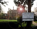
<nowiki>مدرسة بوكس هيل; Box Hill School; Box Hill School; Box Hill School; school in Surrey, UK; Schule im Vereinigten Königreich; sekolah di Britania Raya; school in Surrey, UK; مدرسة في سري، المملكة المتحدة; مدرسه فى المملكه المتحده; school in Verenigd Koninkrijk</nowiki>

 BHSchool.jpg 989 × 768; 201 KB
 Box Hill School - geograph.org.uk - 1393906.jpg 640 × 480; 143 KB
 Dalewod snow.jpg 400 × 286; 33 KB
 Dalewood House, Main School Building.jpg 5,472 × 3,648; 10.24 MB
 Dalewood House, the main building of Box Hill School.JPG 1,936 × 2,592; 2.13 MB
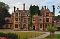 Mickleham, Box Hill School (cropped).jpg 3,110 × 2,047; 1.47 MB
 Mickleham, Box Hill School, Dragon on roof.jpg 2,400 × 1,600; 879 KB
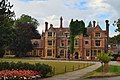 Mickleham, Box Hill School.jpg 4,000 × 2,667; 2.44 MB


.jpg)

