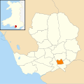
Category:Brackla, Bridgend
community in Bridgend | |||||
| Upload media | |||||
| Pronunciation audio | |||||
|---|---|---|---|---|---|
| Instance of | |||||
| Location | Bridgend County Borough, Wales | ||||
| Population |
| ||||
| Area |
| ||||
 | |||||
Media in category "Brackla, Bridgend"
The following 51 files are in this category, out of 51 total.
-
Approach to Brackla Roundabout, Bridgend - geograph.org.uk - 6710106.jpg 1,600 × 1,234; 393 KB
-
Archbishop-school.jpg 1,100 × 380; 320 KB
-
Bilingual Coychurch Crematorium direction sign - geograph.org.uk - 6710095.jpg 1,600 × 880; 454 KB
-
Bilingual Coychurch Crematorium direction sign - geograph.org.uk - 6711024.jpg 1,477 × 1,600; 579 KB
-
Bilingual Simonston Road name sign, Bridgend - geograph.org.uk - 6710100.jpg 3,252 × 2,445; 1.72 MB
-
Boulder across a footpath near Coychurch Crematorium - geograph.org.uk - 6716488.jpg 1,600 × 1,200; 823 KB
-
Brackla Multi-Storey Carpark - geograph.org.uk - 383650.jpg 640 × 480; 244 KB
-
Brackla Woodlands - geograph.org.uk - 5292477.jpg 3,264 × 2,448; 3.74 MB
-
Bridgend Car Auctions - geograph.org.uk - 1555784.jpg 640 × 303; 47 KB
-
Bridgend, Junction of Brackla and Nolton Streets.jpg 640 × 480; 77 KB
-
Bus stop and shelter, Brackla Way, Brackla, Bridgend - geograph.org.uk - 6685813.jpg 1,600 × 1,199; 536 KB
-
Bus stop opposite the entrance to Coychurch Crematorium - geograph.org.uk - 6716520.jpg 1,387 × 1,600; 531 KB
-
Cheers Diner, Garth Road, Bridgend - geograph.org.uk - 1603947.jpg 640 × 378; 48 KB
-
Church Acre at Lark Rise, Brackla - geograph.org.uk - 4298722.jpg 640 × 480; 54 KB
-
Coychurch Crematorium direction sign - geograph.org.uk - 6685827.jpg 1,600 × 1,283; 346 KB
-
Coychurch Crematorium exit road - geograph.org.uk - 6716454.jpg 1,600 × 1,293; 462 KB
-
Coychurch Road looking west - geograph.org.uk - 3049619.jpg 640 × 480; 41 KB
-
Coychurch Road looking west - geograph.org.uk - 3049622.jpg 640 × 480; 57 KB
-
Dark green cabinet, Brackla Way, Brackla, Bridgend - geograph.org.uk - 6685836.jpg 1,272 × 1,163; 265 KB
-
Easystore, Bridgend - geograph.org.uk - 1555755.jpg 640 × 305; 43 KB
-
Fallen leaves on the Simonston Road pavement, Bridgend - geograph.org.uk - 6716486.jpg 1,200 × 1,600; 656 KB
-
Fox Hollows houses behind trees, Brackla, Bridgend - geograph.org.uk - 6716507.jpg 1,600 × 1,200; 755 KB
-
From 30 to 40, Brackla Way, Brackla, Bridgend - geograph.org.uk - 6685789.jpg 1,600 × 1,074; 335 KB
-
Nant Bryn Glas - geograph.org.uk - 4908069.jpg 2,448 × 3,264; 2.26 MB
-
New house, Briary Way, Brackla - geograph.org.uk - 2814108.jpg 640 × 480; 85 KB
-
Ordnance Survey Cut Mark - geograph.org.uk - 5788389.jpg 640 × 396; 115 KB
-
Public footpath west of Simonston Road, Bridgend - geograph.org.uk - 6710118.jpg 1,343 × 1,600; 842 KB
-
Rear of Brackla Street Centre - geograph.org.uk - 383835.jpg 640 × 480; 341 KB
-
Roundabout near Coychurch Crematorium - geograph.org.uk - 6685801.jpg 1,600 × 1,144; 297 KB
-
Simonston Road towards Coity - geograph.org.uk - 6716480.jpg 1,600 × 1,200; 769 KB
-
Skate park, Brackla Hill - geograph.org.uk - 2536430.jpg 640 × 456; 78 KB
-
SSE along Simonston Road, Bridgend - geograph.org.uk - 6716499.jpg 1,565 × 1,600; 471 KB
-
The Haywain, Coychurch Rd, Tremains, Bridgend - geograph.org.uk - 2125779.jpg 4,000 × 3,000; 2.48 MB
-
Tremains Infants School - geograph.org.uk - 2525718.jpg 640 × 480; 76 KB
-
Wales Bridgend Community Brackla map.svg 512 × 509; 326 KB
-
White direction arrows on Simonston Road, Bridgend - geograph.org.uk - 6710140.jpg 1,600 × 1,275; 606 KB
-
Ysgol Bro Ogwr - geograph.org.uk - 4853772.jpg 3,025 × 2,268; 1.61 MB
-
Brackla Roundabout - geograph.org.uk - 339049.jpg 640 × 412; 125 KB
-
Brackla Way - geograph.org.uk - 341083.jpg 640 × 403; 92 KB
-
Church in Wales School Brackla - geograph.org.uk - 341088.jpg 640 × 434; 115 KB


