Category:Brading
town in Isle of Wight, England, UK  | |||||
| Upload media | |||||
| Instance of | |||||
|---|---|---|---|---|---|
| Location | Isle of Wight, South East England, England | ||||
| Area |
| ||||
| Said to be the same as | Brading (Wikimedia duplicated page, civil parish) | ||||
| official website | |||||
 | |||||
Subcategories
This category has the following 16 subcategories, out of 16 total.
A
- Adgestone (25 F)
B
- Brading Down (21 F)
- Brading Marshes (17 F)
- Brading Methodist Church (14 F)
- Brading railway station (60 F)
- Brading United Reformed Church (13 F)
- Brading War Memorial (1 F)
E
- The Brading Experience (17 F)
M
- Morton Manor (8 F)
N
- New Town Hall, Brading (5 F)
- Nunwell (1 F)
- Nunwell House (1 F)
O
- Old Town Hall, Brading (5 F)
S
- Statues in Brading (5 F)
Media in category "Brading"
The following 200 files are in this category, out of 287 total.
(previous page) (next page)-
 45 speed limit sign, Brading - geograph.org.uk - 4628364.jpg 800 × 569; 146 KB
-
 A junction of paths, north of Alverstone - geograph.org.uk - 2652460.jpg 800 × 600; 330 KB
-

-
-

-

-

-

-

-

-
-

-
-

-
 A3055 Morton Road - geograph.org.uk - 3764622.jpg 640 × 480; 255 KB
-
 Across a Brading level crossing - geograph.org.uk - 4628405.jpg 800 × 600; 134 KB
-
 Adgestone ahead - geograph.org.uk - 5505369.jpg 640 × 480; 172 KB
-
 An OS flush bracket - geograph.org.uk - 5968663.jpg 1,024 × 768; 292 KB
-
 Ann's Hair Studio, Brading - geograph.org.uk - 4627061.jpg 800 × 800; 148 KB
-
 Arnold's Yard, Brading - geograph.org.uk - 4627235.jpg 800 × 696; 120 KB
-
 Arriva Guildford & West Surrey 3099 R299 CMV rear advert.JPG 3,712 × 2,088; 3.19 MB
-
 Attrill's Lane, near Nettlestone, Isle of Wight - geograph.org.uk - 5497514.jpg 3,733 × 2,507; 2.54 MB
-
 B3395 crossing the River Yar at Yarbridge - geograph.org.uk - 5383849.jpg 3,456 × 2,592; 4.37 MB
-
 Beaper Shute - geograph.org.uk - 3758504.jpg 640 × 480; 373 KB
-
 Bembridge Downs - geograph.org.uk - 5535327.jpg 1,010 × 638; 186 KB
-
 Bembridge Fort - geograph.org.uk - 5619258.jpg 2,848 × 2,144; 1.48 MB
-
 Bend in High Street, Brading - geograph.org.uk - 4627183.jpg 585 × 800; 89 KB
-
 Bend on A3055, Beaper Shute - geograph.org.uk - 5504487.jpg 640 × 480; 153 KB
-
 Boot above High Street, Brading - geograph.org.uk - 4627127.jpg 603 × 800; 98 KB
-
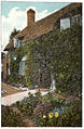 Little Jane's Cottage, Brading c1910 - Project Gutenberg eText 17296.jpg 505 × 773; 251 KB
-
 Brading - The Bull Ring 2.JPG 3,072 × 2,304; 2.26 MB
-
 Brading - the sundial c1910 - Project Gutenberg eText 17296.jpg 507 × 775; 224 KB
-
 Brading car park advertising.JPG 3,072 × 2,304; 2.31 MB
-
 Brading church - geograph.org.uk - 5532915.jpg 777 × 518; 178 KB
-
 Brading church - geograph.org.uk - 5532916.jpg 643 × 1,012; 198 KB
-
 Brading cottages - geograph.org.uk - 5532914.jpg 1,015 × 638; 200 KB
-
 Brading distant view from sea wall - geograph.org.uk - 6335315.jpg 1,024 × 768; 236 KB
-
 Brading Down - geograph.org.uk - 4107627.jpg 800 × 531; 126 KB
-
 Brading Down and the English Channel from Southern Vectis route 10 bus 2.JPG 3,712 × 2,088; 2.98 MB
-
 Brading Down and the English Channel from Southern Vectis route 10 bus 3.JPG 3,712 × 2,088; 2.79 MB
-
 Brading Down and the English Channel from Southern Vectis route 10 bus.JPG 3,712 × 2,088; 2.87 MB
-
 Brading Down from Southern Vectis route 10 bus 2.JPG 3,712 × 2,088; 2.54 MB
-
 Brading Down from Southern Vectis route 10 bus 3.JPG 3,712 × 2,088; 2.48 MB
-
 Brading Down from Southern Vectis route 10 bus 4.JPG 3,712 × 2,088; 2.54 MB
-
 Brading Down from Southern Vectis route 10 bus 5.JPG 3,712 × 2,088; 2.99 MB
-
 Brading Down from Southern Vectis route 10 bus.JPG 3,712 × 2,088; 3.2 MB
-
 Brading Down Road from Southern Vectis route 10 bus.JPG 3,712 × 2,088; 3.04 MB
-
 Brading eco toilets.JPG 3,072 × 2,304; 2.46 MB
-
 Brading Footpath - geograph.org.uk - 5533994.jpg 991 × 638; 251 KB
-
 Brading Footpath - geograph.org.uk - 5533998.jpg 1,015 × 636; 236 KB
-
 Brading Gaol - geograph.org.uk - 5532918.jpg 790 × 527; 216 KB
-
 Brading gaol - geograph.org.uk - 5532926.jpg 654 × 406; 100 KB
-
 Brading Garden.JPG 1,892 × 1,347; 801 KB
-
 Brading Heritage Centre and Reading Room - geograph.org.uk - 4626914.jpg 759 × 800; 140 KB
-
 Brading Heritage Centre.JPG 3,072 × 2,304; 2.52 MB
-
 Brading High Street - geograph.org.uk - 3764628.jpg 640 × 480; 278 KB
-
 Brading High Street - geograph.org.uk - 5602713.jpg 424 × 640; 60 KB
-
 Brading High Street - geograph.org.uk - 6243453.jpg 6,789 × 4,526; 5.59 MB
-
 Brading High Street roadworks in October 2011 2.JPG 4,000 × 3,000; 4.52 MB
-
 Brading High Street roadworks in October 2011.JPG 4,000 × 3,000; 4.77 MB
-
 Brading Marshes - geograph.org.uk - 5129702.jpg 640 × 480; 131 KB
-
 Brading old lamp.JPG 2,304 × 3,072; 2.36 MB
-
 Brading old water pump 2.JPG 2,304 × 3,072; 2.22 MB
-
 Brading old water pump.JPG 2,304 × 3,072; 2.26 MB
-
 Brading on a splendid July morning - geograph.org.uk - 3148018.jpg 640 × 480; 59 KB
-
 Brading Post Office.JPG 4,224 × 2,462; 2.5 MB
-
 Brading Signal Box - geograph.org.uk - 4547616.jpg 4,896 × 3,672; 5.61 MB
-
 Brading Signal Box - geograph.org.uk - 5602779.jpg 424 × 640; 77 KB
-
 Brading station - geograph.org.uk - 5129667.jpg 640 × 428; 118 KB
-
 Brading Station - geograph.org.uk - 5602759.jpg 424 × 640; 60 KB
-
 Brading Station - geograph.org.uk - 5619250.jpg 2,848 × 2,144; 1.52 MB
-
 Brading Town Trust car park recycling site.JPG 4,000 × 3,000; 4.39 MB
-
 Brading Town Trust Car Park.JPG 3,072 × 2,304; 2.33 MB
-
 Brading water pump plaque.JPG 2,304 × 2,016; 1.62 MB
-
 Brading Waxworks museum - geograph.org.uk - 5532936.jpg 775 × 489; 150 KB
-
 Brading Waxworks museum - geograph.org.uk - 5532942.jpg 662 × 441; 162 KB
-
 Brading Waxworks museum - geograph.org.uk - 5532945.jpg 501 × 751; 147 KB
-
 Brading West Street public toilets.JPG 4,000 × 3,000; 4.35 MB
-
 Brading Youth ^ Community Centre - geograph.org.uk - 3148022.jpg 640 × 480; 62 KB
-
 Brading, Isle of Wight - geograph.org.uk - 2447150.jpg 2,685 × 1,787; 3.02 MB
-
 Brading, Isle of Wight, England (2).jpg 2,272 × 1,704; 1.94 MB
-
 Brading, Isle of Wight, England.jpg 2,254 × 1,678; 1.62 MB
-
 Brading, Isle of Wight; Little Jane's Cottage Wellcome L0044661.jpg 3,268 × 2,656; 2.05 MB
-
 Brading, IW, UK, from Culver Down.jpg 2,272 × 1,704; 1.58 MB
-
 Brading, Morton Common - geograph.org.uk - 3764619.jpg 640 × 480; 317 KB
-
 Brading, St. Mary's Church - geograph.org.uk - 6243466.jpg 5,321 × 3,547; 4.91 MB
-
 Brading, St. Mary's Church - geograph.org.uk - 6243469.jpg 6,312 × 4,208; 6.76 MB
-
 Brading, St. Mary's Church - geograph.org.uk - 6243476.jpg 6,920 × 4,613; 7.57 MB
-
-
 Brading, Stocks - geograph.org.uk - 6243457.jpg 6,751 × 4,500; 6.16 MB
-
 Brading, The Giraffe and Custard gift shop - geograph.org.uk - 6243458.jpg 6,674 × 4,449; 4.85 MB
-

-

-
 Bridges at Yarbridge Causeway - geograph.org.uk - 6335330.jpg 1,024 × 768; 218 KB
-
 Bridleway crossing over railway - geograph.org.uk - 5352519.jpg 640 × 480; 181 KB
-
 Bridleway in Whitefield Wood - geograph.org.uk - 469531.jpg 640 × 477; 156 KB
-
 Bull Ring Brading - geograph.org.uk - 5535549.jpg 1,020 × 638; 251 KB
-
 Byway towards A3055 - geograph.org.uk - 484491.jpg 640 × 477; 85 KB
-
 Carpenters Farm campsite - geograph.org.uk - 1047982.jpg 640 × 480; 90 KB
-
 Carpenters Road - geograph.org.uk - 1047995.jpg 640 × 480; 69 KB
-
 Cattle, Adgestone - geograph.org.uk - 5507649.jpg 640 × 428; 119 KB
-
 Closed Public Conveniences - geograph.org.uk - 4358710.jpg 640 × 480; 83 KB
-
 Community artwork on the side of Brading eco toilets.JPG 3,072 × 2,304; 2.33 MB
-
 Congregational Church - geograph.org.uk - 6367644.jpg 1,024 × 768; 239 KB
-
 Coppice1.JPG 1,232 × 1,632; 710 KB
-
 Country north of Upper Road - geograph.org.uk - 5504774.jpg 640 × 480; 103 KB
-
 Crossing near Brading Station - geograph.org.uk - 4547621.jpg 4,896 × 3,672; 5.24 MB
-
 Crossroads, Yarbridge - geograph.org.uk - 3323098.jpg 640 × 431; 75 KB
-

-
 Ding dong bell - geograph.org.uk - 5561343.jpg 640 × 480; 81 KB
-
 Dismantled railway - geograph.org.uk - 1039628.jpg 640 × 480; 89 KB
-
 Doctor's Lane - geograph.org.uk - 4358707.jpg 640 × 480; 122 KB
-
 Doctor's lane, Brading - geograph.org.uk - 1455216.jpg 640 × 480; 55 KB
-
 Downland near Brading Down - geograph.org.uk - 1455137.jpg 640 × 480; 80 KB
-
 End of the Road - geograph.org.uk - 2450845.jpg 2,666 × 1,774; 4.13 MB
-
 Entrance sign to Brading.JPG 2,296 × 1,528; 1.55 MB
-
 Fallen tree being cleared from Brading Morton Common Road.JPG 4,000 × 3,000; 4.53 MB
-
 Field near Hill Farm - geograph.org.uk - 469535.jpg 640 × 477; 104 KB
-
 Field north of Hill Farm Brading - geograph.org.uk - 6330460.jpg 1,024 × 768; 214 KB
-
 Floods Beside the Cycle Route, Alverstone, Isle of Wight - geograph.org.uk - 2928214.jpg 3,480 × 2,320; 6.42 MB
-
 Footpath on Brading Down - geograph.org.uk - 4107623.jpg 800 × 531; 123 KB
-
 Footpath on Nunwell Down - geograph.org.uk - 4107619.jpg 800 × 531; 152 KB
-

-

-
 From Brading Down Road - panoramio.jpg 5,052 × 3,368; 12.3 MB
-
 From Brading Down road Toward Shanklin, Lake and Sandown. - panoramio.jpg 5,061 × 3,373; 15.38 MB
-
 Garden dahlias, Grove Farm - geograph.org.uk - 5507450.jpg 640 × 480; 173 KB
-
 Going nuts - geograph.org.uk - 5562115.jpg 1,024 × 768; 148 KB
-
 Grove Farm, Adgestone - geograph.org.uk - 5507445.jpg 640 × 480; 134 KB
-
 Grove Farm, Adgestone - geograph.org.uk - 5507461.jpg 640 × 428; 126 KB
-
 Heading downhill towards Nunwell Farm - geograph.org.uk - 2652494.jpg 800 × 600; 241 KB
-
 High Street Brading - geograph.org.uk - 5532921.jpg 666 × 444; 101 KB
-
 High Street Brading - geograph.org.uk - 5533566.jpg 1,005 × 643; 203 KB
-
 High Street, Brading - geograph.org.uk - 1581622.jpg 640 × 419; 59 KB
-
 High Street, Brading - geograph.org.uk - 5504523.jpg 640 × 480; 115 KB
-
 High Street, Brading, Isle of Wight - geograph.org.uk - 2927739.jpg 4,500 × 3,000; 4.2 MB
-
 High Street, Brading, Isle of Wight - geograph.org.uk - 2927754.jpg 4,500 × 3,000; 5.08 MB
-
 High Street, Brading, Isle of Wight - geograph.org.uk - 2927809.jpg 4,380 × 2,920; 4.79 MB
-
 High Street, Brading, Isle of Wight - geograph.org.uk - 2927818.jpg 4,380 × 2,920; 4.7 MB
-
 High Street, Brading, Isle of Wight, England.jpg 3,992 × 2,988; 3.17 MB
-
 Hill north of Grove Farm - geograph.org.uk - 5507471.jpg 640 × 480; 141 KB
-
 Homecroft, Adgestone - geograph.org.uk - 5507481.jpg 640 × 480; 110 KB
-
 In memory of Camilla - geograph.org.uk - 3277278.jpg 444 × 640; 277 KB
-

-
 Isle of Wight Steam Railway - geograph.org.uk - 6369551.jpg 1,024 × 768; 519 KB
-
 It's that Bus Again - geograph.org.uk - 5602789.jpg 640 × 424; 63 KB
-
 Junction at Little Hardingshute - geograph.org.uk - 484469.jpg 640 × 477; 96 KB
-
 Keep on Rolling - geograph.org.uk - 2926149.jpg 3,900 × 2,411; 5.17 MB
-
 Kynges Well pub and restaurant, Brading - geograph.org.uk - 4626924.jpg 800 × 776; 134 KB
-
 Leghrichmond.jpg 1,063 × 1,329; 201 KB
-

-

-
 Little Janes Cottage - geograph.org.uk - 5533557.jpg 1,017 × 638; 289 KB
-
 Looking across Brading Down - geograph.org.uk - 1928715.jpg 1,500 × 975; 158 KB
-
 Looking down from Brading Down - geograph.org.uk - 1928719.jpg 1,500 × 981; 164 KB
-
 Looking out to sea from Brading Down - geograph.org.uk - 1928717.jpg 1,500 × 987; 199 KB
-
 Looking towards Ryde from Brading Down - geograph.org.uk - 3313813.jpg 1,600 × 1,289; 409 KB
-
 Lower Adgestone Road, Adgestone - geograph.org.uk - 5505378.jpg 640 × 480; 134 KB
-
 Lower Furlongs gas installation, Brading - geograph.org.uk - 4626511.jpg 800 × 552; 142 KB
-
 Lower Furlongs, Brading - geograph.org.uk - 4626532.jpg 800 × 576; 135 KB
-
 Mini Recycling Site, Brading - geograph.org.uk - 4626567.jpg 800 × 594; 136 KB
-
 Morton Manor - geograph.org.uk - 2931115.jpg 2,086 × 1,413; 1.07 MB
-
 Morton Manor - geograph.org.uk - 2931119.jpg 2,086 × 1,411; 1.29 MB
-
 Morton Road, Morton, Isle of Wight - geograph.org.uk - 2926162.jpg 4,200 × 2,800; 4.97 MB
-
 Narrow Lane - geograph.org.uk - 4089508.jpg 640 × 427; 463 KB
-

-
 New Farm - geograph.org.uk - 1455176.jpg 640 × 480; 76 KB
-
 New Road, Brading, Isle of Wight - geograph.org.uk - 2927715.jpg 3,900 × 2,600; 4.33 MB
-
 New Road, Yarbridge - geograph.org.uk - 3764626.jpg 640 × 480; 295 KB
-
 No Entry to Cross Street, Brading - geograph.org.uk - 4627094.jpg 773 × 800; 127 KB
-
 Nunwell Farm - geograph.org.uk - 1455153.jpg 640 × 480; 67 KB
-
 Nunwell Farm - geograph.org.uk - 2652505.jpg 800 × 600; 261 KB
-
 Nunwell Farm Lane joins West Lane - geograph.org.uk - 2652517.jpg 800 × 600; 280 KB
-
 Nunwell House - geograph.org.uk - 2931299.jpg 1,400 × 2,088; 756 KB
-
 Nunwell House from the south-east - geograph.org.uk - 6180023.jpg 3,966 × 2,974; 3.44 MB
-
 Old rail track St Helens to Brading - geograph.org.uk - 5534029.jpg 1,015 × 643; 229 KB
-
 Old railway line near Brading - geograph.org.uk - 484521.jpg 640 × 477; 145 KB
-
 Old sea wall near Brading - geograph.org.uk - 6330330.jpg 1,024 × 768; 250 KB
-
 Opening soon in Brading - geograph.org.uk - 4626577.jpg 800 × 468; 102 KB
-
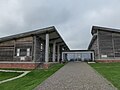
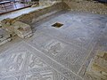
 Overlooking Brading Roman Villa, Isle of Wight - geograph.org.uk - 6175786.jpg 1,024 × 683; 1.22 MB
-

-
 Pedestrian Crossing, Brading High Street - geograph.org.uk - 3764629.jpg 640 × 480; 273 KB
-
 Picnic area, Brading Down - geograph.org.uk - 3313803.jpg 1,600 × 991; 340 KB
-
 Pillbox on isle of wight.jpg 3,024 × 4,032; 7.63 MB
-

-
 Public Bridleway B19 to Great Upton, Isle of Wight - geograph.org.uk - 5496173.jpg 4,000 × 3,000; 3.57 MB
-
 Public Bridleway from Great Upton, Isle of Wight - geograph.org.uk - 5496185.jpg 4,000 × 3,000; 2.97 MB
-
 Public footpath B10 towards Bullen, Isle of Wight - geograph.org.uk - 5500065.jpg 3,944 × 2,958; 2.46 MB
-
 Rainbow over Culver Down - geograph.org.uk - 5507668.jpg 3,231 × 1,450; 823 KB
-
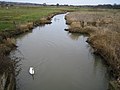 River Yar - geograph.org.uk - 120713.jpg 640 × 480; 83 KB
-
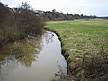 River Yar - geograph.org.uk - 143540.jpg 640 × 480; 89 KB
-
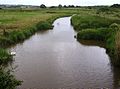 River Yar - geograph.org.uk - 484532.jpg 640 × 477; 80 KB
-
 River Yar and marshes, aerial 2014 - geograph.org.uk - 4034275.jpg 640 × 385; 52 KB
-
 River Yar, Yarbridge, Isle of Wight - geograph.org.uk - 2926426.jpg 4,200 × 2,800; 6.22 MB
-
 River Yar, Yarbridge, Isle of Wight - geograph.org.uk - 2926436.jpg 4,200 × 2,800; 6.34 MB
-
 Roke Mead Copse - geograph.org.uk - 1047836.jpg 640 × 480; 94 KB
-
 Rough grassland near Brading - geograph.org.uk - 5823366.jpg 2,700 × 2,088; 476 KB
-
 Rough grassland near Morton - geograph.org.uk - 5823376.jpg 2,700 × 1,749; 317 KB
-
 Rough grassland near Yarbridge - geograph.org.uk - 5823374.jpg 2,700 × 1,971; 324 KB
-
 Row of houses, High Street, Brading - geograph.org.uk - 4626903.jpg 800 × 600; 113 KB


_-_geograph.org.uk_-_6356569.jpg)
_-_geograph.org.uk_-_6356574.jpg)
_-_geograph.org.uk_-_6356576.jpg)
_-_geograph.org.uk_-_6356577.jpg)
_-_geograph.org.uk_-_6356579.jpg)
_-_geograph.org.uk_-_6356582.jpg)
_-_geograph.org.uk_-_6356584.jpg)
_-_geograph.org.uk_-_6356588.jpg)
_-_geograph.org.uk_-_6356591.jpg)
_-_geograph.org.uk_-_6356598.jpg)
_-_geograph.org.uk_-_6356603.jpg)
_-_geograph.org.uk_-_6356607.jpg)


.jpg)


