Category:Braintree, Essex
town in Essex, England  | |||||
| Upload media | |||||
| Instance of | |||||
|---|---|---|---|---|---|
| Part of | |||||
| Location | Braintree, Essex, East of England, England | ||||
 | |||||
Български: мини|300px|Библиотеката в Брейнтрий
Deutsch: Braintree ist eine Mittelstadt von ungefähr 30.000 Einwohnern in Essex, England. Sie ist Hauptstadt des Distriktes Braintree.
English: Braintree is a town of about 42,000 people and the principal settlement of the Braintree district of Essex in the East of England. It is ten miles north-east of Chelmsford and fifteen miles west of Colchester on the River Blackwater, A120 road and a branch of the Great Eastern Main Line.
Français : Braintree est une ville du comté de l'Essex dans l'est de l'Angleterre. Avec 42 200 habitants c'est la ville la plus peuplés de l'arrondissement Braintree.
Nederlands: Braintree is een plaats in het bestuurlijke gebied Braintree, in het Engelse graafschap Essex. De plaats telt 42.393 inwoners.
Polski: Braintree - miasto w Wielkiej Brytanii, w Anglii, w regionie East of England, w hrabstwie Essex. W 2001r. miasto to zamieszkiwało 42 393 osób.
Română: Braintree este un oraş şi un district nemetropolitan în comitatul Essex, regiunea East, Anglia. Districtul are o populaţie de 139.700 locuitori din care 42.393 locuiesc în oraşul propriu zis Braintree. Alte oraşe din district sunt Coggeshall.
Subcategories
This category has the following 26 subcategories, out of 26 total.
A
B
- Bocking Blackwater (19 F)
- Braintree Library (3 F)
- Braintree Town Hall (5 F)
- The Bull, Braintree (1 F)
C
- Christ Church, Braintree (1 F)
- Cuckoo Wood (4 F)
F
- Flagfinders (bus company) (5 F)
- Freeport Braintree (7 F)
H
- Hoppit Mead (11 F)
O
P
- St Paul's Church, Braintree (1 F)
S
- The Swan, Braintree (1 F)
W
Media in category "Braintree, Essex"
The following 111 files are in this category, out of 111 total.
-
 002osd000000008u00090000.jpg 4,000 × 2,264; 3.25 MB
-
 ECR(1851) p62a - Braintree.jpg 938 × 765; 190 KB
-
 A view from Convent Lane - geograph.org.uk - 1724710.jpg 3,648 × 2,736; 1.39 MB
-
 B1256, South Street - geograph.org.uk - 1037716.jpg 640 × 480; 71 KB
-
 B1256, South Street - geograph.org.uk - 1037723.jpg 640 × 480; 89 KB
-
 Benjamin Allen blue plaque.JPG 2,592 × 3,888; 7.44 MB
-
 Braintree co-operative.jpg 3,072 × 2,304; 1.32 MB
-
 Braintree from the air - geograph.org.uk - 2413105.jpg 640 × 480; 172 KB
-
 Braintree Manor House front.jpg 2,817 × 5,441; 2.46 MB
-
 Braintree Museum, Manor Street, 1992.jpg 4,724 × 3,149; 2.15 MB
-
 Braintree Rose Hill - Greater Anglia 312303.JPG 1,024 × 768; 440 KB
-
 Braintree Rugby Club - geograph.org.uk - 54453.jpg 640 × 480; 113 KB
-
 Braintree Rugby Union Football Club - geograph.org.uk - 1424999.jpg 3,072 × 2,304; 1.33 MB
-
 Braintree Rugby Union Football Club - geograph.org.uk - 1425001.jpg 3,072 × 2,304; 1.46 MB
-
 Braintree Town Hall 1926 front elevation.jpg 3,589 × 3,283; 2.2 MB
-
 Braintree Town Hall 1926 rear elevation.jpg 5,077 × 3,613; 3.34 MB
-
 BraintreeCatholicPriests2020.jpg 3,456 × 4,608; 3.39 MB
-
 BraintreeConstituency.svg 305 × 263; 129 KB
-

-
 Car park, Braintree retail park - geograph.org.uk - 734900.jpg 640 × 480; 82 KB
-
 Carriage entrance to The Swan Beraintree.jpg 3,268 × 4,348; 1.9 MB
-
 Chapel in Cemetery, London Road, Braintree - geograph.org.uk - 65399.jpg 640 × 480; 156 KB
-
 Charter Way - geograph.org.uk - 646346.jpg 640 × 480; 55 KB
-
 Clay Pits, Braintree - geograph.org.uk - 1248099.jpg 640 × 480; 66 KB
-
 Clay Pits, Braintree - geograph.org.uk - 1248112.jpg 640 × 480; 69 KB
-
 Clean it up.JPG 1,944 × 2,592; 959 KB
-
 CM7 1101D PB1054-1 Rayne Rd - George Yard Braintree.jpg 3,073 × 4,425; 1.68 MB
-
 CM7 16D GR PB1025-2 with E2R K6.jpg 2,945 × 5,273; 2.54 MB
-
 CM7 67D PB1027-5B Rayne Rd Braintree.jpg 2,350 × 4,528; 2.35 MB
-
 CM7 999D PB1054-2 Bank St Braintree.jpg 3,466 × 4,816; 1.93 MB
-
 CM7 RoMEC sheet steel pillar New St Braintree.jpg 3,129 × 5,345; 1.9 MB
-

-
 Dodgy plate on air mail box.jpg 2,947 × 3,970; 702 KB
-
 EU71FPB Peugeot 307 estate, Essex Police. Braintree.jpg 4,375 × 2,647; 1.69 MB
-
 Fairfield Road - geograph.org.uk - 1037730.jpg 640 × 480; 85 KB
-
 Flitch Way Country Park - Braintree station entrance.JPG 1,024 × 683; 418 KB
-
 Jobcentre, Braintree - geograph.org.uk - 1037739.jpg 640 × 480; 78 KB
-
 Lamp base (31234333570).jpg 2,934 × 2,934; 1.92 MB
-
 Main entrance, Freeport Braintree - geograph.org.uk - 734911.jpg 640 × 480; 67 KB
-
 Manor Street - geograph.org.uk - 1036936.jpg 640 × 480; 76 KB
-
 Marks Farm Community Centre - geograph.org.uk - 1424950.jpg 3,072 × 2,304; 1.39 MB
-
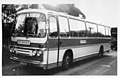 Mrs Wicks Seddon FLY 755J at Braintree.jpg 1,596 × 1,038; 107 KB
-

-
 New Street - geograph.org.uk - 1037713.jpg 640 × 480; 71 KB
-
 Ordnance Survey One-Inch Sheet 149 Colchester, Published 1946.jpg 10,992 × 12,810; 16.25 MB
-
 Ordnance Survey One-Inch Sheet 149 Colchester, Published 1956.jpg 8,317 × 9,954; 10.68 MB
-
 Ordnance Survey One-Inch Sheet 149 Colchester, Published 1969.jpg 8,288 × 9,870; 33.67 MB
-
 Pargetting and Lintel of Manor House.jpg 6,000 × 4,000; 3.29 MB
-
 Pargetting on rear of Manor House 1.jpg 4,915 × 2,809; 3.32 MB
-
 Pargetting on rear of Manor House 2.jpg 2,275 × 2,173; 1.15 MB
-

-
 Rear elevation of the Manor House.jpg 2,111 × 5,751; 1.53 MB
-
 Road sign, Braintree Freeport - geograph.org.uk - 2496062.jpg 1,600 × 1,200; 408 KB
-
 Roundabout on Clay Pits way - geograph.org.uk - 1248078.jpg 640 × 480; 58 KB
-
 St Michaels church Braintree.jpg 3,025 × 5,347; 2.54 MB
-
 St Peters Marsh - geograph.org.uk - 1306027.jpg 640 × 428; 134 KB
-

-
 Tesco Car Park, Braintree - geograph.org.uk - 1037754.jpg 640 × 480; 93 KB
-
 Tesco Car Park, Braintree - geograph.org.uk - 1037758.jpg 640 × 480; 119 KB
-

-
 Tesco Supermarket Car Park - geograph.org.uk - 562447.jpg 640 × 480; 91 KB
-

-

-
 Thatched cottage - geograph.org.uk - 399103.jpg 640 × 442; 66 KB
-

-
 The Cortauld Fountain, Braintree - 1937 - 53830351916.jpg 3,705 × 4,601; 2.41 MB
-
 The Cortauld Fountain, Braintree - 1937 - 53830351961.jpg 3,409 × 3,713; 1.85 MB
-
 The Cortauld Fountain, Braintree - 1937 - 53830351986.jpg 2,981 × 5,421; 2.61 MB
-
 The Cortauld Fountain, Braintree - 1937 - 53830591883.jpg 3,133 × 5,131; 2.88 MB
-
 The Cortauld Fountain, Braintree - 1937 - 53830786520.jpg 2,881 × 4,285; 1.84 MB
-
 The Cortauld Fountain, Braintree - 1937.jpg 2,457 × 4,001; 837 KB
-
 The Hawthorns Retirement Home Braintree, Essex 1.jpg 774 × 518; 120 KB
-
 The Hawthorns Retirement Home Braintree, Essex.jpg 518 × 774; 108 KB
-
 The Manor House Little Square Braintree.jpg 3,667 × 5,932; 2.53 MB
-
 The Picture Palace - geograph.org.uk - 1036914.jpg 640 × 480; 69 KB
-
 The Swan Bank St Braintree.jpg 4,740 × 3,186; 2.24 MB
-
 The White Hart decorative tiling by Doulton & Co Lambeth.jpg 4,963 × 3,571; 2.51 MB
-
 The White Hart Inn entrance.jpg 3,520 × 5,500; 2.33 MB
-

-
 Toppesfieldview.jpg 3,072 × 2,304; 541 KB
-
 Town centre - panoramio (1).jpg 2,322 × 4,128; 2.32 MB
-
 Town Hall stained glass panel.jpg 2,905 × 4,673; 1.99 MB
-
 Twelve Acres, Braintree - geograph.org.uk - 1248086.jpg 640 × 480; 56 KB
-
 Warner Textile Archive - geograph.org.uk - 1037769.jpg 640 × 480; 60 KB
-

-
 White Hart Hotel, Braintree, 1992.jpg 4,724 × 3,149; 1.82 MB
-
 Yeldham Transport Museum Open Day 2014 0319-5 180514 CPS (14237964094).jpg 6,000 × 4,000; 3.91 MB
-
 B1018 Cressing Road - geograph.org.uk - 1424964.jpg 3,072 × 2,304; 1.31 MB
-
 B1018 Cressing Road - geograph.org.uk - 1424966.jpg 3,072 × 2,304; 1.29 MB
-

-
 Bocking Place, Courtauld Road, Braintree - geograph.org.uk - 59704.jpg 640 × 480; 139 KB
-

-

-

-

-
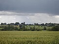
 Braintree expands - geograph.org.uk - 450553.jpg 640 × 480; 103 KB
-
 Braintree Rugby Union Football Club Ground - geograph.org.uk - 1425000.jpg 3,072 × 2,304; 1.27 MB
-
 Children's Play area at King Georges Playing Field - geograph.org.uk - 1424975.jpg 3,072 × 2,304; 1.36 MB
-
 Childrens Play area at King Georges Playing Field - geograph.org.uk - 1424973.jpg 3,072 × 2,304; 1.43 MB
-
 Clay Pits - geograph.org.uk - 1424993.jpg 2,304 × 3,072; 1.59 MB
-
 Coggeshall Road, Braintree, Essex - geograph.org.uk - 252489.jpg 640 × 396; 47 KB
-
 Derelict Pond near King Georges Playing Field - geograph.org.uk - 1425002.jpg 3,072 × 2,304; 1.67 MB
-
 Entrance to King Georges Playing Field - geograph.org.uk - 1424956.jpg 2,304 × 3,072; 1.79 MB
-

-

-

-

-
 John Ray County Junior School - geograph.org.uk - 397750.jpg 640 × 403; 60 KB
-
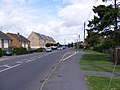
 Modern housing, Braintree - geograph.org.uk - 405137.jpg 640 × 386; 243 KB
-

-


_p62a_-_Braintree.jpg)


.jpg)


.jpg)


,_Hilly_Gant,_off_New_Street_-_geograph.org.uk_-_1411900.jpg)


.jpg)