Category:Brancaster Staithe
village in Norfolk, England  | |||||
| Upload media | |||||
| Instance of | |||||
|---|---|---|---|---|---|
| Location | Brancaster, King's Lynn and West Norfolk, Norfolk, East of England, England | ||||
 | |||||
Subcategories
This category has the following 2 subcategories, out of 2 total.
P
- Pubs in Brancaster Staithe (3 F)
V
Media in category "Brancaster Staithe"
The following 79 files are in this category, out of 79 total.
-
 Bags of mussels - geograph.org.uk - 852557.jpg 640 × 427; 96 KB
-
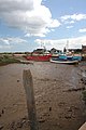
 Boats aground at Brancaster Staithe - geograph.org.uk - 852568.jpg 640 × 427; 70 KB
-
 Brancaster Staithe - geograph.org.uk - 11545.jpg 640 × 480; 77 KB
-
 Brancaster Staithe - geograph.org.uk - 5295459.jpg 1,024 × 683; 178 KB
-
 Brancaster Staithe - geograph.org.uk - 852355.jpg 427 × 640; 70 KB
-
 Brancaster Staithe - geograph.org.uk - 949271.jpg 640 × 480; 95 KB
-
 Brancaster Staithe - the new quay - geograph.org.uk - 838434.jpg 640 × 480; 164 KB
-
 Brancaster Staithe - the old quay - geograph.org.uk - 838416.jpg 640 × 480; 178 KB
-
 Brancaster Staithe and marshes - geograph.org.uk - 1093341.jpg 640 × 190; 29 KB
-
 Brent Geese at Brancaster Staithe. - geograph.org.uk - 1680162.jpg 2,048 × 1,536; 1.38 MB
-
 Channel to Brancaster Staithe - geograph.org.uk - 852562.jpg 640 × 427; 103 KB
-

-
 Cottages at Brancaster Staithe - geograph.org.uk - 1463364.jpg 640 × 337; 69 KB
-
 Creek, Deepdale marsh - geograph.org.uk - 389112.jpg 640 × 480; 80 KB
-

-
 Environment Agency 110922 093937.jpg 4,288 × 2,848; 5.01 MB
-
 Environment Agency 110922 093949.jpg 4,288 × 2,848; 3.81 MB
-
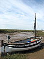
 Fishing boat aground at low water - geograph.org.uk - 852561.jpg 640 × 427; 64 KB
-
 Fishing boats and paraphernalia - geograph.org.uk - 852566.jpg 640 × 427; 108 KB
-
 Fishing boats at Brancaster Staithe - geograph.org.uk - 852571.jpg 640 × 437; 82 KB
-

-
 Fishing equipment at Brancaster Staithe - geograph.org.uk - 949274.jpg 640 × 480; 116 KB
-
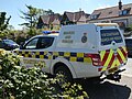 H M Coastguard Search And Rescue Vehicle.jpg 5,184 × 3,888; 9.45 MB
-
 Harbour Way - geograph.org.uk - 838394.jpg 480 × 640; 112 KB
-
 High and dry in Mow Creek - geograph.org.uk - 838410.jpg 640 × 480; 155 KB
-
 HM Coastguard Search and Rescue Vehicle Livery.jpg 5,184 × 3,888; 8.36 MB
-
 HM Coastguard Search and Rescue Vehicle.jpg 5,184 × 3,888; 8.14 MB
-
 Letzer's Seafood - geograph.org.uk - 838402.jpg 480 × 640; 131 KB
-
 Low water channel - geograph.org.uk - 852560.jpg 640 × 427; 114 KB
-
 Moored by the new quay - geograph.org.uk - 838425.jpg 480 × 640; 141 KB
-
 Mow Creek - geograph.org.uk - 838406.jpg 480 × 640; 169 KB
-
 Mow Creek at low water - geograph.org.uk - 852348.jpg 640 × 427; 92 KB
-
 Mow Creek, Brancaster Staithe - geograph.org.uk - 1463366.jpg 600 × 450; 59 KB
-
 Mow Creek, Brancaster Staithe - geograph.org.uk - 1463375.jpg 600 × 450; 54 KB
-
 Mud and marshes at Brancaster Staithe - geograph.org.uk - 1517684.jpg 640 × 480; 310 KB
-
 No sailing today - geograph.org.uk - 838404.jpg 480 × 640; 180 KB
-
 Not going anywhere - geograph.org.uk - 838432.jpg 480 × 640; 152 KB
-
 Old mooring post - geograph.org.uk - 838420.jpg 480 × 640; 199 KB
-
 On the saltmarsh edge - geograph.org.uk - 838438.jpg 480 × 640; 188 KB
-
 Painting the hull - geograph.org.uk - 852556.jpg 640 × 427; 71 KB
-

-
 Saltmarsh at Brancaster Staithe - geograph.org.uk - 852574.jpg 640 × 427; 111 KB
-
 Sea Dog BN2 Trawler.jpg 5,184 × 3,888; 8.76 MB
-
 Sitting in a bed of mud - geograph.org.uk - 838417.jpg 640 × 480; 160 KB
-
 Terraced cottages - geograph.org.uk - 838399.jpg 640 × 445; 195 KB
-

-
 The Lookout - geograph.org.uk - 838430.jpg 480 × 640; 160 KB
-
 The Lookout at Brancaster Staithe - geograph.org.uk - 490953.jpg 640 × 480; 152 KB
-
 The tide is out - geograph.org.uk - 838403.jpg 640 × 480; 194 KB
-
 Tidal Pond - geograph.org.uk - 950103.jpg 640 × 480; 93 KB
-
 Unloading Mussels at Brancaster Staithe. - geograph.org.uk - 1680154.jpg 2,048 × 1,536; 1.45 MB
-
-
 Waiting for the tide to come in - geograph.org.uk - 838409.jpg 640 × 480; 161 KB
-

-
 White Horse public house, Brancaster Staithe, 19 05 2010.JPG 4,000 × 3,000; 2.29 MB
-
 WW2 Radar Station at Barrow Common. - geograph.org.uk - 1527320.jpg 640 × 480; 119 KB
-
 A tranquil afternoon at the staithe - geograph.org.uk - 838405.jpg 480 × 640; 136 KB
-
 All quiet in the staithe - geograph.org.uk - 838413.jpg 480 × 640; 179 KB
-
 Blue house - geograph.org.uk - 838400.jpg 640 × 459; 165 KB
-
 Boat at Brancaster Staithe - geograph.org.uk - 661381.jpg 640 × 427; 53 KB
-
 Boats at Brancaster Staithe - geograph.org.uk - 1517678.jpg 640 × 480; 229 KB
-
 Boats at Brancaster Staithe - geograph.org.uk - 659213.jpg 427 × 640; 61 KB
-
 Boats at Brancaster Staithe - geograph.org.uk - 659214.jpg 640 × 420; 61 KB
-
 Boats at Brancaster Staithe - geograph.org.uk - 659215.jpg 411 × 640; 89 KB
-
 Boats at Brancaster Staithe - geograph.org.uk - 661380.jpg 640 × 427; 50 KB
-
 Boats at Brancaster Staithe - geograph.org.uk - 661388.jpg 640 × 427; 68 KB
-
 Boats at Brancaster Staithe - geograph.org.uk - 661474.jpg 640 × 429; 74 KB
-
 Boats at Brancaster Staithe - geograph.org.uk - 661475.jpg 640 × 429; 65 KB
-
 Boats at Brancaster Staithe - geograph.org.uk - 661476.jpg 640 × 429; 60 KB
-
 Brancaster Staithe from Barrow Common - geograph.org.uk - 1517712.jpg 640 × 480; 265 KB
-
 Brancaster Staithe harbour entrance - geograph.org.uk - 293844.jpg 640 × 480; 57 KB
-
 Jolly Sailor, Brancaster Staithe - geograph.org.uk - 11543.jpg 640 × 480; 82 KB
-
 National Trust Sign at Brancaster Staithe - geograph.org.uk - 661477.jpg 402 × 600; 104 KB
-
 Sailing at Brancaster Staithe - geograph.org.uk - 661382.jpg 427 × 640; 47 KB
-
 Sailing at Brancaster Staithe - geograph.org.uk - 661383.jpg 426 × 640; 53 KB
-
 Sailing at Brancaster Staithe - geograph.org.uk - 661384.jpg 411 × 640; 62 KB
-
 Sailing at Brancaster Staithe - geograph.org.uk - 661385.jpg 426 × 640; 57 KB
-
 Sailing at Brancaster Staithe - geograph.org.uk - 661386.jpg 640 × 427; 46 KB
-
 Sailing at Brancaster Staithe - geograph.org.uk - 661387.jpg 640 × 427; 54 KB


