Category:Brederodestraat 1, Vianen
| Object location | | View all coordinates using: OpenStreetMap |
|---|
 | |||||
| Upload media | |||||
| Instance of |
| ||||
|---|---|---|---|---|---|
| Location | Vianen, Vijfheerenlanden, Utrecht, Netherlands | ||||
| Street address |
| ||||
| Heritage designation |
| ||||
 | |||||
|
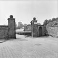
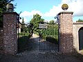
This is a category about rijksmonument number 37395
|
| Address |
|
Media in category "Brederodestraat 1, Vianen"
The following 5 files are in this category, out of 5 total.
-
 Inrijhek - Vianen - 20241944 - RCE.jpg 1,200 × 807; 200 KB
-
 Toegangshek - Vianen - 20241946 - RCE.jpg 1,198 × 1,200; 253 KB
-
 Vianen Brederodestraat 1.JPG 3,264 × 2,448; 2.11 MB
-
 Vianen RM Brederodestraat 1 Hek en muur.jpg 3,786 × 2,431; 3.57 MB
-
 Voorgevel - Vianen - 20241945 - RCE.jpg 1,192 × 1,200; 338 KB


