Category:Bremen in the 18th century
Subcategories
This category has the following 13 subcategories, out of 13 total.
- Bremen in the 1740s (4 F)
- Bremen in the 1770s (4 F)
1
- 18th-century maps of Bremen (10 F)
D
- Drawings by J D Heinbach (16 F)
H
R
- Heinrich Wilhelm Rotermund (1 F)
Media in category "Bremen in the 18th century"
The following 12 files are in this category, out of 12 total.
-
Abortwarnung.JPG 3,000 × 2,440; 4.29 MB
-
Amtsbeil.jpg 3,710 × 1,730; 348 KB
-
Bremen Old Map 5.jpg 978 × 833; 201 KB
-
Bremen ULF Gräberplan 1765.png 837 × 1,037; 986 KB
-
Carl Philipp Cassel.jpg 595 × 794; 738 KB
-
J D Heinbach Ansgaritor.png 556 × 340; 211 KB
-
J D Heinbach Buntentor.png 1,639 × 666; 1.42 MB
-
J D Heinbach Ostertorsturm Glocke.png 211 × 416; 120 KB
-
J D Heinbach, Herdentorsturm.png 207 × 467; 138 KB
-
S. Stephan(i) F. B. Werner 1729.png 445 × 445; 323 KB
-
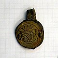
Tuchplombe Färber.jpg 392 × 391; 115 KB
-
Zeughaus - Bremen.jpg 822 × 561; 857 KB


