Category:Brentor
English: Brentor is a village in West Devon, England. Its population in 2001 was 423. The village is dominated by the hill of Brent Tor, topped by the village's church.
village in Devon, England, UK  | |||||
| Upload media | |||||
| Instance of | |||||
|---|---|---|---|---|---|
| Location | West Devon, Devon, South West England, England | ||||
| Population |
| ||||
 | |||||
Subcategories
This category has the following 4 subcategories, out of 4 total.
Media in category "Brentor"
The following 200 files are in this category, out of 213 total.
(previous page) (next page)-
 'Hillside', near Brent Tor - geograph.org.uk - 1475087.jpg 640 × 480; 84 KB
-
 'Pentyre', North Brentor - geograph.org.uk - 1475109.jpg 640 × 480; 68 KB
-
 A very short lane - geograph.org.uk - 3759221.jpg 640 × 428; 152 KB
-
 Adit mine, Lydford Gorge - geograph.org.uk - 4290655.jpg 1,920 × 1,440; 675 KB
-
 Allium ursinum - geograph.org.uk - 421278.jpg 480 × 640; 139 KB
-
 Altar and Pulpit - geograph.org.uk - 4261201.jpg 5,472 × 3,648; 2.33 MB
-

-
 Approaching Brentor Inn - geograph.org.uk - 3395744.jpg 1,024 × 768; 97 KB
-
 Asheltor Wood - geograph.org.uk - 418877.jpg 640 × 480; 157 KB
-
 Bird hide above Lydford Gorge - geograph.org.uk - 1913353.jpg 640 × 480; 137 KB
-
 Bird hide overlooking Lydford Gorge - geograph.org.uk - 3929266.jpg 1,536 × 1,152; 1.62 MB
-
 Brent Tor - geograph.org.uk - 4304188.jpg 1,920 × 969; 376 KB
-
 Brent Tor Church - geograph.org.uk - 3759143.jpg 640 × 428; 52 KB
-
 Brent Tor Church - geograph.org.uk - 3759170.jpg 640 × 428; 52 KB
-
 Brent Tor Church - geograph.org.uk - 5472687.jpg 1,600 × 1,067; 448 KB
-
 Brent Tor church from the east - geograph.org.uk - 4052435.jpg 1,920 × 2,690; 1.19 MB
-
 Brent Tor church plus livestock - geograph.org.uk - 4052463.jpg 1,920 × 1,336; 574 KB
-
 Brent Tor from public footpath - geograph.org.uk - 3912235.jpg 800 × 450; 56 KB
-
 Brent Tor, Church of St Michel de Rupe - geograph.org.uk - 3275198.jpg 2,560 × 1,920; 2.68 MB
-
 Brentor church - geograph.org.uk - 4304069.jpg 1,920 × 2,451; 1.2 MB
-
 Brentor panoramic.jpg 14,852 × 2,117; 6.66 MB
-
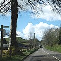
 Brentor Road nr Langestone Manor - geograph.org.uk - 1824823.jpg 640 × 465; 77 KB
-
 Bridge over disused railway - geograph.org.uk - 418895.jpg 640 × 480; 165 KB
-
 Bridge over former railway near Lydford - geograph.org.uk - 2895599.jpg 800 × 600; 452 KB
-
 Bridge over Lyd - geograph.org.uk - 421325.jpg 480 × 640; 114 KB
-
 Bridge over River Burn - geograph.org.uk - 4478955.jpg 1,600 × 1,067; 1.11 MB
-
 Bridge over River Burn - geograph.org.uk - 6613109.jpg 1,600 × 1,134; 1.04 MB
-
 Bridge over the former railway - geograph.org.uk - 1824781.jpg 640 × 432; 74 KB
-
 Broadpark, formation of old railway - geograph.org.uk - 5723264.jpg 1,600 × 1,066; 739 KB
-
 Burn Cottage - geograph.org.uk - 418791.jpg 640 × 480; 106 KB
-
 Burnville - geograph.org.uk - 418858.jpg 640 × 480; 85 KB
-
 Burnville House 1883 2.jpg 2,000 × 1,066; 452 KB
-
 Burnville House.jpg 1,000 × 800; 319 KB
-
 Cattle below Brent Tor - geograph.org.uk - 4304222.jpg 1,920 × 1,277; 715 KB
-
 Cattle near Brentor - geograph.org.uk - 421250.jpg 640 × 480; 123 KB
-
 Christchurch, North Brentor - geograph.org.uk - 1932237.jpg 3,780 × 2,520; 2.49 MB
-
 Church of St Michael de Rupe - geograph.org.uk - 4778253.jpg 640 × 480; 86 KB
-
 Coryton Ford - geograph.org.uk - 4188218.jpg 3,872 × 2,592; 5.78 MB
-
 Countryside, north west of Brent Tor - geograph.org.uk - 1474911.jpg 640 × 480; 87 KB
-
 Crags on Brent Tor Summit - geograph.org.uk - 183211.jpg 640 × 413; 120 KB
-
 Crossroads near Brent Tor and Westcott - geograph.org.uk - 2897568.jpg 800 × 600; 370 KB
-
 Cyclists on National Cycle Route 27 - geograph.org.uk - 3444886.jpg 640 × 480; 118 KB
-
 Dartmoor (3274520027).jpg 3,488 × 2,616; 3.49 MB
-

-

-
 Disused mine adit in Lydford Gorge - geograph.org.uk - 3929416.jpg 1,152 × 1,536; 1.73 MB
-
 Disused railway bridge, Lydford Gorge - geograph.org.uk - 4276543.jpg 1,920 × 2,560; 1.36 MB
-
 Disused railway line, Lydford Gorge - geograph.org.uk - 4289080.jpg 1,920 × 2,560; 1.69 MB
-
 Disused railway line, Lydford Gorge - geograph.org.uk - 4289140.jpg 1,920 × 2,560; 1.88 MB
-
 Disused railway line, Lydford Gorge - geograph.org.uk - 4289146.jpg 1,920 × 1,440; 1.06 MB
-
 Empty car park for Brentor - geograph.org.uk - 6257339.jpg 1,024 × 768; 156 KB
-
 Evening at Brent Tor - geograph.org.uk - 6402065.jpg 1,802 × 1,201; 371 KB
-
 Field below Brent Tor - geograph.org.uk - 4304071.jpg 1,920 × 1,440; 688 KB
-
 Field near Manor Farm, Lydford - geograph.org.uk - 4277421.jpg 1,920 × 1,440; 668 KB
-
 Field near Woodmanswell - geograph.org.uk - 418912.jpg 640 × 480; 142 KB
-
 Field on Liddaton Down - geograph.org.uk - 432602.jpg 640 × 480; 123 KB
-
 Field windbreak near Woodmanswell - geograph.org.uk - 2896945.jpg 800 × 600; 307 KB
-
 Fields below Brent Tor - geograph.org.uk - 4304190.jpg 1,920 × 1,329; 683 KB
-
 Footbridge, Lydford Gorge - geograph.org.uk - 4291461.jpg 1,920 × 2,597; 1.51 MB
-
 Footpath along old railway track - geograph.org.uk - 3929262.jpg 1,536 × 1,152; 1.6 MB
-
 Footpath on abandoned railway at Lydford - geograph.org.uk - 3929231.jpg 1,536 × 1,152; 1.58 MB
-
 Ford at Liddaton Down - geograph.org.uk - 5927300.jpg 4,032 × 3,024; 5.13 MB
-
 Former LSWR station House, Brentor - geograph.org.uk - 1475139.jpg 640 × 480; 75 KB
-
 Former Railway trackbed - geograph.org.uk - 1824802.jpg 640 × 470; 67 KB
-

-
 Former schoolhouse, near Furzeleigh - geograph.org.uk - 1475160.jpg 640 × 480; 80 KB
-
 Gorse bushes in flower on the moor - geograph.org.uk - 3444891.jpg 640 × 480; 184 KB
-
 Green Fields below Brent Tor - geograph.org.uk - 183220.jpg 640 × 471; 121 KB
-
 Green lane, east of South Brentor - geograph.org.uk - 1476663.jpg 640 × 480; 108 KB
-
 GWR Ply - Launceston railway bridge - geograph.org.uk - 1824884.jpg 640 × 425; 92 KB
-
 Hidden pond, near South Brentor - geograph.org.uk - 1475098.jpg 640 × 480; 134 KB
-

-
 Inside Brent Tor Church - geograph.org.uk - 3759157.jpg 640 × 428; 52 KB
-
 Kissing gate - geograph.org.uk - 5472691.jpg 1,067 × 1,600; 720 KB
-
 Lane from Bowden Down - geograph.org.uk - 418949.jpg 640 × 480; 104 KB
-
 Lane junction near Rowden Farm - geograph.org.uk - 316852.jpg 480 × 640; 141 KB
-
 Lane to Holyeat Farm - geograph.org.uk - 4304014.jpg 1,920 × 1,269; 426 KB
-
 Lane to Liddaton - geograph.org.uk - 432614.jpg 640 × 480; 108 KB
-
 Langstone Manor, Brentor - geograph.org.uk - 2844227.jpg 1,839 × 1,266; 599 KB
-
 Liddaton Down - geograph.org.uk - 432630.jpg 640 × 480; 136 KB
-
 Liddaton Down Cross - geograph.org.uk - 432607.jpg 480 × 640; 93 KB
-
 Liddaton Down Cross - geograph.org.uk - 432621.jpg 480 × 640; 103 KB
-
 LSWR Brentor station house - geograph.org.uk - 1813323.jpg 640 × 431; 84 KB
-
 LSWR former trackbed at Brentor - geograph.org.uk - 1813333.jpg 640 × 431; 84 KB
-

-

-
 Lydford forest - geograph.org.uk - 3444876.jpg 640 × 480; 99 KB
-
 Lydford Gorge (17) - geograph.org.uk - 5938715.jpg 4,320 × 3,240; 3.96 MB
-
 Lydford Gorge (18) - geograph.org.uk - 5938718.jpg 4,320 × 3,240; 4.04 MB
-
 Lydford Gorge (19) - geograph.org.uk - 5938723.jpg 2,885 × 3,847; 2.27 MB
-
 Lydford Gorge (20) - geograph.org.uk - 5938725.jpg 3,240 × 4,320; 4.26 MB
-
 Lydford Gorge (21) - geograph.org.uk - 5938728.jpg 4,320 × 3,240; 4.62 MB
-
 Lydford Gorge (22) - geograph.org.uk - 5939684.jpg 4,320 × 3,240; 4.49 MB
-
 Lydford Gorge (23) - geograph.org.uk - 5939686.jpg 4,320 × 3,240; 3.8 MB
-
 Lydford Gorge (24) - geograph.org.uk - 5939688.jpg 4,320 × 3,240; 4.38 MB
-
 Lydford Gorge (25) - geograph.org.uk - 5939691.jpg 4,320 × 3,240; 4.33 MB
-
 Lydford Gorge (26) - geograph.org.uk - 5939692.jpg 4,320 × 3,240; 4.44 MB
-
 Lydford Gorge (27) - geograph.org.uk - 5939696.jpg 4,320 × 3,240; 3.75 MB
-
 Lydford Gorge (28) - geograph.org.uk - 5939698.jpg 3,240 × 4,320; 3.68 MB
-
 Lydford Gorge (29) - geograph.org.uk - 5939701.jpg 4,320 × 3,240; 4.1 MB
-
 Lydford Gorge (30) - geograph.org.uk - 5939705.jpg 3,899 × 2,924; 2.38 MB
-
 Lydford Gorge (31) - geograph.org.uk - 5939707.jpg 4,320 × 3,240; 4.06 MB
-
 Lydford Gorge (32) - geograph.org.uk - 5939709.jpg 3,240 × 4,320; 3.94 MB
-
 Lydford straight on - geograph.org.uk - 1824737.jpg 640 × 447; 88 KB
-
 Main street, North Brentor - geograph.org.uk - 1475125.jpg 640 × 477; 63 KB
-
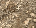 Map Brentor 1809.jpg 1,200 × 945; 460 KB
-
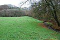
 Meadow in Burn valley - geograph.org.uk - 421228.jpg 640 × 480; 143 KB
-

-
 Minor road alongside Brent Tor - geograph.org.uk - 3701052.jpg 640 × 480; 71 KB
-
 Minor road near Brent Tor - geograph.org.uk - 2886607.jpg 3,008 × 2,000; 6.42 MB
-
 Minor road to Liddaton - geograph.org.uk - 1474922.jpg 640 × 480; 68 KB
-
 Missing bridge - geograph.org.uk - 3759306.jpg 640 × 428; 147 KB
-
 Moss on ash seedlings - geograph.org.uk - 421296.jpg 480 × 640; 112 KB
-
 Near Bush Park - geograph.org.uk - 2895613.jpg 800 × 600; 357 KB
-
 North Brentor - geograph.org.uk - 421239.jpg 640 × 480; 121 KB
-
 North Brentor Church from Brentor High Street. - geograph.org.uk - 1932241.jpg 2,520 × 3,780; 2.89 MB
-
 North-western edge of Brent Tor - geograph.org.uk - 2885147.jpg 3,008 × 2,000; 6.47 MB
-
 Old Boundary Marker - geograph.org.uk - 6599207.jpg 462 × 1,024; 217 KB
-

-

-
 Old railway bridge above Lydford Gorge - geograph.org.uk - 1913333.jpg 480 × 640; 134 KB
-
 On National Cycle Route 27, near Brentor - geograph.org.uk - 1346626.jpg 640 × 480; 164 KB
-

-
-
 Pasture land - geograph.org.uk - 3759251.jpg 640 × 428; 66 KB
-
 Pasture land - geograph.org.uk - 3759328.jpg 640 × 428; 110 KB
-
 Path junction, Westford Wood - geograph.org.uk - 4290500.jpg 1,920 × 1,440; 1.09 MB
-
 Path signpost, Westford Wood - geograph.org.uk - 4289190.jpg 1,920 × 2,560; 1.71 MB
-
 Path, Westford Wood - geograph.org.uk - 4289182.jpg 1,920 × 2,560; 1.8 MB
-
 Path, Westford Wood - geograph.org.uk - 4289957.jpg 1,920 × 1,440; 959 KB
-
 Ponds in the cutting of an abandoned railway line - geograph.org.uk - 3929238.jpg 1,536 × 1,152; 1.64 MB
-
 Postbox set into bridge parapet near Lydford - geograph.org.uk - 6613547.jpg 1,600 × 1,029; 924 KB
-
 Puddles in the field but sun on the moors - geograph.org.uk - 1824752.jpg 1,024 × 683; 114 KB
-
 Rental notice East Langstone 1814.jpg 800 × 1,139; 365 KB
-
 River Lyd - geograph.org.uk - 418931.jpg 480 × 640; 139 KB
-
 River Lyd below the gorge - geograph.org.uk - 3929281.jpg 1,536 × 1,152; 1.42 MB
-

-
 Road junction near Bearwood Farm - geograph.org.uk - 2896947.jpg 800 × 799; 550 KB
-
 Road junction near Brent Tor - geograph.org.uk - 4304254.jpg 1,920 × 1,350; 592 KB
-
 Road near Langstone Manor - geograph.org.uk - 421270.jpg 640 × 480; 124 KB
-
 Road to Longcross at Brent Tor - geograph.org.uk - 2897563.jpg 800 × 600; 322 KB
-
 Sale notice Burnville Lodge 1860.jpg 800 × 526; 152 KB
-

-
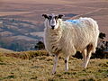 Sheep (3274512265).jpg 3,488 × 2,616; 4.33 MB
-
 Sheep pasture near Holyeat Farm - geograph.org.uk - 4042198.jpg 1,920 × 1,204; 480 KB
-
 Slopes of Brent Tor - geograph.org.uk - 4304184.jpg 1,920 × 1,440; 821 KB
-
 Small Footbridge - geograph.org.uk - 3759290.jpg 640 × 428; 127 KB
-
 South Brentor Farm - geograph.org.uk - 1475092.jpg 640 × 480; 84 KB
-
 South of Liddaton Down - geograph.org.uk - 421468.jpg 640 × 480; 119 KB
-
 Station View, North Brentor - geograph.org.uk - 1475136.jpg 640 × 449; 70 KB
-
 Stowfordhill - geograph.org.uk - 432637.jpg 640 × 480; 120 KB
-
 Stream above White Lady Waterfall - geograph.org.uk - 3929219.jpg 1,152 × 1,536; 1.6 MB
-
 Stream, Lydford Gorge - geograph.org.uk - 4276536.jpg 1,920 × 2,560; 1.73 MB
-
 Stream, Lydford Gorge - geograph.org.uk - 4276538.jpg 1,920 × 2,560; 1.54 MB
-

-

-
 The Old Schoolhouse, North Brentor - geograph.org.uk - 1932231.jpg 3,780 × 2,520; 2.13 MB
-
 The path to Brent Tor - geograph.org.uk - 3701047.jpg 640 × 480; 63 KB
-
 The River Lyd in Lydford Gorge - geograph.org.uk - 1913271.jpg 640 × 480; 156 KB
-
 The road to Liddaton - geograph.org.uk - 2896948.jpg 800 × 600; 445 KB
-
 The road to Lydford - geograph.org.uk - 3444879.jpg 640 × 480; 165 KB
-
 Through The Porch - geograph.org.uk - 4261187.jpg 3,648 × 5,472; 1.46 MB
-
 Towards Coryton Mill - geograph.org.uk - 5723249.jpg 1,600 × 1,077; 707 KB
-
 Track and field near Brent Tor - geograph.org.uk - 4304252.jpg 1,920 × 1,206; 722 KB
-
 Track and Footpath - geograph.org.uk - 3759235.jpg 640 × 428; 94 KB
-

-
 Track to farmhouse, near Furzeleigh - geograph.org.uk - 1475164.jpg 640 × 480; 99 KB
-
 Valley, Brentor - geograph.org.uk - 4304080.jpg 1,920 × 1,337; 568 KB
-
 Vicarage Field, North Brentor - geograph.org.uk - 418838.jpg 640 × 480; 139 KB
-
 View from Brent Tor - geograph.org.uk - 4778252.jpg 480 × 640; 127 KB
-
 View from Brent Tor, North - geograph.org.uk - 183208.jpg 640 × 399; 116 KB
-
 View from Brent Tor, Northeast - geograph.org.uk - 183213.jpg 640 × 427; 81 KB
-
 View looking north from Brent Tor - geograph.org.uk - 1021866.jpg 640 × 480; 172 KB
-
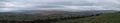
 View of Devonshire countryside - geograph.org.uk - 1282224.jpg 640 × 317; 54 KB
-
 View West from Gibbet Hill.jpg 3,832 × 2,848; 1.8 MB
-
 West Blackdown - geograph.org.uk - 418807.jpg 640 × 480; 101 KB
-
 West Blackdown across the valley - geograph.org.uk - 1824768.jpg 640 × 427; 74 KB
-
 West Devon , Footpath - geograph.org.uk - 5901827.jpg 6,000 × 4,000; 6.95 MB
-
 West Devon , Lydford Gorge - Footbridge - geograph.org.uk - 5945081.jpg 6,000 × 4,000; 7.13 MB
-
 West Devon , Lydford Gorge - Footpath - geograph.org.uk - 5945082.jpg 6,000 × 4,000; 6.06 MB
-
 West Devon , Lydford Gorge - Footpath - geograph.org.uk - 5945084.jpg 4,000 × 6,000; 6.4 MB
-
 West Devon , Lydford Gorge - Gate - geograph.org.uk - 5945093.jpg 6,000 × 4,000; 6.51 MB
-
 West Devon , Lydford Gorge - River Lyd - geograph.org.uk - 5945086.jpg 6,000 × 4,000; 7.5 MB
-
 West Devon , Lydford Gorge - River Lyd - geograph.org.uk - 5945088.jpg 6,000 × 4,000; 6.44 MB
-
 West Devon , Lydford Gorge - River Lyd - geograph.org.uk - 5945089.jpg 6,000 × 4,000; 5.69 MB
-
 West Devon , Lydford Gorge - River Lyd - geograph.org.uk - 5945090.jpg 6,000 × 4,000; 7.33 MB
-
 West Devon , Lydford Gorge - River Lyd - geograph.org.uk - 5945094.jpg 6,000 × 4,000; 7.01 MB
-
 West Devon , Lydford Gorge - River Lyd - geograph.org.uk - 5945095.jpg 6,000 × 4,000; 6.19 MB
-
 West Devon , Lydford Gorge - River Lyd - geograph.org.uk - 5945097.jpg 6,000 × 4,000; 7.63 MB
-
 West Devon , Lydford Gorge - River Lyd - geograph.org.uk - 5945098.jpg 4,000 × 6,000; 5.6 MB
-
 West Devon , Lydford Gorge - River Lyd - geograph.org.uk - 5945099.jpg 4,000 × 6,000; 7.11 MB
-
 West Devon , Lydford Gorge - River Lyd - geograph.org.uk - 5945100.jpg 6,000 × 4,000; 7.15 MB
-
 West Devon , Lydford Gorge - River Lyd - geograph.org.uk - 5945101.jpg 6,000 × 4,000; 6.35 MB
-
 West Devon , Lydford Gorge - River Lyd - geograph.org.uk - 5945105.jpg 6,000 × 4,000; 6.21 MB
-
 West Devon , Lydford Gorge - Stream - geograph.org.uk - 5945077.jpg 4,000 × 6,000; 5.84 MB
-
 West Devon , Lydford Gorge - Stream - geograph.org.uk - 5945078.jpg 6,000 × 4,000; 7.72 MB
-
 West Devon , Lydford Gorge - Stream - geograph.org.uk - 5945079.jpg 4,000 × 6,000; 5.61 MB
-
 West Devon , Lydford Gorge - Stream - geograph.org.uk - 5945080.jpg 4,000 × 6,000; 5.73 MB
-
 West Devon , Lydford Gorge - White Lady Waterfall - geograph.org.uk - 5945102.jpg 6,000 × 4,000; 6.96 MB
-
 West Devon , Lydford Gorge - White Lady Waterfall - geograph.org.uk - 5945103.jpg 4,000 × 6,000; 6.43 MB


.jpg)


_-_geograph.org.uk_-_5938715.jpg)
_-_geograph.org.uk_-_5938718.jpg)
_-_geograph.org.uk_-_5938723.jpg)
_-_geograph.org.uk_-_5938725.jpg)
_-_geograph.org.uk_-_5938728.jpg)
_-_geograph.org.uk_-_5939684.jpg)
_-_geograph.org.uk_-_5939686.jpg)
_-_geograph.org.uk_-_5939688.jpg)
_-_geograph.org.uk_-_5939691.jpg)
_-_geograph.org.uk_-_5939692.jpg)
_-_geograph.org.uk_-_5939696.jpg)
_-_geograph.org.uk_-_5939698.jpg)
_-_geograph.org.uk_-_5939701.jpg)
_-_geograph.org.uk_-_5939705.jpg)
_-_geograph.org.uk_-_5939707.jpg)
_-_geograph.org.uk_-_5939709.jpg)


_south-west_of_Brentor_Inn_-_geograph.org.uk_-_2897561.jpg)


.jpg)


