Category:Brewery District (Columbus, Ohio)
human settlement in Columbus, Ohio, United States of America  | |||||
| Upload media | |||||
| Instance of | |||||
|---|---|---|---|---|---|
| Location | Columbus, Franklin County, Ohio | ||||
 | |||||
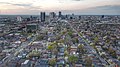
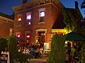
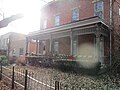
English: The Brewery District is a neighborhood located just south of the central business district and has a history stretching nearly 200 years. It is bounded by I-70 on the north, N. High or Pearl Street on the east, Greenlawn Avenue on the south, and the Scioto River on the west. In recent years, redevelopment has taken place on a large scale, with numerous restaurants, bars, and even a grocery store coming to the area. It is sometimes referred to as being part of the greater German Village.
Subcategories
This category has the following 9 subcategories, out of 9 total.
A
- August Wagner Breweries (2 F)
B
E
- E. C. Buchsieb Block (2 F)
H
- High Beck Tavern (3 F)
L
S
- South Wind Motel (9 F)
T
W
- Worly Building (13 F)
Media in category "Brewery District (Columbus, Ohio)"
The following 65 files are in this category, out of 65 total.
-
 Brewer's Yard Kroger.jpg 612 × 612; 153 KB
-
 Brewery District aerial.jpg 5,566 × 2,804; 8.71 MB
-
 Brewery District Houses.jpg 800 × 600; 282 KB
-
 Building on Front Street.jpg 800 × 600; 303 KB
-
 COGO Brewery District.jpg 600 × 800; 320 KB
-
 Columbus house move.jpg 800 × 600; 152 KB
-
 Columbus Illustrated (76b).jpg 4,457 × 2,673; 2.89 MB
-
 Columbus, Ohio 192.jpg 1,600 × 1,200; 401 KB
-
 Columbus, Ohio 193.jpg 1,600 × 1,200; 408 KB
-
 Columbus, Ohio 194.jpg 1,600 × 1,200; 399 KB
-
 Columbus, Ohio 195.jpg 1,600 × 1,200; 415 KB
-
 Columbus, Ohio 196.jpg 1,600 × 1,200; 412 KB
-
 Columbus, Ohio 197.jpg 1,600 × 1,200; 389 KB
-
 Columbus, Ohio 198.jpg 1,600 × 1,200; 423 KB
-
 Columbus, Ohio 199.jpg 1,600 × 1,200; 423 KB
-
 Columbus, Ohio 200.jpg 1,600 × 1,200; 421 KB
-
 Columbus, Ohio 201.jpg 1,600 × 1,200; 444 KB
-
 Columbus, Ohio 202.jpg 1,600 × 1,200; 416 KB
-
 Columbus, Ohio 203.jpg 1,600 × 1,200; 400 KB
-
 Columbus, Ohio 204.jpg 1,600 × 1,200; 426 KB
-
 Columbus, Ohio 205.jpg 1,600 × 1,200; 440 KB
-
 Columbus, Ohio 206.jpg 1,600 × 1,200; 366 KB
-
 Columbus, Ohio 207.jpg 1,600 × 1,200; 425 KB
-
 Columbus, Ohio 208.jpg 1,600 × 1,200; 409 KB
-
 Columbus, Ohio 212.jpg 1,600 × 1,200; 400 KB
-
 Columbus, Ohio 213.jpg 1,600 × 1,200; 423 KB
-
 Columbus, Ohio 214.jpg 1,600 × 1,200; 423 KB
-
 Columbus, Ohio 215.jpg 1,600 × 1,200; 407 KB
-
 Columbus, Ohio 216.jpg 1,600 × 1,200; 428 KB
-
 Columbus, Ohio 217.jpg 1,600 × 1,200; 406 KB
-
 Columbus, Ohio 218.jpg 1,600 × 1,200; 406 KB
-
 Columbus, Ohio 219.jpg 1,600 × 1,200; 415 KB
-
 Columbus, Ohio 220.jpg 1,600 × 1,200; 383 KB
-
 Columbus, Ohio 221.jpg 1,600 × 1,200; 427 KB
-
 Columbus, Ohio 222.jpg 1,600 × 1,200; 409 KB
-
 Columbus, Ohio 223.jpg 1,600 × 1,200; 400 KB
-
 Columbus, Ohio 224.jpg 1,600 × 1,200; 399 KB
-
 Columbus, Ohio 225.jpg 1,600 × 1,200; 421 KB
-
 Columbus, Ohio building 01.jpg 4,596 × 3,303; 2.48 MB
-
 Columbus, Ohio building 26.jpg 4,513 × 3,400; 3.89 MB
-
 Columbus, Ohio c. 1898 - 47.jpg 580 × 442; 52 KB
-
 Columbus, Ohio Ɱ 154.jpg 3,109 × 2,056; 1.65 MB
-
 Columbus, Ohio Ɱ 155.jpg 4,032 × 3,024; 3.31 MB
-
 Columbus, Ohio Ɱ 196.jpg 4,032 × 3,024; 3.8 MB
-
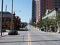
 COTA in Brewery District.jpg 800 × 600; 214 KB
-
 George Daimler Building — Columbus, Ohio.jpg 1,900 × 1,290; 1.63 MB
-
 German Village and the Brewery District 01.jpg 3,668 × 2,059; 1.4 MB
-
 German Village and the Brewery District 02.jpg 4,000 × 2,250; 1.89 MB
-
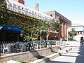
 Grange Insurance Brewery District.jpg 800 × 600; 302 KB
-
 Gressos.jpg 2,048 × 1,536; 567 KB
-
 House in Brewery District, Columbus, Ohio.jpg 900 × 600; 683 KB
-
 I-70, I-71 overpass, Columbus, OH.jpg 4,000 × 2,250; 4.47 MB
-
 Jones Heel Manufacturing Company building 01.jpg 2,559 × 2,469; 4.81 MB
-
 Jones Heel Manufacturing Company building.jpg 4,032 × 3,024; 4.01 MB
-
 King Brewery District.jpg 600 × 800; 232 KB
-
 Moehl Buggy and Wagon Works — Columbus, Ohio.jpg 1,266 × 1,700; 1.54 MB
-
 Old Brewery District Home.JPG 4,608 × 3,456; 3.82 MB
-
 Old Home in Brewery District.JPG 4,608 × 3,456; 3.7 MB
-
 Photo 975 South High JD Healy.jpg 3,888 × 2,794; 2.26 MB
-
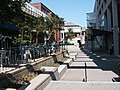
 Sidewalk Brewery District.jpg 800 × 600; 359 KB
-
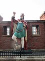
 Statue of King Gambrinus, Brewery District, Columbus, Ohio.jpg 1,632 × 1,232; 515 KB
-
 Trinity Lutheran Seminary marker 01.jpg 4,032 × 3,024; 10.1 MB
-
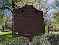 Trinity Lutheran Seminary marker.jpg 2,919 × 2,249; 3.34 MB
-
 View down Front Street, Brewery District.jpg 3,456 × 4,608; 3.28 MB
-
 Worly Building.jpg 5,338 × 3,813; 1.94 MB


.jpg)


