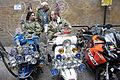
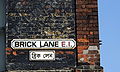
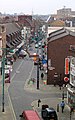
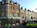
Category:Brick Lane
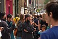
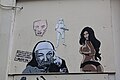
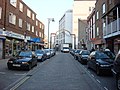
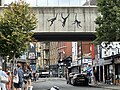
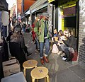
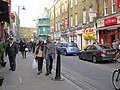
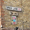
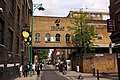
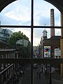
English: Brick Lane (Bengali: ব্রিক লেন Brik Len) is a long street in the London Borough of Tower Hamlets, in the East End of London. It runs from Swanfield Street in the northern part of Bethnal Green, crosses Bethnal Green Road, passes through Spitalfields and is linked to Whitechapel High Street to the south by the short stretch of Osborn Street. Today, it is the heart of the city's Bangladeshi-Sylheti community, and is fondly known as Banglatown.
street in East London, England  .jpg)  | |||||
| Upload media | |||||
| Instance of | |||||
|---|---|---|---|---|---|
| Location | London Borough of Tower Hamlets, Greater London, London, England | ||||
| Connects with |
| ||||
 | |||||
Subcategories
This category has the following 12 subcategories, out of 12 total.
1
- 149 Brick Lane, London (2 F)
5
- 57 Brick Lane, London (1 F)
B
- Beigel Bake (34 F)
- Beigel Shop (Brick Lane) (6 F)
- Brick Lane Mosque (26 F)
C
D
F
- Free Range art & design show (4 F)
O
R
S
Media in category "Brick Lane"
The following 200 files are in this category, out of 339 total.
(previous page) (next page)-

-
 -i---i- (49870550002).jpg 5,038 × 3,359; 8.72 MB
-
 1 Brick Lane - geograph.org.uk - 5617121.jpg 2,327 × 3,105; 1.03 MB
-
 114 - 122, Brick Lane E1 6RL.jpg 3,504 × 2,336; 4.02 MB
-
 122 to 112 Brick Lane (01).jpg 4,248 × 3,170; 9.39 MB
-
 123 Brick Lane (5438159345).jpg 2,592 × 3,888; 3.38 MB
-
 157 Brick Lane E1 - geograph.org.uk - 1113098.jpg 640 × 480; 95 KB
-

-
 1978.06 Brick Lane.JPG 720 × 500; 124 KB
-
 2010-06-06 Brick Lane street.jpg 3,888 × 2,592; 4.36 MB
-
 2010-06-06 Nice open air restaurant.jpg 3,888 × 2,592; 3.31 MB
-
 2010-06-06 Spreading the word.jpg 3,669 × 2,446; 2.1 MB
-
 2010-06-06 Street art at Brick Lane, London.jpg 3,888 × 2,592; 3.29 MB
-
 2010-06-06 Street art in Brick Lane, London.jpg 3,888 × 2,592; 2.75 MB
-
 2010-06-06 street vendors cooking Takoyaki at Brick Lane, London.jpg 3,888 × 2,592; 3.73 MB
-
 2015 Graffiti Big.jpg 3,648 × 5,472; 7.19 MB
-
 2015 Graffiti IMG 3359.jpg 3,648 × 5,472; 8.47 MB
-
 2015 Graffiti IMG 3361.jpg 3,648 × 5,472; 6.15 MB
-
 2015 Graffiti In the name of art.jpg 5,472 × 3,648; 7.49 MB
-
 2015 Graffiti Real hope.jpg 3,648 × 5,472; 7.49 MB
-
 2015 Graffiti Skulls.jpg 5,472 × 3,648; 7.47 MB
-
 2015 Graffiti Stickers.jpg 3,648 × 5,472; 8.51 MB
-
 2015 Graffiti The liberation of artists.jpg 3,648 × 5,472; 9.3 MB
-
 2015 Graffiti Tile.jpg 3,648 × 5,472; 6.63 MB
-
 2024--18 September--City Spice Indian Restaurant in Brick Lane, London.jpg 5,472 × 3,648; 8.39 MB
-
 2024--18 September--Food at City Spice Indian Restaurant in Brick Lane, London.jpg 5,472 × 3,648; 7.89 MB
-
 3 works of art, brick lane (24827151079).jpg 1,781 × 1,292; 742 KB
-
 A Girl in Brick Lane (31103317091).jpg 4,992 × 3,744; 5.61 MB
-
 Alice (11034620595).jpg 4,608 × 2,592; 4.21 MB
-
 An Island Who Nose Where (8407705545).jpg 3,418 × 2,558; 2.16 MB
-
 Archway on Brick Lane - geograph.org.uk - 3167112.jpg 3,456 × 2,592; 2.94 MB
-
 Assassin's creed (Unsplash).jpg 4,272 × 2,856; 1.19 MB
-
 B134, Brick Lane - geograph.org.uk - 1032560.jpg 640 × 480; 89 KB
-
 Bangladeshi man in Brick Lane, London.jpg 1,591 × 2,387; 1.17 MB
-
 Banksy Monkeys 2024-08-14.jpg 4,032 × 3,024; 4.6 MB
-
 Banksy's monkey business.jpg 5,472 × 3,648; 8.36 MB
-
 Banksy-art.jpg 600 × 450; 83 KB
-
 Bar 2012, Shoreditch, E1 (3171976466).jpg 1,200 × 1,600; 882 KB
-
 Beer Coal Hole cover.jpg 3,024 × 4,032; 3.96 MB
-
 Behind Koi Ramen Bar - 2.jpg 2,900 × 2,800; 1.2 MB
-
 Behind the Koi Ramen Bar on Brick Lane.jpg 3,400 × 3,000; 1.61 MB
-
 Bird (13784784194).jpg 3,888 × 2,592; 3.62 MB
-
 Boat on Stilts.jpg 2,605 × 2,074; 1.07 MB
-
 Boogie woogie piano player.jpg 1,280 × 960; 467 KB
-
 Bowler and cutaway on Brick Lane.jpg 2,212 × 3,309; 4.88 MB
-
 Brick Lane (14068306).jpg 1,254 × 740; 530 KB
-
 Brick Lane (33805259603).jpg 4,439 × 3,009; 2.6 MB
-
 Brick Lane (6847570850).jpg 2,448 × 3,264; 3.19 MB
-
 Brick Lane (6847591966).jpg 2,448 × 3,264; 3.02 MB
-
 Brick Lane (6847593376).jpg 2,448 × 3,264; 3 MB
-
 Brick Lane - 40674953791.jpg 2,466 × 3,287; 2.04 MB
-
 Brick Lane - geograph.org.uk - 1552957.jpg 640 × 480; 82 KB
-
 Brick Lane - geograph.org.uk - 6156686.jpg 889 × 1,024; 265 KB
-
 Brick Lane - geograph.org.uk - 642279.jpg 640 × 427; 78 KB
-
 Brick Lane - geograph.org.uk - 6652724.jpg 1,024 × 684; 142 KB
-
 Brick Lane - geograph.org.uk - 6652727.jpg 1,024 × 684; 109 KB
-
 Brick Lane - geograph.org.uk - 6652728.jpg 1,024 × 684; 153 KB
-
 Brick Lane - geograph.org.uk - 6652750.jpg 1,024 × 684; 161 KB
-
 Brick Lane - geograph.org.uk - 6652755.jpg 1,024 × 684; 179 KB
-
 Brick Lane - geograph.org.uk - 6652780.jpg 1,024 × 684; 167 KB
-
 Brick Lane - geograph.org.uk - 6652806.jpg 1,024 × 684; 181 KB
-
 Brick Lane - geograph.org.uk - 6652837.jpg 1,024 × 684; 167 KB
-
 Brick Lane - geograph.org.uk - 6652843.jpg 1,024 × 684; 160 KB
-
 Brick Lane - geograph.org.uk - 6658033.jpg 1,024 × 684; 223 KB
-
 Brick Lane - geograph.org.uk - 6662365.jpg 1,024 × 684; 212 KB
-
 Brick Lane - geograph.org.uk - 762558.jpg 640 × 480; 72 KB
-
 Brick Lane - London.jpg 640 × 480; 153 KB
-
 Brick Lane - Street Scene.jpg 4,000 × 3,000; 2.68 MB
-
 Brick Lane 2002.jpg 1,024 × 768; 441 KB
-
 Brick Lane 2005.jpg 2,560 × 1,920; 3.03 MB
-
 Brick Lane 2011-06-27.jpg 2,776 × 2,536; 5.14 MB
-
 Brick Lane and Bortusk Leer poster. (30777455076).jpg 1,031 × 1,035; 994 KB
-
 Brick Lane at Heneage Street - geograph.org.uk - 5383473.jpg 3,280 × 2,736; 2 MB
-
 Brick Lane Banglatown.jpg 4,624 × 3,472; 2.61 MB
-
 Brick Lane Barbers shop Street art. London (49958876396).jpg 2,685 × 3,946; 4.07 MB
-
 Brick Lane Bookshop (15998912249).jpg 640 × 640; 157 KB
-
 Brick Lane Bookshop.jpg 3,264 × 2,448; 5.58 MB
-
 Brick Lane Businesses - geograph.org.uk - 4517441.jpg 1,280 × 960; 387 KB
-
 Brick Lane Coffee, Shoreditch, E1 (3342826042).jpg 3,648 × 2,736; 3.92 MB
-
 Brick Lane Coffee.jpg 3,570 × 2,630; 1.86 MB
-
 Brick Lane corner.jpg 4,160 × 3,120; 2.87 MB
-
 Brick Lane Corner.jpg 4,160 × 3,120; 3.61 MB
-
 Brick Lane Dark Sugar chocalate.jpg 4,160 × 3,120; 3.31 MB
-
 Brick Lane E1 (1637697371).jpg 638 × 477; 74 KB
-
 Brick Lane E1. (26228566834).jpg 3,456 × 2,304; 3.18 MB
-
 Brick Lane E2 (20878431839).jpg 1,936 × 570; 734 KB
-
 Brick Lane Fabric Shop - geograph.org.uk - 263661.jpg 640 × 480; 119 KB
-
 Brick Lane girls (4972371960).jpg 4,256 × 2,832; 1.3 MB
-
 Brick Lane graffiti (34627110545).jpg 4,831 × 3,220; 4.39 MB
-
 Brick Lane Graffiti - 7825759978.jpg 4,288 × 2,848; 9.67 MB
-
 Brick Lane graffiti.jpg 3,264 × 1,840; 1.71 MB
-
 Brick Lane in East London - geograph.org.uk - 3322674.jpg 1,500 × 1,000; 206 KB
-
 Brick Lane in Spitalfields - geograph.org.uk - 3322741.jpg 1,500 × 1,000; 215 KB
-
 Brick Lane London 1 ABowery.jpg 1,536 × 2,048; 1.11 MB
-
 Brick Lane London E1.jpg 3,648 × 2,736; 4.36 MB
-
 Brick Lane London.JPG 3,648 × 2,736; 4.12 MB
-
 Brick Lane mods (4971755399).jpg 4,256 × 2,832; 2.02 MB
-
 Brick Lane near to Fournier Street - geograph.org.uk - 813222.jpg 640 × 480; 115 KB
-
 Brick Lane on a lockdown Sunday.jpg 5,184 × 3,888; 6.56 MB
-
 Brick Lane Road Sign (16068464626).jpg 5,472 × 3,648; 4.71 MB
-
 Brick Lane Sign with Stickers.jpg 5,184 × 3,456; 4.31 MB
-
 Brick Lane signage (7759846494).jpg 829 × 368; 129 KB
-
 Brick Lane Street art London.jpg 3,470 × 3,470; 7.8 MB
-
 Brick Lane street sign (12967647793).jpg 1,600 × 1,053; 430 KB
-
 Brick Lane street signs.JPG 1,886 × 1,131; 1.13 MB
-
 Brick Lane with cloudless February sky.jpg 3,648 × 2,736; 2.1 MB
-
 Brick Lane, 5 August 2012 (7879687042).jpg 3,264 × 4,928; 2.27 MB
-
 Brick Lane, City of Ronzo. (26561028250).jpg 2,223 × 1,480; 2.98 MB
-
 Brick Lane, E1 - geograph.org.uk - 6117113.jpg 1,024 × 684; 267 KB
-
 Brick Lane, E1 - geograph.org.uk - 6117286.jpg 1,024 × 684; 271 KB
-
 Brick Lane, E1 - geograph.org.uk - 6117971.jpg 1,024 × 768; 273 KB
-
-
 Brick Lane, London, February 2023 (1).jpg 4,032 × 3,024; 7.98 MB
-
 Brick Lane, London, February 2023 (2).jpg 3,024 × 4,032; 3.59 MB
-
 Brick Lane, London, February 2023 (3).jpg 4,032 × 3,024; 7.5 MB
-
 Brick Lane, London, United Kingdom (Unsplash nBBtjGXHtwM).jpg 5,400 × 3,750; 11.11 MB
-
 Brick Lane, London, United Kingdom (Unsplash).jpg 5,400 × 4,290; 13.99 MB
-
 Brick Lane, London.jpg 2,109 × 3,164; 1.43 MB
-

-

-
 Brick Lane, Shoreditch - geograph.org.uk - 4341044.jpg 2,272 × 1,704; 830 KB
-
 Brick Lane, Spitalfields - geograph.org.uk - 40752.jpg 457 × 600; 88 KB
-
 Brick Lane, Spitalfields - geograph.org.uk - 4267145.jpg 1,024 × 768; 178 KB
-
 Brick Lane, Spitalfields - geograph.org.uk - 4340583.jpg 1,704 × 2,272; 751 KB
-
 Brick Lane, Spitalfields - geograph.org.uk - 4341024.jpg 1,704 × 2,272; 776 KB
-
 Brick Lane, Spitalfields - geograph.org.uk - 5617128.jpg 3,264 × 2,448; 3.13 MB
-
 Brick Lane, Spitalfields, London - geograph.org.uk - 983451.jpg 640 × 481; 130 KB
-
 Brick Lane, Whitechapel - geograph.org.uk - 263657.jpg 640 × 480; 97 KB
-
 Brick Lane.JPG 3,148 × 2,108; 3.98 MB
-
 Bricked Up 2011.jpg 4,224 × 3,168; 7.66 MB
-
 Bridge over Brick Lane - geograph.org.uk - 3322699.jpg 1,500 × 1,000; 249 KB
-
 Bridge over Brick Lane - geograph.org.uk - 3322734.jpg 1,500 × 1,000; 244 KB
-
 Britannia, Shoreditch, E2 (3291559126).jpg 2,136 × 2,849; 2.4 MB
-
 Buzz to the rescue!! (15047553359).jpg 3,680 × 5,520; 3.02 MB
-
 By @alex e avem (15231221751).jpg 3,104 × 5,520; 5.23 MB
-
 Chess for fun - geograph.org.uk - 5617130.jpg 3,264 × 2,448; 1.4 MB
-
 Christ School Church, Brick Lane - geograph.org.uk - 3245550.jpg 2,560 × 1,920; 1.14 MB
-
 City of Ronzo Brick Lane E1 (30159108234).jpg 1,550 × 1,183; 1.56 MB
-
 Coffee@bricklane - geograph.org.uk - 762569.jpg 480 × 640; 74 KB
-
 Costprice, Brick Lane E1 - geograph.org.uk - 3335835.jpg 480 × 640; 60 KB
-
 Cranio Graffito (9988889934).jpg 2,048 × 3,090; 2.82 MB
-
 Creative coal hole.jpg 4,032 × 3,022; 5.91 MB
-
 Crowds on Brick Lane (14045121).jpg 1,280 × 960; 325 KB
-
 Dan Kitchener Geisha (12701277943).jpg 1,060 × 1,600; 548 KB
-
 Dark Sugar, Brick Lane - geograph.org.uk - 5620465.jpg 640 × 480; 69 KB
-
 Deckchairs at Dawn (4971754335).jpg 4,256 × 2,832; 1.42 MB
-
 Delivery, Brick Lane Market.jpg 2,226 × 1,716; 1,005 KB
-
 Dog tired Brick Lane.jpg 2,667 × 4,000; 8.1 MB
-
 Doorway - 16922723918.jpg 3,648 × 5,472; 9.59 MB
-

-
 Drinking Fountain Christ Church School 47 Brick Lane E1 6PU.jpg 2,210 × 3,314; 1.36 MB
-
 Dukes Motto, Shoreditch, E1 (3210966878).jpg 2,136 × 2,848; 2.55 MB
-
 Eastend cabaret Bagel Envy.jpg 827 × 827; 458 KB
-
 Exit, Spitalfields, E1 (3171974512).jpg 2,136 × 2,848; 2.34 MB
-
 Faces - 16902975947.jpg 3,648 × 5,472; 7.77 MB
-
 Flickr - Duncan~ - Brick Lane.jpg 2,082 × 1,453; 974 KB
-
 Flickr - Duncan~ - Chicksand Street.jpg 2,791 × 3,574; 2.83 MB
-
 Fournier Street & Brick Lane.jpg 1,589 × 1,219; 1.04 MB
-
 Free Range 2006 view.jpg 2,000 × 2,667; 1.41 MB
-
 George and Guy, Spitalfields, E1 (3026197156).jpg 1,600 × 1,200; 513 KB
-
 Graffed Up Lorry.jpg 2,592 × 1,552; 1.12 MB
-

-
 Graffiti in Brick Lane, London, February 2023.jpg 4,032 × 3,024; 8.75 MB
-
 Graffiti in Brick Lane.jpg 3,264 × 2,448; 2.7 MB
-
 Graffiti in Shoreditch, London - Alo, Tear (13805534225).jpg 2,592 × 3,888; 4.76 MB
-
 Graffiti in Shoreditch, London - Anna Laurini (13805614363).jpg 3,888 × 2,592; 5.03 MB
-
 Graffiti in Shoreditch, London - Anna Laurini, I don't explain (13784562334).jpg 2,592 × 3,888; 4.93 MB
-
 Graffiti in Shoreditch, London - Anna Laurini, The biggest challenge... (13784591824).jpg 2,592 × 3,888; 5.14 MB
-
 Graffiti in Shoreditch, London - Borderline (13784738014).jpg 3,888 × 2,592; 5.06 MB
-
 Graffiti in Shoreditch, London - Borondo (13805577445).jpg 2,592 × 3,888; 5.13 MB
-
 Graffiti in Shoreditch, London - Brick Lane (13784252283).jpg 3,888 × 2,592; 4.48 MB
-
 Graffiti in Shoreditch, London - Brick Lane (13784436385).jpg 3,888 × 2,592; 4.7 MB
-
 Graffiti in Shoreditch, London - Brick Lane (13805571543).jpg 2,592 × 3,888; 4.69 MB
-
 Graffiti in Shoreditch, London - Brick Lane (13805585913).jpg 2,592 × 3,888; 5 MB
-
 Graffiti in Shoreditch, London - City of Ronzo Crest by Ronzo (9446987228).jpg 4,608 × 3,072; 7.03 MB
-
 Graffiti in Shoreditch, London - City of Ronzo Plaque by Ronzo (9603950416).jpg 4,608 × 3,072; 7.91 MB
-
 Graffiti in Shoreditch, London - Del Boy by Paul Don Smith (9425025402).jpg 1,536 × 2,048; 950 KB
-
 Graffiti in Shoreditch, London - Dr Cream, Bridge (13784724004).jpg 3,888 × 2,592; 4.86 MB
-
 Graffiti in Shoreditch, London - Dr Cream, Rolling fool (13784387813).jpg 3,888 × 2,592; 4.66 MB
-
 Graffiti in Shoreditch, London - Female Portrait 3 by C215 (9447089216).jpg 3,072 × 4,608; 8.38 MB
-
 Graffiti in Shoreditch, London - Gee Street Art, Embraced (13784621834).jpg 2,592 × 3,888; 4.6 MB
-
 Graffiti in Shoreditch, London - Giraffe - Pixie, Girls on Top crew (13784427523).jpg 2,592 × 3,888; 4.44 MB
-
 Graffiti in Shoreditch, London - James Cagney (13784213403).jpg 2,592 × 3,888; 6.76 MB
-

-
 Graffiti in Shoreditch, London - Lion in Brick Lane (13784222033).jpg 3,497 × 2,404; 3.25 MB
-
 Graffiti in Shoreditch, London - Love Me Tender by Paul Don Smith (9529877456).jpg 3,072 × 4,608; 9.75 MB
-

-
 Graffiti in Shoreditch, London - Malarky (13784283973).jpg 3,888 × 2,592; 4.92 MB
-
 Graffiti in Shoreditch, London - Male Portrait by C215 (9447053142).jpg 3,072 × 4,608; 9.7 MB
-
 Graffiti in Shoreditch, London - Miilo, I love yr post box... (13784474103).jpg 2,592 × 3,888; 5.01 MB
-
 Graffiti in Shoreditch, London - Olympic Mascot by Teddy Baden (9422246971).jpg 1,525 × 2,048; 303 KB
-
 Graffiti in Shoreditch, London - Otto Schade (13784439563).jpg 3,888 × 2,592; 4.76 MB
-
 Graffiti in Shoreditch, London - Pixie, Girls on Top crew (13784696784).jpg 2,592 × 3,888; 4.74 MB
-

-
 Graffiti in Shoreditch, London - Syd, Savant, Bruce Lee (13784808624).jpg 2,592 × 3,888; 4.69 MB
-

-

-

-
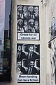 Greed for oil.jpg 3,648 × 5,472; 7.31 MB
-
 Harem, Shoreditch, E1.jpg 519 × 1,280; 217 KB

.jpg)


.jpg)
.jpg)


.jpg)
.jpg)
.jpg)
.jpg)

.jpg)


.jpg)


.jpg)


.jpg)
.jpg)
.jpg)
.jpg)
.jpg)


.jpg)


.jpg)
.jpg)


.jpg)


.jpg)
.jpg)

.jpg)
.jpg)


.jpg)


.jpg)

.jpg)

.jpg)

.jpg)
.jpg)


.jpg)
.jpg)
.jpg)
.jpg)
.jpg)


.jpg)
.jpg)
.jpg)


.jpg)


.jpg)

.jpg)
.jpg)

.jpg)


.jpg)

.jpg)

.jpg)


.jpg)


.jpg)
.jpg)
.jpg)
.jpg)
.jpg)
.jpg)
.jpg)
.jpg)
.jpg)
.jpg)
.jpg)
.jpg)
.jpg)
.jpg)
.jpg)
.jpg)
.jpg)
.jpg)
.jpg)
.jpg)
.jpg)
.jpg)
.jpg)
.jpg)
.jpg)
.jpg)
.jpg)
.jpg)
.jpg)
.jpg)
.jpg)
.jpg)
.jpg)
.jpg)

.jpg)