Category:Bridges at Chieveley
Media in category "Bridges at Chieveley"
The following 24 files are in this category, out of 24 total.
-
 A34 - M4 junction - geograph.org.uk - 2295882.jpg 640 × 430; 38 KB
-

-
 A34 farm-bridge east of Fir Tree Farm - geograph.org.uk - 2905808.jpg 3,648 × 2,736; 1.52 MB
-
 A34 near Down Farm - geograph.org.uk - 2595210.jpg 640 × 390; 43 KB
-
 A34 northbound - geograph.org.uk - 3338487.jpg 640 × 480; 39 KB
-
 A34 northbound - geograph.org.uk - 3341268.jpg 640 × 480; 46 KB
-
 A34 northbound - geograph.org.uk - 3341270.jpg 640 × 480; 46 KB
-
 A34 passing under the M4 - geograph.org.uk - 2595204.jpg 640 × 373; 36 KB
-
 Bridge over M4 at Oare 01.jpg 4,128 × 3,096; 7.4 MB
-
 Bridge over M4 at Oare 02.jpg 4,128 × 3,096; 3.76 MB
-
 Bridge over M4 at Oare 03.jpg 4,128 × 3,096; 3.23 MB
-
 Bussock Wood Bridge - geograph.org.uk - 597510.jpg 640 × 477; 98 KB
-
 Bussock Wood bridge - geograph.org.uk - 597519.jpg 640 × 477; 85 KB
-
 Curridge Road - geograph.org.uk - 2158347.jpg 640 × 480; 57 KB
-
 M4 sliproad - geograph.org.uk - 1101337.jpg 640 × 480; 35 KB
-
 Northbound A34, Chieveley - geograph.org.uk - 3292033.jpg 640 × 480; 407 KB
-
 Northbound A34, Graces Lane Bridge - geograph.org.uk - 3292043.jpg 640 × 480; 417 KB
-
 Oareborough Lane bridge, M4 - geograph.org.uk - 2296564.jpg 640 × 327; 27 KB
-
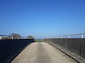
 Public right of way goes over the A34 - geograph.org.uk - 4654178.jpg 1,600 × 1,200; 638 KB
-
 The A34 - geograph.org.uk - 1079121.jpg 640 × 426; 43 KB
-
 The A34 northbound goes under the M4 - geograph.org.uk - 4649959.jpg 1,600 × 1,167; 533 KB
-
 The A34 runs under a slip road to the M4 - geograph.org.uk - 4536257.jpg 1,500 × 999; 101 KB
-
 Three bridges - geograph.org.uk - 1101345.jpg 640 × 480; 35 KB
-
 Under the bridge - geograph.org.uk - 1213033.jpg 640 × 426; 39 KB


