Category:Bridges in County Monaghan
Subcategories
This category has the following 2 subcategories, out of 2 total.
C
- Carragunt Bridge (4 F)
F
- Frankford Bridge (1 F)
Media in category "Bridges in County Monaghan"
The following 53 files are in this category, out of 53 total.
-

-
 Advisory Offices, Monaghan - geograph.org.uk - 2695851.jpg 640 × 480; 66 KB
-
 Aghabog Church of Ireland - geograph.org.uk - 2960230.jpg 640 × 480; 70 KB
-
 Aghabog Early Years Play School - geograph.org.uk - 3087123.jpg 640 × 480; 38 KB
-
 Anaglaive National School, Carga - geograph.org.uk - 3202378.jpg 640 × 480; 68 KB
-
 Annaghraw Bridge (geograph 2047867).jpg 640 × 480; 59 KB
-
 Annalitten National School - geograph.org.uk - 3202276.jpg 640 × 480; 49 KB
-
 Ardaghey Community Centre - geograph.org.uk - 3116643.jpg 640 × 481; 37 KB
-
 Ardaghey Forge - geograph.org.uk - 3116645.jpg 640 × 480; 72 KB
-
 Aughnamullen Orange Hall - geograph.org.uk - 3150749.jpg 640 × 480; 54 KB
-
 Barn Latton - geograph.org.uk - 3151152.jpg 640 × 480; 56 KB
-
 Barn, Aghnamullen - geograph.org.uk - 3150722.jpg 640 × 480; 77 KB
-
 Barn, Drumully - geograph.org.uk - 2007334.jpg 640 × 480; 49 KB
-
 Beattie's Takeaway, Scotshouse - geograph.org.uk - 3042531.jpg 640 × 480; 45 KB
-
-
 Bridge over Ulster Canal, Tyholland - geograph.org.uk - 673307.jpg 640 × 479; 85 KB
-
 Carrickatee RC Church, Annahaia - geograph.org.uk - 3173767.jpg 640 × 480; 37 KB
-

-
 Church at Creevagh - geograph.org.uk - 3013195.jpg 640 × 480; 50 KB
-
 Church at Urcher - geograph.org.uk - 3104718.jpg 640 × 480; 95 KB
-

-

-
 Connolly's, Doohamlet - geograph.org.uk - 3012255.jpg 640 × 480; 44 KB
-
 Connolly's, Scotshouse - geograph.org.uk - 2047627.jpg 640 × 480; 46 KB
-
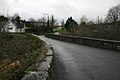
 Coolshannagh Road, Monaghan - geograph.org.uk - 2695845.jpg 640 × 480; 45 KB
-
 Coragarry Free Presbyterian Church - geograph.org.uk - 2960401.jpg 640 × 480; 56 KB
-
 Corlat Old School - geograph.org.uk - 3178293.jpg 1,024 × 682; 115 KB
-
 Corlea Presbyterian Church - geograph.org.uk - 3150988.jpg 640 × 480; 71 KB
-

-
 Corragilta National School, Shee - geograph.org.uk - 3071289.jpg 640 × 480; 49 KB
-
 Cottage, Derrnahesco - geograph.org.uk - 1993356.jpg 640 × 480; 58 KB
-
 Cross roads on the R181 at Tullynamaira - geograph.org.uk - 3060088.jpg 1,024 × 536; 90 KB
-
 Crossduff CoI Parish Church, Co Monaghan - geograph.org.uk - 3060017.jpg 913 × 1,024; 282 KB
-
 Derelict house, Killymarley - geograph.org.uk - 3116632.jpg 640 × 480; 71 KB
-
 Derryvally Presbyterian Church - geograph.org.uk - 3150670.jpg 640 × 480; 68 KB
-
 Dinkins Coffee Shop, Ballybay - geograph.org.uk - 3012920.jpg 640 × 480; 49 KB
-

-

-
 Drummuck National School (side view) - geograph.org.uk - 3181267.jpg 640 × 480; 62 KB
-

-
 Empty building, Scotshouse - geograph.org.uk - 3042580.jpg 640 × 480; 58 KB
-
 Empty house, Scotshouse - geograph.org.uk - 3042539.jpg 640 × 480; 48 KB
-
 Erryroe Gospel Hall - geograph.org.uk - 3192317.jpg 640 × 480; 42 KB
-
 Farmoyle School, Mountain Lodge Demesne - geograph.org.uk - 3214335.jpg 4,000 × 3,000; 4.73 MB
-
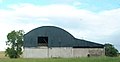 Field Barn at Aghareagh - geograph.org.uk - 3172832.jpg 1,024 × 525; 64 KB
-
 Former school, Annahaia - geograph.org.uk - 3173768.jpg 640 × 480; 46 KB
-
 Former school, Lough Morne - geograph.org.uk - 3180853.jpg 640 × 480; 77 KB
-
 Frankford Presbyterian Church - geograph.org.uk - 3192688.jpg 640 × 480; 67 KB
-
 Gatehouse at Lady Rose Estate - geograph.org.uk - 3071518.jpg 640 × 480; 68 KB
-
 Gatehouse, Lady Rose Estate - geograph.org.uk - 3071489.jpg 640 × 480; 86 KB
-
-
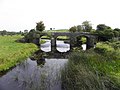
 Ravallea Bridge, Aughnacloy - geograph.org.uk - 168122.jpg 640 × 479; 119 KB
-
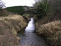
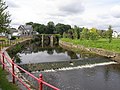 River Blackwater at Ballanode - geograph.org.uk - 537379.jpg 640 × 480; 106 KB


.jpg)


_-_geograph.org.uk_-_3071349.jpg)


_at_Annadrumman,_Co._Monaghan_-_geograph.org.uk_-_2540804.jpg)

_-_geograph.org.uk_-_3181267.jpg)


