Category:Bridgetown, Somerset
English: Bridgetown is a village of the Exton civil parish, found south-west of Dunster in Somerset, England. It lies on the River Exe on Exmoor. The village of Bridgetown covers 2,017 ha, all of which is within the National Park.
hamlet in Somerset, United Kingdom | |||||
| Upload media | |||||
| Instance of | |||||
|---|---|---|---|---|---|
| Location | Exton, Somerset West and Taunton, Somerset, South West England, England | ||||
| Different from | |||||
 | |||||
Media in category "Bridgetown, Somerset"
The following 37 files are in this category, out of 37 total.
-

-
 Badgers Holt, Bridgetown - geograph.org.uk - 3335082.jpg 1,024 × 768; 139 KB
-
 Badgers Holt, Bridgetown - geograph.org.uk - 3411889.jpg 1,024 × 636; 157 KB
-
 Bridgetown , Badgers Holt - geograph.org.uk - 4032482.jpg 4,288 × 2,848; 6.91 MB
-
 Bridgetown , Exe Valley Caravan ^ Camping - geograph.org.uk - 4032500.jpg 4,288 × 2,848; 6.23 MB
-
 Bridgetown , Grassy Field - geograph.org.uk - 4032474.jpg 4,288 × 2,848; 6.32 MB
-
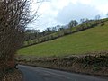
 Bridgetown , The A396 - geograph.org.uk - 3708145.jpg 4,288 × 2,848; 6.78 MB
-
 Bridgetown , The A396 - geograph.org.uk - 3708149.jpg 4,288 × 2,848; 5.2 MB
-
 Bridgetown , The A396 - geograph.org.uk - 4031831.jpg 4,288 × 2,848; 6.3 MB
-
 Bridgetown , The A396 - geograph.org.uk - 4032490.jpg 4,288 × 2,848; 6.28 MB
-
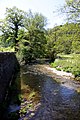
 Bridgetown , The River Exe - geograph.org.uk - 4032496.jpg 4,288 × 2,848; 6.35 MB
-
 Bridgetown , The River Exe - geograph.org.uk - 4032505.jpg 4,288 × 2,848; 6.37 MB
-
 Bridgetown , Week Lane - geograph.org.uk - 4032513.jpg 4,288 × 2,848; 6.3 MB
-
 Bridgetown Cricket Club Pavilion - geograph.org.uk - 679026.jpg 640 × 480; 94 KB
-
 Bridgetown over the fields, Somerset - geograph.org.uk - 3407209.jpg 640 × 380; 49 KB
-
 Bridgetown, Mill tail - geograph.org.uk - 685200.jpg 640 × 480; 138 KB
-
 Chilly Bridge Cottage - geograph.org.uk - 1765233.jpg 1,600 × 1,187; 411 KB
-
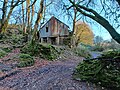
 Derelict barn above Redcleeve Plantation, Exmoor 01.jpg 4,000 × 3,000; 6.16 MB
-
 Derelict barn above Redcleeve Plantation, Exmoor 02.jpg 4,000 × 3,000; 6.01 MB
-
 Derelict barn above Redcleeve Plantation, Exmoor 03.jpg 4,000 × 3,000; 5.71 MB
-
 Derelict barn above Redcleeve Plantation, Exmoor 04.jpg 4,000 × 3,000; 5.15 MB
-
 Derelict barn above Redcleeve Plantation, Exmoor 05.jpg 4,000 × 3,000; 3.93 MB
-
 Exton - Bridgetown Mill - geograph.org.uk - 71109.jpg 640 × 413; 127 KB
-
 Exton, Bridgetown - geograph.org.uk - 316341.jpg 640 × 427; 256 KB
-
 Exton, Bridgetown - geograph.org.uk - 316347.jpg 640 × 427; 176 KB
-
 Hedge-laying by A396 north of Bridgetown - geograph.org.uk - 3335105.jpg 1,024 × 768; 150 KB
-

-
 Narrow lane, approaching Bridgetown. - geograph.org.uk - 3608272.jpg 4,320 × 3,240; 3.03 MB
-
 River Exe, Bridgetown - geograph.org.uk - 3874235.jpg 1,024 × 799; 261 KB
-
 Stream-side cottage, Bridgetown - geograph.org.uk - 3874225.jpg 1,024 × 768; 204 KB
-
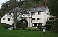
 The Badgers Holt in Bridgetown - geograph.org.uk - 3541981.jpg 1,500 × 969; 250 KB
-
 The River Exe at Bridgetown - geograph.org.uk - 3542007.jpg 1,000 × 1,500; 271 KB
-
 The River Exe at Bridgetown - geograph.org.uk - 3543297.jpg 1,000 × 1,500; 282 KB
-
 West Somerset , Bridgetown Scenery - geograph.org.uk - 4038898.jpg 4,288 × 2,848; 5.93 MB
-
 Wild garlic near Bridgetown - geograph.org.uk - 3541991.jpg 1,500 × 1,046; 123 KB
-

-
 Winsford, on South Hill - geograph.org.uk - 309450.jpg 640 × 427; 207 KB


