Category:Brink 21-22 (Norg)
| Object location | | View all coordinates using: OpenStreetMap |
|---|
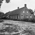
farmhouse in Noordenveld, Netherlands  | |||||
| Upload media | |||||
| Instance of | |||||
|---|---|---|---|---|---|
| Location | Norg, Drenthe, Netherlands | ||||
| Street address |
| ||||
| Located on street |
| ||||
| Heritage designation |
| ||||
 | |||||
Nederlands: Brink 21-22, vm. jachtweide, Norg
|
This is a category about rijksmonument number 30786
|
| Address |
|
Media in category "Brink 21-22 (Norg)"
The following 22 files are in this category, out of 22 total.
-
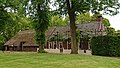 Boerderij aan de Brink te Norg.jpg 5,333 × 3,000; 3.69 MB
-
 Gevel met muuranker nr. F 227-14 - Norg - 20454300 - RCE.jpg 611 × 891; 87 KB
-
 Interieur woonkamer nr. F 468-07 - Norg - 20454289 - RCE.jpg 1,200 × 900; 147 KB
-
 Interieur woonkamer nr. F 468-08 - Norg - 20454288 - RCE.jpg 1,200 × 900; 142 KB
-
 Interieur woonkamer nr. F 468-10 - Norg - 20454296 - RCE.jpg 1,200 × 900; 151 KB
-
 Interieur woonkamer nr. F 468-11 - Norg - 20454282 - RCE.jpg 1,200 × 900; 149 KB
-
 Interieur woonkamer nr. F 468-12 - Norg - 20454284 - RCE.jpg 1,200 × 900; 142 KB
-
 Interieur woonkamer nr. F 468-13 - Norg - 20454285 - RCE.jpg 1,200 × 900; 152 KB
-
 Interieur woonkamer nr. F 468-14 - Norg - 20454286 - RCE.jpg 1,200 × 900; 137 KB
-
 Interieur woonkamer schouw met kachel nr. F 468-09 - Norg - 20454283 - RCE.jpg 1,200 × 900; 139 KB
-
 Jachtweide - Norg - 20170049 - RCE.jpg 1,193 × 1,200; 401 KB
-
 Schouw met kachel nr. F 468-15 - Norg - 20454287 - RCE.jpg 1,200 × 900; 86 KB
-
 Stalraam zijgevel nr. 142-17 - Norg - 20454293 - RCE.jpg 1,200 × 900; 86 KB
-
 Topgevel met muuranker '1816' nr. 142-15 - Norg - 20454297 - RCE.jpg 1,200 × 900; 79 KB
-
 Topgevel met muuranker nr. F 227-13 - Norg - 20454292 - RCE.jpg 1,200 × 900; 89 KB
-
 Voorgevel nr. F 227-12 - Norg - 20454281 - RCE.jpg 1,200 × 900; 95 KB
-
 Zij- en voorgevel nr. 142-14 - Norg - 20454291 - RCE.jpg 1,200 × 900; 115 KB
-
 Zij- en voorgevel nr. 166-22 - Norg - 20454295 - RCE.jpg 1,200 × 900; 137 KB
-
 Zij- en voorgevel nr. F 227-11 - Norg - 20454294 - RCE.jpg 1,200 × 900; 123 KB
-
 Zijgevel nr. 142-16 - Norg - 20454298 - RCE.jpg 1,200 × 900; 142 KB
-
 Zijgevel nr. 142-18 - Norg - 20454299 - RCE.jpg 1,200 × 900; 145 KB
-
 Zijgevels boer met varken - Norg - 20454290 - RCE.jpg 1,200 × 900; 125 KB


