Category:Brixton Deverill
village and civil parish in the United Kingdom  | |||||
| Upload media | |||||
| Instance of | |||||
|---|---|---|---|---|---|
| Location | Wiltshire, South West England, England | ||||
| official website | |||||
 | |||||
Subcategories
This category has only the following subcategory.
Media in category "Brixton Deverill"
The following 102 files are in this category, out of 102 total.
-
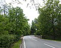
 2012 , B3095 heading north leaving Brixton Deverill - geograph.org.uk - 2891385.jpg 3,549 × 2,541; 2.48 MB
-
 2012 , The first and last house in Brixton Deverill - geograph.org.uk - 2868556.jpg 3,995 × 2,882; 4.79 MB
-
 A350 heading north over Rook Hill - geograph.org.uk - 1515702.jpg 640 × 486; 124 KB
-
 A350 on a misty November morning - geograph.org.uk - 1062017.jpg 640 × 480; 41 KB
-

-

-
 Barn at Woodcombe Farm - geograph.org.uk - 1522758.jpg 640 × 512; 186 KB
-
 Barn, Summerslade Down - geograph.org.uk - 1401637.jpg 640 × 480; 115 KB
-
 Bridge over River Wylye, Brixton Deverill - geograph.org.uk - 5447176.jpg 1,600 × 1,281; 899 KB
-
 Bridge over the River Wyelye - geograph.org.uk - 3389992.jpg 4,320 × 3,240; 6.64 MB
-
 Brixton Deverill from the north - geograph.org.uk - 3417716.jpg 640 × 425; 48 KB
-
 Brixton Deverill village from the north (geograph 3417723).jpg 640 × 464; 87 KB
-
 Brixton Deverill.JPG 2,272 × 1,704; 1.77 MB
-
 Crow - geograph.org.uk - 424140.jpg 640 × 480; 156 KB
-
 Down the track from Brims Down - geograph.org.uk - 1515206.jpg 640 × 479; 183 KB
-
 From Rook Hill on the downs - geograph.org.uk - 1537605.jpg 640 × 522; 206 KB
-

-
 House and lane near Woodcombe Farm - geograph.org.uk - 1522170.jpg 640 × 504; 152 KB
-
 House with brick and stone wall, Brixton Deverill - geograph.org.uk - 5447183.jpg 1,600 × 1,202; 718 KB
-

-

-
-

-

-

-

-
 Lower Pertwood - geograph.org.uk - 1992182.jpg 640 × 480; 66 KB
-
 Lower Pertwood - geograph.org.uk - 1992203.jpg 640 × 527; 63 KB
-
 Lower Pertwood - geograph.org.uk - 1996851.jpg 640 × 388; 50 KB
-
 North from the A350 near Higher Pertwood - geograph.org.uk - 1537537.jpg 640 × 498; 144 KB
-
 November mist on Pertwood Down - geograph.org.uk - 1062015.jpg 640 × 480; 55 KB
-
 Old Barn House in Brixton Deverill - geograph.org.uk - 3417730.jpg 640 × 435; 78 KB
-
 Ordnance Survey Flush Bracket G3790 - geograph.org.uk - 5343776.jpg 4,000 × 3,000; 4.6 MB
-
 Path up Whitecliff Down seen from Upper Deverill - geograph.org.uk - 3390875.jpg 4,320 × 3,240; 5.72 MB
-
 Pertwood Down Long Barrow - geograph.org.uk - 2436477.jpg 1,288 × 966; 1.38 MB
-
 Pertwood Down Long Barrow - geograph.org.uk - 2438250.jpg 1,288 × 966; 609 KB
-
 Pertwood, postbox № SP3 410 - geograph.org.uk - 4058862.jpg 640 × 480; 144 KB
-
 Recent ploughing east of the A350 - geograph.org.uk - 1537522.jpg 640 × 532; 150 KB
-

-

-
 River Wylye near Whitecliff Farm - geograph.org.uk - 261092.jpg 640 × 480; 103 KB
-
 Road at Laurel House heading west - geograph.org.uk - 3417737.jpg 640 × 387; 53 KB
-
 Round bales near A350 - geograph.org.uk - 1401780.jpg 640 × 480; 126 KB
-
 Sheep meadow south of Brixton Deverill - geograph.org.uk - 1515208.jpg 640 × 503; 144 KB
-

-
-

-

-

-

-

-

-

-

-

-

-

-

-
-

-

-

-

-
 Telephone box, Brixton Deverill - geograph.org.uk - 2244313.jpg 640 × 480; 86 KB
-
 Thatched cottage at Brixton Deverill - geograph.org.uk - 54246.jpg 640 × 480; 89 KB
-
 Thatched house in Brixton Deverill - geograph.org.uk - 5447173.jpg 1,600 × 1,068; 754 KB
-
 The River Wylye at Brixton Deverill - geograph.org.uk - 423913.jpg 640 × 480; 191 KB
-
 The way up to Brims Down - geograph.org.uk - 1521110.jpg 640 × 519; 136 KB
-
 Track on Brims Down - geograph.org.uk - 1522669.jpg 640 × 513; 181 KB
-
 Track on the side of Brims Down - geograph.org.uk - 1522331.jpg 640 × 462; 125 KB
-
 Track, Summerslade Down - geograph.org.uk - 1401661.jpg 640 × 480; 134 KB
-
 Trees on the north side of Brixton Deverill - geograph.org.uk - 5447168.jpg 1,600 × 1,201; 733 KB
-
 Triangulation Pillar, Summerslade Down - geograph.org.uk - 1401695.jpg 640 × 480; 122 KB
-
 View at Cold Kitchen Triangulation Pillar - geograph.org.uk - 5343790.jpg 4,000 × 3,000; 2.75 MB
-
 Water trough, Summerslade Down - geograph.org.uk - 1401651.jpg 640 × 481; 161 KB
-
 Woodcombe Farm and Brixton Deverill - geograph.org.uk - 1522699.jpg 640 × 505; 161 KB
-
 Woodcombe Farm and Brixton Deverill -2 - geograph.org.uk - 1522798.jpg 640 × 475; 111 KB
-
 All is safely gathered in... - geograph.org.uk - 269648.jpg 640 × 480; 164 KB
-
 Arable land, Pertwood Down - geograph.org.uk - 1167823.jpg 640 × 480; 204 KB
-
 Barn at Marriages Farm - geograph.org.uk - 269647.jpg 640 × 480; 151 KB
-
 Barn, Summerslade Down - geograph.org.uk - 538664.jpg 640 × 480; 134 KB
-
 Bridleway crossing - geograph.org.uk - 330654.jpg 640 × 480; 26 KB
-
 Bridleway to Rye Hill Farm - geograph.org.uk - 330649.jpg 640 × 480; 58 KB
-
 Bridleway, Pertwood Down - geograph.org.uk - 1401721.jpg 640 × 480; 159 KB
-
 Bridleway, Summerslade Down - geograph.org.uk - 1401614.jpg 640 × 480; 126 KB
-
 Bridleway, Summerslade Down - geograph.org.uk - 1401641.jpg 640 × 480; 147 KB
-
 Bridleway, Summerslade Down - geograph.org.uk - 1401679.jpg 640 × 482; 157 KB
-
 Bridleway, Summerslade Down - geograph.org.uk - 1401705.jpg 640 × 481; 94 KB
-
 Downland track above Brixton Deverill - geograph.org.uk - 534365.jpg 640 × 480; 165 KB
-
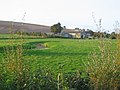
 Farmland, Brixton Deverill - geograph.org.uk - 535782.jpg 640 × 480; 106 KB
-
 Farmland, Pertwood - geograph.org.uk - 539197.jpg 640 × 480; 144 KB
-
 Fir Clump on Brims Down - geograph.org.uk - 456424.jpg 640 × 480; 115 KB
-
 Footpath, Summerslade Down - geograph.org.uk - 1401632.jpg 640 × 481; 146 KB
-
 Hay bales - geograph.org.uk - 539202.jpg 640 × 480; 158 KB
-
 Little Down - geograph.org.uk - 538671.jpg 640 × 480; 141 KB
-
 Pertwood Down - geograph.org.uk - 199394.jpg 640 × 480; 86 KB
-
 Pertwood Down - geograph.org.uk - 534357.jpg 640 × 480; 138 KB
-
 Pertwood Down - geograph.org.uk - 539203.jpg 640 × 480; 134 KB
-
 Pertwood Down - geograph.org.uk - 539204.jpg 640 × 480; 168 KB
-
 The A350 at Pertwood Down - geograph.org.uk - 199398.jpg 640 × 480; 77 KB
-
 Trees - geograph.org.uk - 456503.jpg 640 × 480; 115 KB
-
 Wiltshire downland - geograph.org.uk - 199390.jpg 640 × 480; 93 KB


.jpg)


_-_geograph.org.uk_-_5094980.jpg)
_-_geograph.org.uk_-_5094982.jpg)
_-_geograph.org.uk_-_5094983.jpg)
_-_geograph.org.uk_-_5094985.jpg)
_-_geograph.org.uk_-_5094986.jpg)
_-_geograph.org.uk_-_5094987.jpg)
_-_geograph.org.uk_-_5094989.jpg)


_-_geograph.org.uk_-_5094929.jpg)
_-_geograph.org.uk_-_5094970.jpg)
_-_geograph.org.uk_-_5094972.jpg)
_-_geograph.org.uk_-_5094974.jpg)
_-_geograph.org.uk_-_5094976.jpg)
_-_geograph.org.uk_-_5094977.jpg)
_-_geograph.org.uk_-_5094978.jpg)


_-_geograph.org.uk_-_5094992.jpg)
_-_geograph.org.uk_-_5094995.jpg)
_-_geograph.org.uk_-_5094997.jpg)
_-_geograph.org.uk_-_5094998.jpg)
_-_geograph.org.uk_-_5094999.jpg)


