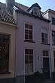
Category:Broederenkerkhof 7, Zutphen
| Object location | | View all coordinates using: OpenStreetMap |
|---|
building in Zutphen, Netherlands  | |||||
| Upload media | |||||
| Instance of | |||||
|---|---|---|---|---|---|
| Location | Zutphen, Gelderland, Netherlands | ||||
| Street address |
| ||||
| Located on street |
| ||||
| Heritage designation |
| ||||
 | |||||
|
This is a category about rijksmonument number 41175
|
| Address |
|
Media in category "Broederenkerkhof 7, Zutphen"
The following 2 files are in this category, out of 2 total.
-
 Zutphen Broederenkerkhof 7.jpg 1,728 × 2,592; 1.07 MB
-
 Zutphen, Netherlands - panoramio (29).jpg 2,048 × 1,375; 328 KB
.jpg)