Category:Broekzijder Molen, Abcoude
| Object location | | View all coordinates using: OpenStreetMap |
|---|
windmill in Abcoude, Netherlands  | |||||
| Upload media | |||||
| Instance of |
| ||||
|---|---|---|---|---|---|
| Location | Abcoude, Utrecht, Netherlands | ||||
| Street address |
| ||||
| Located on street |
| ||||
| Has use |
| ||||
| Heritage designation |
| ||||
| Inception |
| ||||
| Source of energy | |||||
 | |||||
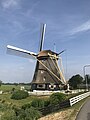
Nederlands: De Broekzijder Molen (ook: Broekzijdse Molen) is een Nederlandse windmolen uit 1641 aan het riviertje het Gein, die werd gebruikt als poldermolen.
|
This is a category about rijksmonument number 6958
|
| Address |
|
Media in category "Broekzijder Molen, Abcoude"
The following 43 files are in this category, out of 43 total.
-
 01 Wind Mill 1986 detail.jpg 2,240 × 3,600; 8.75 MB
-
 01 Wind Mill 1986 detail green.jpg 2,240 × 3,600; 9.04 MB
-
 Aan de voet van achtkante grondzeiler - AMR Molenfoto - 20541687 - RCE.jpg 1,200 × 900; 275 KB
-
 Abcoude - Broekzijdse Molen tegenlicht.jpg 1,000 × 1,500; 824 KB
-
 Abcoude Gein Noord Broekzijdse Molen 2.jpg 3,648 × 2,736; 4.39 MB
-
 Abcoude Gein Noord Broekzijdse Molen.jpg 2,499 × 2,984; 2.95 MB
-

-

-

-

-

-

-

-

-
 Achtkante rietgedekte poldermolen in landschap - Abcoude - 20004373 - RCE.jpg 771 × 1,200; 166 KB
-
 Broekzijder Molen Abcoude 01.jpg 3,024 × 4,032; 2.46 MB
-
 Broekzijder Molen Abcoude 02.jpg 3,024 × 4,032; 4.1 MB
-
 Broekzijder Molen Abcoude 03.jpg 2,812 × 3,750; 1.63 MB
-
 Broekzijder Molen Abcoude informatiebord 01.jpg 3,488 × 2,495; 1.39 MB
-
 Broekzijder molen Abcoude OKT 2023 01.jpg 4,032 × 3,024; 3.3 MB
-
 Broekzijder molen Abcoude OKT 2023 02.jpg 4,032 × 3,024; 2.96 MB
-
 Broekzijder molen Abcoude OKT 2023 03.jpg 4,032 × 3,024; 4.1 MB
-
 Broekzijder molen Abcoude OKT 2023 04.jpg 4,032 × 3,024; 2.68 MB
-
 Broekzijdse molen - Abcoude - panoramio.jpg 2,000 × 3,008; 1.15 MB
-
 Bruggetje bij achtkante grondzeiler - AMR Molenfoto - 20541682 - RCE.jpg 1,200 × 900; 273 KB
-

-

-
 De Broekzijdse Molen aan het riviertje het Gein bij Acoude.jpg 1,191 × 794; 323 KB
-

-
 Interieur van achtkante grondzeiler - AMR Molenfoto - 20541689 - RCE.jpg 1,200 × 900; 209 KB
-
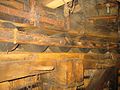 Interieur van achtkante grondzeiler - AMR Molenfoto - 20541690 - RCE.jpg 1,200 × 900; 226 KB
-
 Interieur van achtkante grondzeiler - AMR Molenfoto - 20541691 - RCE.jpg 1,200 × 900; 186 KB
-
 Interieur van achtkante grondzeiler - AMR Molenfoto - 20541692 - RCE.jpg 1,200 × 900; 222 KB
-
 Mondriaan Molen aan t Gein.jpg 1,024 × 763; 297 KB
-
 Overzicht - Abcoude - 20363280 - RCE.jpg 1,200 × 1,198; 206 KB
-
 Overzicht - Abcoude - 20363310 - RCE.jpg 1,200 × 1,200; 267 KB
-
 Overzicht achtkante rietgedekte poldermolen - Abcoude - 20004374 - RCE.jpg 771 × 1,200; 144 KB
-
 Overzicht achtkante rietgedekte poldermolen - Abcoude - 20004375 - RCE.jpg 766 × 1,200; 153 KB
-
 Overzicht achtkante rietgedekte poldermolen - Abcoude - 20004377 - RCE.jpg 1,186 × 1,200; 273 KB
-

-

-

-
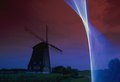 Wind light painting, double exposure, Windmill.tif 2,869 × 1,964; 7.38 MB


