Category:Broome, Norfolk
English: Broome is a village and civil parish in the English county of Norfolk. It is situated on the north bank of the River Waveney, which forms the border with Suffolk, some 2 km north of the town of Bungay and 20 km south-east of the city of Norwich.
village in Norfolk, England | |||||
| Upload media | |||||
| Instance of | |||||
|---|---|---|---|---|---|
| Location | South Norfolk, Norfolk, East of England, England | ||||
| Area |
| ||||
 | |||||
Subcategories
This category has the following 7 subcategories, out of 7 total.
Media in category "Broome, Norfolk"
The following 200 files are in this category, out of 219 total.
(previous page) (next page)-
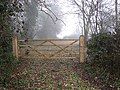
 A gate in the fog - geograph.org.uk - 2213313.jpg 640 × 480; 111 KB
-
 A private road south of Oaklands Farm - geograph.org.uk - 2213269.jpg 640 × 480; 130 KB
-
 A143 Yarmouth Road, Ditchingham - geograph.org.uk - 3764616.jpg 3,072 × 2,304; 1.78 MB
-
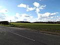
 A143, Broome Bypass - geograph.org.uk - 2662944.jpg 1,024 × 768; 731 KB
-

-

-

-
 Arable land east of Broome House Farm - geograph.org.uk - 983295.jpg 640 × 477; 96 KB
-
 Arable land west of Redhouse Farm - geograph.org.uk - 983302.jpg 640 × 477; 86 KB
-
 Bare trees beside Lug's Lane - geograph.org.uk - 2213320.jpg 640 × 480; 138 KB
-
 Bare trees in the mist - geograph.org.uk - 2213326.jpg 640 × 480; 128 KB
-
 Barn conversion at Oaklands Farm - geograph.org.uk - 2213264.jpg 640 × 480; 98 KB
-
 Barn near Broome church - geograph.org.uk - 983316.jpg 640 × 477; 82 KB
-
 Bench behind Broome Village Hall - geograph.org.uk - 2665813.jpg 1,024 × 768; 575 KB
-
 Big shed at Red House Farm - geograph.org.uk - 2213302.jpg 640 × 480; 84 KB
-
 Bridge over Broome Beck - geograph.org.uk - 5516095.jpg 3,648 × 2,736; 4.18 MB
-
 Bridleway from Manor Farm - geograph.org.uk - 983334.jpg 640 × 477; 82 KB
-
 Bridleway past Manor Farm, Ellingham - geograph.org.uk - 2213552.jpg 640 × 480; 126 KB
-
 Broome Beck - geograph.org.uk - 3895796.jpg 2,304 × 3,072; 1.92 MB
-
 Broome Beck ^ Longford Bridge - geograph.org.uk - 3895235.jpg 3,072 × 2,304; 2.93 MB
-
 Broome Beck ^ Longford Bridge - geograph.org.uk - 3895954.jpg 3,072 × 2,304; 2.34 MB
-
 Broome Pits sign - geograph.org.uk - 3632248.jpg 3,072 × 2,304; 1.37 MB
-
 Broome Village Hall - geograph.org.uk - 3632176.jpg 3,072 × 2,304; 1.4 MB
-
 Broome Village Hall ^ Village Notice Boards - geograph.org.uk - 3632232.jpg 3,072 × 2,304; 1.3 MB
-
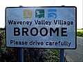
 Broome Village Name sign - geograph.org.uk - 3764303.jpg 3,072 × 2,304; 1.8 MB
-
 Broome Village Name sign on Yarmouth Road - geograph.org.uk - 3895829.jpg 2,304 × 3,072; 1.57 MB
-
 Broome Village Name sign on Yarmouth Road - geograph.org.uk - 3895950.jpg 3,029 × 2,276; 1.19 MB
-
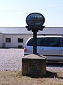 Broome Village sign - geograph.org.uk - 3632108.jpg 2,304 × 3,072; 1.29 MB
-
 Broome Village sign - geograph.org.uk - 3632109.jpg 3,072 × 2,304; 1.12 MB
-
 Bungay Road, Broome - geograph.org.uk - 1912645.jpg 2,304 × 3,072; 2.81 MB
-

-
 Bus Shelter ^ Broome Village Hall - geograph.org.uk - 3632230.jpg 3,072 × 2,304; 1.29 MB
-
 Church Lane sign - geograph.org.uk - 3885721.jpg 3,028 × 2,269; 1.8 MB
-
 Church Lane, Broome Street - geograph.org.uk - 3885701.jpg 3,072 × 2,304; 1.95 MB
-
 Church Lane, Broome Street - geograph.org.uk - 3885727.jpg 2,890 × 2,166; 1.58 MB
-
 Church Road Broome in the fog - geograph.org.uk - 2213190.jpg 640 × 480; 128 KB
-
 Copse east of Lug's Lane - geograph.org.uk - 2213323.jpg 640 × 480; 124 KB
-
 Crisp Maltings - geograph.org.uk - 3636025.jpg 3,072 × 2,304; 1.52 MB
-
 Crisp Maltings sign - geograph.org.uk - 3636035.jpg 3,072 × 2,304; 1.36 MB
-
 Crop field west of Ingloss Lane - geograph.org.uk - 5244688.jpg 640 × 360; 298 KB
-
 Dead Tree near Broome Pits - geograph.org.uk - 5516097.jpg 3,648 × 2,255; 2.6 MB
-
 Ditchingham and Bungay Bypass - geograph.org.uk - 1525450.jpg 640 × 480; 147 KB
-
 Driveway to Broome Lodge - geograph.org.uk - 2213346.jpg 640 × 480; 112 KB
-

-
 Entering Broome on Yarmouth Road - geograph.org.uk - 3764300.jpg 3,072 × 2,304; 1.86 MB
-
 Entering Broome on Yarmouth Road - geograph.org.uk - 3895827.jpg 3,072 × 2,304; 1.24 MB
-
 Entrance of Broome Pits - geograph.org.uk - 3632250.jpg 3,072 × 2,304; 1.34 MB
-

-
 Entrance to Broome Pits - geograph.org.uk - 3632247.jpg 3,072 × 2,304; 1.44 MB
-
 Entrance to Broome Pits - geograph.org.uk - 3632249.jpg 3,072 × 2,304; 1.45 MB
-
 Entrance to Old Rectory. Broome - geograph.org.uk - 3073097.jpg 3,264 × 2,448; 2.5 MB
-

-
 Farm buildings, near Broome village - geograph.org.uk - 2665295.jpg 1,024 × 768; 1.07 MB
-
 Fields by Oaklands Farm - geograph.org.uk - 5244671.jpg 640 × 360; 259 KB
-
 First view of Broome church - geograph.org.uk - 983308.jpg 640 × 477; 81 KB
-
 Flooded Gravel Extraction workings - geograph.org.uk - 1714480.jpg 800 × 531; 150 KB
-
 Foot and bridlepath parallel with the A143 Broome bypass - geograph.org.uk - 3285743.jpg 3,264 × 2,448; 2.66 MB
-
 Footpath approaching the A143 - geograph.org.uk - 2665289.jpg 1,024 × 768; 1,007 KB
-
 Footpath near Ellingham - geograph.org.uk - 5306286.jpg 507 × 640; 203 KB
-
 Footpath parallel with the A143 Broome bypass - geograph.org.uk - 3285742.jpg 3,264 × 2,448; 2.8 MB
-
 Footpath through a field of sugar beet - geograph.org.uk - 3073100.jpg 3,264 × 2,448; 2.26 MB
-
 Footpath to Broome church - geograph.org.uk - 983330.jpg 640 × 456; 105 KB
-
 Footpath to Ingloss Lane - geograph.org.uk - 5244676.jpg 640 × 360; 311 KB
-
 Footpath to Loddon Road - geograph.org.uk - 3895835.jpg 3,072 × 2,304; 1.36 MB
-
 Footpath to Thwaite St Mary - geograph.org.uk - 4786934.jpg 640 × 360; 352 KB
-
 Ford at Longford Bridge - geograph.org.uk - 3189394.jpg 3,872 × 2,592; 2.38 MB
-
 Ford at Spink's Hill - geograph.org.uk - 3189403.jpg 3,872 × 2,592; 2.33 MB
-

-
 Frozen puddle beside Lug's Lane - geograph.org.uk - 2213295.jpg 640 × 480; 118 KB
-
 Gate into Grove Plantation - geograph.org.uk - 2213278.jpg 640 × 480; 173 KB
-
 Gate into unused field - geograph.org.uk - 1525405.jpg 640 × 480; 102 KB
-
 Gate that might as well be open - geograph.org.uk - 2213203.jpg 640 × 480; 91 KB
-
 Gateway beside the footpath to Broome village - geograph.org.uk - 2665292.jpg 1,024 × 768; 992 KB
-
 Gateway to the A143 - geograph.org.uk - 2665290.jpg 1,024 × 768; 1.03 MB
-
 Gone fishing, Broome Heath - geograph.org.uk - 5521061.jpg 427 × 640; 89 KB
-
 Hedge beside the path to Ingloss Lane - geograph.org.uk - 5244678.jpg 640 × 360; 320 KB
-
 Ingloss Lane past Grove Plantation - geograph.org.uk - 2213276.jpg 640 × 480; 140 KB
-
 Ingloss Lane, Broome - geograph.org.uk - 5726841.jpg 3,648 × 2,736; 3.37 MB
-
 Ivy Farm George V Postbox - geograph.org.uk - 3885175.jpg 2,196 × 2,928; 2.22 MB
-
 Ivy Farm George V Postbox - geograph.org.uk - 3885184.jpg 2,224 × 2,965; 1.99 MB
-
 Ivy Farm George V Postbox - geograph.org.uk - 3885193.jpg 2,304 × 3,072; 2.05 MB
-
 Ivy House Farm, Willow Lane, Broom Street - geograph.org.uk - 2936715.jpg 1,600 × 963; 282 KB
-
 Junction with Bungay to Loddon Road, Broome - geograph.org.uk - 1912634.jpg 3,072 × 2,304; 2.65 MB
-
 Lane to Rectory Road - geograph.org.uk - 1406543.jpg 480 × 640; 104 KB
-
 Large Lake - geograph.org.uk - 1714728.jpg 800 × 531; 130 KB
-
 Loading bay at The Grain Store - geograph.org.uk - 3636020.jpg 2,164 × 2,888; 1 MB
-
 Loddon Road Bridge over the River Broome - geograph.org.uk - 3886008.jpg 3,072 × 2,304; 2.04 MB
-
 Loddon Road sign - geograph.org.uk - 3586552.jpg 3,072 × 2,304; 1.63 MB
-
 Loddon Road sign - geograph.org.uk - 3885715.jpg 3,028 × 2,269; 1.77 MB
-
 Loddon Road sign - geograph.org.uk - 3886366.jpg 3,072 × 2,304; 1.82 MB
-
 Loddon Road ^ Ivy Farm George V Postbox - geograph.org.uk - 3885076.jpg 3,028 × 2,269; 1.33 MB
-
 Loddon Road, Broome Street - geograph.org.uk - 3885674.jpg 3,072 × 2,304; 1.78 MB
-
 Loddon Road, Broome Street - geograph.org.uk - 3885679.jpg 3,072 × 2,304; 1.56 MB
-
 Loddon Road, Ditchingham - geograph.org.uk - 3586151.jpg 3,072 × 2,304; 1.44 MB
-
 Loddon Road, Ditchingham - geograph.org.uk - 3631467.jpg 3,072 × 2,304; 1.43 MB
-
 Looking up Spink's Hill after the ford - geograph.org.uk - 3073080.jpg 2,448 × 3,264; 2.4 MB
-
 Lug's Lane north of Red House Farm - geograph.org.uk - 2213282.jpg 640 × 480; 155 KB
-
 Lug's Lane past Red House Farm - geograph.org.uk - 2213298.jpg 640 × 447; 93 KB
-
 Lug's Lane, parishes of Ellingham and Broome - geograph.org.uk - 1920093.jpg 3,072 × 2,304; 2.32 MB
-
 Maltings, Wainford - geograph.org.uk - 5306312.jpg 565 × 640; 213 KB
-
 Mini Valley - geograph.org.uk - 1426999.jpg 640 × 480; 70 KB
-
 No Wading - geograph.org.uk - 3636531.jpg 480 × 640; 306 KB
-

-
 Oaklands Cottage - geograph.org.uk - 2213272.jpg 640 × 450; 131 KB
-
 Oaklands Farm - geograph.org.uk - 5244686.jpg 640 × 360; 290 KB
-
 Oaklands Farmhouse - geograph.org.uk - 2213266.jpg 640 × 480; 117 KB
-
 Old barn by Red House Farm - geograph.org.uk - 2213291.jpg 640 × 480; 97 KB
-
 Old Railway crossing - geograph.org.uk - 1525409.jpg 640 × 480; 119 KB
-
 Paddock beside the A143 - geograph.org.uk - 2663000.jpg 1,024 × 768; 1.24 MB
-
 Paddock beside the A143 - geograph.org.uk - 2663024.jpg 1,024 × 768; 864 KB
-
 Paddock beside the footpath to Broome village - geograph.org.uk - 2665293.jpg 1,024 × 768; 896 KB
-
 Paddocks beside the footpath to Broome village - geograph.org.uk - 2665294.jpg 1,024 × 768; 974 KB
-
 Pasture near Wainford Road, Broome - geograph.org.uk - 5483958.jpg 3,648 × 2,255; 2.65 MB
-
 Path past St Michael's church - geograph.org.uk - 1406551.jpg 640 × 480; 130 KB
-

-
 Path through a field - geograph.org.uk - 1406548.jpg 640 × 480; 99 KB
-
 Plank bridge over a drainage ditch - geograph.org.uk - 5244681.jpg 640 × 360; 347 KB
-
 Postbox, Willow Lane, Broom Street - geograph.org.uk - 2936717.jpg 1,024 × 896; 275 KB
-
 Private road to Broome House Farm - geograph.org.uk - 4786940.jpg 640 × 360; 260 KB
-

-
 Public footpath to Thwaite St Mary - geograph.org.uk - 5244701.jpg 640 × 360; 331 KB
-
 Pumping Station off Yarmouth Road - geograph.org.uk - 3895935.jpg 3,072 × 2,304; 2.15 MB
-
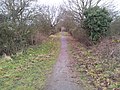
 Railway walk near Broome - geograph.org.uk - 2662977.jpg 1,024 × 768; 1,018 KB
-
 Railway walk near Broome - geograph.org.uk - 2662981.jpg 1,024 × 768; 1.08 MB
-
 Railway walk near Broome - geograph.org.uk - 2662988.jpg 768 × 1,024; 1.24 MB
-
 Railway walk near Broome - geograph.org.uk - 2663007.jpg 1,024 × 768; 1.24 MB
-
 Railway walk near Broome - geograph.org.uk - 2665287.jpg 1,024 × 768; 1.14 MB
-
 Railway walk near Broome - geograph.org.uk - 2665288.jpg 1,024 × 768; 1.24 MB
-
 Rectory Road near Ellingham - geograph.org.uk - 5306275.jpg 486 × 640; 220 KB
-

-
 River off Alma Bridge - geograph.org.uk - 3866770.jpg 3,072 × 2,304; 2.27 MB
-
 Road from St Michael's church - geograph.org.uk - 4003586.jpg 900 × 600; 152 KB
-
 Road past Redhouse Farm, Broome - geograph.org.uk - 5726843.jpg 3,433 × 2,122; 2.34 MB
-
 Roadsign on Loddon Road - geograph.org.uk - 3586171.jpg 2,304 × 3,072; 1.64 MB
-
 Seat at Broome Heath - geograph.org.uk - 3636497.jpg 640 × 480; 181 KB
-
 Sheep pasture by Broome Lodge - geograph.org.uk - 2213337.jpg 640 × 498; 134 KB
-
 Small Ford - geograph.org.uk - 1427003.jpg 640 × 480; 90 KB
-
 St Michael, Broome - Road to church - geograph.org.uk - 4003609.jpg 900 × 600; 170 KB
-

-
 Stream past the maltings at Wainford - geograph.org.uk - 1970373.jpg 471 × 640; 232 KB
-
 Sun on the Lakes - geograph.org.uk - 1714493.jpg 800 × 531; 87 KB
-
 Sun Road past JR's, Broome - geograph.org.uk - 3636457.jpg 640 × 480; 147 KB
-
 Sun Road Postbox - geograph.org.uk - 3632217.jpg 2,206 × 2,944; 1.19 MB
-
 Sun Road sign - geograph.org.uk - 3631471.jpg 3,072 × 2,304; 1.47 MB
-
 Sun Road sign - geograph.org.uk - 3895842.jpg 3,072 × 2,304; 1.9 MB
-
 Sun Road ^ Sun Road Postbox - geograph.org.uk - 3632206.jpg 3,072 × 2,304; 1.29 MB
-
 Sun Road, Broome - geograph.org.uk - 3632182.jpg 2,601 × 2,305; 1.13 MB
-
 Sun Road, Broome - geograph.org.uk - 3632194.jpg 3,072 × 2,304; 1.37 MB
-
 Sun Road, Broome - geograph.org.uk - 3632244.jpg 3,072 × 2,304; 1.26 MB
-
 Sun Road, Broome - geograph.org.uk - 3632253.jpg 3,072 × 2,304; 1.42 MB
-
 Sun Road-Yarmouth Road junction, Broome - geograph.org.uk - 3636462.jpg 640 × 480; 146 KB
-
 Sunley Close sign - geograph.org.uk - 3632196.jpg 3,072 × 2,304; 1.65 MB
-
 Sunley Close, Broome - geograph.org.uk - 3632207.jpg 2,872 × 2,158; 1.22 MB
-
 Telephone Box ^ Sun Road Postbox - geograph.org.uk - 3632223.jpg 2,260 × 3,017; 1.64 MB
-
 Telephone Box ^ Sun Road Postbox - geograph.org.uk - 3632226.jpg 2,304 × 3,072; 1.47 MB
-
 Telephone Box ^ Sun Road Postbox - geograph.org.uk - 3632228.jpg 3,072 × 2,304; 1.67 MB
-

-
 The end of the lane - geograph.org.uk - 1406547.jpg 640 × 480; 113 KB
-
 The Grain Store - geograph.org.uk - 3635944.jpg 2,304 × 3,072; 1.53 MB
-
 The Grain Store, Wainford - geograph.org.uk - 5165512.jpg 640 × 480; 68 KB
-
 The largest Lake - geograph.org.uk - 1714538.jpg 800 × 531; 105 KB
-
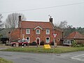 The old 'Sun Inn', Broome - geograph.org.uk - 5279035.jpg 3,337 × 2,503; 1.97 MB
-
 The Old Road - geograph.org.uk - 1426916.jpg 640 × 480; 90 KB
-
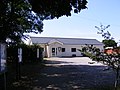
 The Old School at Broome, Norfolk - geograph.org.uk - 2241867.jpg 640 × 480; 124 KB
-
 The remains of a mineral block - geograph.org.uk - 2213309.jpg 640 × 509; 96 KB
-
 The River Waveney at Wainford Mill - geograph.org.uk - 1968919.jpg 640 × 480; 110 KB
-
 Trackbed looking towards Ditchingham - geograph.org.uk - 1525437.jpg 640 × 480; 99 KB
-

-

-

-
 Trackbed of the Waveney Valley Railway - geograph.org.uk - 1014793.jpg 640 × 480; 115 KB
-
 Tracks traversing cultivated field - geograph.org.uk - 2213653.jpg 640 × 450; 125 KB
-
 Transformer by Oaklands Farmhouse - geograph.org.uk - 2213258.jpg 640 × 480; 66 KB
-

-
 View along Ingloss Lane - geograph.org.uk - 4786937.jpg 640 × 452; 411 KB
-
 View along Yarmouth Road, Broome - geograph.org.uk - 3636461.jpg 640 × 480; 134 KB
-
 View north along Ingloss Lane - geograph.org.uk - 2213261.jpg 640 × 480; 62 KB
-
 View north along Lug's Lane - geograph.org.uk - 4786941.jpg 640 × 597; 528 KB
-
 View towards houses in Sun Road, Broome - geograph.org.uk - 3636501.jpg 640 × 480; 229 KB
-
 View towards Oaklands Farm - geograph.org.uk - 5244683.jpg 640 × 360; 290 KB
-
 View towards Sun Road, Broome - geograph.org.uk - 3636551.jpg 640 × 480; 234 KB
-

-
 Wainford Road ^ The Grain Store - geograph.org.uk - 3636015.jpg 2,304 × 3,072; 1.42 MB
-
 Wainford Sluice - geograph.org.uk - 1426959.jpg 640 × 480; 71 KB
-
 Walpole Close sign - geograph.org.uk - 3764325.jpg 3,072 × 2,304; 1.9 MB
-
 Walpole Close ^ Yarmouth Road Postbox - geograph.org.uk - 3764313.jpg 3,072 × 2,304; 1.84 MB
-
 Walpole Close ^ Yarmouth Road Postbox - geograph.org.uk - 3764316.jpg 3,072 × 2,304; 1.96 MB
-
 Walpole Close ^ Yarmouth Road Postbox - geograph.org.uk - 3764332.jpg 3,072 × 2,304; 1.68 MB
-
 Walpole Close, Broome - geograph.org.uk - 3764323.jpg 2,304 × 3,072; 1.75 MB
-
 Waterlogged field by Oaklands Farm - geograph.org.uk - 4786936.jpg 640 × 360; 359 KB
-
 Where the trackbed was cut - geograph.org.uk - 1014795.jpg 640 × 480; 84 KB
-
 Willow Lane sign - geograph.org.uk - 3885192.jpg 3,072 × 2,304; 1.32 MB
-
 Willow Lane ^ Ivy Farm George V Postbox - geograph.org.uk - 3885185.jpg 3,072 × 2,304; 2.03 MB
-
 Willow Lane, Broome Heath - geograph.org.uk - 3885188.jpg 3,072 × 2,304; 1.48 MB
-
 Willow Lane, Broome Street - geograph.org.uk - 3885698.jpg 3,072 × 2,304; 902 KB
-
 Wind-drift in the spray - geograph.org.uk - 4419777.jpg 1,024 × 768; 267 KB
-
 Winter meadow near the A143 - geograph.org.uk - 2665291.jpg 1,024 × 768; 751 KB
-
 Works, Wainford - geograph.org.uk - 5306460.jpg 640 × 436; 154 KB
-
 Yarmouth Road Postbox - geograph.org.uk - 3764318.jpg 2,304 × 3,072; 1.43 MB
-
 Yarmouth Road Postbox - geograph.org.uk - 3764319.jpg 2,304 × 3,072; 1.91 MB


