Category:Bruisyard
village and civil parish in Suffolk, United Kingdom | |||||
| Upload media | |||||
| Instance of | |||||
|---|---|---|---|---|---|
| Location |
| ||||
 | |||||
Subcategories
This category has the following 5 subcategories, out of 5 total.
Media in category "Bruisyard"
The following 126 files are in this category, out of 126 total.
-

-
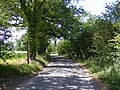
 A quiet Suffolk Lane near Bruisyard - geograph.org.uk - 72691.jpg 640 × 480; 166 KB
-
 Abbey Fishing Lakes - geograph.org.uk - 2591921.jpg 800 × 531; 87 KB
-
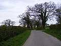
 Bend On Road - geograph.org.uk - 4237616.jpg 1,024 × 768; 189 KB
-
 Broad Oak Farm - geograph.org.uk - 2266379.jpg 3,072 × 2,304; 1.31 MB
-
 Bruisyard Arch and River Alde - geograph.org.uk - 1821509.jpg 2,304 × 3,072; 1.49 MB
-
 Bruisyard Ford - geograph.org.uk - 3189292.jpg 3,872 × 2,592; 2.43 MB
-
 Bruisyard Road - geograph.org.uk - 2256407.jpg 3,072 × 2,304; 1.41 MB
-
 Bruisyard Road - geograph.org.uk - 2256411.jpg 2,304 × 3,072; 1.47 MB
-
 Bruisyard Road - geograph.org.uk - 2257725.jpg 3,072 × 2,304; 1.32 MB
-
 Bruisyard Road - geograph.org.uk - 2257726.jpg 3,072 × 2,304; 1.38 MB
-
 Bruisyard Road - geograph.org.uk - 2345887.jpg 3,072 × 2,304; 1.36 MB
-
 Bruisyard Road - geograph.org.uk - 2345977.jpg 3,072 × 2,304; 1.29 MB
-
 Bruisyard Road - geograph.org.uk - 2345983.jpg 3,072 × 2,304; 1.35 MB
-
 Bruisyard Road - geograph.org.uk - 4246038.jpg 768 × 1,024; 339 KB
-
 Bruisyard Road and College Farm Postbox - geograph.org.uk - 1442037.jpg 3,072 × 2,304; 1.61 MB
-
 Bruisyard Road near Hernsey Wood - geograph.org.uk - 2266359.jpg 3,072 × 2,304; 1.36 MB
-
 Bruisyard Road ^ Hernsey Wood Farm - geograph.org.uk - 2257715.jpg 3,072 × 2,304; 1.26 MB
-
 Bruisyard Road, Bruisyard - geograph.org.uk - 1827774.jpg 3,072 × 2,304; 1.48 MB
-
 Bruisyard Road, Bruisyard - geograph.org.uk - 1831071.jpg 3,072 × 2,304; 1.65 MB
-
 Bruisyard Village Notice Board - geograph.org.uk - 1821649.jpg 3,072 × 2,304; 1.47 MB
-
 Bruisyard Vineyard - geograph.org.uk - 1924218.jpg 800 × 600; 159 KB
-
 Bruisyard Vineyard - geograph.org.uk - 1924919.jpg 800 × 600; 141 KB
-
 Bruisyard War Memorial - geograph.org.uk - 4444159.jpg 1,024 × 768; 205 KB
-
 Bruisyard Wood - geograph.org.uk - 2300183.jpg 760 × 570; 365 KB
-
 Bruiyard Road junction - geograph.org.uk - 1827763.jpg 3,072 × 2,304; 1.39 MB
-
 Buildings at Wood Farm near Bruisyard - geograph.org.uk - 4151158.jpg 4,320 × 3,240; 3.63 MB
-
 Bungalow with solar panels near Bruisyard - geograph.org.uk - 4151166.jpg 4,320 × 3,240; 3.85 MB
-
 Church Road, Bruisyard - geograph.org.uk - 1442054.jpg 3,072 × 2,304; 1.48 MB
-
 Church Road, Bruisyard - geograph.org.uk - 1442055.jpg 3,072 × 2,304; 1.5 MB
-
 Church Road, Bruisyard - geograph.org.uk - 1821643.jpg 3,072 × 2,304; 1.62 MB
-
 Church Road, Bruisyard - geograph.org.uk - 2424668.jpg 2,304 × 3,072; 1.45 MB
-
 Church Road, Bruisyard and footpath to Shrublands Farm - geograph.org.uk - 2424652.jpg 3,072 × 2,304; 1.66 MB
-
 Church Road, Bruisyards - geograph.org.uk - 1868784.jpg 2,304 × 3,072; 1.67 MB
-
 Church Road, Bruisyards - geograph.org.uk - 1868811.jpg 2,304 × 3,072; 1.65 MB
-

-
 Crossroads - geograph.org.uk - 4178438.jpg 1,024 × 768; 304 KB
-
 Cut Mark Bruisyard St Peters Church - geograph.org.uk - 5715736.jpg 2,231 × 2,231; 3.25 MB
-
 Earthworks at Bruisyard - geograph.org.uk - 2591928.jpg 4,288 × 2,848; 5.27 MB
-
 Earthworks at Bruisyard - geograph.org.uk - 2591949.jpg 4,288 × 2,848; 5.93 MB
-
 Entrance to Sandpit Farm, Bruisyard - geograph.org.uk - 2280353.jpg 760 × 570; 278 KB
-
 Farmland opposite Bruisyard Wood - geograph.org.uk - 2300209.jpg 760 × 570; 182 KB
-
 Farmyard at Bruisyard - geograph.org.uk - 2591904.jpg 800 × 531; 116 KB
-
 Field - geograph.org.uk - 219251.jpg 1,600 × 1,200; 909 KB
-
 Flint remains - geograph.org.uk - 2591934.jpg 800 × 531; 185 KB
-
 Footbridge on the footpath to Bruisyard Wood - geograph.org.uk - 2356252.jpg 2,304 × 3,072; 1.52 MB
-
 Footpath - geograph.org.uk - 4237620.jpg 1,024 × 768; 310 KB
-
 Footpath - geograph.org.uk - 4246043.jpg 1,024 × 768; 210 KB
-
 Footpath No.19 off to the left - geograph.org.uk - 2277518.jpg 760 × 570; 357 KB
-
 Footpath No.20 over a field headland - geograph.org.uk - 2277496.jpg 760 × 570; 229 KB
-
 Footpath off Low Road, Bruisyard - geograph.org.uk - 1821921.jpg 3,072 × 2,304; 1.7 MB
-

-

-
 Footpath to Bruisyard Road - geograph.org.uk - 1827786.jpg 3,072 × 2,304; 1.7 MB
-
 Footpath to Bruisyard Street - geograph.org.uk - 2356273.jpg 3,072 × 2,304; 1.43 MB
-
 Footpath to Bruisyard Street - geograph.org.uk - 2356275.jpg 3,072 × 2,304; 1.53 MB
-
 Footpath to Bruisyard Wood - geograph.org.uk - 2356245.jpg 3,072 × 2,304; 1.68 MB
-
 Footpath to Bruisyard Wood - geograph.org.uk - 2356247.jpg 2,304 × 3,072; 1.66 MB
-
 Footpath to Bruisyard Wood - geograph.org.uk - 2356251.jpg 3,072 × 2,304; 1.35 MB
-
 Footpath to Bruisyard Wood - geograph.org.uk - 2356256.jpg 2,304 × 3,072; 1.64 MB
-
 Footpath to Hill Farm - geograph.org.uk - 2257717.jpg 3,072 × 2,304; 1.33 MB
-
 Footpath to Hill Farm - geograph.org.uk - 2257719.jpg 3,072 × 2,304; 1.34 MB
-
 Footpath to Low Road ^ Entrance to Sandpit Farm - geograph.org.uk - 2219780.jpg 3,072 × 2,304; 1.62 MB
-
 Footpath to Risings Farm - geograph.org.uk - 2345966.jpg 3,072 × 2,304; 1.33 MB
-
 Footpath to Risings Farm - geograph.org.uk - 2345970.jpg 3,072 × 2,304; 1.33 MB
-

-

-
 Footpath to the U2512 - geograph.org.uk - 2356377.jpg 3,072 × 2,304; 1.43 MB
-
 Footpath to the U2512 - geograph.org.uk - 2356386.jpg 2,304 × 3,072; 1.42 MB
-
 Footpath to the U2512 - geograph.org.uk - 2356388.jpg 2,304 × 3,072; 1.51 MB
-
 Footpath to Upper Grove Farm ^ Hill Farm Road - geograph.org.uk - 2256403.jpg 2,304 × 3,072; 1.47 MB
-
 Footpath to Upper Grove ^ Rendham Hall Farms - geograph.org.uk - 2256412.jpg 2,304 × 3,072; 1.42 MB
-
 Ford in Church Road - geograph.org.uk - 1868779.jpg 3,072 × 2,304; 1.4 MB
-
 Ford on Church Road, Bruisyard - geograph.org.uk - 2300128.jpg 760 × 570; 281 KB
-
 Ford, Bruisyard - geograph.org.uk - 4151187.jpg 4,320 × 3,240; 4.9 MB
-
 Former Fish Ponds - geograph.org.uk - 2591973.jpg 800 × 531; 110 KB
-
 Former Stables - geograph.org.uk - 2591911.jpg 800 × 531; 177 KB
-

-
 Hernsey Wood Road, Bruisyard - geograph.org.uk - 2266366.jpg 3,072 × 2,304; 1.26 MB
-
 Logging activity at Bruisyard Wood - geograph.org.uk - 2300270.jpg 760 × 570; 327 KB
-
 Low Road junction with Church Road, Bruisyard - geograph.org.uk - 1821642.jpg 3,072 × 2,304; 1.5 MB
-
 Low Road, Bruisyard - geograph.org.uk - 1821645.jpg 3,072 × 2,304; 1.39 MB
-
 Low Road, Bruisyard - geograph.org.uk - 1821937.jpg 3,072 × 2,304; 1.39 MB
-
 Low Road, Bruisyard - geograph.org.uk - 1822023.jpg 3,072 × 2,304; 1.62 MB
-
 Low Road, Bruisyard - geograph.org.uk - 2424602.jpg 3,072 × 2,304; 1.7 MB
-
 Low Road, Bruisyard - geograph.org.uk - 2424634.jpg 3,072 × 2,304; 1.66 MB
-
 Low Road, Bruisyard ^ footpath to Church Road - geograph.org.uk - 2424624.jpg 3,072 × 2,304; 1.56 MB
-
 Mobile chicane ahead - geograph.org.uk - 2300116.jpg 760 × 570; 215 KB
-
 Ploughed Field - geograph.org.uk - 4237613.jpg 1,024 × 768; 272 KB
-
 Rendham Road, Bruisyard - geograph.org.uk - 1739026.jpg 2,304 × 3,072; 1.59 MB
-
 Rendham Road, Bruisyard - geograph.org.uk - 1739031.jpg 2,304 × 3,072; 1.42 MB
-
 River Alde at Bruisyard - geograph.org.uk - 1821532.jpg 2,304 × 3,072; 1.66 MB
-
 River Alde at Bruisyard - geograph.org.uk - 1821635.jpg 3,072 × 2,304; 1.47 MB
-
 River Alde at Church Road Bridge - geograph.org.uk - 1868773.jpg 2,304 × 3,072; 1.66 MB
-
 River Alde at Church Road Bridge - geograph.org.uk - 1868776.jpg 3,072 × 2,304; 1.64 MB
-
 River Alde, Bruisyard - geograph.org.uk - 1821512.jpg 2,304 × 3,072; 1.38 MB
-

-

-
 Roadsign on Bruisyard Road - geograph.org.uk - 2266360.jpg 2,304 × 3,072; 1.26 MB
-

-

-
 Site of Bruisyard Abbey - geograph.org.uk - 2591872.jpg 4,288 × 2,848; 4.71 MB
-
 The entrance to Bruisyard Wood - geograph.org.uk - 1827767.jpg 3,072 × 2,304; 1.68 MB
-
 The U2512 at Bruisyard - geograph.org.uk - 2356259.jpg 3,072 × 2,304; 1.51 MB
-
 The U2512 at Bruisyard - geograph.org.uk - 2356261.jpg 3,072 × 2,304; 1.45 MB
-
 The U2512 looking towards Bruisyard Hall - geograph.org.uk - 2356278.jpg 3,072 × 2,304; 1.53 MB
-
 The U2512 looking towards St.Peter's Church - geograph.org.uk - 2356280.jpg 3,072 × 2,304; 1.44 MB
-
 View across the fields from the A1120 - geograph.org.uk - 224058.jpg 1,600 × 1,200; 296 KB
-
 View From The Top - geograph.org.uk - 4116570.jpg 1,024 × 768; 245 KB
-

-
 Wood Farm - geograph.org.uk - 4237608.jpg 1,024 × 768; 159 KB
-
 Bannocks Lane - geograph.org.uk - 365906.jpg 640 × 480; 97 KB
-
 Boundary Farm - geograph.org.uk - 228871.jpg 1,600 × 1,200; 515 KB
-
 Bridge Works - geograph.org.uk - 237849.jpg 1,600 × 1,200; 428 KB
-
 Bruisyard Road, Notice Board and College Farm Postbox - geograph.org.uk - 1442066.jpg 3,072 × 2,304; 1.63 MB
-
 Bruisyard Wood - geograph.org.uk - 219245.jpg 1,600 × 1,200; 1,014 KB
-
 Bruisyard Wood, Bruisyard, Suffolk - geograph.org.uk - 72687.jpg 640 × 480; 61 KB
-
 Crossroads at Badingham - geograph.org.uk - 221208.jpg 1,600 × 1,200; 351 KB
-
 Glebe Farm - geograph.org.uk - 233060.jpg 1,600 × 1,200; 551 KB
-
 Lane near Shrubland Farm - geograph.org.uk - 237830.jpg 1,600 × 1,200; 611 KB
-
 Looking towards Grove House - geograph.org.uk - 85432.jpg 1,600 × 1,200; 677 KB
-
 Road Junction - geograph.org.uk - 234776.jpg 1,600 × 1,200; 698 KB
-
 Sandpit Farm near Bruisyard, Suffolk - geograph.org.uk - 72648.jpg 640 × 480; 121 KB
-
 Shrublands Farm - geograph.org.uk - 237826.jpg 1,600 × 1,200; 482 KB
-
 Straw Baled - geograph.org.uk - 219230.jpg 1,600 × 1,200; 917 KB
-
 Straw Baled - geograph.org.uk - 219232.jpg 1,600 × 1,200; 968 KB


