Category:Brunnen (Hambach)
| Object location | | View all coordinates using: OpenStreetMap |
|---|
This is the category of the Hessian Kulturdenkmal (cultural monument) with the ID 14242 (Wikidata)
|
| Upload media | |||||
| Instance of | |||||
|---|---|---|---|---|---|
| Location | Taunusstein, Rheingau-Taunus-Kreis, Darmstadt Government Region, Hesse, Germany | ||||
| Heritage designation | |||||
 | |||||
Media in category "Brunnen (Hambach)"
The following 2 files are in this category, out of 2 total.
-
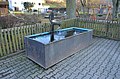 Hambach, Brunnen (1).JPG 4,928 × 3,264; 7.33 MB
-
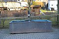 Hambach, Brunnen.JPG 4,928 × 3,264; 6.67 MB
.JPG)
