Category:Brunswick, Tyne and Wear
civil parish in Newcastle upon Tyne, Tyne and Wear, United Kingdom  | |||||
| Upload media | |||||
| Instance of | |||||
|---|---|---|---|---|---|
| Location | Newcastle upon Tyne, Tyne and Wear, North East England, England | ||||
| Population |
| ||||
 | |||||
Deutsch: Brunswick ist sowohl ein Dorf als auch eine Gemeinde in dem Metropolitan Borough Newcastle upon Tyne, England. Der Ort liegt etwa 16 Kilometer nördlich des Stadtzentrums. Die Fernstraße A1 verläuft durch den Ort, der durch Reihenbausbesiedelung gekennzeichnet ist. Zu den wichtigsten Bauwerken gehören die St. Columba's Methodist Church und die St. Johns Reformed United Church.
English: Brunswick is a village and civil parish in the City of Newcastle upon Tyne in Tyne and Wear, England. It is north of the city centre, just off the A1. It has a population of 1,024.
Subcategories
This category has the following 2 subcategories, out of 2 total.
B
- Brunswick Methodist Church (7 F)
- Brunswick Village (17 F)
Media in category "Brunswick, Tyne and Wear"
The following 51 files are in this category, out of 51 total.
-

-
 Access Track, Car Park, Big Waters Country Park - geograph.org.uk - 6671073.jpg 1,600 × 1,200; 895 KB
-
 Aged Miners Homes, Brunswick Village - geograph.org.uk - 3846424.jpg 3,264 × 2,448; 1.3 MB
-
 And More Reflections - geograph.org.uk - 2780123.jpg 1,780 × 930; 212 KB
-
 Arable land near Seaton Burn - geograph.org.uk - 4867242.jpg 1,024 × 768; 382 KB
-
 Arable land near Seaton Burn - geograph.org.uk - 4867243.jpg 1,024 × 768; 392 KB
-
 Big Waters Country Park - geograph.org.uk - 2946830.jpg 640 × 480; 86 KB
-
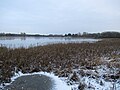 Big Waters Nature Reserve (frozen) - geograph.org.uk - 5645627.jpg 5,184 × 3,888; 1.12 MB
-
 Big Waters Nature Reserve (frozen) - geograph.org.uk - 5645637.jpg 5,184 × 3,888; 1.45 MB
-
 Big Waters Nature Reserve (frozen) - geograph.org.uk - 5645644.jpg 5,184 × 3,888; 1.01 MB
-
 Big Waters Nature Reserve - geograph.org.uk - 2946822.jpg 640 × 480; 84 KB
-
 Big Waters Nature Reserve - geograph.org.uk - 3236901.jpg 3,648 × 2,736; 877 KB
-
 Big Waters Nature Reserve - geograph.org.uk - 3278342.jpg 640 × 480; 77 KB
-
 Big Waters Nature Reserve - geograph.org.uk - 3278344.jpg 640 × 480; 76 KB
-
 Big Waters through the trees - geograph.org.uk - 2790713.jpg 3,264 × 2,448; 1.35 MB
-
 Bridge over the A1 - geograph.org.uk - 5265720.jpg 2,000 × 1,500; 564 KB
-
 Brunswick Village War Memorial - geograph.org.uk - 6671132.jpg 1,200 × 1,600; 508 KB
-
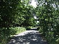
 Coach Lane heading west - geograph.org.uk - 3583824.jpg 640 × 480; 65 KB
-
 Crop field near Brunswick Village - geograph.org.uk - 3058357.jpg 640 × 480; 101 KB
-
 Darrell House, Darrell Street, Brunswick Village - geograph.org.uk - 6671124.jpg 1,200 × 1,600; 502 KB
-
 Entrance to Big Waters Country Park - geograph.org.uk - 6671063.jpg 1,600 × 1,200; 662 KB
-
 Farmland near the A1 - geograph.org.uk - 3058363.jpg 640 × 480; 80 KB
-
 Footbridge at Big Waters Country Park - geograph.org.uk - 1921057.jpg 2,048 × 1,536; 1.3 MB
-
 Footbridge, Big Waters Country Park - geograph.org.uk - 6671002.jpg 1,600 × 1,200; 919 KB
-
 Footbridge, Big Waters Country Park - geograph.org.uk - 6671040.jpg 1,600 × 1,200; 844 KB
-
 Footbridge, Big Waters Country Park - geograph.org.uk - 6671054.jpg 1,600 × 1,200; 898 KB
-
 Footpath, Big Waters Country Park - geograph.org.uk - 6671059.jpg 1,600 × 1,200; 793 KB
-
 Gate and Public Footpath near Big Waters Country Park - geograph.org.uk - 6671086.jpg 1,600 × 1,200; 960 KB
-
 Goal Posts, Recreation Ground, Brunswick Village - geograph.org.uk - 6671099.jpg 1,600 × 1,200; 441 KB
-
 Horse Mounting Block and Signage near Seaton Burn - geograph.org.uk - 6670968.jpg 1,200 × 1,600; 551 KB
-
 Looking out of the hide at Big Waters - geograph.org.uk - 2790735.jpg 3,264 × 2,448; 1.11 MB
-
 More Reflections, Big Waters - geograph.org.uk - 2780115.jpg 640 × 480; 121 KB
-
 National Cycle Route 10 heading east - geograph.org.uk - 3058361.jpg 640 × 480; 111 KB
-
 National Cycle Route 10 heading east - geograph.org.uk - 3058367.jpg 640 × 480; 112 KB
-
 North East Mason Farm - geograph.org.uk - 3762834.jpg 640 × 480; 127 KB
-
 Pond dipping platform at Big Waters Country Park - geograph.org.uk - 1921099.jpg 2,048 × 1,536; 670 KB
-
 Pond, Big Waters Country Park - geograph.org.uk - 6671015.jpg 1,600 × 1,200; 593 KB
-
 Public Footpath near Big Waters Country Park - geograph.org.uk - 6670989.jpg 1,600 × 1,200; 792 KB
-
 Reiver's Cycle Route at Seaton Burn - geograph.org.uk - 3762842.jpg 640 × 480; 78 KB
-
 Reiver's Cycle Route near Big Waters - geograph.org.uk - 3762832.jpg 640 × 480; 107 KB
-
 Reiver's Cycle Route near Big Waters - geograph.org.uk - 3762833.jpg 640 × 480; 98 KB
-
 Seaton Burn to Dinnington track - geograph.org.uk - 4867241.jpg 1,024 × 768; 376 KB
-
 Sheep grazing near North East Mason Farm - geograph.org.uk - 5265715.jpg 2,000 × 1,500; 391 KB
-
 Signpost near Big Waters Country Park - geograph.org.uk - 6671089.jpg 1,200 × 1,600; 477 KB
-

-
 Stepping stones over Seaton Burn - geograph.org.uk - 2946839.jpg 480 × 640; 127 KB
-
 Stepping Stones, Big Waters Country Park - geograph.org.uk - 6671034.jpg 1,600 × 1,200; 876 KB
-
 Track from Seaton Burn - geograph.org.uk - 3649841.jpg 1,604 × 1,218; 374 KB
-
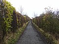
 Track into woodland - geograph.org.uk - 3583820.jpg 640 × 480; 142 KB
-
 View South from the track - geograph.org.uk - 2790706.jpg 3,146 × 2,200; 976 KB
-
 Wideopen hatchbacks - geograph.org.uk - 5772813.jpg 5,177 × 2,913; 2.12 MB


_-_geograph.org.uk_-_5645627.jpg)
_-_geograph.org.uk_-_5645637.jpg)
_-_geograph.org.uk_-_5645644.jpg)


