Category:Buan, Gwynedd
community in Gwynedd, Wales, UK   | |||||
| Upload media | |||||
| Pronunciation audio | |||||
|---|---|---|---|---|---|
| Instance of | |||||
| Location | Gwynedd, Wales | ||||
| Population |
| ||||
| Area |
| ||||
 | |||||
Subcategories
This category has the following 5 subcategories, out of 5 total.
Media in category "Buan, Gwynedd"
The following 200 files are in this category, out of 398 total.
(previous page) (next page)-
 A celebrant's view of Eglwys Ceidio Sant - geograph.org.uk - 1935447.jpg 1,024 × 768; 104 KB
-

-
 A gateway with a view - geograph.org.uk - 1987410.jpg 1,024 × 766; 236 KB
-

-
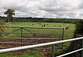
 A herd of cattle grazing near Cors yr Hafod - geograph.org.uk - 1941733.jpg 1,024 × 551; 166 KB
-
 A memorial cross in honour of St Buan - geograph.org.uk - 1989905.jpg 768 × 1,024; 269 KB
-
 A modern covered reservoir - geograph.org.uk - 1987452.jpg 1,024 × 768; 257 KB
-

-
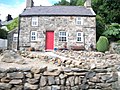
 A riverside cottage at Rhyd-y-clafdy - geograph.org.uk - 1990306.jpg 1,024 × 768; 244 KB
-
 AA box by the A497 - geograph.org.uk - 5567494.jpg 3,000 × 4,000; 4.62 MB
-
 AA Box number 580 - geograph.org.uk - 3867372.jpg 640 × 480; 137 KB
-
 Access road for Caerau Uchaf - geograph.org.uk - 3648677.jpg 1,500 × 842; 1.16 MB
-
 Access road to Cwm Iwrch - geograph.org.uk - 1989585.jpg 1,024 × 768; 247 KB
-
 Access road to Tyddyn-yr-haint - geograph.org.uk - 1987377.jpg 1,024 × 611; 199 KB
-
 Access track to the Glas Ynys reserve - geograph.org.uk - 1998834.jpg 1,024 × 768; 148 KB
-
 Afon Geirch from Pont Sarn-glorian - geograph.org.uk - 1998706.jpg 1,024 × 768; 286 KB
-
 Afon Penrhos - geograph.org.uk - 2719950.jpg 4,000 × 3,000; 4.12 MB
-
 Afon Penrhos - geograph.org.uk - 2719951.jpg 4,000 × 3,000; 5.08 MB
-

-
 Allt Foel Bach - the hill below Foel Bach - geograph.org.uk - 1987473.jpg 1,024 × 768; 158 KB
-

-
 Approaching Groesffordd - geograph.org.uk - 1936363.jpg 1,024 × 767; 259 KB
-

-
 Approaching the floor of Nant y Gledrydd - geograph.org.uk - 1941100.jpg 1,024 × 768; 319 KB
-
 Approaching the minor junction with Lon Ffridd - geograph.org.uk - 1936416.jpg 1,024 × 768; 319 KB
-
 Approaching the minor road junction at Penbodlas - geograph.org.uk - 2001665.jpg 1,024 × 768; 188 KB
-
 Approaching the road junction - geograph.org.uk - 1940638.jpg 1,024 × 768; 308 KB
-
 Approaching Ty'n Lon Farm - geograph.org.uk - 1936384.jpg 1,024 × 768; 248 KB
-
 Bedd dan y Coed - Grave beneath the trees - geograph.org.uk - 852693.jpg 640 × 428; 148 KB
-
 Bedw a Bysedd y Cŵn - Birch and Foxgloves - geograph.org.uk - 852685.jpg 640 × 428; 120 KB
-
 Bend in the Lon Boduan lane - geograph.org.uk - 1936468.jpg 1,024 × 769; 189 KB
-
 Bend in the road south Mathan Uchaf - geograph.org.uk - 1989587.jpg 1,024 × 768; 310 KB
-
 Bends in the road near Bryniau - geograph.org.uk - 1990282.jpg 1,024 × 768; 288 KB
-
 Beudy Mawr - geograph.org.uk - 1933541.jpg 1,024 × 768; 322 KB
-
 Bodsela Bach Cottage - geograph.org.uk - 1990176.jpg 1,024 × 768; 263 KB
-

-
 Boduan - geograph.org.uk - 4700828.jpg 3,872 × 2,592; 2.42 MB
-
 Bryn Bach, Rhyd-y-clafdy - geograph.org.uk - 1987061.jpg 1,024 × 768; 238 KB
-
 Bryn Celyn Hall, Rhyd-y-clafdy - geograph.org.uk - 1989036.jpg 1,024 × 768; 274 KB
-
 Bunker, Near Dinas - geograph.org.uk - 3991489.jpg 1,600 × 1,200; 535 KB
-

-
 Cae Newydd from the Mochras Farm road - geograph.org.uk - 1941080.jpg 1,024 × 768; 146 KB
-

-
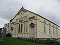
 Capel Bodfean - geograph.org.uk - 1988621.jpg 1,024 × 768; 214 KB
-
 Capel Boduan from the east - geograph.org.uk - 1990094.jpg 1,024 × 768; 212 KB
-
 Capel Peniel from the Brynheulog Farm Road - geograph.org.uk - 1936083.jpg 1,024 × 768; 178 KB
-
 Capel Rhydyclafdy - geograph.org.uk - 2719944.jpg 4,000 × 3,000; 2.08 MB
-
 Capel Rhydyclafdy - geograph.org.uk - 2719945.jpg 4,000 × 3,000; 2.77 MB
-
 Capel Rhydyclafdy - geograph.org.uk - 2719946.jpg 4,000 × 3,000; 1.96 MB
-
 Car park below Garn Boduan - geograph.org.uk - 5843733.jpg 4,032 × 3,024; 3.02 MB
-
 Carn Fadryn TrigPoint - geograph.org.uk - 462230.jpg 478 × 640; 42 KB
-

-
 Cattle at Ty-isaf - geograph.org.uk - 1989060.jpg 1,024 × 768; 287 KB
-
 Cattle grazing near Graig-wen - geograph.org.uk - 1941152.jpg 1,024 × 768; 213 KB
-
 Cattle grid at the entrance to Caerau-isaf Farm - geograph.org.uk - 1941892.jpg 1,024 × 768; 321 KB
-
 Chapel and cottages at the hamlet of Boduan - geograph.org.uk - 1990098.jpg 1,024 × 768; 206 KB
-
 Coed Bodgadle woodland - geograph.org.uk - 1942369.jpg 1,024 × 531; 151 KB
-
 Coed Bryn Hendre woodland - geograph.org.uk - 1990257.jpg 1,024 × 768; 291 KB
-
 Coed Tal-y-sarn woodland - geograph.org.uk - 2006491.jpg 1,024 × 636; 179 KB
-
 Cofeb Ryfel Rhydyclafdy War Memorial - geograph.org.uk - 2719947.jpg 4,000 × 3,000; 3.07 MB
-
 Concreted track through Coed Bryn Hendre - geograph.org.uk - 1990246.jpg 1,024 × 768; 318 KB
-
 Cottage below Garn Boduan - geograph.org.uk - 2009972.jpg 1,024 × 768; 198 KB
-
 Cottages below the forested Garn Boduan - geograph.org.uk - 2009966.jpg 1,024 × 597; 206 KB
-
 Cottages near St Buan's Church - geograph.org.uk - 3951605.jpg 2,669 × 2,039; 2.51 MB
-

-
 Country lane south of Hendre Farm - geograph.org.uk - 1990252.jpg 1,024 × 768; 183 KB
-
 Country lane west of Ceidio Church - geograph.org.uk - 1935407.jpg 1,024 × 869; 379 KB
-
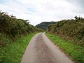
 Country road below Garn Saethon Hill - geograph.org.uk - 1987289.jpg 1,024 × 768; 219 KB
-
 Country road east of Maesoglan - geograph.org.uk - 1936398.jpg 1,024 × 768; 293 KB
-
 Country road north of Tyddyn-yr-haint - geograph.org.uk - 1987359.jpg 1,024 × 768; 204 KB
-

-
 Crop field south of Coed Mynydd-Meilian - geograph.org.uk - 1941022.jpg 1,024 × 768; 322 KB
-
 Crop land at Ty-isaf - geograph.org.uk - 1989078.jpg 1,024 × 768; 273 KB
-

-
 Cropland west of the road - geograph.org.uk - 1990548.jpg 1,024 × 768; 219 KB
-

-
 Dairy herd at Gallt y Beren - geograph.org.uk - 1989322.jpg 1,024 × 710; 198 KB
-

-
 Derelict farm buildings near Cae Newydd - geograph.org.uk - 1933464.jpg 1,024 × 768; 322 KB
-
 Disused Bunker, at the Former RAF Nefyn - geograph.org.uk - 4143713.jpg 1,600 × 1,200; 521 KB
-
 Disused quarry - geograph.org.uk - 2350449.jpg 640 × 480; 95 KB
-
 Down hill above Beudy Mawr - geograph.org.uk - 1987577.jpg 1,024 × 768; 273 KB
-
 Downhill all the way - geograph.org.uk - 1987439.jpg 1,024 × 768; 216 KB
-

-
 Entrance to Rhyd-y-Clafdy - geograph.org.uk - 3243099.jpg 640 × 480; 58 KB
-
 Entrance to the Mochras farm road - geograph.org.uk - 1936450.jpg 1,024 × 768; 223 KB
-
 Farm access road at Garn View - geograph.org.uk - 1998830.jpg 1,024 × 753; 175 KB
-
 Farm access road to Tref-erwyn - geograph.org.uk - 1998941.jpg 1,024 × 768; 198 KB
-
 Farm buildings at Bryn Rhydd - geograph.org.uk - 1998717.jpg 1,024 × 671; 142 KB
-
 Farm buildings at the former Madryn Park - geograph.org.uk - 2000540.jpg 1,024 × 765; 252 KB
-
 Farm buildings at Ty'n y Coed Uchaf - geograph.org.uk - 1941740.jpg 1,024 × 768; 250 KB
-
 Farm road leading to Hendre - geograph.org.uk - 1990194.jpg 1,024 × 768; 200 KB
-
 Farm road leading to Llanfihangal Farm - geograph.org.uk - 1987265.jpg 1,024 × 768; 211 KB
-
 Farm road to Caerau Isaf - geograph.org.uk - 1933478.jpg 1,024 × 768; 234 KB
-
 Farm track at Llanfihangel - geograph.org.uk - 1942572.jpg 1,024 × 768; 235 KB
-
 Farm Track doubling as a public footpath - geograph.org.uk - 1989086.jpg 1,024 × 768; 286 KB
-
 Farmland above Madryn Castle - geograph.org.uk - 2000785.jpg 1,024 × 641; 95 KB
-
 Farmland and bunkers at Cefn Leisiog - geograph.org.uk - 1998858.jpg 1,024 × 520; 80 KB
-

-
 Farmland at Gallt y Beren Farm - geograph.org.uk - 1989310.jpg 1,024 × 768; 193 KB
-
 Farmland at Mathan Uchaf farm - geograph.org.uk - 1989579.jpg 1,024 × 768; 154 KB
-
 Farmland west of Hendre - geograph.org.uk - 1990234.jpg 1,024 × 768; 170 KB
-
 Farmland west of Pont Sarn-glorian - geograph.org.uk - 1998715.jpg 1,024 × 508; 111 KB
-
 Fferm Bodlas farm from the Penbodlas path - geograph.org.uk - 1997867.jpg 1,024 × 658; 122 KB
-
 Fferm Tal-y-sarn Farm - geograph.org.uk - 1934018.jpg 1,024 × 741; 106 KB
-
 Fferm Tal-y-sarn from the A499 - geograph.org.uk - 2006483.jpg 1,024 × 393; 70 KB
-
 Field at Penbodlas - geograph.org.uk - 3648687.jpg 1,500 × 893; 1.05 MB
-
 Field gate with a view - geograph.org.uk - 1936096.jpg 1,024 × 767; 263 KB
-
 Field walls at Tyddyn-yr-haint - geograph.org.uk - 1987374.jpg 1,024 × 768; 200 KB
-
 Field with ewes and lambs - geograph.org.uk - 2350415.jpg 640 × 480; 96 KB
-
 Fields west of the A497 - geograph.org.uk - 1934064.jpg 1,024 × 504; 71 KB
-

-
 Footpath due south towards the B4415 - geograph.org.uk - 1941917.jpg 1,024 × 768; 181 KB
-
 Footpath south to the B4415 - geograph.org.uk - 1933492.jpg 1,024 × 767; 169 KB
-
 Footpath through the meadow above Lon Madryn - geograph.org.uk - 2000743.jpg 1,024 × 768; 215 KB
-

-

-
 From the mountain to the sea - geograph.org.uk - 2002131.jpg 1,024 × 755; 169 KB
-
 Gallt y Beren Farmhouse, Rhyd-y-Clafdy - geograph.org.uk - 1988707.jpg 1,024 × 768; 207 KB
-
 Garden Cottage, Boduan - geograph.org.uk - 1990004.jpg 1,024 × 768; 228 KB
-
 Garn Bach - geograph.org.uk - 3648920.jpg 1,500 × 1,125; 1.45 MB
-
 Gateway to Madryn Castle Caravan Park - geograph.org.uk - 2000591.jpg 1,024 × 768; 238 KB
-
 Grave digger's hut at Eglwys St Buan, Boduan - geograph.org.uk - 1989834.jpg 1,024 × 768; 363 KB
-
 Grazing sheep at Hendre-wen - geograph.org.uk - 1989299.jpg 1,024 × 768; 167 KB
-
 Grazing sheep at Mochras Farm - geograph.org.uk - 1940502.jpg 1,024 × 607; 137 KB
-

-
 Grazing sheep south of Cors yr Hafod - geograph.org.uk - 1941824.jpg 1,024 × 642; 206 KB
-
 Grazings on the northern slopes of Garn Fadryn - geograph.org.uk - 2000777.jpg 1,024 × 768; 129 KB
-
 Greenwood path in Coed Mynydd-Meilian - geograph.org.uk - 1940983.jpg 1,024 × 768; 280 KB
-
 Gwarchodfa Boduan - Boduan Sanctuary - geograph.org.uk - 3040892.jpg 4,000 × 3,000; 5.49 MB
-
 Gwarchodfa Boduan - Boduan Sanctuary - geograph.org.uk - 852642.jpg 640 × 428; 148 KB
-
 Gwarchodfa Boduan - Boduan Sanctuary - geograph.org.uk - 852818.jpg 640 × 428; 116 KB
-
 Harvested hay fields at Bronallt Farm - geograph.org.uk - 1934083.jpg 1,024 × 424; 59 KB
-
 Harvested hayfield at Tyddyn-yr-haint - geograph.org.uk - 1933505.jpg 1,024 × 768; 187 KB
-
 Hay meadow at Mochras - geograph.org.uk - 1936452.jpg 1,024 × 768; 211 KB
-
 Hay meadow at Mochras Farm - geograph.org.uk - 1936422.jpg 1,024 × 768; 226 KB
-

-
 Hendre Farm - geograph.org.uk - 1988636.jpg 1,024 × 641; 181 KB
-
 Hillfort Garn Boduan - geograph.org.uk - 4143738.jpg 1,600 × 1,200; 648 KB
-
 House by the A497 - geograph.org.uk - 3951600.jpg 3,513 × 3,053; 4.61 MB
-

-
 Iard Fferm Mochras Farmyard - geograph.org.uk - 1933469.jpg 1,024 × 767; 183 KB
-

-

-
 Inscription within the lych gate at Boduan - geograph.org.uk - 1989895.jpg 1,024 × 768; 133 KB
-
 Junction of a minor road with the A497 at Boduan - geograph.org.uk - 1989822.jpg 1,024 × 758; 202 KB
-

-
 Lane to Cors yr Hafod - geograph.org.uk - 1941725.jpg 1,024 × 768; 274 KB
-
 Large, square fields above Madryn Castle - geograph.org.uk - 2000794.jpg 1,024 × 526; 77 KB
-
 Lay-by and Garden Cottage, Boduan - geograph.org.uk - 1989802.jpg 1,024 × 768; 263 KB
-

-
 Llanfihangel farm - geograph.org.uk - 3841059.jpg 1,600 × 1,200; 423 KB
-
 Lloches gwaith coed - Woodworking shelter - geograph.org.uk - 3040887.jpg 4,000 × 3,000; 4.76 MB
-

-
 Lodge Cottage, Boduan - geograph.org.uk - 1990061.jpg 1,024 × 768; 319 KB
-
 Lodge Isaf from the road junction - geograph.org.uk - 1936492.jpg 1,024 × 768; 287 KB
-
 Lon Ffridd just north of Ty Newydd - geograph.org.uk - 1940595.jpg 1,024 × 851; 348 KB
-

-
 Lon Pin north of Wern Fawr - geograph.org.uk - 1988970.jpg 1,024 × 768; 274 KB
-

-
 Lon Ty-isaf near the junction with the B4415 - geograph.org.uk - 1989099.jpg 1,024 × 768; 185 KB
-

-
 Looking towards Yr Eifl - geograph.org.uk - 5843735.jpg 4,032 × 3,024; 2.76 MB
-
 Lush grassland at Mathan Uchaf - geograph.org.uk - 1989593.jpg 1,024 × 768; 182 KB
-

-
 Maen Hir Madryn Standing Stone - geograph.org.uk - 555279.jpg 640 × 428; 132 KB
-
 Maen Hir Madryn Standing Stone - geograph.org.uk - 555283.jpg 640 × 428; 163 KB
-
 Maen Hir Madryn Standing Stone - geograph.org.uk - 555286.jpg 640 × 428; 152 KB
-
 Maen Hir Meillionen Standing Stone - geograph.org.uk - 555290.jpg 640 × 428; 134 KB
-
 Main bunker at the former RAF Nevin - geograph.org.uk - 1998870.jpg 1,024 × 768; 122 KB
-

-
 Milestone - Pwllheli 5 - geograph.org.uk - 4891063.jpg 480 × 640; 147 KB
-

-

-
 Minor road junction below Beudy Mawr - geograph.org.uk - 1987607.jpg 1,024 × 768; 205 KB
-
 Minor road junction by Coed Llanfair - geograph.org.uk - 1989001.jpg 1,024 × 768; 249 KB
-
 Minor road junction near Capel Boduan - geograph.org.uk - 1990101.jpg 1,024 × 768; 254 KB
-
 Minor road junction near Pen-y-bryn - geograph.org.uk - 1990166.jpg 1,024 × 768; 244 KB
-
 Minor road junction of the A497 north of Boduan - geograph.org.uk - 1990074.jpg 1,024 × 768; 202 KB
-
 Minor road junction on the B4415 near Bryn Bach - geograph.org.uk - 1933498.jpg 1,024 × 668; 169 KB
-
 Minor road junction south of Mathan Uchaf Farm - geograph.org.uk - 1988656.jpg 1,024 × 767; 191 KB
-
 Minor road north-eastwards towards Plasyngeidio - geograph.org.uk - 1998211.jpg 1,024 × 628; 150 KB
-

-
 Mountain walls on Carn Fadryn - geograph.org.uk - 2002102.jpg 1,024 × 414; 111 KB
-

-
 Narrow Lane near Maesoglan - geograph.org.uk - 1035191.jpg 640 × 427; 94 KB
-
 Narrow Lane near Maesoglan - geograph.org.uk - 1035202.jpg 640 × 427; 101 KB
-

-

-

-

-

-

-

-

-

-

-

-

-


_-_geograph.org.uk_-_5409570.jpg)
_-_geograph.org.uk_-_5493279.jpg)
_-_geograph.org.uk_-_5493284.jpg)
_-_geograph.org.uk_-_5493275.jpg)
_-_geograph.org.uk_-_5409615.jpg)
_-_geograph.org.uk_-_5409604.jpg)
_-_geograph.org.uk_-_5409575.jpg)
_-_geograph.org.uk_-_5409583.jpg)
_-_geograph.org.uk_-_5409588.jpg)
_-_geograph.org.uk_-_5409591.jpg)
_-_geograph.org.uk_-_5409598.jpg)
_-_geograph.org.uk_-_5493288.jpg)
_-_geograph.org.uk_-_5493300.jpg)