Category:Buckland, Hertfordshire
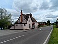
English: Buckland is a village and civil parish in the East Hertfordshire district of Hertfordshire, England. According to the 2001 census it had a population of 285. The village is about 4½ miles south of Royston on the A10 road.
village and civil parish in Hertfordshire, UK  | |||||
| Upload media | |||||
| Instance of | |||||
|---|---|---|---|---|---|
| Location | East Hertfordshire, Hertfordshire, East of England, England | ||||
| Said to be the same as | Buckland (Wikimedia duplicated page, civil parish) | ||||
 | |||||
Subcategories
This category has the following 2 subcategories, out of 2 total.
A
C
- Chipping, Hertfordshire (8 F)
Media in category "Buckland, Hertfordshire"
The following 67 files are in this category, out of 67 total.
-
 A10 - geograph.org.uk - 4784603.jpg 640 × 426; 28 KB
-
 A10 heading north - geograph.org.uk - 5678306.jpg 640 × 428; 142 KB
-
 A10 heading north - geograph.org.uk - 5678307.jpg 640 × 428; 116 KB
-
 A10 heading north, Chipping - geograph.org.uk - 5680974.jpg 640 × 428; 108 KB
-
 A10, Buckland - geograph.org.uk - 4784597.jpg 640 × 426; 52 KB
-
 A10, Buckland Bury - geograph.org.uk - 4784601.jpg 640 × 426; 46 KB
-
 A10, Ermine Street - geograph.org.uk - 4784588.jpg 640 × 426; 29 KB
-
 A10, south of Chipping - geograph.org.uk - 4784612.jpg 640 × 426; 47 KB
-
 A10, southbound - geograph.org.uk - 4784608.jpg 640 × 426; 30 KB
-
 Arable land - geograph.org.uk - 4211141.jpg 1,600 × 1,200; 812 KB
-
 Bridleway around Capons Wood - geograph.org.uk - 4211070.jpg 1,600 × 1,200; 1.02 MB
-
 Bridleway to Chipping - geograph.org.uk - 4211058.jpg 1,600 × 1,200; 733 KB
-
 Bridleway to some footpaths - geograph.org.uk - 4211134.jpg 1,600 × 1,200; 828 KB
-
 Buckland Bottom - geograph.org.uk - 4209011.jpg 1,600 × 1,200; 848 KB
-
 Buckland, Herts - geograph.org.uk - 900.jpg 640 × 480; 24 KB
-
 Capons Wood - geograph.org.uk - 4211040.jpg 1,600 × 1,200; 746 KB
-
 Chipping Hall - geograph.org.uk - 4209000.jpg 1,600 × 1,200; 540 KB
-
 Daw's Lane - geograph.org.uk - 4211212.jpg 1,600 × 1,200; 1.29 MB
-
 Ditch and fields - geograph.org.uk - 4211192.jpg 1,600 × 1,200; 895 KB
-
 Entering Buckland on the A10 - geograph.org.uk - 4784593.jpg 640 × 426; 48 KB
-
 Entering Chipping, A10 - geograph.org.uk - 4784609.jpg 640 × 426; 32 KB
-
 Ermine Street - geograph.org.uk - 4209028.jpg 1,600 × 1,200; 805 KB
-
 Ermine Street - geograph.org.uk - 4784591.jpg 640 × 426; 31 KB
-
 Ermine Street, Buckland - geograph.org.uk - 5580589.jpg 2,048 × 1,536; 989 KB
-
 Ermine Street, Chipping - geograph.org.uk - 5580590.jpg 1,937 × 1,430; 837 KB
-
 Ermine Street, Chipping - geograph.org.uk - 5580591.jpg 2,048 × 1,536; 1,004 KB
-
 Farmed valley - geograph.org.uk - 4218403.jpg 1,600 × 1,200; 845 KB
-
 Farmland by Hodenhoe Manor - geograph.org.uk - 4208690.jpg 1,600 × 1,200; 823 KB
-
 Fields by Buckland Bottom - geograph.org.uk - 4209016.jpg 1,600 × 1,200; 934 KB
-
 Fields by the A10, Chipping - geograph.org.uk - 2992370.jpg 1,600 × 1,200; 504 KB
-
 Fields by the A10, Chipping - geograph.org.uk - 2992379.jpg 1,600 × 1,200; 587 KB
-
 Fields south of Buckland - geograph.org.uk - 4211032.jpg 1,600 × 1,200; 661 KB
-
 Footpath across ploughed field - geograph.org.uk - 4208671.jpg 1,600 × 1,200; 787 KB
-
 Footpath by Buckland Bottom - geograph.org.uk - 4209022.jpg 1,600 × 1,200; 665 KB
-
 Footpath from Buckland - geograph.org.uk - 4209077.jpg 1,600 × 1,200; 800 KB
-
 Footpath junction - geograph.org.uk - 4208687.jpg 1,600 × 1,200; 678 KB
-
 Footpath to Buckland - geograph.org.uk - 4211169.jpg 1,600 × 1,200; 794 KB
-
 Footpath to Buckland - geograph.org.uk - 4211181.jpg 1,600 × 1,200; 752 KB
-
 Footpath to Buckland - geograph.org.uk - 4211198.jpg 1,600 × 1,200; 849 KB
-
 Footpath to Hodenhoe Manor - geograph.org.uk - 4208668.jpg 1,600 × 1,200; 732 KB
-
 Footpath to Reed - geograph.org.uk - 4211263.jpg 1,600 × 1,200; 758 KB
-
 Footpath to Reed - geograph.org.uk - 4211426.jpg 1,600 × 1,200; 847 KB
-
 Footpath to Reed - geograph.org.uk - 4211429.jpg 1,600 × 1,200; 805 KB
-
 Hedge by Buckland Bottom - geograph.org.uk - 4209014.jpg 1,600 × 1,200; 750 KB
-
 House on the A10, Chipping - geograph.org.uk - 2992377.jpg 1,600 × 1,200; 477 KB
-
 Hyde Hall Farm and business centre entrance - geograph.org.uk - 4208685.jpg 1,600 × 1,200; 779 KB
-
 Maize cover crop - geograph.org.uk - 4211084.jpg 1,600 × 1,200; 800 KB
-
 Milestone 34 on A10 at Buckland.jpg 2,736 × 3,648; 4.77 MB
-
 New house in Chipping - geograph.org.uk - 4209044.jpg 1,600 × 1,200; 743 KB
-
 Open fields - geograph.org.uk - 4211157.jpg 1,600 × 1,200; 756 KB
-
 Pheasants on the bridleway - geograph.org.uk - 4211079.jpg 1,600 × 1,125; 1.11 MB
-
 Recently sown field - geograph.org.uk - 4209018.jpg 1,600 × 1,200; 848 KB
-
 Redundant gate - geograph.org.uk - 4211124.jpg 1,600 × 1,200; 940 KB
-
 Road to Barkway - geograph.org.uk - 4211230.jpg 1,600 × 1,200; 961 KB
-
 Royal Oak Close - geograph.org.uk - 4209037.jpg 1,600 × 1,200; 700 KB
-
 St Andrew's church Buckland - geograph.org.uk - 4486106.jpg 4,320 × 3,240; 5.31 MB
-
 St Andrew's Church, Buckland - geograph.org.uk - 3445523.jpg 4,320 × 3,240; 4.44 MB
-
 St Andrew's church, Buckland - geograph.org.uk - 4486100.jpg 4,320 × 3,240; 4.44 MB
-

-
 Terraced cottages, Buckland - geograph.org.uk - 4209071.jpg 1,600 × 1,200; 611 KB
-
 The A10, just south of Reed - geograph.org.uk - 389395.jpg 640 × 384; 44 KB
-
 The Countryman pub, Ermine Street - geograph.org.uk - 4486134.jpg 4,320 × 3,240; 4.26 MB
-
 The Countryman, Chipping - geograph.org.uk - 3510036.jpg 1,024 × 768; 239 KB
-
 Track to Capons Wood - geograph.org.uk - 4209057.jpg 1,600 × 1,200; 877 KB
-
 Trees by the A10, Chipping - geograph.org.uk - 2992374.jpg 1,600 × 1,200; 529 KB
-
 View South - geograph.org.uk - 502024.jpg 565 × 640; 271 KB
-


