Category:Building of Military Institute of Geography, Warsaw
| Object location | | View all coordinates using: OpenStreetMap |
|---|
 | |||||
| Upload media | |||||
| Instance of | |||||
|---|---|---|---|---|---|
| Location | Ochota, Warsaw, Masovian Voivodeship, Poland | ||||
| Street address |
| ||||
| Located on street |
| ||||
| Architect | |||||
| Occupant | |||||
| Heritage designation |
| ||||
| Inception |
| ||||
| Significant event |
| ||||
 | |||||
Media in category "Building of Military Institute of Geography, Warsaw"
The following 14 files are in this category, out of 14 total.
-
 2019 Warszawa aleje Jerozolimskie 97, tablica, 1.jpg 4,580 × 3,438; 9.26 MB
-
 2019 Warszawa aleje Jerozolimskie 97, tablica, 2.jpg 4,904 × 3,681; 9.64 MB
-
 Aleje Jerozolimskie 97 tablica.jpg 1,387 × 1,272; 281 KB
-
 Budynek WIG.jpg 2,592 × 1,944; 1,013 KB
-
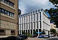
 Gmach Wojskowego Instytutu Geograficznego 2022.jpg 5,842 × 3,702; 11.14 MB
-
 Kartusze wig północ.jpg 2,796 × 2,140; 2.11 MB
-
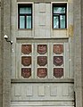 Kartusze wig wschód.jpg 2,607 × 3,365; 3.23 MB
-
 Nowogrodzka square pasaż.jpg 4,448 × 3,240; 3.62 MB
-
 Nowogrodzka square.jpg 4,204 × 2,912; 2.81 MB
-
 Tablica wojskowego instytutu geograficznego.jpg 1,432 × 1,877; 336 KB
-

-
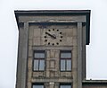 WIG zegar.jpg 3,529 × 2,886; 3.28 MB
-
 Aleje Jerozolimskie Ochota płd.jpg 3,900 × 2,606; 1.31 MB
-
 Wojskowy Instytut Geograficzny.jpg 3,552 × 2,586; 3.51 MB


