Category:Buildings in Chatham, Kent
Subcategories
This category has the following 26 subcategories, out of 26 total.
- Hotels in Chatham, Kent (5 F)
- Restaurants in Chatham (6 F)
3
- 351 High Street, Chatham (2 F)
A
- Anchorage House, Chatham (6 F)
B
- The Bell Mast, Chatham (11 F)
- Brook Pumping House Museum (19 F)
C
- Central Theatre (Chatham) (37 F)
- Chatham Old Town Hall (21 F)
F
- Former Guard House, Chatham (2 F)
H
- Hatchelling House (2 F)
- Houses in Chatham, Kent (45 F)
K
- Kitchener Barracks, Chatham (5 F)
M
- Masonic Hall, Chatham (4 F)
O
- Oasts in Chatham (1 F)
P
R
- Chatham railway station (33 F)
S
T
- Theatre Royal, Chatham (9 F)
W
Media in category "Buildings in Chatham, Kent"
The following 131 files are in this category, out of 131 total.
-

-
 Albany Terrace, Chatham - geograph.org.uk - 3772287.jpg 3,488 × 2,616; 2.18 MB
-
 Albany Terrace, Chatham - geograph.org.uk - 3914086.jpg 3,264 × 2,448; 2.35 MB
-
 All Saints' Children's Centre - geograph.org.uk - 1147300.jpg 640 × 430; 60 KB
-

-
 Any room for one more^ - geograph.org.uk - 2729900.jpg 3,216 × 4,288; 6.92 MB
-
 BBC Radio Kent, Sun Pier, Chatham - geograph.org.uk - 2045901.jpg 2,048 × 1,536; 1.05 MB
-
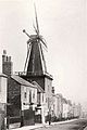 Belsey's Mill, Chatham.jpg 300 × 450; 24 KB
-
 Block of Flats, Luton, Chatham - geograph.org.uk - 1147343.jpg 640 × 430; 46 KB
-
 Blockbusters, Chatham - geograph.org.uk - 3340302.jpg 4,288 × 3,216; 3.87 MB
-
 Bournville Avenue - geograph.org.uk - 3065382.jpg 640 × 427; 96 KB
-
 Brenchley Close, Rochester - geograph.org.uk - 4075999.jpg 3,488 × 2,616; 2.84 MB
-
 Broadside, MHS Homes - geograph.org.uk - 1613032.jpg 640 × 427; 54 KB
-
 Brook House, Chatham - geograph.org.uk - 3955768.jpg 3,264 × 2,448; 2 MB
-
 Brook Multi Storey Car Park, Chatham - geograph.org.uk - 636917.jpg 640 × 480; 85 KB
-
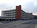 Brook Pentagon car park, Chatham - geograph.org.uk - 3955753.jpg 3,264 × 2,448; 2.18 MB
-

-

-
 Bryant Street, Chatham - geograph.org.uk - 3782701.jpg 3,488 × 2,616; 2.26 MB
-
 Bryant Street, Chatham - geograph.org.uk - 3782704.jpg 3,488 × 2,616; 1.94 MB
-
 Building by the bus station - geograph.org.uk - 3889573.jpg 640 × 430; 64 KB
-
 Bus Driver rest room, Chatham Bus Station - geograph.org.uk - 2646991.jpg 4,288 × 3,216; 5.96 MB
-
 Cafe Milano, Chatham - geograph.org.uk - 3772235.jpg 3,488 × 2,616; 2.16 MB
-

-
 Chapel of Rest,Chatham Cemetery - geograph.org.uk - 2891353.jpg 4,288 × 3,216; 6.06 MB
-
 Chatham fire station - geograph.org.uk - 1284269.jpg 640 × 426; 199 KB
-
 Chatham High Street - geograph.org.uk - 929065.jpg 640 × 480; 83 KB
-
 Chatham Maritime (geograph 2926442).jpg 640 × 430; 89 KB
-
 Chatham Mosque, Chatham Hill - geograph.org.uk - 616962.jpg 480 × 640; 64 KB
-
 Chatham Police Station - geograph.org.uk - 3955763.jpg 3,264 × 2,448; 1.72 MB
-
 Chatham Post Office - geograph.org.uk - 1671912.jpg 2,580 × 1,932; 1.03 MB
-
 Chatham Riverside Apartments and River Medway - geograph.org.uk - 4273073.jpg 4,608 × 3,456; 4.4 MB
-
 Chatham Sorting Office - geograph.org.uk - 701908.jpg 640 × 480; 88 KB
-
 Chatham Telephone Exchange (1) - geograph.org.uk - 701909.jpg 640 × 480; 67 KB
-
 Chatham Telephone Exchange (2) - geograph.org.uk - 701910.jpg 640 × 480; 63 KB
-
 ChathamSunPier4171.JPG 2,048 × 1,536; 802 KB
-
 ChathamSunPier4174.JPG 2,048 × 1,536; 794 KB
-
 Closed Age Concern Building, Chatham - geograph.org.uk - 1938563.jpg 3,072 × 2,304; 1.09 MB
-
 Collapsed Building, High Street, Chatham - geograph.org.uk - 3850281.jpg 3,488 × 2,616; 2.22 MB
-
 Community Hub Chatham - geograph.org.uk - 3889598.jpg 640 × 430; 64 KB
-
 Completed Chatham Riverside Apartments (2) - geograph.org.uk - 4538156.jpg 4,608 × 3,456; 3.64 MB
-
 Completed Chatham Riverside Apartments - geograph.org.uk - 4538125.jpg 4,608 × 3,456; 4.33 MB
-
 Construction in Chatham - geograph.org.uk - 1339436.jpg 640 × 480; 76 KB
-
 Coombs of Medway, car dealership - geograph.org.uk - 2045907.jpg 2,048 × 1,536; 1.15 MB
-
 Cornwallis Avenue, Chatham - geograph.org.uk - 3720484.jpg 3,488 × 2,616; 2.17 MB
-
 Coronation Flats, Jenkins Dale, Chatham - geograph.org.uk - 3581781.jpg 3,488 × 2,616; 2.14 MB
-
 Cranleigh Gardens, Chatham - geograph.org.uk - 3972302.jpg 3,488 × 2,616; 2.19 MB
-
 Crest Road, Warren Wood - geograph.org.uk - 3972323.jpg 3,488 × 2,616; 1.89 MB
-
 Cromwell Terrace, Chatham - geograph.org.uk - 3581780.jpg 3,488 × 2,616; 2.22 MB
-
 Cross Street, Chatham - geograph.org.uk - 3772217.jpg 3,488 × 2,616; 2.21 MB
-
 Cross Street, Chatham - geograph.org.uk - 4317408.jpg 2,272 × 1,704; 822 KB
-
 Cross Street, Chatham - geograph.org.uk - 4791823.jpg 2,272 × 1,704; 784 KB
-
 Curzon Road, Chatham - geograph.org.uk - 4773521.jpg 2,272 × 1,704; 789 KB
-
 Dale Street, Chatham - geograph.org.uk - 4076246.jpg 3,488 × 2,616; 3.57 MB
-
 Demolition at Hards Town, Chatham - geograph.org.uk - 903092.jpg 640 × 480; 64 KB
-
 Dorrit Way, Warren Wood - geograph.org.uk - 3972335.jpg 3,488 × 2,616; 2.15 MB
-

-
 Drivers restroom, 17 January 2018.jpg 5,152 × 3,864; 8.51 MB
-
 Elmhurst Gardens, Chatham - geograph.org.uk - 3972298.jpg 3,488 × 2,616; 2.16 MB
-
 Empire Reach - geograph.org.uk - 4452776.jpg 4,608 × 3,456; 3.95 MB
-
 Empty building in Chatham - geograph.org.uk - 1954284.jpg 3,072 × 2,304; 1.14 MB
-
 Finishing touches on Chatham Riverside Apartments - geograph.org.uk - 4382770.jpg 3,456 × 4,608; 3.91 MB
-
 Finishing touches on Chatham Riverside Apartments - geograph.org.uk - 4382778.jpg 3,456 × 4,608; 3.62 MB
-
 Flats, Dock Rd, Chatham - geograph.org.uk - 1148619.jpg 640 × 430; 69 KB
-
 Flats, Ordnance Rd - geograph.org.uk - 1147754.jpg 640 × 430; 53 KB
-
 Former Age Concern building, Chatham Riverside - geograph.org.uk - 1950402.jpg 3,488 × 2,616; 2.13 MB
-
 Former Guardshouse to Fort Amherst - geograph.org.uk - 3730589.jpg 4,288 × 3,216; 4.27 MB
-
 Former Ordnance Store, Gun Wharf - geograph.org.uk - 3889606.jpg 640 × 430; 89 KB
-

-
 Gala Bingo, Chatham - geograph.org.uk - 929063.jpg 640 × 480; 60 KB
-

-
 Gatekeepers Lodge on Pembroke Road - geograph.org.uk - 1561207.jpg 640 × 427; 97 KB
-
 Ghurkas Brother - geograph.org.uk - 3889455.jpg 640 × 430; 54 KB
-
 Haig Avenue, Rochester - geograph.org.uk - 3720466.jpg 3,488 × 2,616; 2.11 MB
-
 Haig Avenue, Rochester - geograph.org.uk - 3850209.jpg 3,488 × 2,616; 1.73 MB
-
 Hamond Hill, Chatham - geograph.org.uk - 3599226.jpg 3,488 × 2,616; 2.17 MB
-
 Hards Town, Chatham - geograph.org.uk - 3772194.jpg 3,488 × 2,616; 1.82 MB
-
 Harptree Drive, Chatham - geograph.org.uk - 1350315.jpg 640 × 480; 68 KB
-
 Hook Meadow Library - geograph.org.uk - 1043513.jpg 640 × 481; 61 KB
-

-
 Jackson Avenue, Rochester - geograph.org.uk - 3720461.jpg 3,488 × 2,616; 2.21 MB
-
 Keygate Motors, Chatham - geograph.org.uk - 3772081.jpg 3,488 × 2,616; 1.91 MB
-
 King's Theatre, Chatham - geograph.org.uk - 4225351.jpg 3,264 × 2,448; 1.24 MB
-
 Kingswood Avenue, Chatham - geograph.org.uk - 3720508.jpg 3,488 × 2,616; 2.27 MB
-
 Lines Terrace, Chatham - geograph.org.uk - 4317469.jpg 2,272 × 1,704; 879 KB
-

-
 Magpie Hall Road, Chatham - geograph.org.uk - 141129.jpg 640 × 480; 87 KB
-

-
 Medway Maritime Hospital - geograph.org.uk - 3393799.jpg 640 × 430; 35 KB
-
 Medway Maritime Hospital - geograph.org.uk - 922479.jpg 640 × 480; 67 KB
-
 Mid Kent College, Horsted Campus - geograph.org.uk - 925051.jpg 640 × 480; 46 KB
-
 New block of apartments - geograph.org.uk - 4273067.jpg 4,559 × 2,381; 2.65 MB
-
 New housing on Eldon Street, Chatham - geograph.org.uk - 4607399.jpg 4,608 × 3,456; 4.71 MB
-
 Nucleus Arts, Chatham - geograph.org.uk - 3827331.jpg 3,488 × 2,616; 2.6 MB
-
 Ordnance Terrace, Chatham - geograph.org.uk - 2521580.jpg 4,000 × 3,000; 4.07 MB
-
 Ordnance Terrace, Chatham - geograph.org.uk - 3510180.jpg 3,488 × 2,616; 2.29 MB
-
 Ordnance Terrace, Chatham - geograph.org.uk - 3510183.jpg 3,488 × 2,616; 2.24 MB
-
 Otway Street, Chatham - geograph.org.uk - 3581778.jpg 3,488 × 2,616; 2.11 MB
-
 Otway Terrace, Chatham - geograph.org.uk - 4059804.jpg 3,488 × 2,616; 2.32 MB
-
 Peak House, Chatham - geograph.org.uk - 3827256.jpg 3,488 × 2,616; 2.14 MB
-
 Pier Chambers, Chatham - geograph.org.uk - 1341083.jpg 640 × 480; 73 KB
-
 Piggys Cafe, High Street, Chatham - geograph.org.uk - 4795269.jpg 2,448 × 3,264; 1.57 MB
-
 Post Office, Scotteswood Av. - geograph.org.uk - 1147363.jpg 640 × 430; 51 KB
-
 Pumping Station, Chatham.jpg 3,868 × 2,720; 4.52 MB
-
 Rats Bay pumping station, Chatham - geograph.org.uk - 1341066.jpg 640 × 480; 70 KB
-
 Rats Bay Pumping Station, Chatham - geograph.org.uk - 3889469.jpg 3,488 × 2,616; 2.24 MB
-
 Rats Bay Pumping Station, Chatham - geograph.org.uk - 3889802.jpg 3,488 × 2,616; 2.17 MB
-

-

-
 Rhode Street Car Park, Chatham - geograph.org.uk - 3302745.jpg 640 × 427; 45 KB
-
 Service Industry, Magpie Hall Rd - geograph.org.uk - 1147238.jpg 640 × 430; 69 KB
-

-
 Spembley Works, Chatham - geograph.org.uk - 3599225.jpg 3,488 × 2,616; 2.14 MB
-
 Spemco Manufacturing LTD, Rochester - geograph.org.uk - 1349090.jpg 640 × 480; 67 KB
-
 St. Michael's Day Nursery, Chatham - geograph.org.uk - 4059663.jpg 3,488 × 2,616; 2.23 MB
-
 The Brook Car Park, Chatham - geograph.org.uk - 681353.jpg 640 × 480; 53 KB
-
 The Brook, Chatham - geograph.org.uk - 3772227.jpg 3,488 × 2,616; 1.52 MB
-
 The Brook, Chatham - geograph.org.uk - 3955754.jpg 3,264 × 2,448; 1.79 MB
-
 The Drill Hall Library - geograph.org.uk - 1256260.jpg 640 × 480; 56 KB
-
 The Eye, Barrier Road, Chatham - geograph.org.uk - 852914.jpg 640 × 480; 84 KB
-
 The Eye, Chatham - geograph.org.uk - 929059.jpg 640 × 480; 80 KB
-
 The Medical Centre, Bryant Street, Chatham - geograph.org.uk - 3460349.jpg 3,648 × 2,736; 1.34 MB
-
 The new block of apartments, Sun Pier - geograph.org.uk - 4273060.jpg 4,608 × 3,456; 4.16 MB
-
 The Old Courthouse, Chatham - geograph.org.uk - 1361280.jpg 640 × 480; 63 KB
-

-
 Tower Blocks on Bryant Street - geograph.org.uk - 140765.jpg 480 × 640; 79 KB
-
 Tower Blocks, Chatham - geograph.org.uk - 1520935.jpg 640 × 369; 47 KB
-
 Tudor House, Chatham High Street - geograph.org.uk - 1340862.jpg 640 × 480; 117 KB
-
 Upper Mast House, Chatham Docks - geograph.org.uk - 1148651.jpg 640 × 430; 54 KB
-

-
 What is an 'ADVCEN ICETRE' - geograph.org.uk - 1742719.jpg 2,304 × 3,072; 1.77 MB


.jpg)


_-_geograph.org.uk_-_701909.jpg)
_-_geograph.org.uk_-_701910.jpg)


_-_geograph.org.uk_-_4538156.jpg)


