Category:Buildings in Chester
Wikimedia category | |||||
| Upload media | |||||
| Instance of | |||||
|---|---|---|---|---|---|
| Category combines topics | |||||
| Category contains |
| ||||
| |||||
Subcategories
This category has the following 29 subcategories, out of 29 total.
- High-rises in Chester (2 F)
1
- 1 Bridge Street, Chester (5 F)
A
B
- Boughton shot tower, Chester (26 F)
C
- Chester Crown Court (5 F)
- Chester Library (23 F)
- Chester Magistrates' Court (8 F)
- Churchill House, Chester (1 F)
- Countess of Chester Hospital (2 F)
- County Hall, Chester (15 F)
H
M
P
R
- Railway Cocoa Rooms, Chester (2 F)
S
T
U
W
- Walmoor Hill (5 F)
Media in category "Buildings in Chester"
The following 200 files are in this category, out of 278 total.
(previous page) (next page)-
 119 Brook Street to let, Chester - geograph.org.uk - 3706066.jpg 800 × 528; 122 KB
-

-
 15 Abbey Street, Chester - geograph.org.uk - 691467.jpg 480 × 640; 180 KB
-
 2 new houses, Western Court, Newton - geograph.org.uk - 2506534.jpg 640 × 480; 83 KB
-
 20 White Friars, Chester - geograph.org.uk - 4404805.jpg 3,645 × 2,435; 2.92 MB
-
 4-10, Abbey Street.jpg 3,120 × 4,160; 3.96 MB
-
 4A Hunter Street - geograph.org.uk - 497169.jpg 640 × 480; 82 KB
-
 6 keramische Aufsätze.jpg 2,592 × 1,944; 2.01 MB
-
 A High Street for our time - geograph.org.uk - 3604733.jpg 1,600 × 1,200; 459 KB
-
 Abbey House, Chester.jpg 4,320 × 3,240; 3.49 MB
-
 Abbey Square - geograph.org.uk - 1022098.jpg 640 × 480; 244 KB
-
 Abbey Square - north side - geograph.org.uk - 668073.jpg 640 × 480; 194 KB
-
 Abbey Street - geograph.org.uk - 822573.jpg 640 × 457; 452 KB
-
-
 Abbey Street, Chester - geograph.org.uk - 1152385.jpg 640 × 427; 79 KB
-
 Abbot's Nook - geograph.org.uk - 881143.jpg 640 × 457; 358 KB
-
 Abbot's Park Cadet Training Centre - geograph.org.uk - 44926.jpg 640 × 480; 203 KB
-
 Albion Street - geograph.org.uk - 1098147.jpg 640 × 480; 119 KB
-
 Alleyway to the rear of Albion Street. - geograph.org.uk - 1098152.jpg 640 × 480; 110 KB
-
 Anachronism in Chester, England - panoramio.jpg 1,728 × 2,304; 883 KB
-
 Apartments - geograph.org.uk - 1334012.jpg 640 × 457; 226 KB
-
 Apartments - geograph.org.uk - 836816.jpg 640 × 457; 282 KB
-
 Back gardens - geograph.org.uk - 691696.jpg 640 × 480; 372 KB
-
 Behind Crowne Plaza - geograph.org.uk - 833186.jpg 640 × 457; 307 KB
-
 Between Albion Place and Albion Street - geograph.org.uk - 457171.jpg 640 × 480; 204 KB
-
 Bingo hall - geograph.org.uk - 823693.jpg 640 × 457; 281 KB
-
 Blacon Community and Arts Centre (1).JPG 4,320 × 3,240; 2.85 MB
-
 Blacon Sports & Social Club (1).JPG 4,320 × 3,240; 2.56 MB
-
 Blacon Sports & Social Club (2).JPG 4,320 × 3,240; 2.99 MB
-
 Bolland's Court, off White Friars - geograph.org.uk - 1936304.jpg 480 × 640; 123 KB
-
 Bollicini bar-restaurant 2 Abbey Green - geograph.org.uk - 103218.jpg 640 × 480; 134 KB
-
 Boughton Lodge - Front Elevation.jpg 4,896 × 3,672; 6.4 MB
-
 Boughton Post Office, Christleton Road, Chester - DSC07972.JPG 3,648 × 2,736; 3.48 MB
-
 Bouverie Street - geograph.org.uk - 835558.jpg 640 × 457; 337 KB
-
 Bouverie Street - geograph.org.uk - 835559.jpg 640 × 457; 318 KB
-

-
 Bouverie Street, Chester - geograph.org.uk - 3672821.jpg 3,648 × 2,736; 3.93 MB
-
 Bridge Place on Lower Bridge Street - geograph.org.uk - 674014.jpg 480 × 640; 241 KB
-
 Bridge Street Row West - geograph.org.uk - 1335334.jpg 640 × 457; 267 KB
-
 Brookside Hotel - geograph.org.uk - 2349268.jpg 1,600 × 1,064; 376 KB
-
 Building under construction, Crewe Street, Chester.jpg 4,320 × 3,240; 3.01 MB
-
 Buildings on Eastgate Street, Chester (2).JPG 4,320 × 3,240; 3.58 MB
-
 Buildings on Eastgate Street, Chester (3).JPG 3,240 × 4,320; 3.48 MB
-
 Café at Little Roodee car park, Chester - geograph.org.uk - 1128792.jpg 640 × 480; 106 KB
-
 Cambrian Road, Chester - geograph.org.uk - 3658437.jpg 1,280 × 856; 264 KB
-

-
 Canal Basin by Cow Lane Bridge - geograph.org.uk - 630914.jpg 640 × 480; 158 KB
-
 Canal from the towpath - geograph.org.uk - 822575.jpg 640 × 457; 342 KB
-
 Canal in Chester - geograph.org.uk - 1442779.jpg 640 × 426; 322 KB
-
 Canal Street - geograph.org.uk - 836790.jpg 640 × 457; 286 KB
-
 Canal Street - geograph.org.uk - 837078.jpg 640 × 480; 150 KB
-
 Canal Street day centre - geograph.org.uk - 836796.jpg 640 × 457; 292 KB
-
 Canalside development - geograph.org.uk - 1280193.jpg 640 × 457; 314 KB
-
 Canalside development - geograph.org.uk - 825276.jpg 640 × 457; 365 KB
-
 Canalside Inn, Chester - DSC08245.JPG 3,648 × 2,736; 3.47 MB
-
 Canning Street - geograph.org.uk - 859459.jpg 640 × 457; 309 KB
-
 Cathedral Buildings - geograph.org.uk - 667706.jpg 480 × 640; 145 KB
-
 Cathedral Buildings side window - geograph.org.uk - 667715.jpg 480 × 640; 182 KB
-
 Cathedral Chambers, St Werburgh Street - geograph.org.uk - 788272.jpg 480 × 640; 147 KB
-
 Centurion Point - geograph.org.uk - 749847.jpg 640 × 480; 151 KB
-
 Centurion Point ^2 - geograph.org.uk - 749864.jpg 640 × 480; 69 KB
-
 Change of use - geograph.org.uk - 832928.jpg 640 × 457; 354 KB
-
 Chesham Street - geograph.org.uk - 2448469.jpg 3,704 × 2,592; 1.21 MB
-
 ChesrerArch1.JPG 2,816 × 2,112; 2.07 MB
-
 Chester Arch10.JPG 2,488 × 1,412; 2.65 MB
-
 Chester baths.jpeg 640 × 457; 373 KB
-
 Chester Central Telephone Exchange (1) - geograph.org.uk - 5325701.jpg 2,592 × 1,944; 1.36 MB
-
 Chester Cocoa House.jpg 1,805 × 2,716; 1.08 MB
-
 Chester Cultural Centre development - geograph.org.uk - 4500948.jpg 3,184 × 2,123; 1.55 MB
-
 Chester Cultural Centre development - geograph.org.uk - 4500957.jpg 3,184 × 2,123; 1.17 MB
-
 Chester Deaf Centre - geograph.org.uk - 2670219.jpg 800 × 600; 313 KB
-
 Chester Deaf Centre by night - geograph.org.uk - 2670218.jpg 800 × 600; 351 KB
-
 Chester eateries on Pepper Street - geograph.org.uk - 5700547.jpg 640 × 414; 49 KB
-
 Chester Film Co-op - geograph.org.uk - 3829700.jpg 800 × 705; 141 KB
-
 Chester Fire Station - geograph.org.uk - 1068194.jpg 640 × 412; 57 KB
-
 Chester Fire Station, Newtown, Chester - geograph.org.uk - 3305381.jpg 4,000 × 3,000; 2.01 MB
-
 Chester Fire Station, Newtown, Chester - geograph.org.uk - 3305384.jpg 4,000 × 3,000; 2.91 MB
-
 Chester Home Guard club (1).JPG 4,320 × 3,240; 3.93 MB
-
 Chester Home Guard club (2).JPG 4,320 × 3,240; 3.95 MB
-
 Chester Home Guard Club (closed) - geograph.org.uk - 3369330.jpg 4,000 × 3,000; 2.4 MB
-
 Chester Home Guard Club (closed) - geograph.org.uk - 3371467.jpg 4,000 × 3,000; 2.5 MB
-
 Chester Magistrates Court - geograph.org.uk - 2800473.jpg 3,296 × 2,472; 1.92 MB
-
 Chester roofscape - geograph.org.uk - 3839010.jpg 640 × 489; 47 KB
-
 Chester Sailing and Canoeing Club.JPG 4,608 × 3,456; 3.57 MB
-
 Chester Triumphal Arch.jpg 1,195 × 1,549; 841 KB
-
 Bell Tower Walk past the Addleshaw Tower - geograph.org.uk - 787486.jpg 480 × 640; 211 KB
-
 Chester, Canal Street House - geograph.org.uk - 4755742.jpg 3,264 × 2,448; 2.44 MB
-
 Chester, Temperance Hall - geograph.org.uk - 4755768.jpg 3,264 × 2,448; 2.18 MB
-
 Chester-Canning Street - geograph.org.uk - 2339626.jpg 640 × 480; 81 KB
-
 Chester-Northgate Street - geograph.org.uk - 2344196.jpg 640 × 480; 75 KB
-
 ChesterArch2.JPG 2,816 × 2,112; 2.5 MB
-
 ChesterArch3.JPG 2,816 × 2,112; 2.8 MB
-
 ChesterArch4.JPG 2,816 × 2,112; 2.59 MB
-
 ChesterArch7.JPG 2,816 × 2,112; 2.9 MB
-
 ChesterArch8.JPG 2,816 × 2,112; 2.37 MB
-
 ChesterArch9.JPG 2,816 × 2,112; 2.7 MB
-
 ChesterGolfClub.JPG 2,816 × 2,112; 2.67 MB
-
 Cheyney Road, Chester - geograph.org.uk - 2880029.jpg 3,532 × 2,680; 1.99 MB
-
 Chimney ornaments - geograph.org.uk - 2508597.jpg 640 × 480; 58 KB
-
 City of Chester council school.jpg 4,320 × 3,240; 3.28 MB
-
 City Rd, Chester - geograph.org.uk - 1447894.jpg 640 × 480; 69 KB
-
 Clock detail on Cathedral Buildings - geograph.org.uk - 667709.jpg 480 × 640; 225 KB
-
 Commerce House in Hunter Street - geograph.org.uk - 1141826.jpg 480 × 640; 149 KB
-
 Commerce House light-well - geograph.org.uk - 1141833.jpg 640 × 480; 144 KB
-
 Council Offices by roundabout - geograph.org.uk - 1731875.jpg 640 × 480; 80 KB
-
 Cruise night club in St John's Street - geograph.org.uk - 825011.jpg 480 × 640; 61 KB
-
 Demolition by dismantling - geograph.org.uk - 1335428.jpg 640 × 457; 312 KB
-
 Demolition of Commerce House, Chester - geograph.org.uk - 3806629.jpg 4,000 × 3,000; 2.55 MB
-
 Demolition site - geograph.org.uk - 1320994.jpg 640 × 457; 291 KB
-
 Dewa Roman Experience, Chester. - geograph.org.uk - 103586.jpg 640 × 480; 81 KB
-
 Dining Quarter Development, Pepper Street, Chester - geograph.org.uk - 4471187.jpg 4,000 × 3,000; 2.54 MB
-
 Dining Quarter Development, Pepper Street, Chester - geograph.org.uk - 4471214.jpg 4,000 × 3,000; 2.8 MB
-
 Disused Building, Chester - geograph.org.uk - 702139.jpg 640 × 480; 83 KB
-
 Duke Street and Bridgegate Chambers - geograph.org.uk - 588349.jpg 640 × 480; 160 KB
-
 DVLA, Norroy House, Nun's Road, Chester.JPG 4,320 × 3,240; 5.61 MB
-
 Eastern end of Hunter Street, Chester - geograph.org.uk - 3829432.jpg 800 × 600; 132 KB
-
 Egerton Street re-development. - geograph.org.uk - 825291.jpg 640 × 457; 287 KB
-

-
 Ellies Bistro, Chester - geograph.org.uk - 3799719.jpg 800 × 641; 178 KB
-
 Entrance to Hamilton Place - geograph.org.uk - 2593710.jpg 1,024 × 681; 173 KB
-
 Evening Rooftops, Garden Lane - geograph.org.uk - 2749455.jpg 1,600 × 1,074; 431 KB
-
 Eversley Park - geograph.org.uk - 825442.jpg 640 × 457; 322 KB
-
 Ex Ford Dealership Building - geograph.org.uk - 587416.jpg 640 × 480; 145 KB
-
 Fitness centre at night - geograph.org.uk - 827355.jpg 640 × 457; 317 KB
-

-

-

-

-
-

-

-
 Former George Street School - geograph.org.uk - 814508.jpg 640 × 480; 59 KB
-
 Former Police Headquarters - geograph.org.uk - 450333.jpg 640 × 480; 209 KB
-
 Formerly The Northgate Arms - geograph.org.uk - 560992.jpg 640 × 480; 64 KB
-
 Freemasons Hall, Hunter Street ^1 - geograph.org.uk - 450596.jpg 598 × 478; 65 KB
-
 Freemasons Hall, Hunter Street ^3 - geograph.org.uk - 484670.jpg 640 × 480; 61 KB
-
 Frodsham Street, Chester - geograph.org.uk - 3576737.jpg 1,600 × 1,364; 542 KB
-
 Front Elevation of Boughton Lodge.jpg 4,896 × 3,672; 6.88 MB
-
 Fuzz talking to classic car enthusiasts.jpg 960 × 540; 67 KB
-
 Fuzz Townshend and John Woods Motorcare.JPG 1,024 × 768; 197 KB
-
 Fuzz Townshend Classic Friendly Sign.JPG 1,600 × 1,200; 305 KB
-
 Garden Lane car park - geograph.org.uk - 836727.jpg 640 × 457; 296 KB
-
 Garden Quarter, street art in Chester - geograph.org.uk - 3672842.jpg 2,860 × 2,208; 2.76 MB
-
 George Street and school - geograph.org.uk - 1433230.jpg 640 × 480; 125 KB
-
 George Street Centre, Chester - geograph.org.uk - 3691764.jpg 800 × 649; 160 KB
-

-
 George Street, Chester - geograph.org.uk - 3857026.jpg 5,184 × 3,456; 3.37 MB
-
 Gilwern - geograph.org.uk - 881121.jpg 640 × 457; 383 KB
-
 Goldsmith House and Register Office - geograph.org.uk - 785940.jpg 640 × 480; 89 KB
-
 Goldsmiths House - geograph.org.uk - 840017.jpg 640 × 457; 334 KB
-
 Great Western House, Boundary Lane, Saltney.JPG 4,320 × 3,240; 2.53 MB
-
 Grosvenor club1.jpg 640 × 434; 60 KB
-

-
 Guest house on Hough Green, Chester - DSC08050.JPG 3,648 × 2,736; 3.55 MB
-
 Habitat in Pepper Street - geograph.org.uk - 1139694.jpg 640 × 480; 125 KB
-
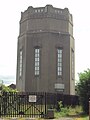 Handbridge Water Tower, Chester - DSC08045.JPG 2,736 × 3,648; 3.76 MB
-
 Haygarth Heights, Chester - geograph.org.uk - 3308000.jpg 3,000 × 4,000; 2.06 MB
-
 Hole in the rock - geograph.org.uk - 857334.jpg 640 × 457; 332 KB
-
 House on Duke Street, Chester (1).JPG 4,320 × 3,240; 2.99 MB
-
 House on Duke Street, Chester (2).JPG 4,320 × 3,240; 3.38 MB
-
 HQ building in the snow - geograph.org.uk - 1654212.jpg 640 × 480; 182 KB
-
 HQ Chester - geograph.org.uk - 1022082.jpg 640 × 480; 229 KB
-
 Hunter Street Surgery, Chester - geograph.org.uk - 982585.jpg 640 × 480; 96 KB
-
 Hydro Electric Power Station - geograph.org.uk - 450315.jpg 640 × 480; 267 KB
-
 Inner ring road apartments - geograph.org.uk - 836887.jpg 640 × 457; 315 KB
-
 Keramische Schornsteinaufsätze.jpg 2,592 × 1,944; 1.94 MB
-
 Kirkton House, Chester - geograph.org.uk - 3829306.jpg 800 × 719; 192 KB
-
 Kirkton House, Hunter Street - geograph.org.uk - 3806639.jpg 3,290 × 2,450; 2.12 MB
-
 Kirkton House, Hunter Street, Chester (1).jpg 1,232 × 2,048; 1.23 MB
-
 Kirkton House, Hunter Street, Chester (2).jpg 2,048 × 1,232; 1.37 MB
-
 Lamont and Sons Depository, Love Street - geograph.org.uk - 622835.jpg 640 × 480; 128 KB
-
 Linenhall stables - geograph.org.uk - 826690.jpg 640 × 457; 382 KB
-
 Lloyds of Chester Hotel (1).JPG 3,240 × 4,320; 2.94 MB
-
 Mallard House, Boundary Lane, Saltney.JPG 4,320 × 3,240; 3.44 MB
-
 Merchants House and the moon - geograph.org.uk - 1116720.jpg 480 × 640; 133 KB
-
 Merchants' House - geograph.org.uk - 833209.jpg 640 × 457; 327 KB
-
 Miniature railway building, Grosvenor Park, Chester - DSC07986.JPG 3,648 × 2,736; 3.56 MB
-
 NCRQ headquarters.jpg 2,000 × 1,335; 3.01 MB
-
 New benches at Chester Cross - geograph.org.uk - 1938094.jpg 640 × 480; 139 KB
-
 New Build in Upper Cambrian Road, Chester - geograph.org.uk - 4471078.jpg 4,000 × 3,000; 2.92 MB
-
 New office and apartment building on George Street, Chester.jpg 4,320 × 3,240; 3.89 MB
-
 New use coming - geograph.org.uk - 2508601.jpg 640 × 480; 90 KB
-
 Newgate House, Chester - geograph.org.uk - 5723136.jpg 5,184 × 3,456; 3.31 MB
-
 NHS Centre and Council Offices, Chester - geograph.org.uk - 3857063.jpg 5,184 × 3,456; 4.67 MB
-
 No 3 Upper Northgate Street - geograph.org.uk - 836931.jpg 480 × 640; 76 KB
-
 Northgate Arena - geograph.org.uk - 2907622.jpg 3,388 × 2,556; 1.62 MB
-
 Northgate arena - geograph.org.uk - 830191.jpg 640 × 457; 312 KB
-
 Northgatearena.jpg 400 × 300; 35 KB
-
 Nun's Road, Chester - geograph.org.uk - 3227748.jpg 640 × 480; 72 KB
-
 Nun's Road, Chester - geograph.org.uk - 3227789.jpg 640 × 480; 73 KB
-
 O'Hares jewellers, Chester - geograph.org.uk - 3799980.jpg 630 × 800; 176 KB
-
 Oak House, Trafford Street - geograph.org.uk - 4416603.jpg 3,184 × 2,123; 759 KB
-

-

-
 Overleigh private day nursery, Handbridge (1).JPG 4,608 × 3,456; 3.55 MB
-
 Overleigh private day nursery, Handbridge (2).JPG 4,608 × 3,456; 3.42 MB
-
 Pine Lodge - geograph.org.uk - 1336849.jpg 640 × 457; 372 KB
-
 Princess Street and Chester Market - geograph.org.uk - 530104.jpg 640 × 480; 135 KB
-
-
 Queen's Park High School, Chester.gif 288 × 384; 416 KB


.JPG)
.JPG)
.JPG)


.JPG)
.JPG)


_-_geograph.org.uk_-_5325701.jpg)


.JPG)
.JPG)
_-_geograph.org.uk_-_3369330.jpg)
_-_geograph.org.uk_-_3371467.jpg)


.JPG)
.JPG)


.jpg)
.jpg)


.JPG)


.JPG)
.JPG)


