Category:Buildings in Newcastle-under-Lyme
Subcategories
This category has the following 8 subcategories, out of 8 total.
- Pubs in Newcastle-under-Lyme (21 F)
- Shops in Newcastle-under-Lyme (37 F)
C
E
N
- New Vic Theatre (5 F)
- Newcastle-under-Lyme Guildhall (14 F)
- Newcastle-under-Lyme School (4 F)
Media in category "Buildings in Newcastle-under-Lyme"
The following 92 files are in this category, out of 92 total.
-
 1 King St, Newcastle-under-Lyme, Staffs, ST5 1EN.jpg 4,032 × 3,024; 4.33 MB
-
 10, King St, Newcastle-under-Lyme, Staffs, ST5 1EL.jpg 3,024 × 4,032; 3.56 MB
-
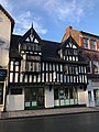 14 and 16 High Street, Newcastle-under-Lyme.jpg 3,024 × 4,032; 2.14 MB
-
 14, 15 and 16 Ironmarket, Newcastle-under-Lyme.jpg 640 × 462; 100 KB
-
 2 Queen St, Newcastle-under-Lyme, Staffs, ST5 1EE.jpg 4,032 × 3,024; 3.54 MB
-
 2, Queen St, Newcastle-under-Lyme, Staffs, ST5 1 EE, full width.jpg 4,032 × 3,024; 3.52 MB
-
 21 Marsh Parade, Newcastle-under-Lyme.jpg 1,600 × 1,166; 472 KB
-
 23 and 25 Marsh Parade, Newcastle-under-Lyme, Staffs ST5 1BT.jpg 4,032 × 3,024; 3.22 MB
-
 27 Marsh Parade, Newcastle-under-Lyme, Staffs, ST5 1BT.jpg 3,024 × 4,032; 3.1 MB
-
 3 King St, Newcastle-under-Lyme, Staffs, ST5 1EN.jpg 4,032 × 3,024; 3.57 MB
-
 31 Ironmarket, Newcastle-under-Lyme.jpg 3,020 × 2,263; 2.17 MB
-
 6 and 8 Queen Street,, Newcastle-under-Lyme.jpg 3,388 × 2,716; 3.76 MB
-
 65 Lower Street, Newcastle-under-Lyme.jpg 1,600 × 1,217; 645 KB
-
 7, 9 and 11 King St, Newcastle-under-Lyme, Staffs, ST5.jpg 4,032 × 3,024; 3.79 MB
-
 75 and 77 High Street, Newcastle-under-Lyme.jpg 3,264 × 2,448; 2.58 MB
-
 8-12 King Street, Newcastle-under-Lyme.jpg 4,032 × 3,024; 3.6 MB
-
 Aspire Housing - panoramio.jpg 2,048 × 1,536; 1,016 KB
-
 Aston Manor Farm - geograph.org.uk - 447947.jpg 640 × 473; 112 KB
-
 Barn at back of Betley Old Hall - geograph.org.uk - 431043.jpg 640 × 480; 93 KB
-
 Blackburn House, Newcastle-under-Lyme (2).jpg 4,320 × 3,240; 3.51 MB
-
 Bradwell House, Newcastle-under-Lyme.jpg 4,032 × 3,024; 2.24 MB
-
 Bradwell Lodge, Newcastle-under-Lyme.jpg 640 × 424; 71 KB
-
 Brampton House, Newcastle-under-Lyme.jpg 640 × 441; 80 KB
-
 Buildings on Ironmarket, Newcastle-under-Lyme (1).jpg 4,608 × 3,456; 3.39 MB
-
 Bungalows and lane near Aspley - geograph.org.uk - 279082.jpg 640 × 480; 96 KB
-
 Carlton House, Newcastle-under-Lyme.jpg 3,264 × 2,448; 3.39 MB
-
 Civic At Night.jpg 2,110 × 3,338; 3.08 MB
-
 Copthall House, Newcastle-under-Lyme.jpg 4,320 × 3,240; 3.14 MB
-
 Cottage, Hookgate - geograph.org.uk - 463885.jpg 640 × 412; 123 KB
-
 Cottages at Mow Cop - geograph.org.uk - 641499.jpg 640 × 480; 110 KB
-
 Disused building, Marsh Parade, Newcastle-under-Lyme (1).jpg 4,608 × 3,456; 3.56 MB
-
 Dunkirk gas plant - geograph.org.uk - 645923.jpg 640 × 480; 165 KB
-
 Eversely, Newcastle, Staffordshire, the dining-room.png 986 × 714; 1.05 MB
-
 Eversely, Newcastle, Staffordshire.png 983 × 674; 991 KB
-
 Former veterinary surgery, Newcastle-under-Lyme.jpg 4,032 × 3,024; 3.64 MB
-
 Gate lodge to Brampton Lodge, Newcastle-under-Lyme.jpg 3,264 × 2,448; 3.05 MB
-
 Heaton Terrace - geograph.org.uk - 488876.jpg 479 × 640; 67 KB
-

-
 Housing development - geograph.org.uk - 547270.jpg 640 × 480; 104 KB
-
 Kennet Close Newcastle-under-Lyme - geograph.org.uk - 327505.jpg 640 × 480; 82 KB
-
 Knowl End - geograph.org.uk - 33368.jpg 610 × 458; 49 KB
-
 Lancaster Building, Newcastle-under-Lyme.jpg 4,608 × 3,456; 3.43 MB
-
 Loggerheads, Brookfield - geograph.org.uk - 469859.jpg 640 × 480; 82 KB
-
 Loggerheads, Chestnut Road - geograph.org.uk - 469851.jpg 640 × 480; 109 KB
-
 Looking Down Watlands View - geograph.org.uk - 488893.jpg 640 × 422; 81 KB
-
 Luxury housing near Baldwins Gate - geograph.org.uk - 547364.jpg 640 × 480; 150 KB
-

-
 Moor Hall - geograph.org.uk - 434704.jpg 640 × 480; 153 KB
-
 Mucklestone - geograph.org.uk - 469863.jpg 640 × 480; 93 KB
-
 Nelson Place, Newcastle-under-Lyme.jpg 4,032 × 3,024; 2.64 MB
-
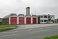 Newcastle fire station - geograph.org.uk - 266817.jpg 640 × 427; 167 KB
-
 Newcastle under Lyme - geograph.org.uk - 276503.jpg 640 × 427; 80 KB
-
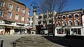 Newcastle under Lyme - Market Cross - geograph.org.uk - 5218441.jpg 5,184 × 2,920; 6.45 MB
-
 Newcastle Under Lyme College - geograph.org.uk - 2108308.jpg 1,600 × 796; 261 KB
-
-

-
 Newcastle-under Lyme Public Library on Ironmarket - geograph.org.uk - 4339647.jpg 3,264 × 2,448; 2.69 MB
-
 Jewish cemetery and Synagogue - geograph.org.uk - 335713.jpg 640 × 480; 46 KB
-
 Newcastle-under-Lyme fire station - geograph.org.uk - 4720327.jpg 3,264 × 2,448; 2.74 MB
-
 Newcastle-under-Lyme Library (1).jpg 4,608 × 3,456; 3.39 MB
-
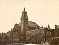 Newcastle-under-Lyme Municipal Buildings.jpg 216 × 163; 11 KB
-
 Newcastle-under-Lyme Museum & Art Gallery (1).jpg 4,608 × 3,456; 3.41 MB
-
 Newcastle-under-Lyme police station.jpg 4,320 × 3,240; 3.49 MB
-
 Newcastle-under-Lyme Registration Office.jpg 4,320 × 3,240; 3.68 MB
-
 Newcastle-under-Lyme, 21 Ironmarket - geograph.org.uk - 5288862.jpg 3,763 × 2,822; 3.13 MB
-
 Newcastle-under-Lyme, 33 Ironmarket - geograph.org.uk - 5312742.jpg 2,961 × 3,884; 2.99 MB
-
 Newcastle-under-Lyme, 41 High Street - geograph.org.uk - 4339598.jpg 3,108 × 2,315; 3.11 MB
-
 Newcastle-under-Lyme, 46-48 High Street - geograph.org.uk - 5311760.jpg 4,032 × 3,024; 3.48 MB
-
 Newcastle-under-Lyme, 53 Ironmarket - geograph.org.uk - 5290124.jpg 4,032 × 3,024; 3.36 MB
-
 Newcastle-under-Lyme, 83 High Street - geograph.org.uk - 5288844.jpg 2,908 × 4,013; 2.57 MB
-
 Newcastle-under-Lyme, entrance to Pepper Street - geograph.org.uk - 5274551.jpg 3,024 × 4,032; 2.96 MB
-
 Newcastle-under-Lyme, Hanover Street - geograph.org.uk - 5285958.jpg 4,032 × 3,024; 3.59 MB
-
 North Staffordshire Justice Centre, Newcastle-under-Lyme.jpg 4,608 × 3,456; 3.45 MB
-
 Orme Boys' School, Newcastle-under-Lyme.jpg 4,512 × 3,309; 3.58 MB
-
 Pitfield House, Newcastle-under-Lyme.jpg 4,320 × 3,240; 2.99 MB
-
 Porch of 3 King Street, Newcastle-under-Lyme.jpg 4,032 × 3,024; 3.32 MB
-
 Remains of the Castle, Newcastle-under-Lyme.jpg 1,600 × 928; 439 KB
-
 Roebuck Shopping Centre, Newcastle-under-Lyme (1).jpg 4,320 × 3,240; 3 MB
-
 Rowhurst Close Industrial Estate - geograph.org.uk - 391783.jpg 640 × 504; 25 KB
-
 Ruined Building near Bowseywood Farm - geograph.org.uk - 598116.jpg 640 × 400; 109 KB
-
 Silk Mill House.jpg 2,989 × 3,985; 1.62 MB
-

-
 Stubbs Walk 100922.jpg 2,791 × 3,721; 2.67 MB
-
-
 The Barracks Workshops, Newcastle-under-Lyme.jpg 1,600 × 1,064; 327 KB
-
 The Brampton at Newcastle-Under-Lyme.png 1,028 × 669; 1,015 KB
-
 The Minton Centre - geograph.org.uk - 1132757.jpg 640 × 480; 72 KB
-
 The Orme (Old Boys' School). - geograph.org.uk - 598490.jpg 640 × 423; 70 KB
-
 Vodafone Building, Holditch - geograph.org.uk - 397353.jpg 640 × 464; 23 KB
-
 Waterhayes Estate - geograph.org.uk - 565835.jpg 640 × 420; 124 KB
-
 Windsor House, Newcastle-under-Lyme.jpg 4,320 × 3,240; 4.05 MB
-
 Wolstanton Colliery circa 1969.jpg 1,920 × 1,481; 905 KB


.jpg)


.jpg)


.jpg)


.jpg)

.jpg)


.jpg)


._-_geograph.org.uk_-_598490.jpg)


